Utah
Arches National Park
Canyonlands - Island in the Sky
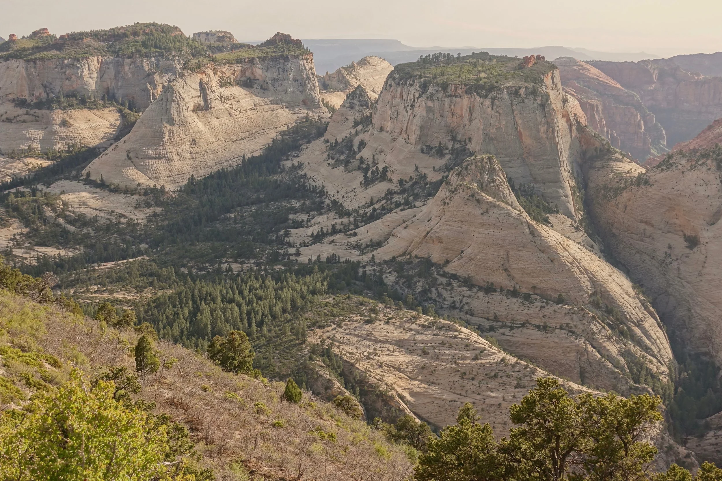
Zion National Park
Grand Staircase Escalante
Canyonlands - Needles District
Fish and Owl Creek Canyon
Arches National Park
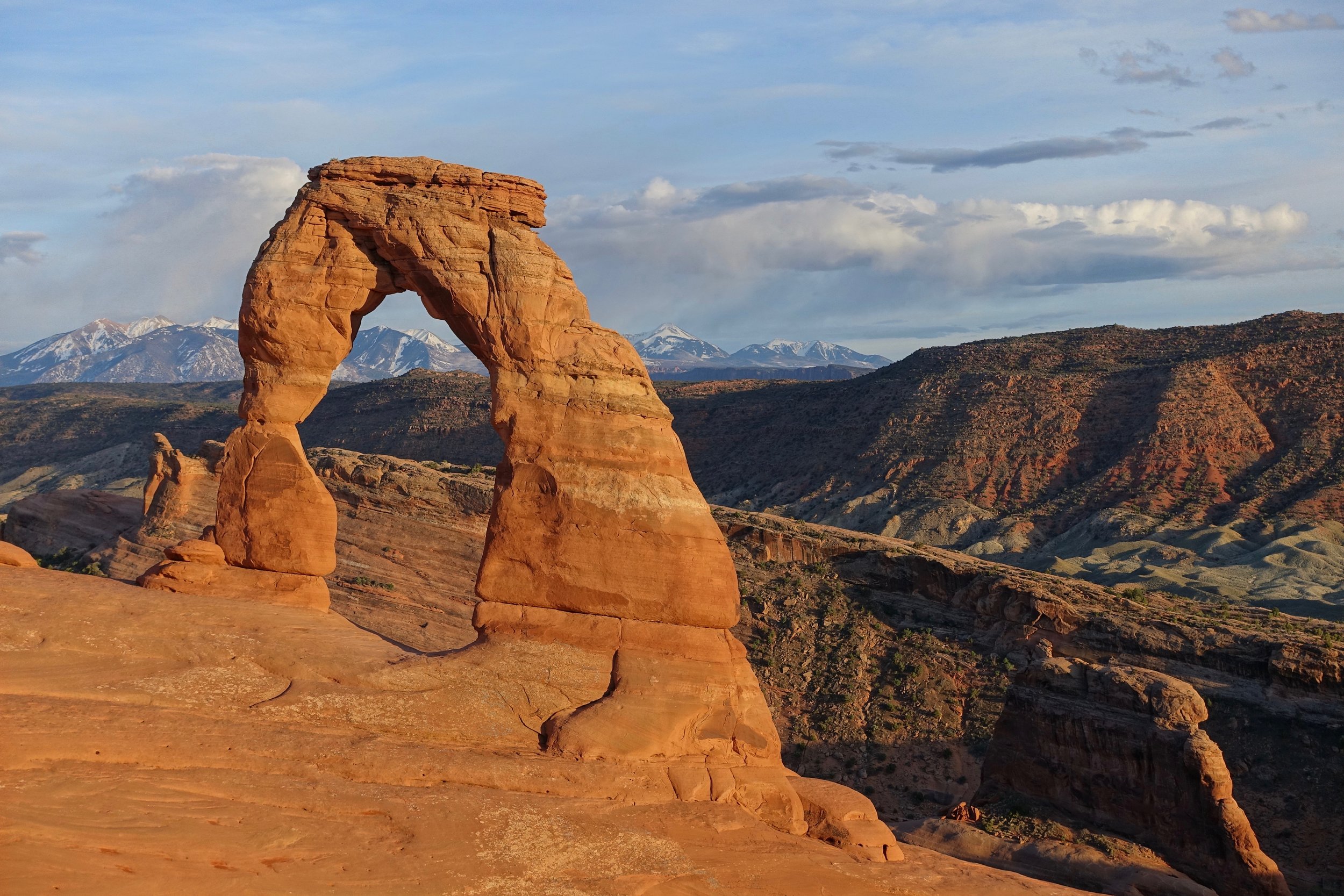
The highlight of Arches National Park is the short uphill hike to Delicate Arch
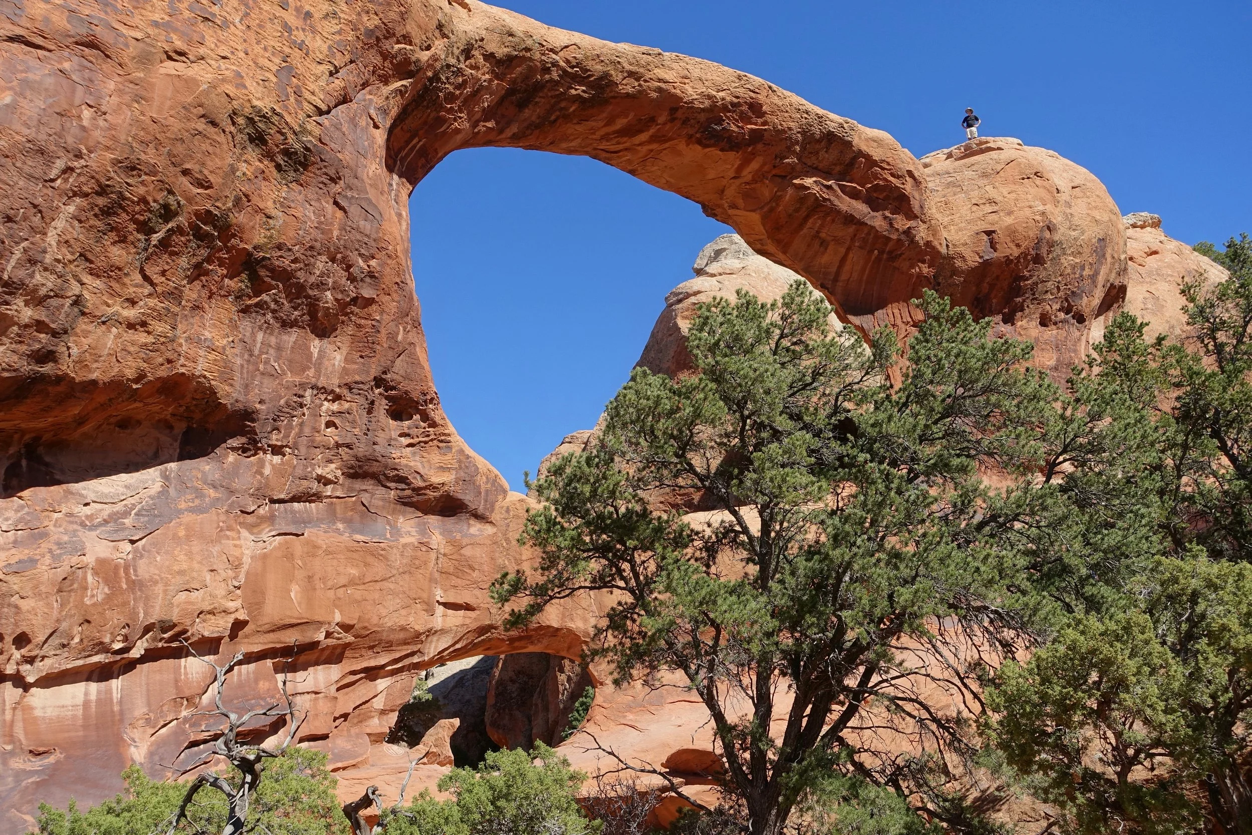
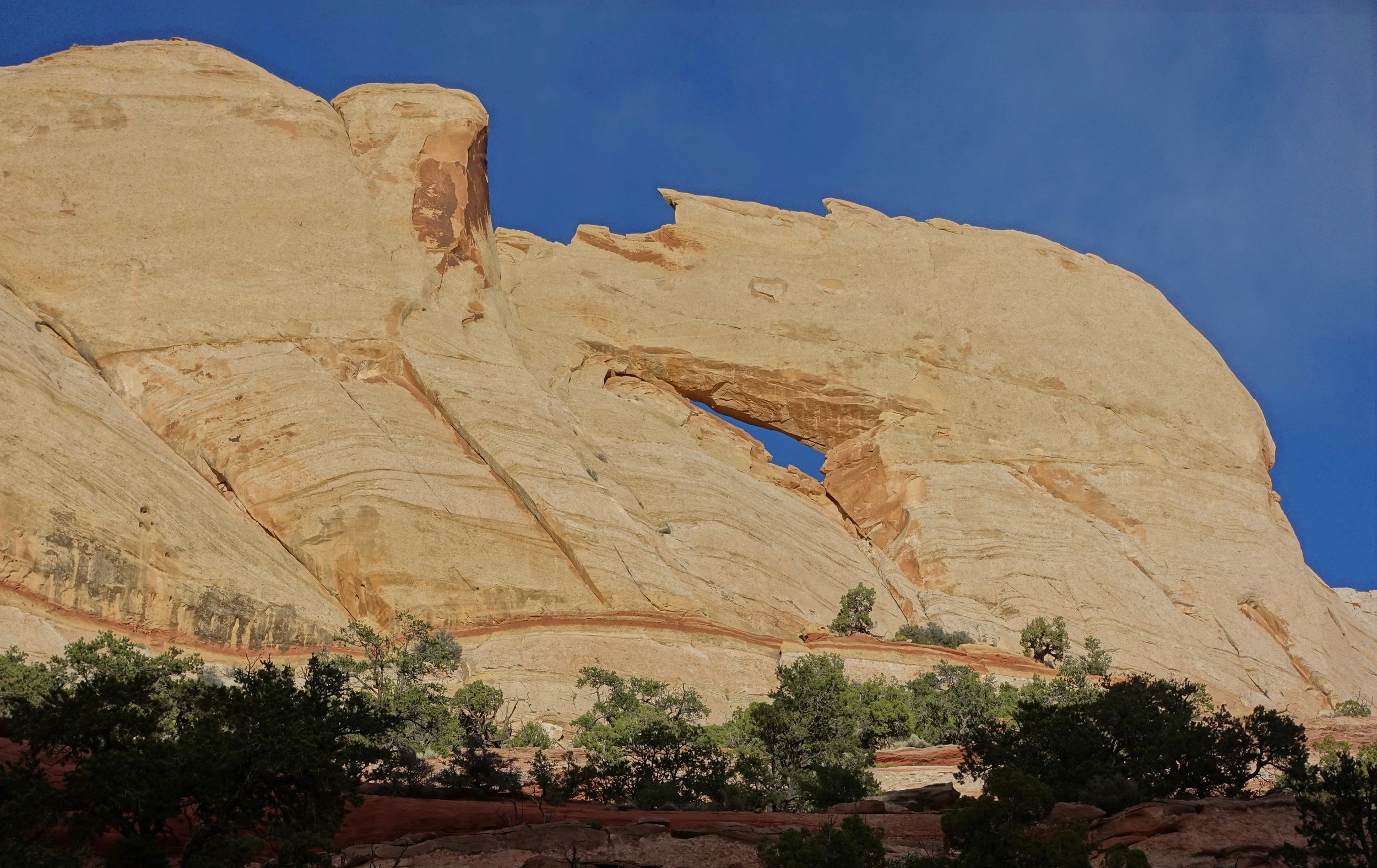
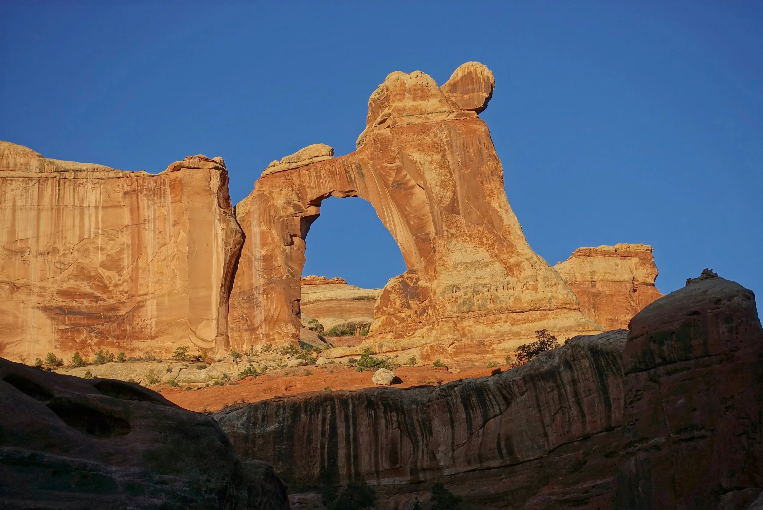
Double O Arch
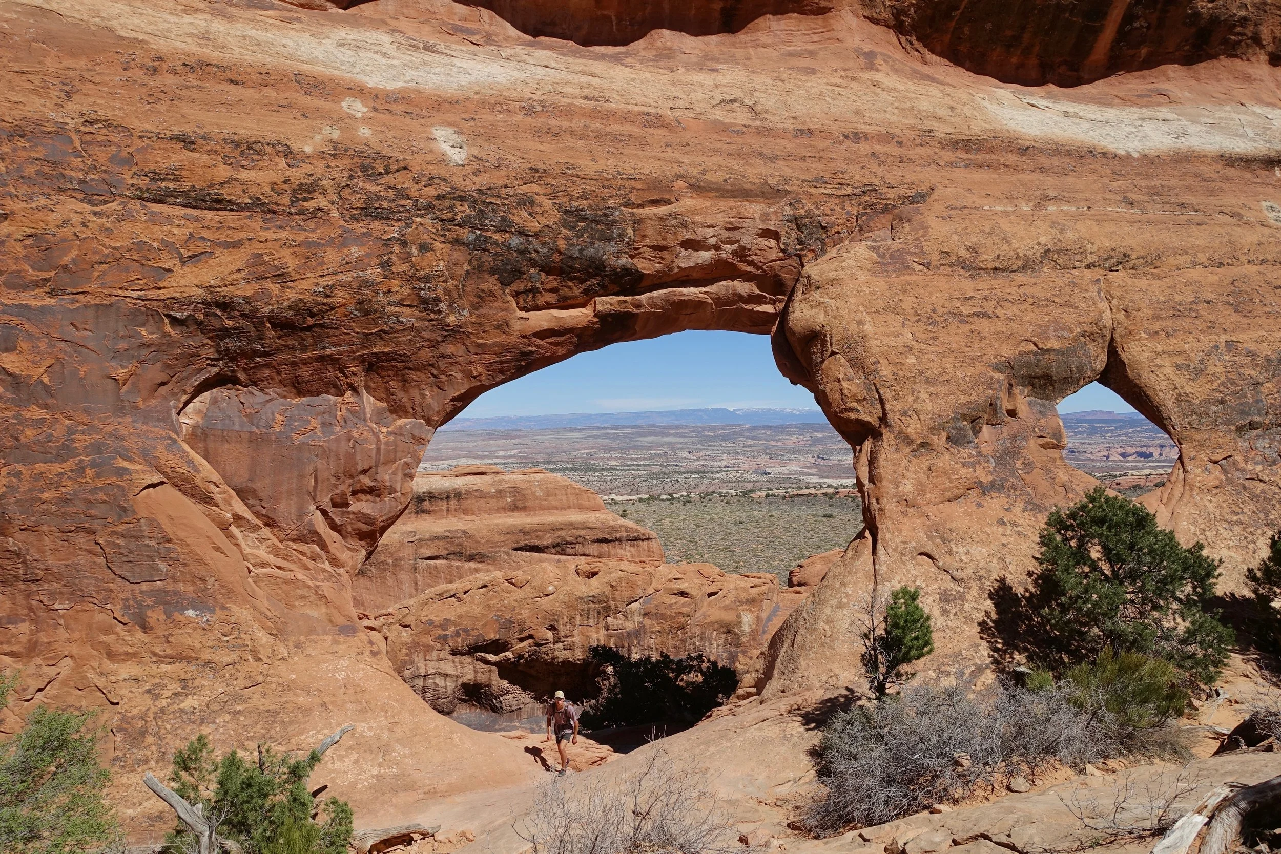
The longest hike in Arches NP is through Devil's Garden (8 miles). Not to be confused with Devil's Garden in Escalante or the nearby Devil's Kitchen.

Skull Rock in Fiery Furnace
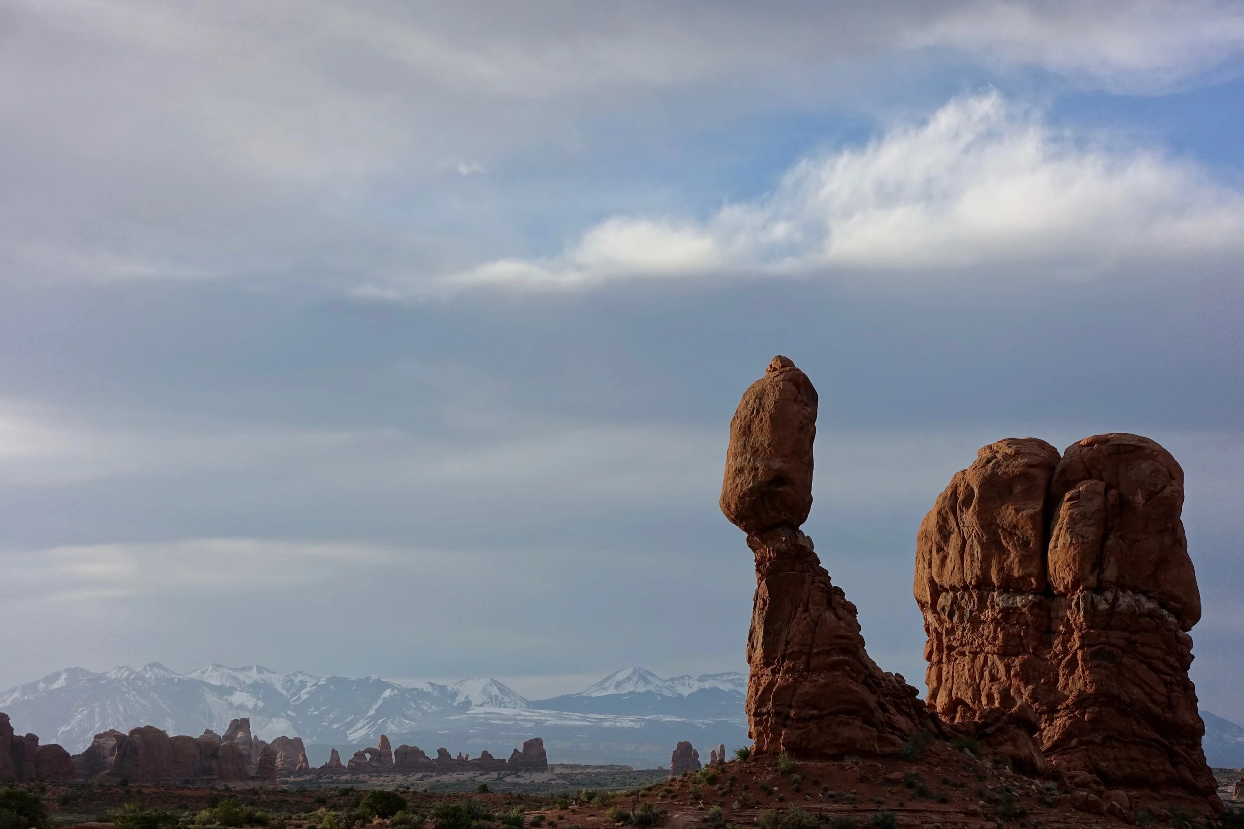
The roadside stop at Balanced Rock
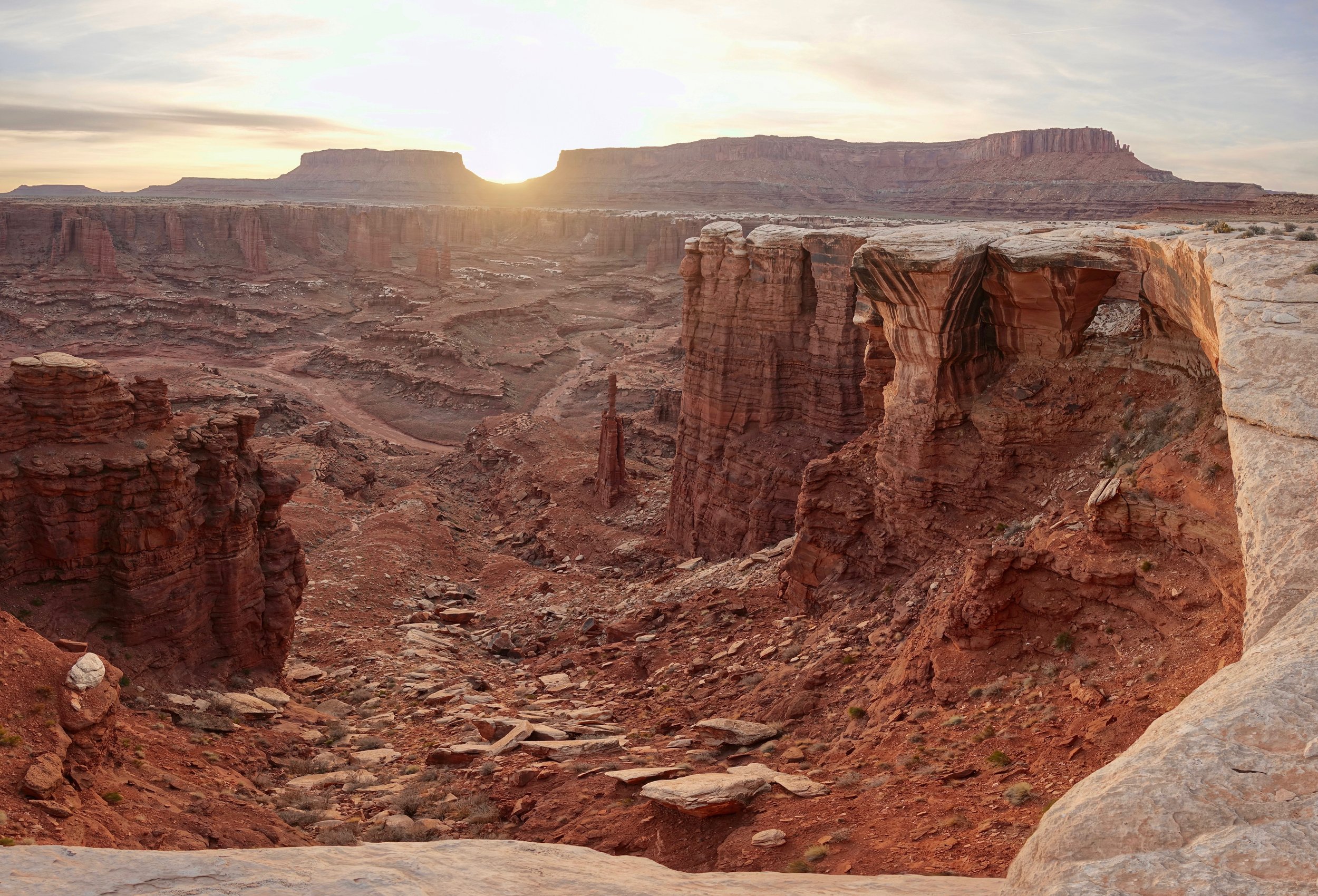
White Rim Trail - Canyonlands Island in the Sky
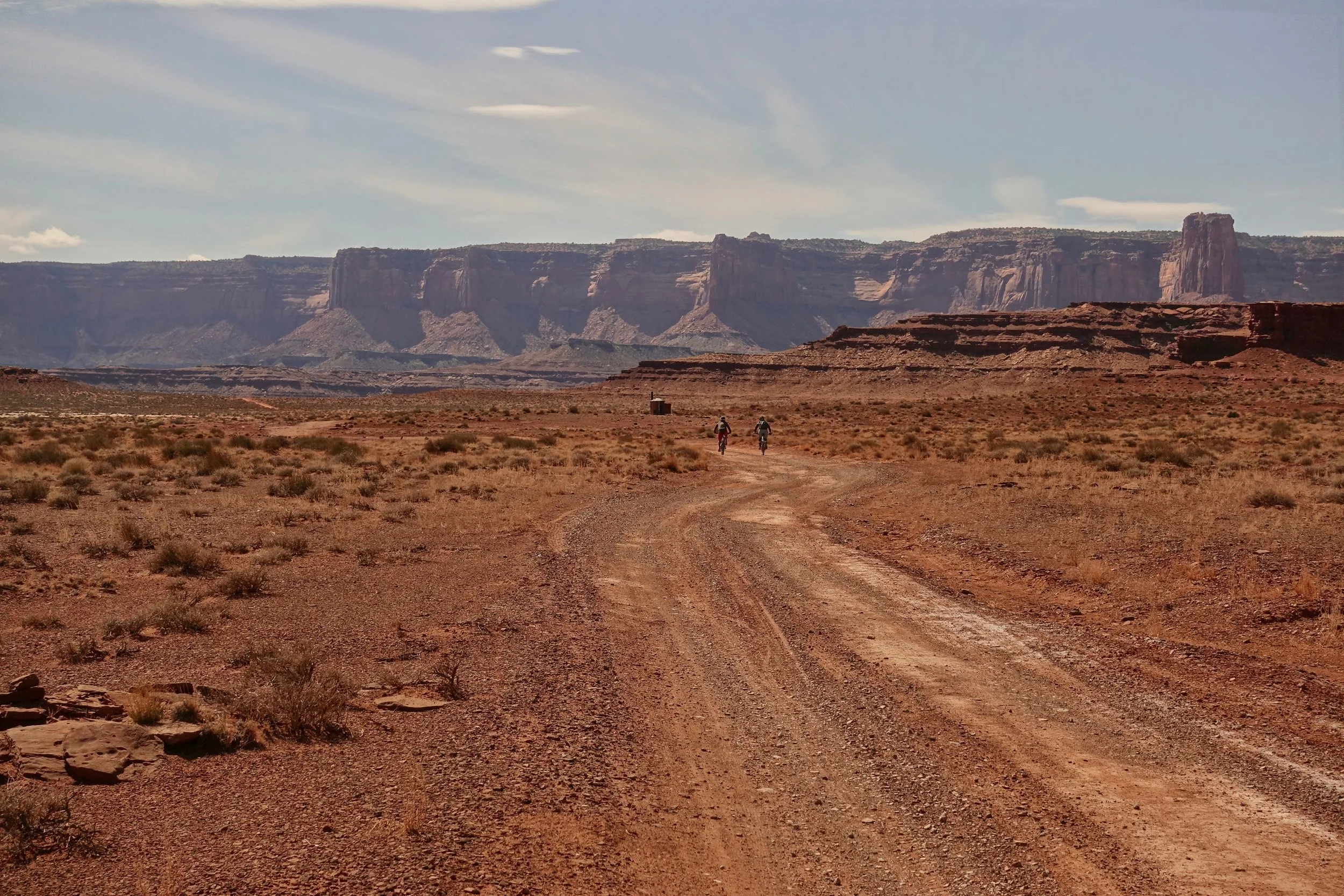
My favorite walk in Canyonlands is the White Rim Trail. Although more commonly done with a jeep or mountain bike, the road can also be walked in 4-5 days
Zone camping is allowed for walkers, no need to compete for the limited car/bike permits. They allow 60 walkers per day- after booking my reservation there were 59 spots remaining. Advanced reservations recommended though as water drops require the head rangers signature
Overview map of the walk
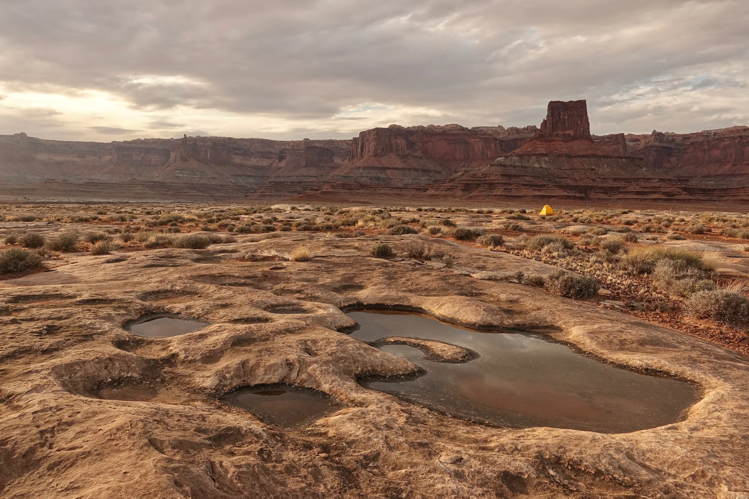
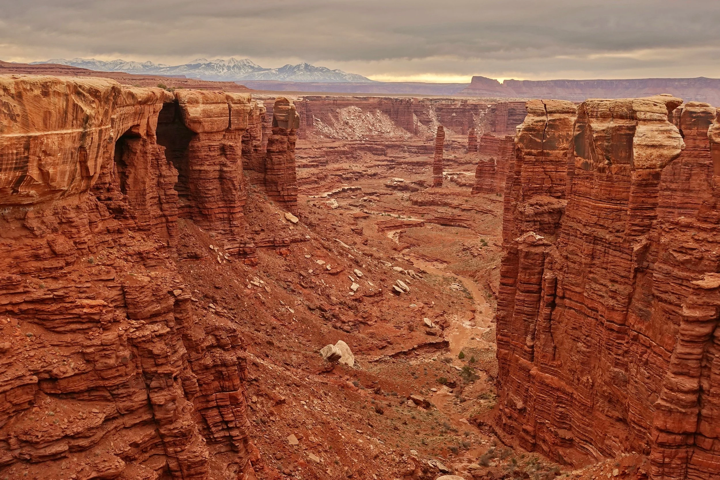
Elevation is level aside from the days where climbing up and down the canyon is required. A water cache was placed at the top of the mesa off the Murphy Point Trail. Weather is the main variable to how much distance can be covered per day. No drinkable water on the road
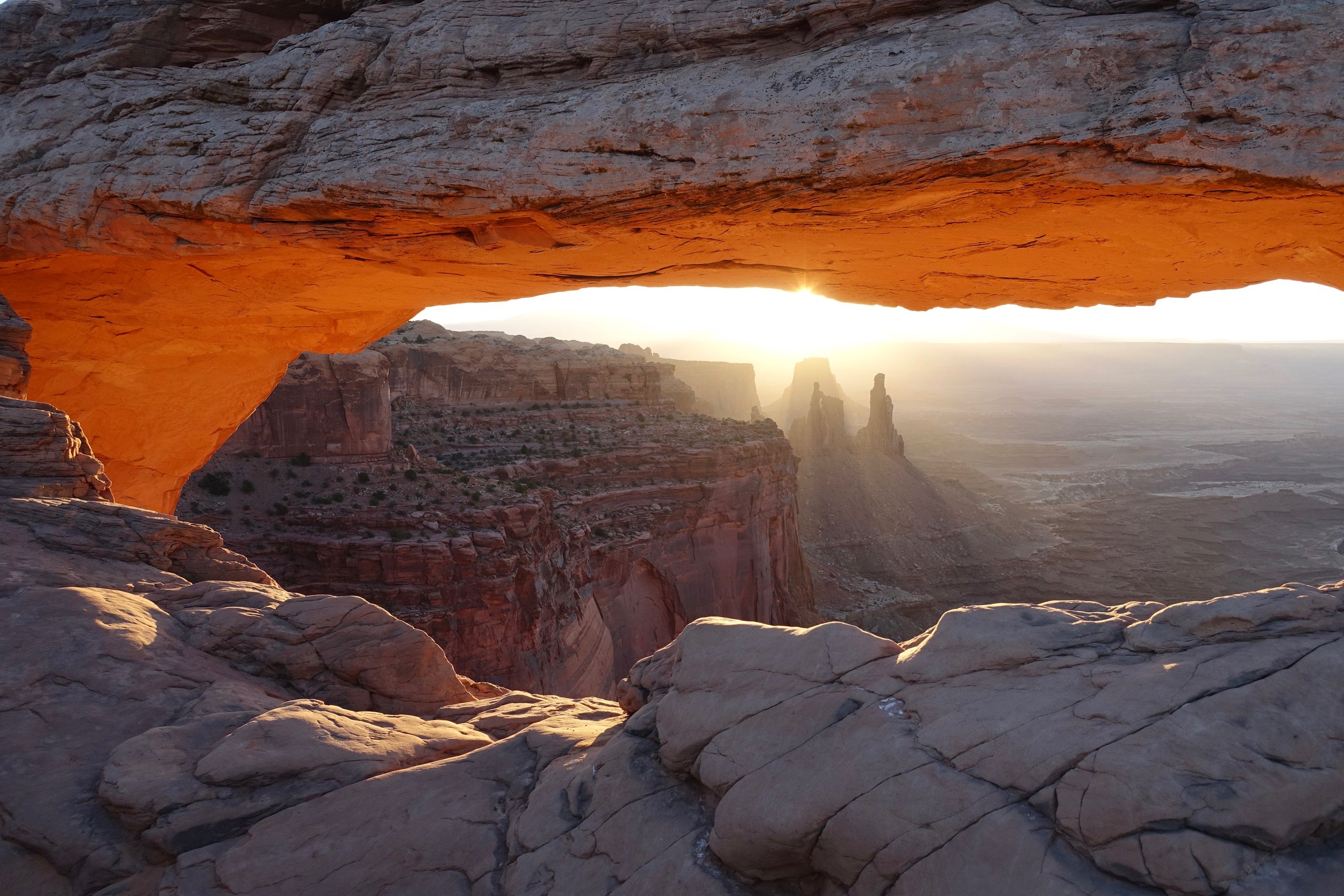
A possible side trip on the route to break up the road walk is the one mile walk to Mesa Arch
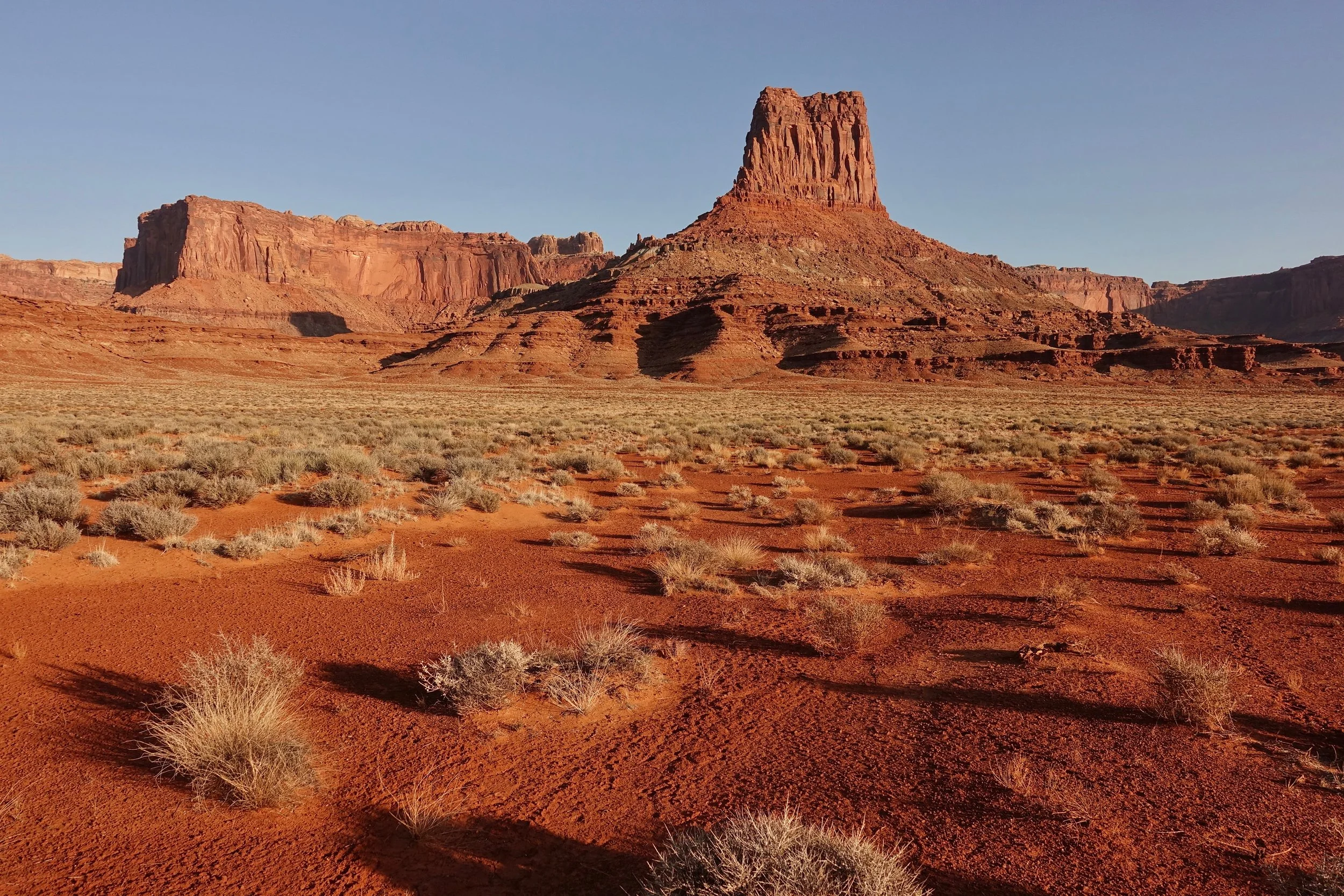
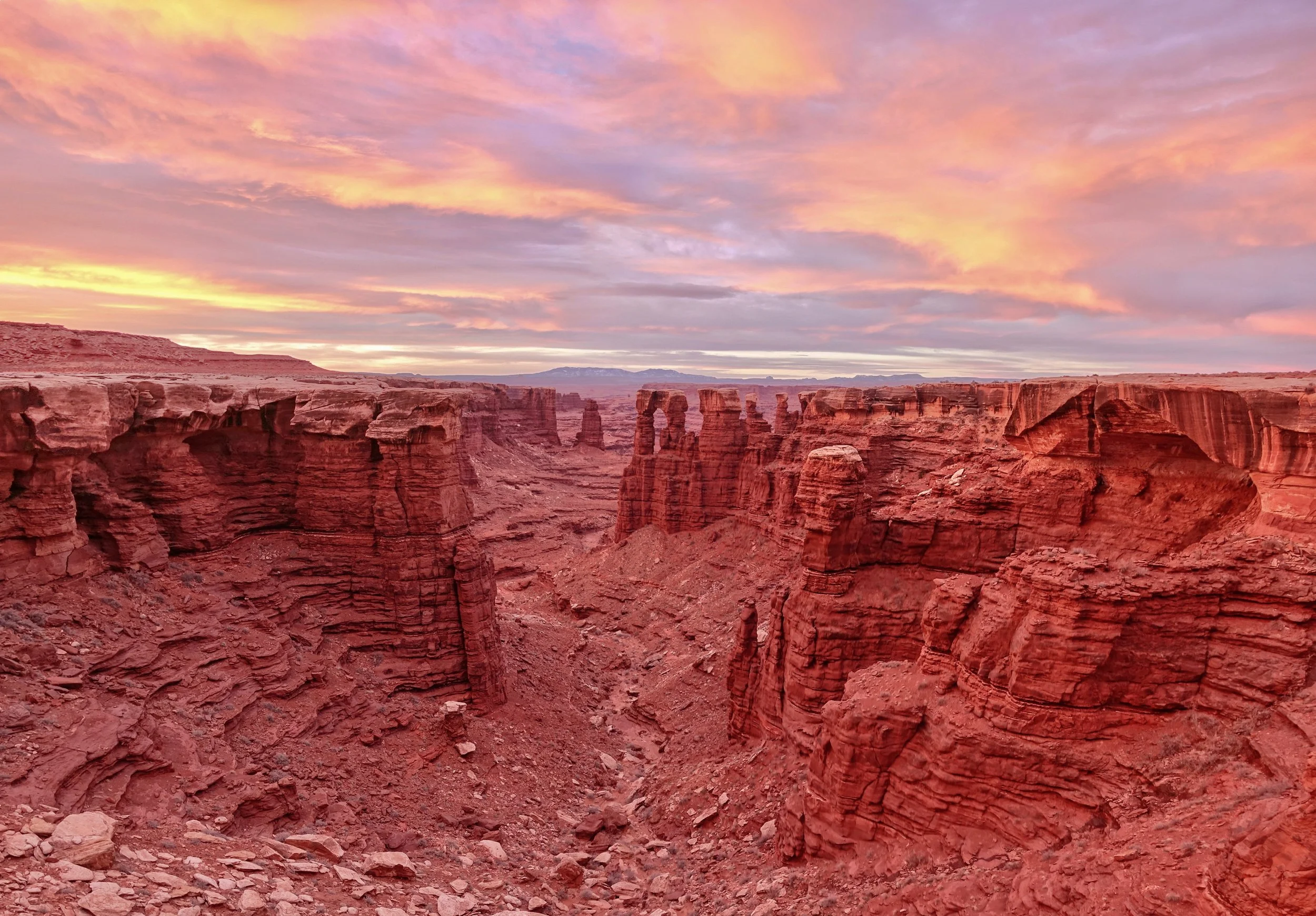
Sunrise near Airport Tower
Sunset near camp at Monument Basin
Beautiful sunrise at Monument Basin
I found myself hiking before sunrise and stopping in the early afternoon each day to get out of the sun
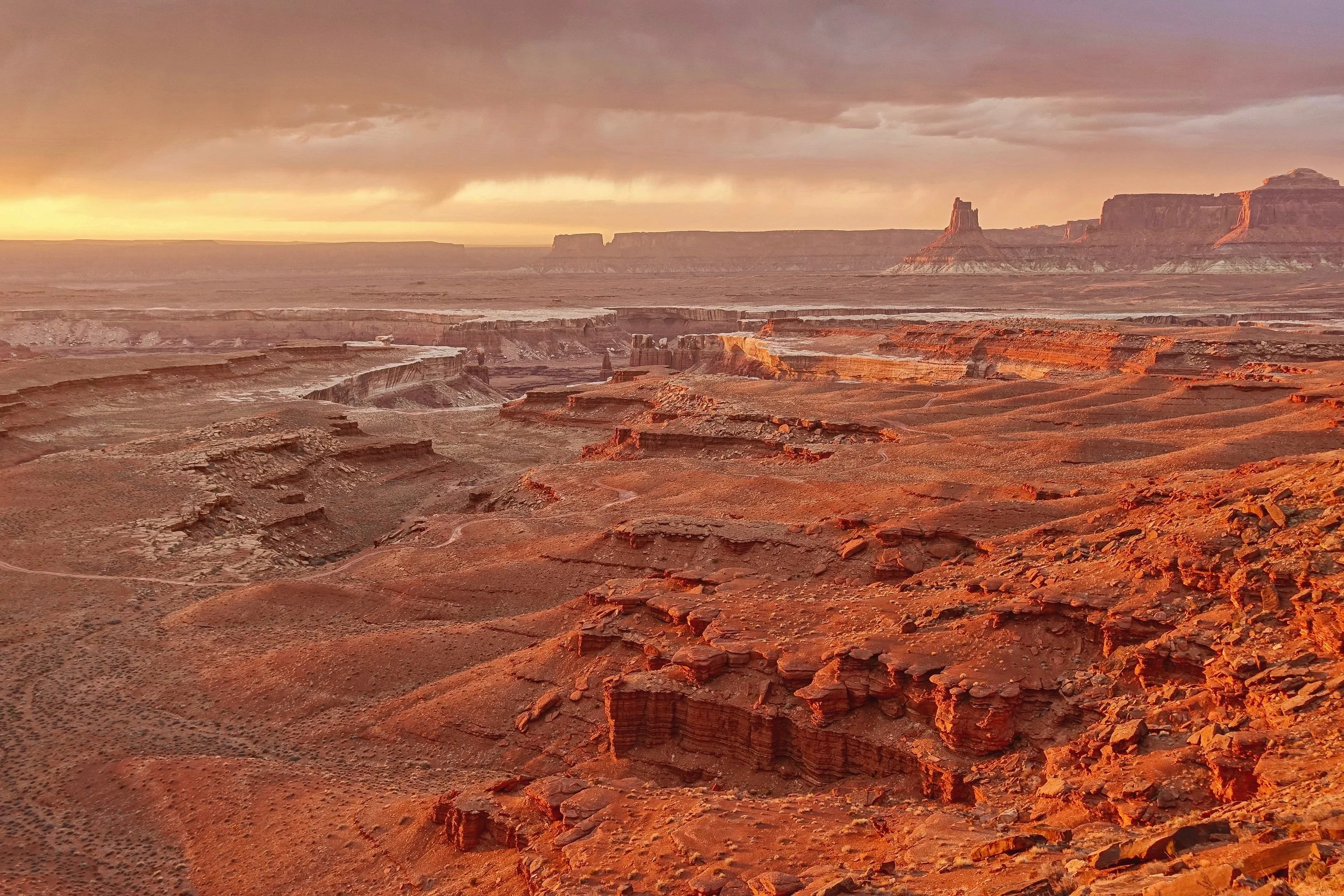
Sunset with Candlestick in the distance
Zion National Park
Zion Narrows
The Zion Narrows is best completed as a one way river walk from Chamberlain Ranch (16 miles with shuttle)
Summer hiking would give the best experience for the Narrows, but other hikes in the park would be best in the spring and fall. Wetsuits as a general rule should be worn when the water temperature is less than 55
Although done in my early hiking days, the Narrows remains as my favorite dayhike in America
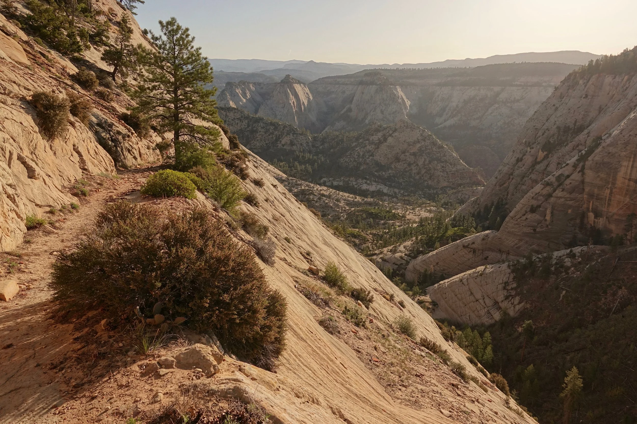
West Rim Trail and Angel’s Landing
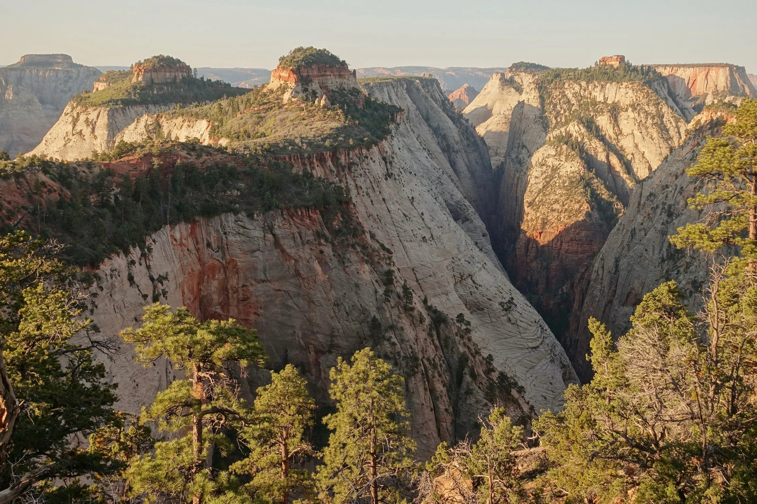
The West Rim Trail is Zion's other signature trail
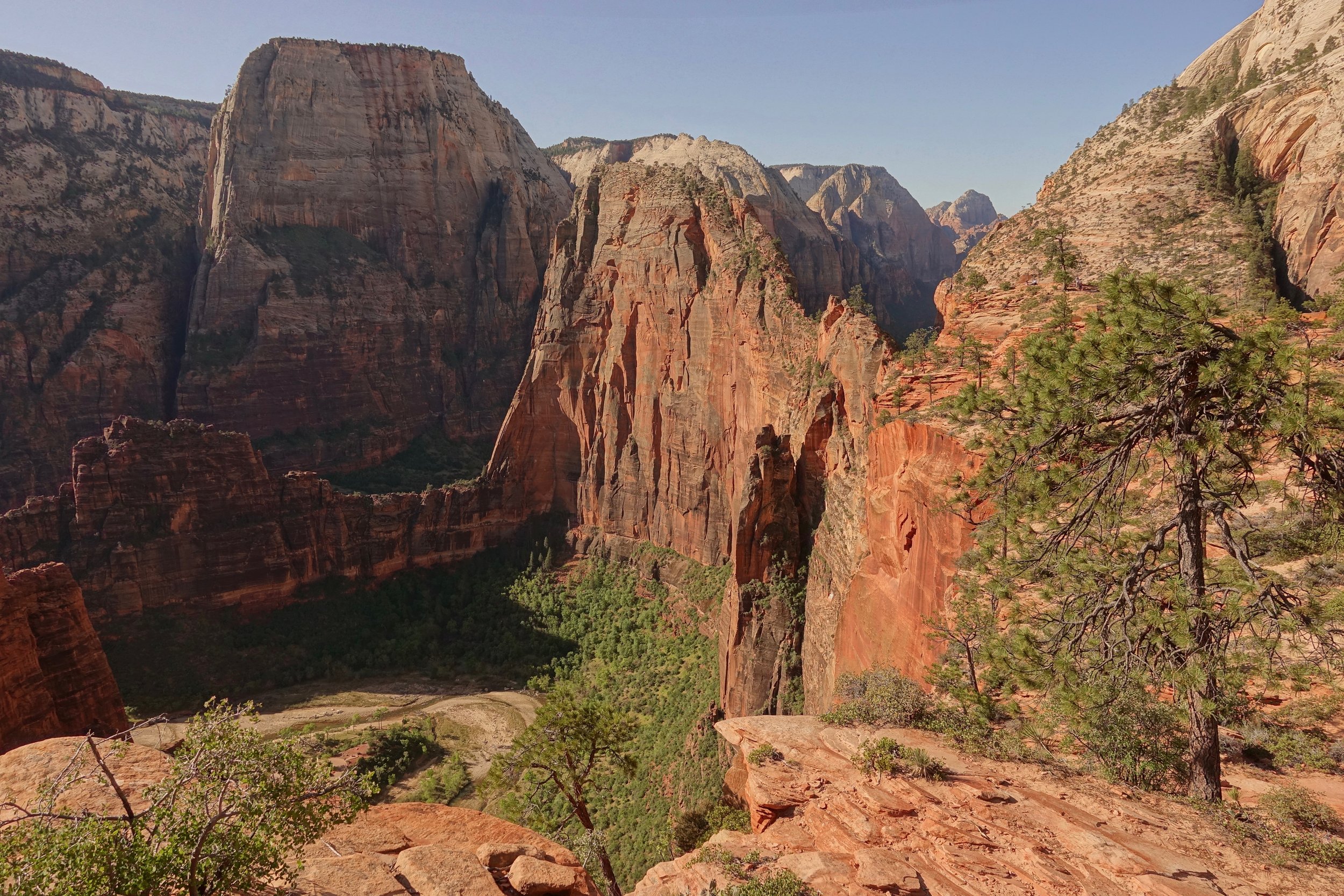
Angels Landing coming into view, a side trip can be made if permits can be grabbed for both
I climbed from the Grotto Shuttle Stop in the valley and spent one night at the top to explore
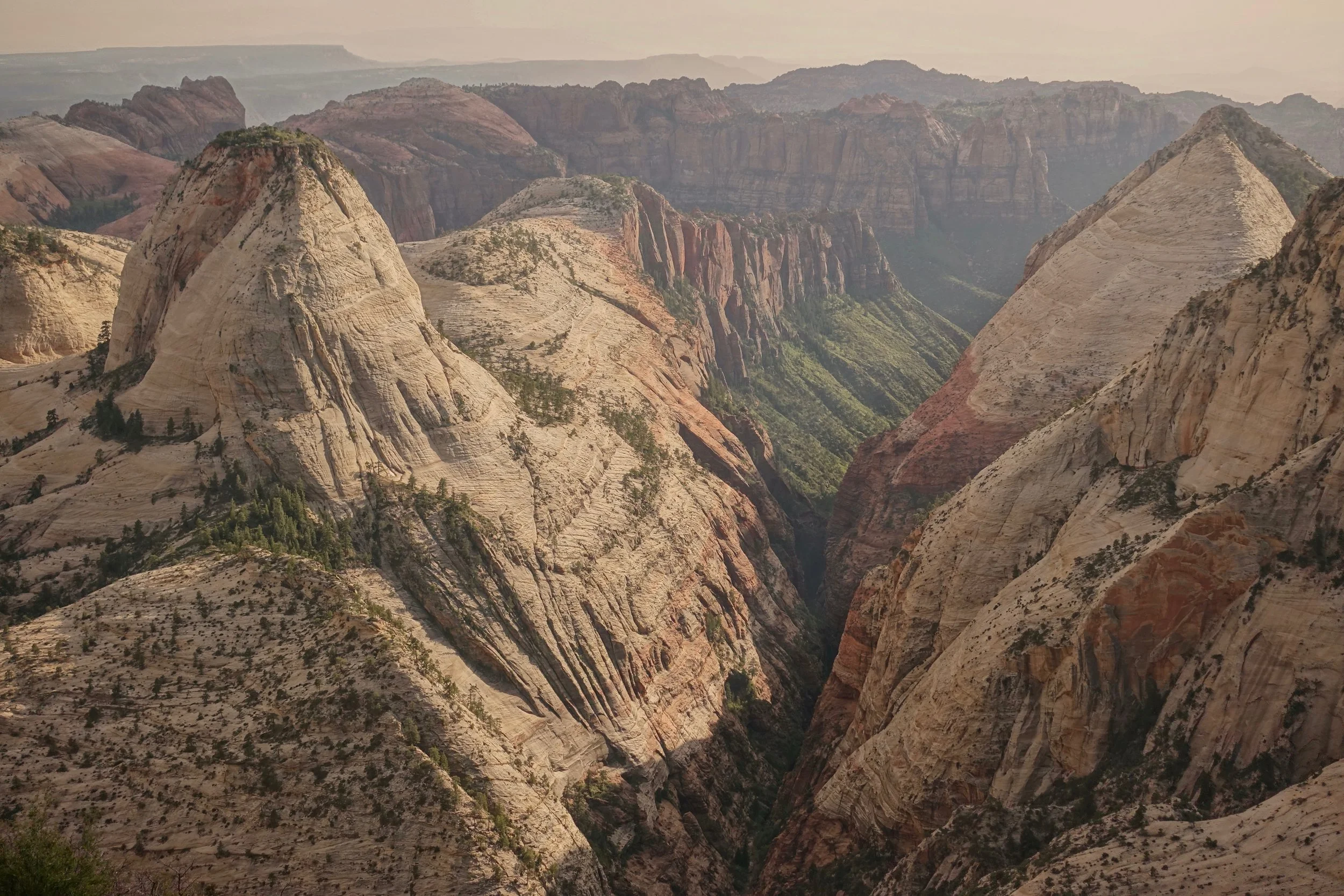
The best views on the West Rim are between campsites 5 and 6
Similar to the Narrows, shuttles can also be arranged for a one way hike across the West Rim or even the entire Zion Traverse
Hop Valley and Langston Mountain
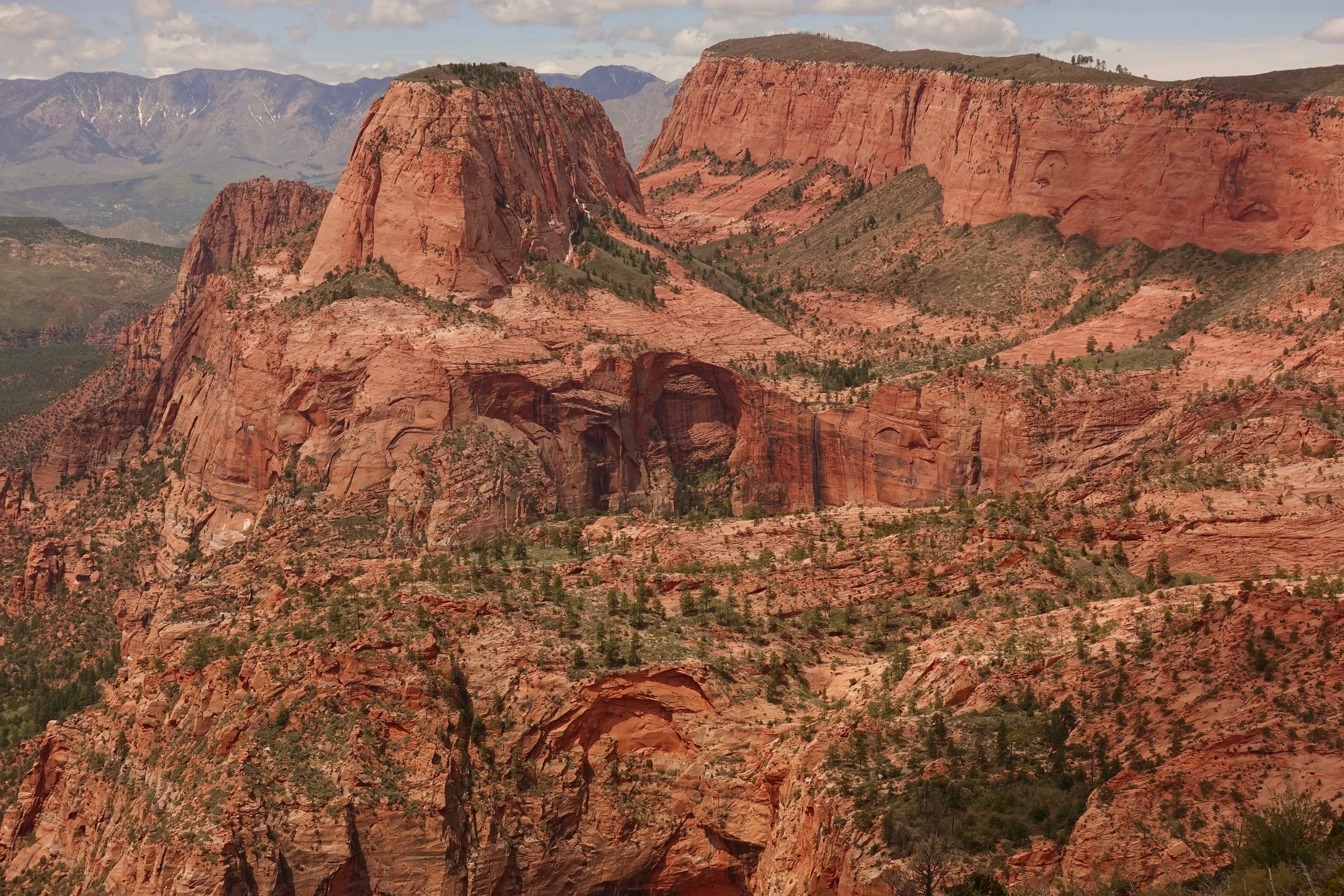
The Langston Mountain summit gives an excellent view of Kolob Arch and Gregory Butte
Unfortunately no easy way to the top, going through the mess of Langston Canyon. The rock was loose and required extra caution on the descent, but fairly easy walking to the summit along the ridgeline after the climb. I stayed two nights at Hop Valley camp A to complete the climb
Escalante Hiking Trails
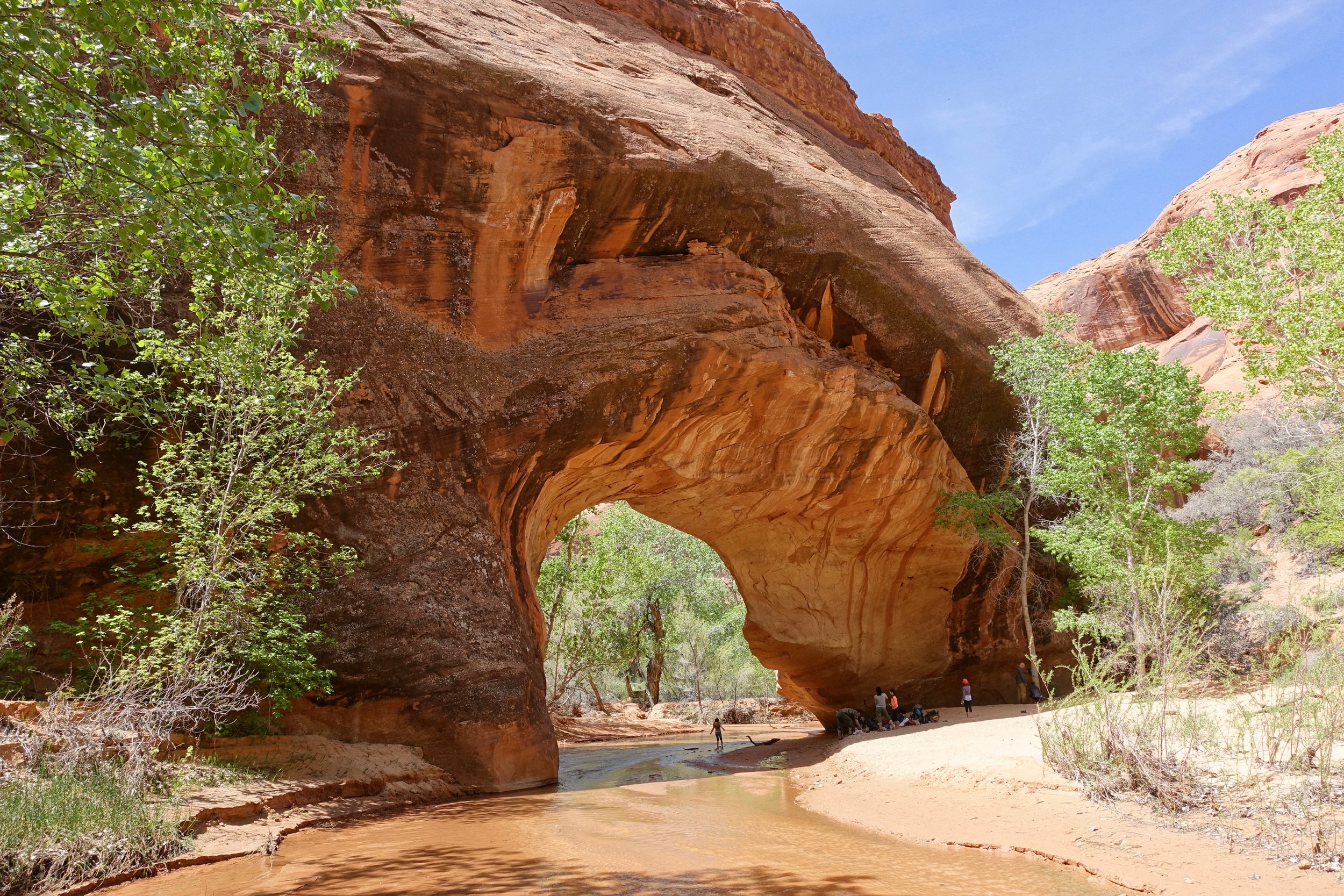
Coyote Gulch

The sneak route loop from the Forty Mile Ridge Trailhead allows plenty of time in the canyon to see Coyote Gulch as a day hike (16 miles)
The climb out the sneak route is easily doable with a daypack. I would not go down into the canyon that way unless you bring a rope
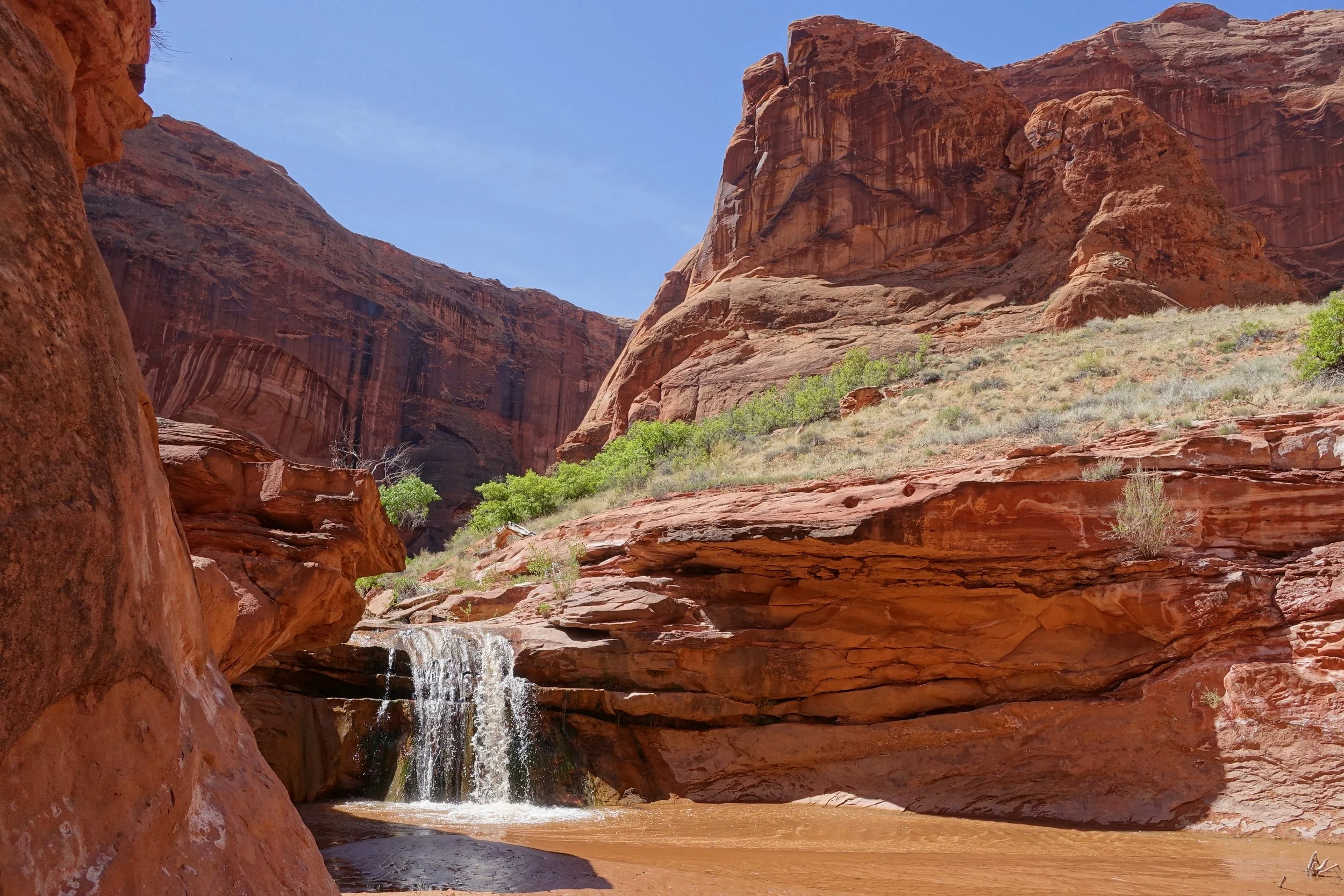
Plenty of water on this section of the canyon during an April visit
East side of Jacob Hamblin Arch
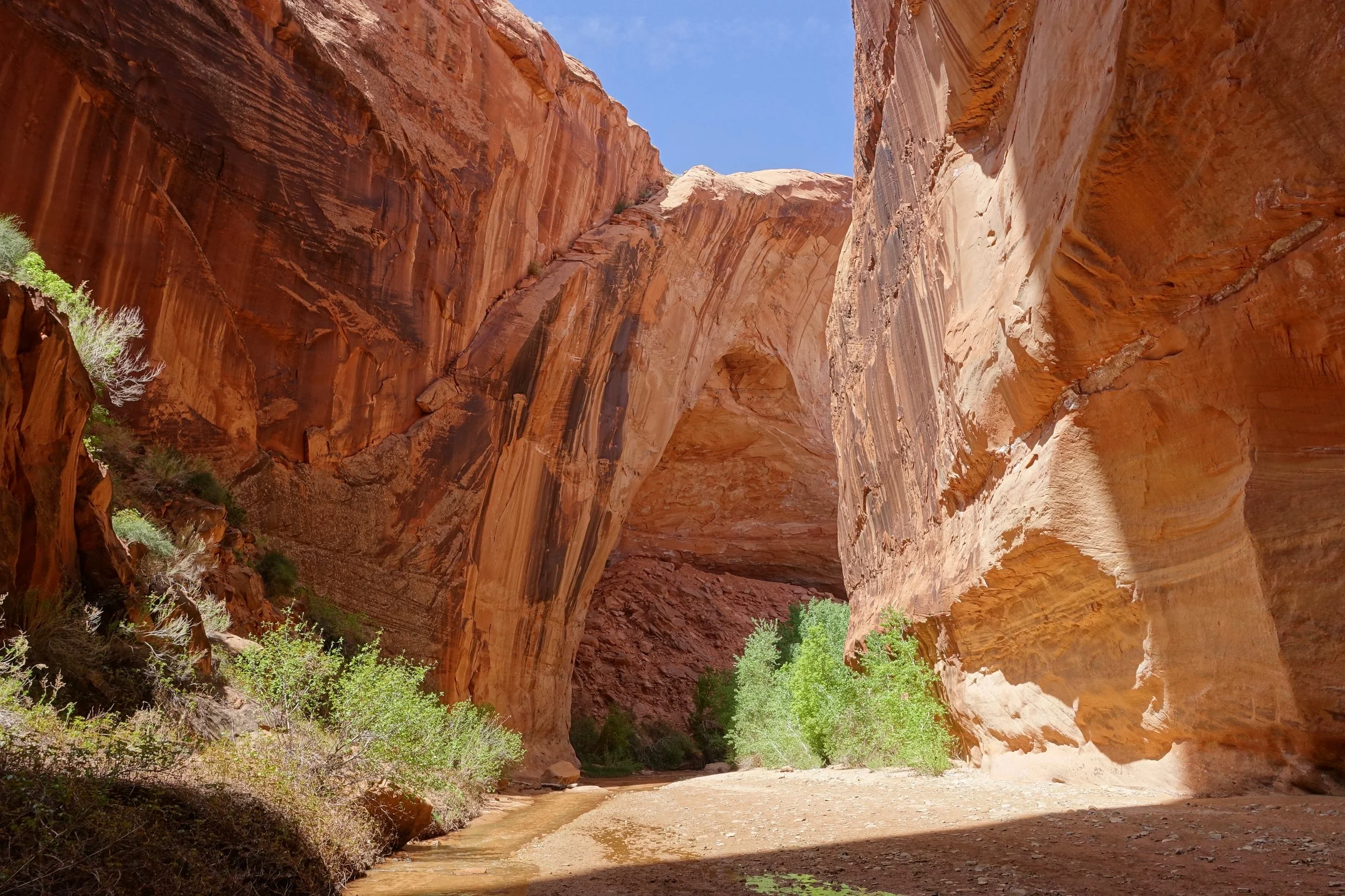
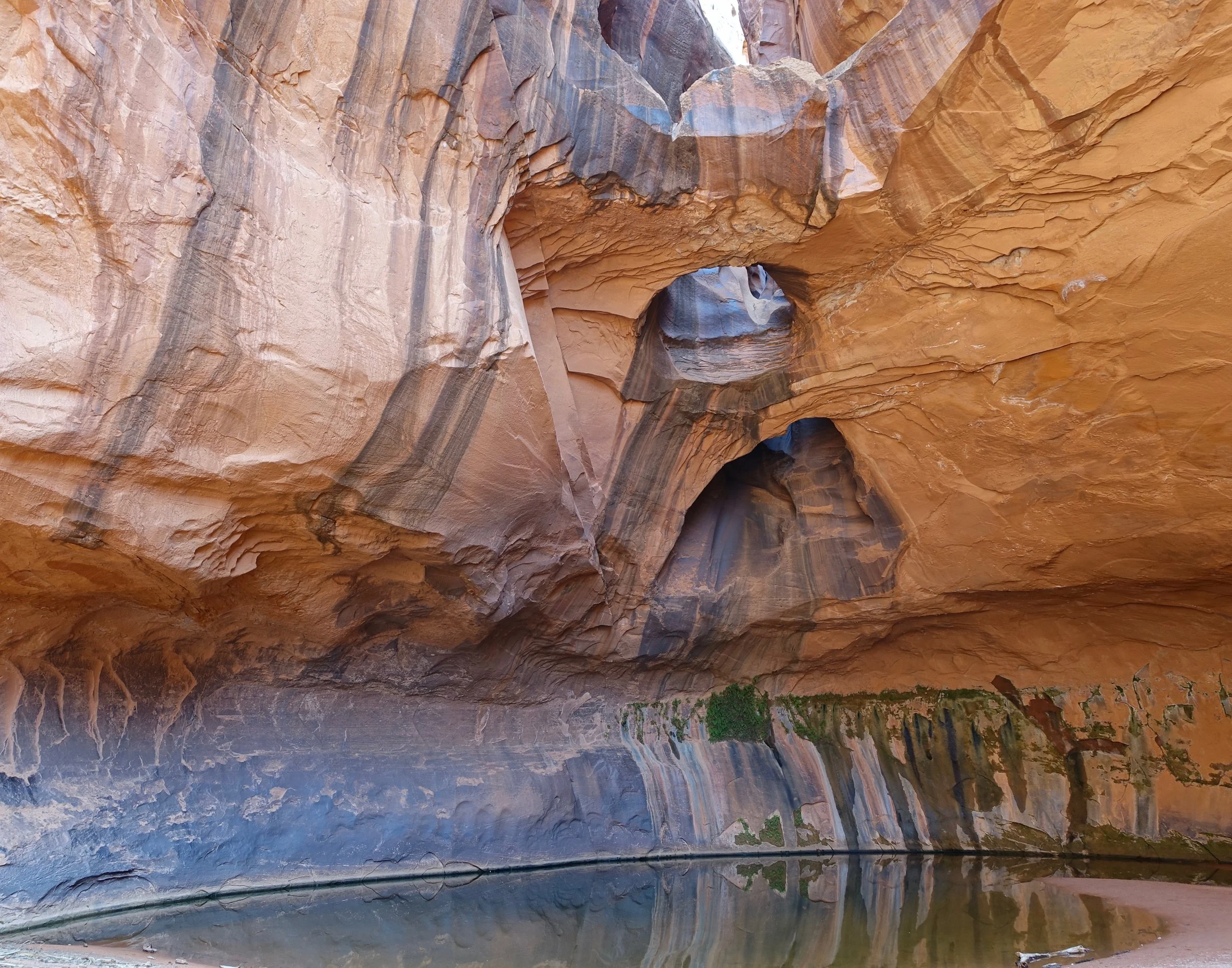
Golden Cathedral in Neon Canyon
The prettiest formation in Escalante is the Golden Cathedral (9.5 miles return, 1200ft). The road to the Egypt trailhead requires a high clearance vehicle and some extra time.
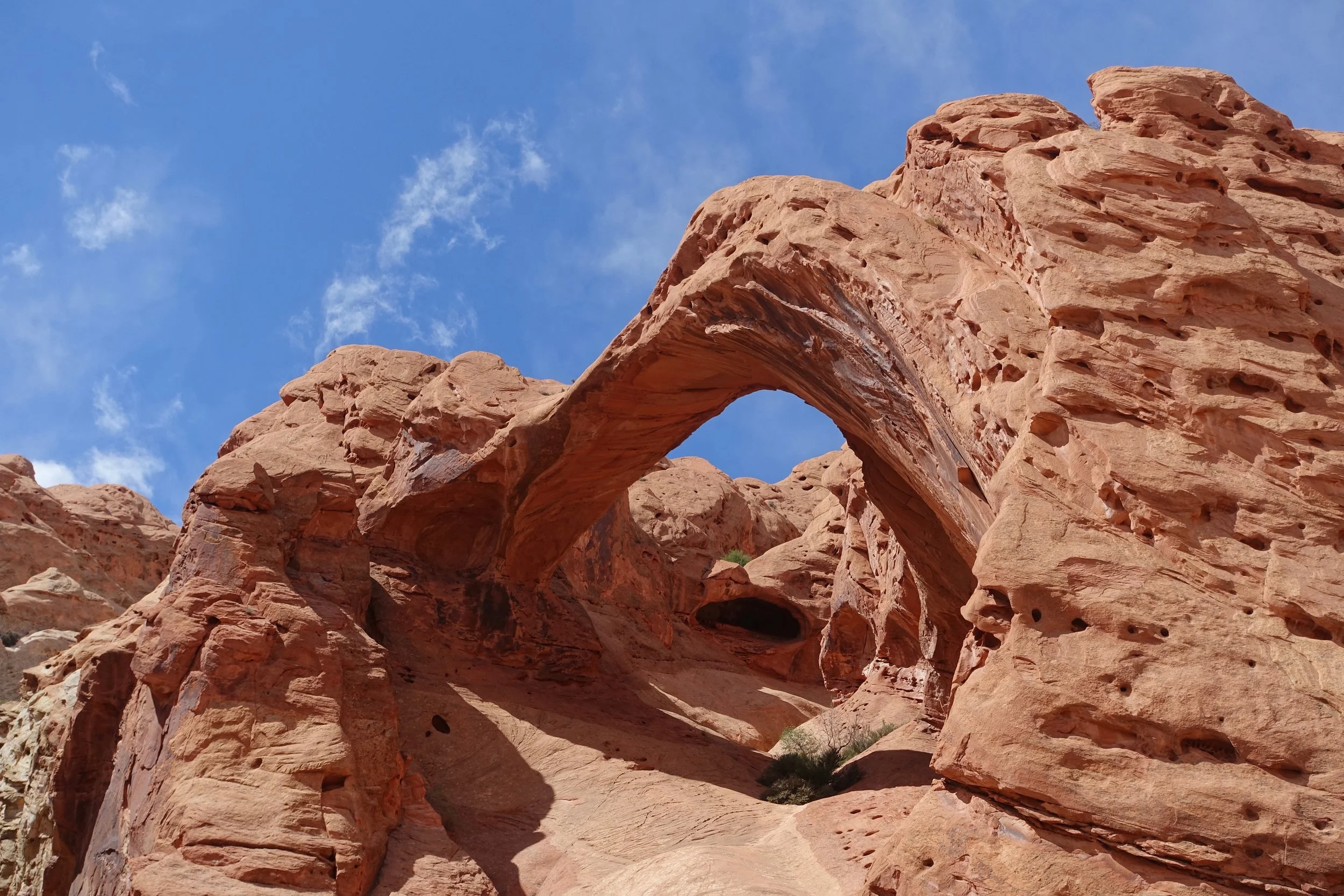
Sunset Arch
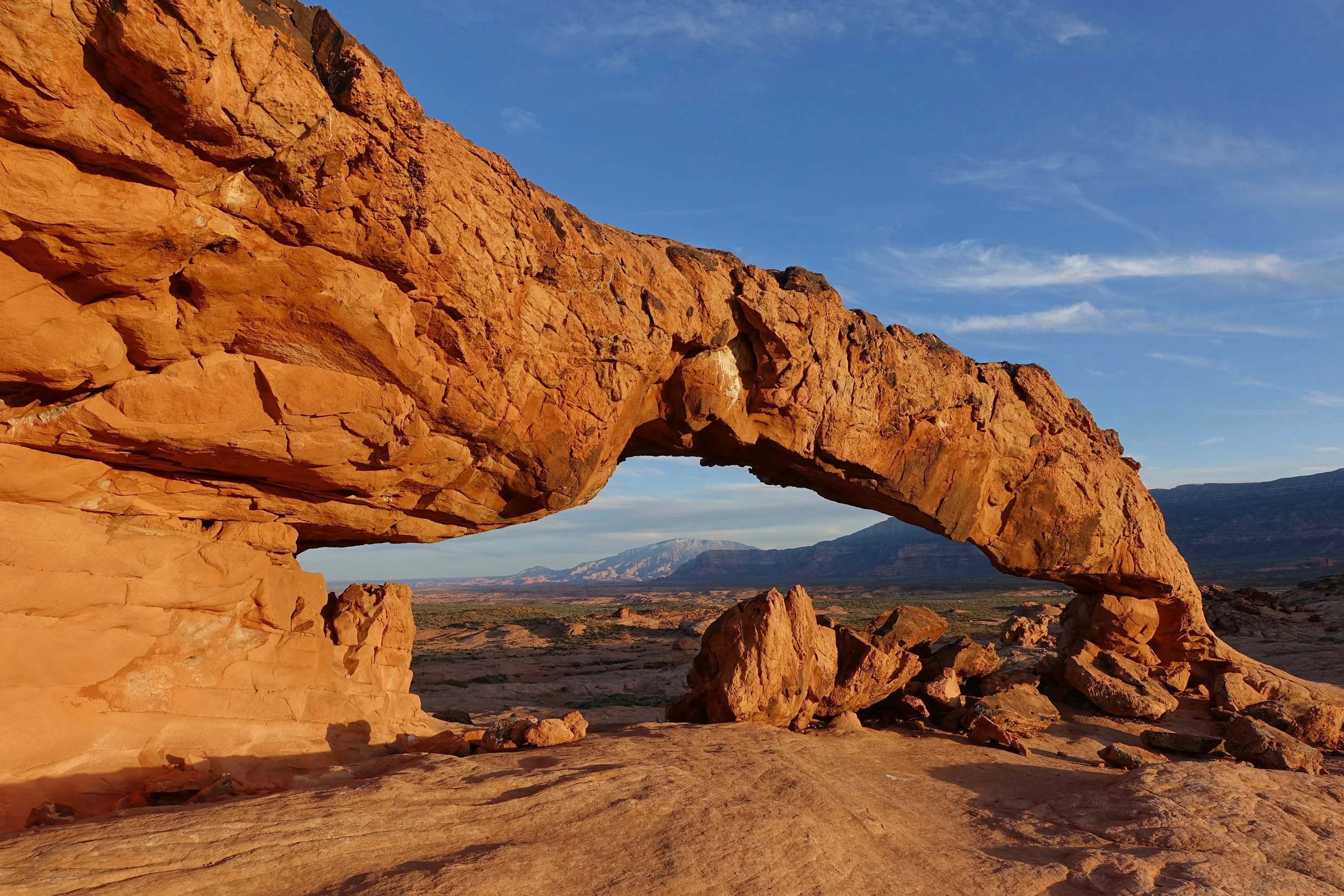
When I visited in 2016 there was no trail to the arch, park at the pullout on the right at 3.5 miles from the start of Fortymile Ridge Rd (BLM-270) and walk south for about one mile.
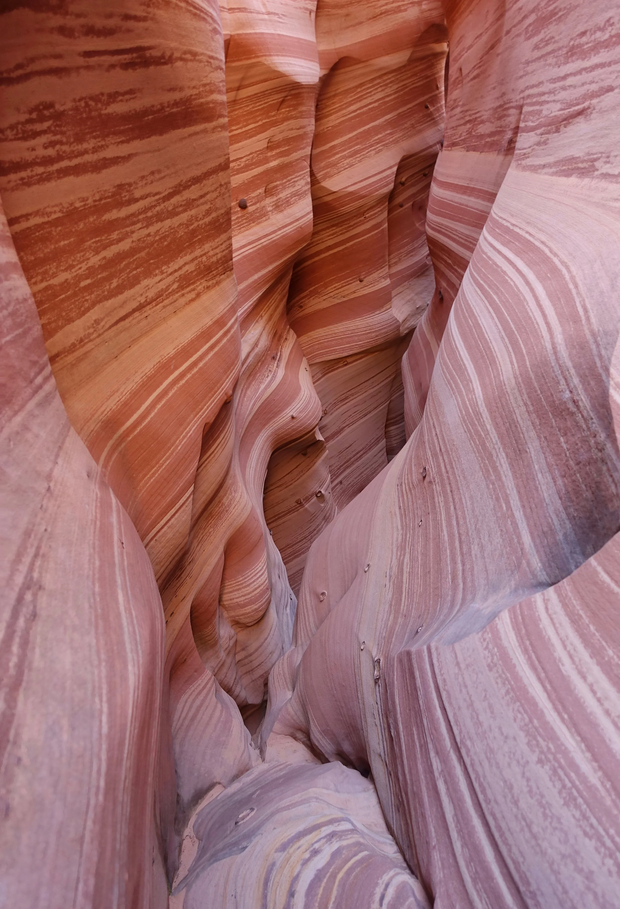
Zebra Slot Canyon
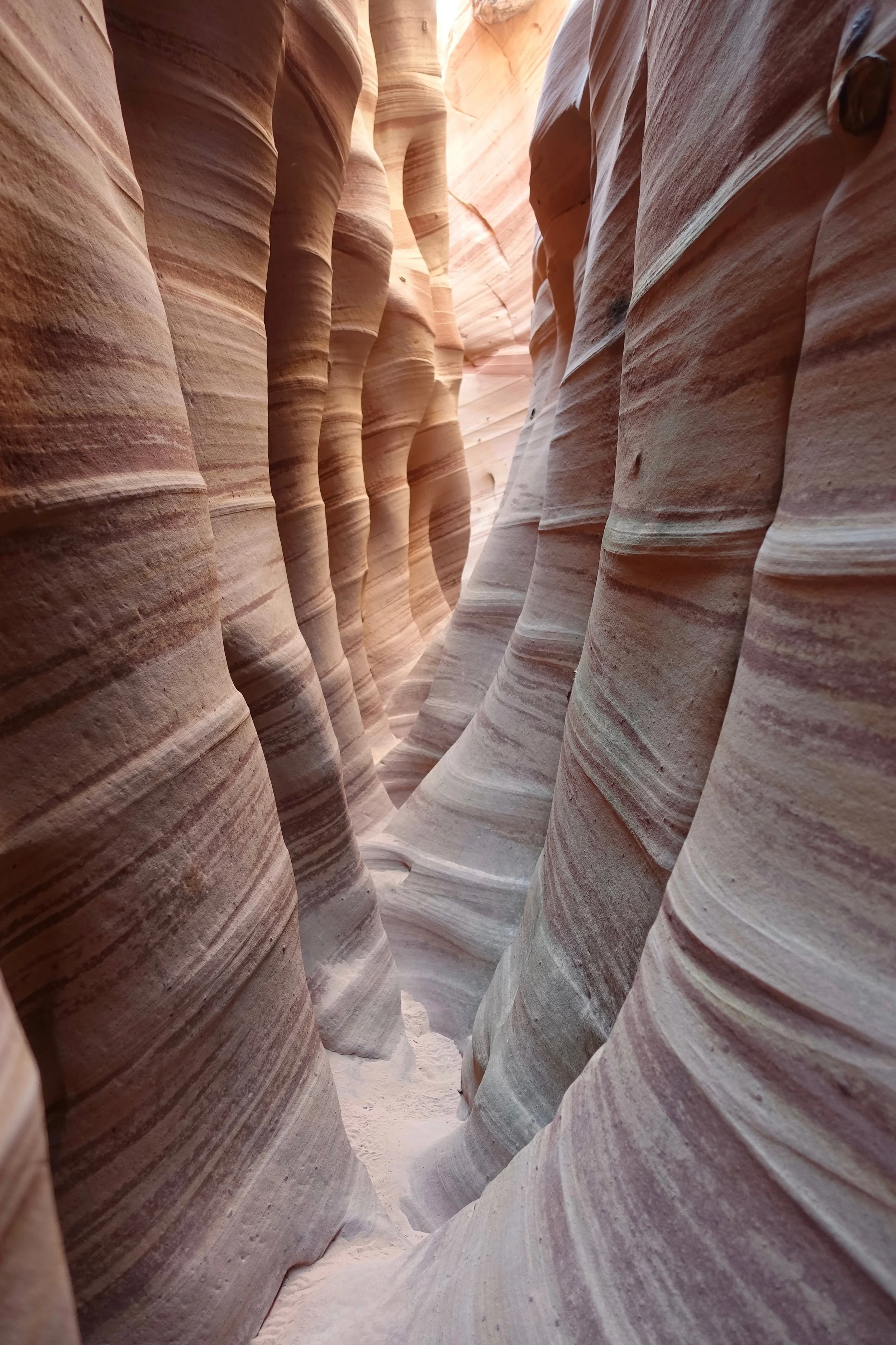
This small slot canyon is unique with zebra like pink and white walls
Willow Gulch
I combined Willow Gulch with Coyote Gulch as it is only five miles south of Fortymile Ridge and both are far down the road. The alcove across from Broken Bow Arch made for a memorable campsite
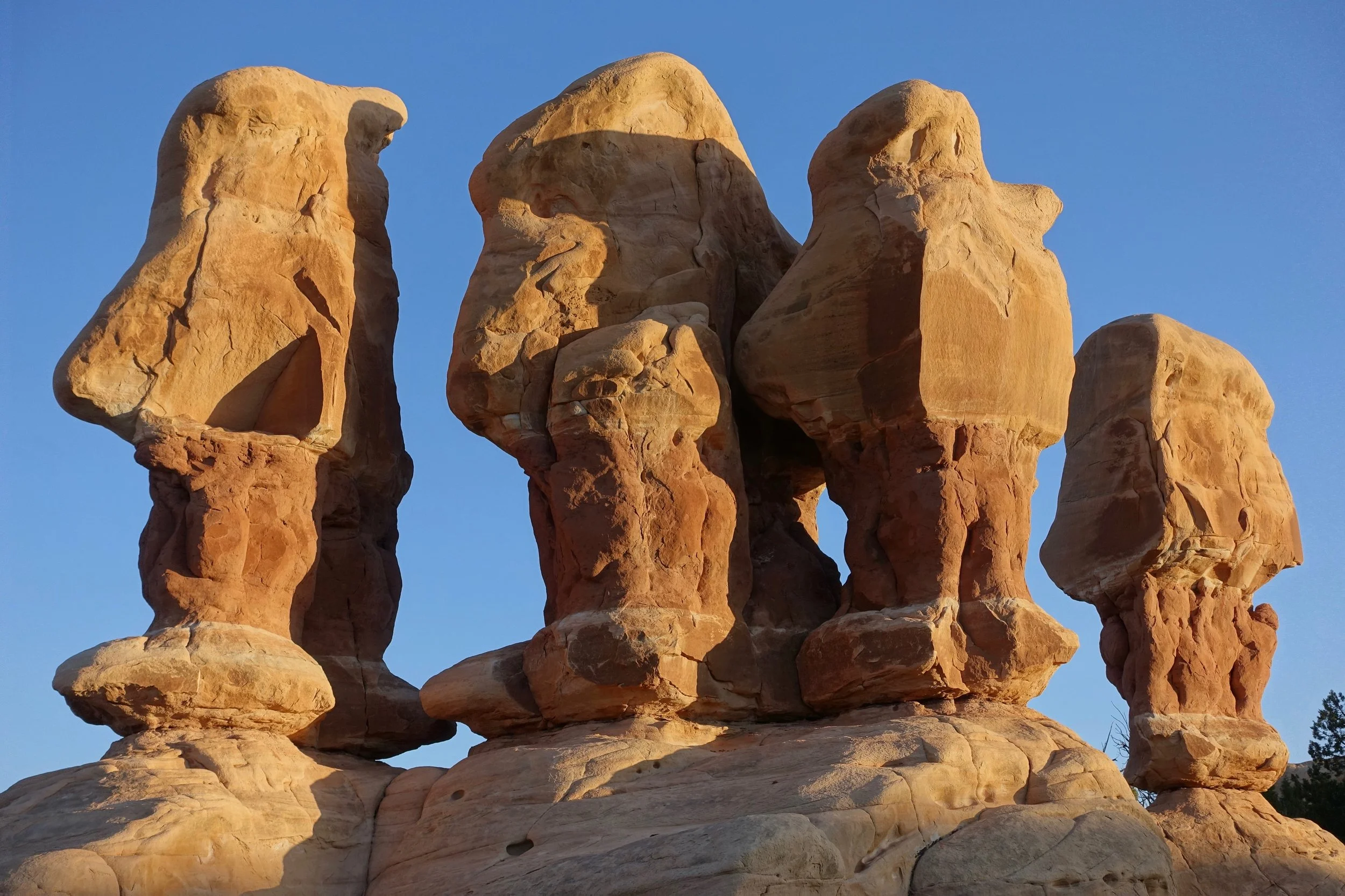
Devil’s Garden
Upper Muley Twist Canyon
Saddle Arch in Capitol Reef National Park
Peek-a-boo Arch
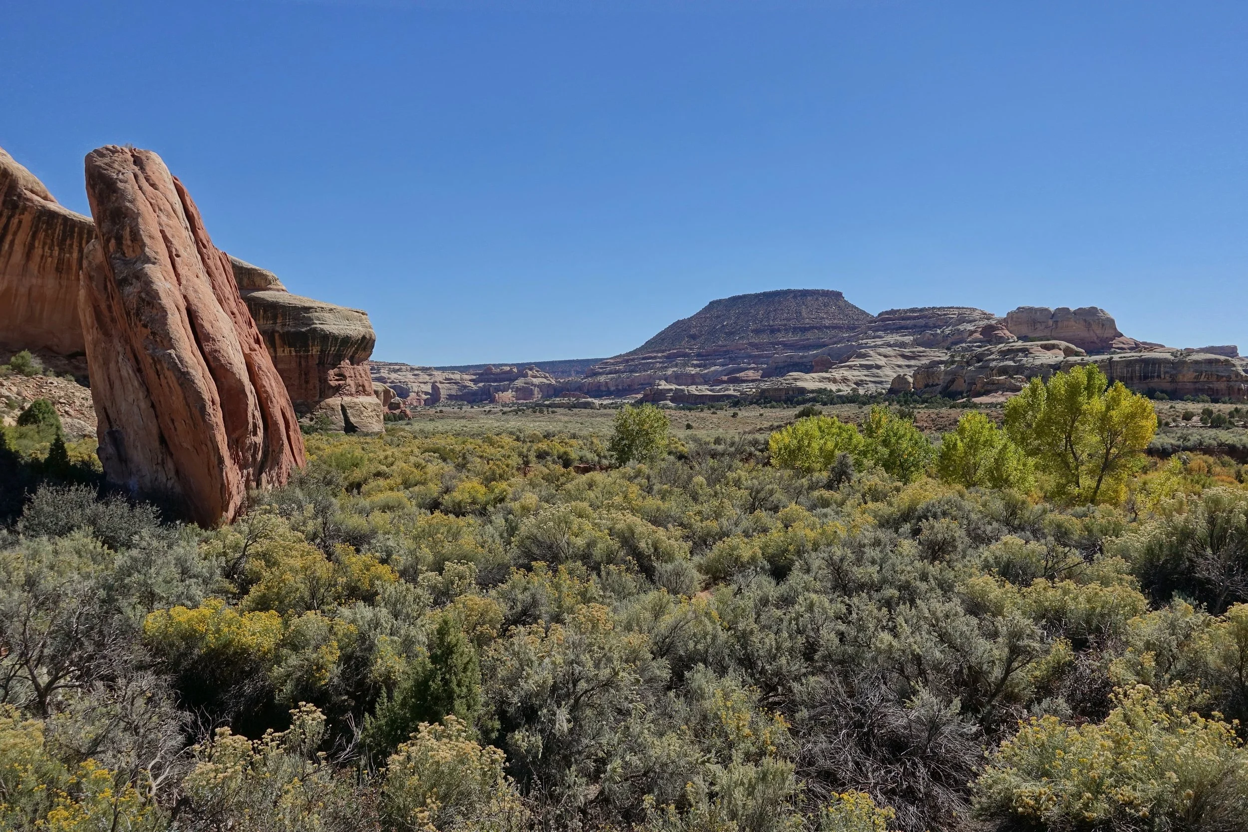
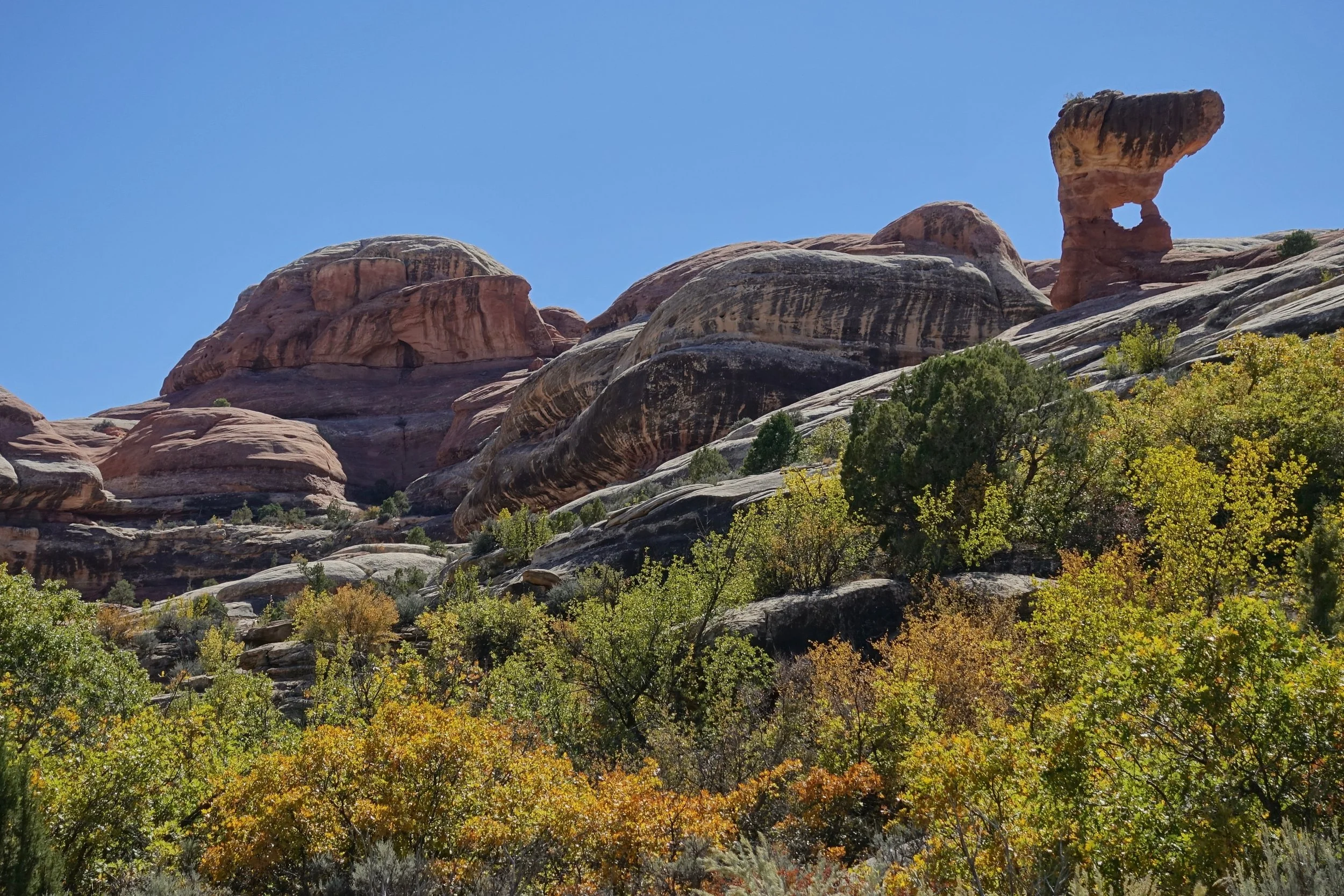
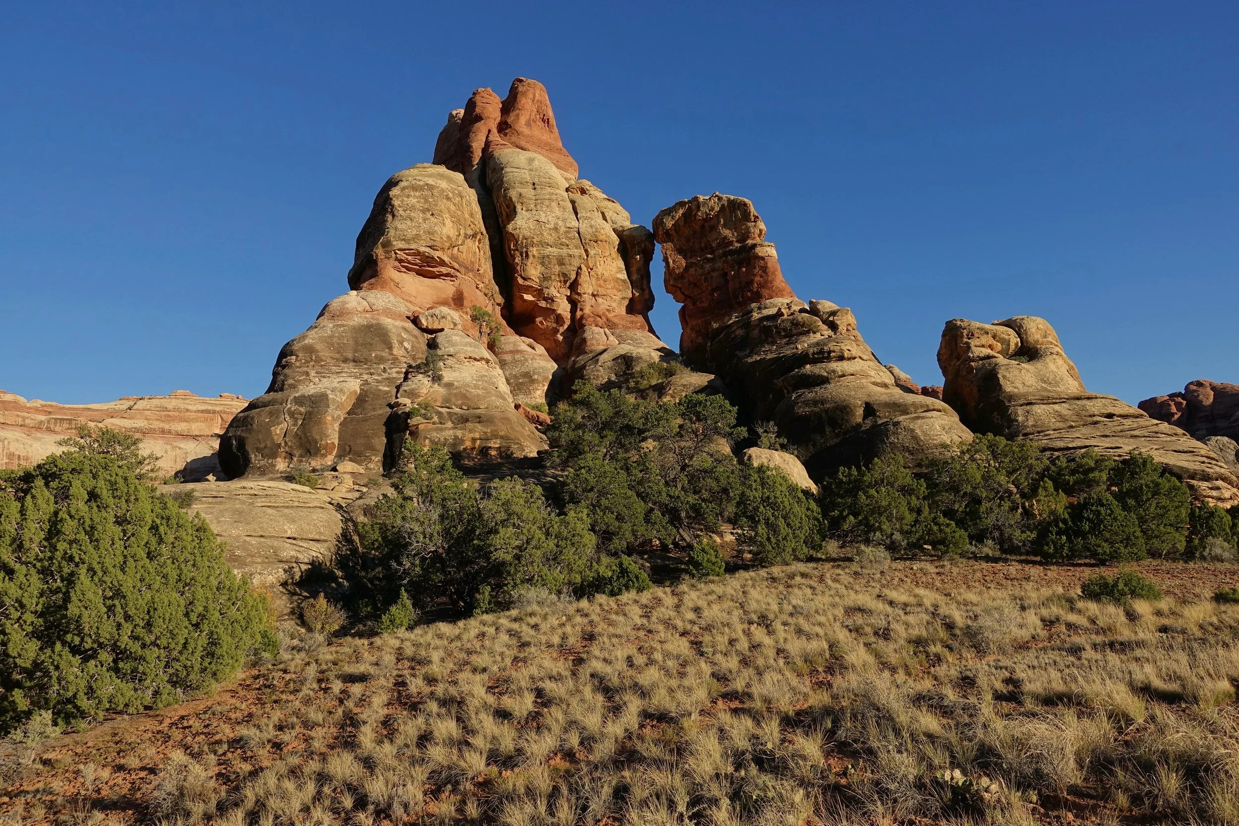
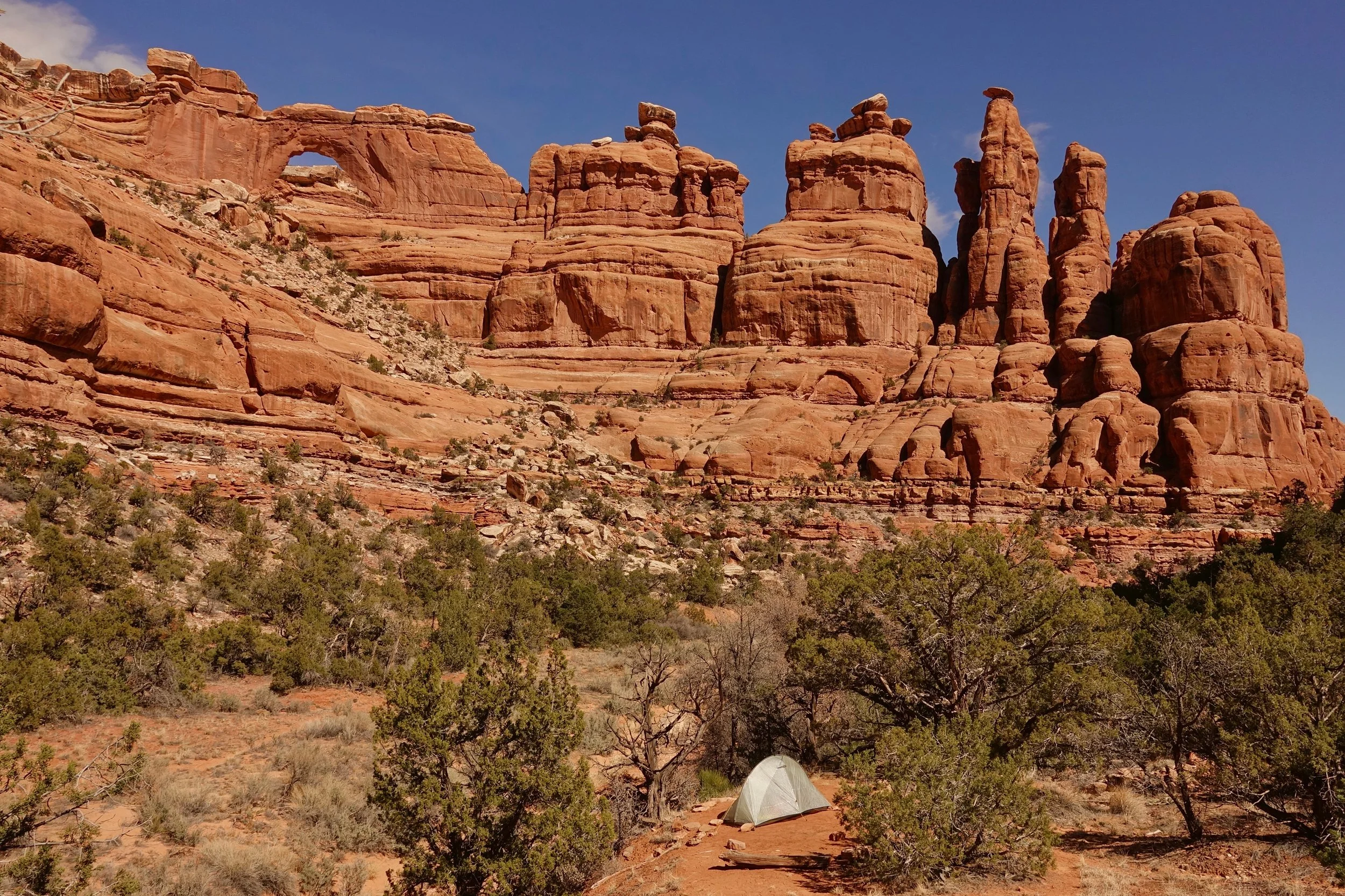
Canyonlands - Needles District
Chesler Park and Druid Arch
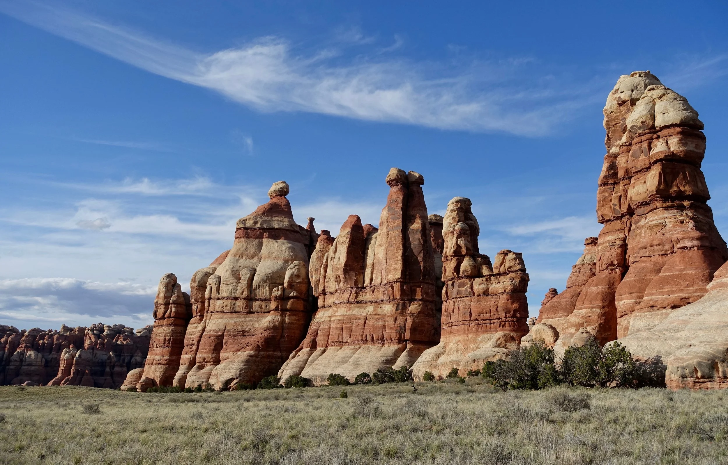
The walk to Chesler Park was my first backpacking trip where I had to carry water. A good place to learn as the campgrounds are no too far from the trailhead.
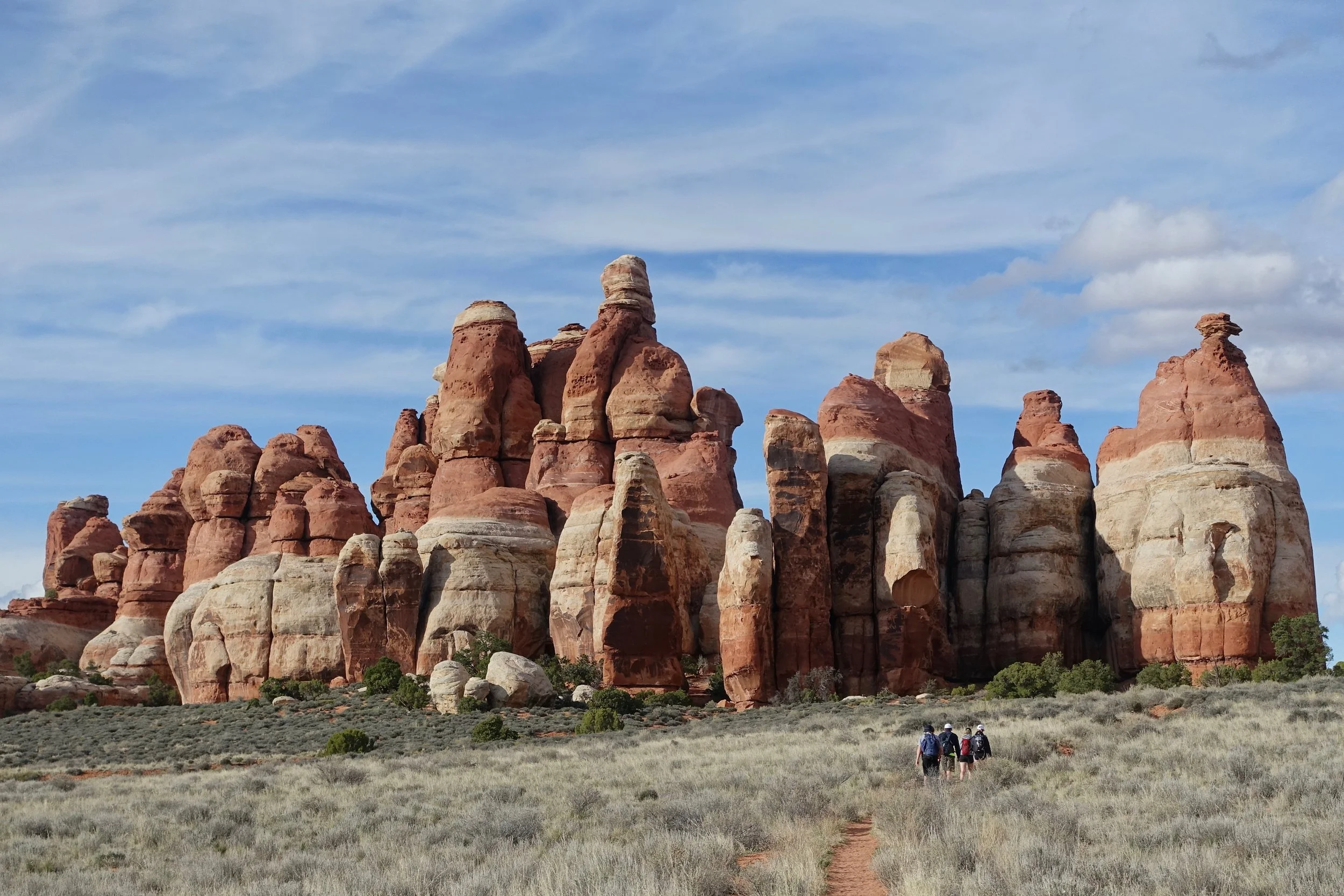
I spent a night in Chesler Park and took side trips to the Joint Trail and Druid Arch
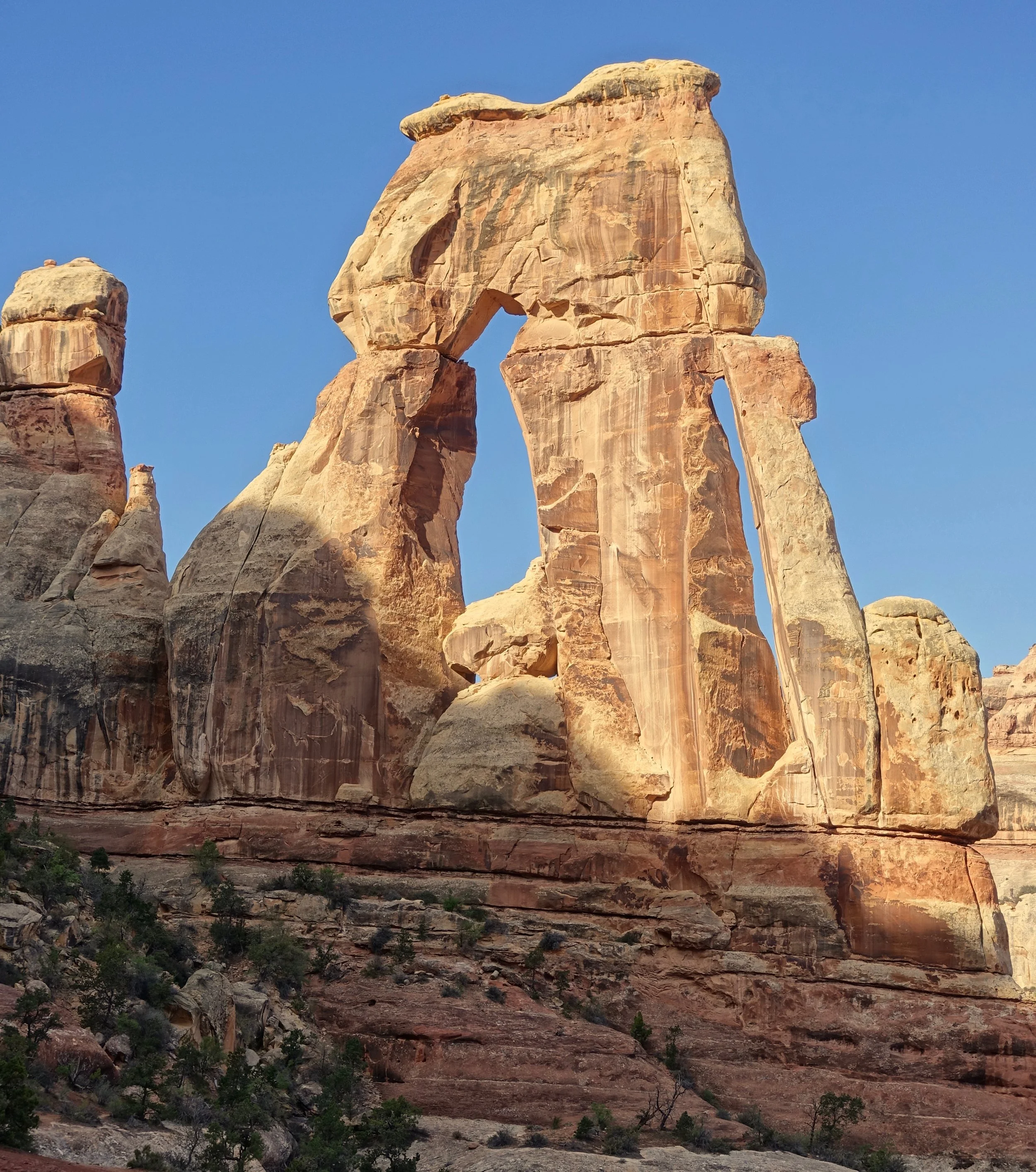
Druid Arch
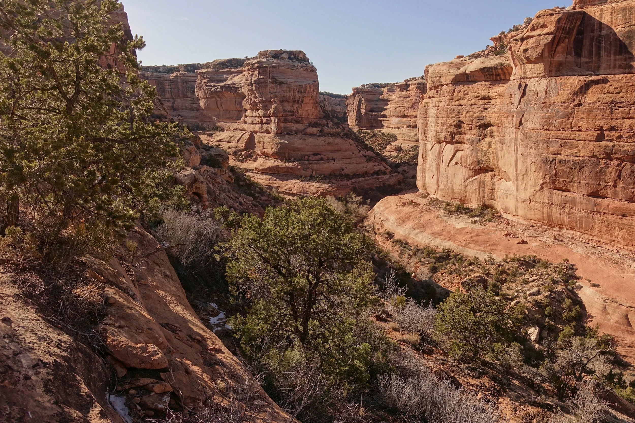
Salt Creek Canyon
A longer backpacking trip is required for the Salt Creek Canyon section of the park in the Needles District
I walked from Cathedral Butte to Angel Arch (40 miles return). It would be possible to do a one way hike of similar distance and exit to the north with a shuttle
The area above SC4 is similar to Chesler Park. The campground all had good water sources near them

Angel Arch and Molar Rock
The nearest campground to the arch is SC4 which meant walking in the dark to see it at sunrise..
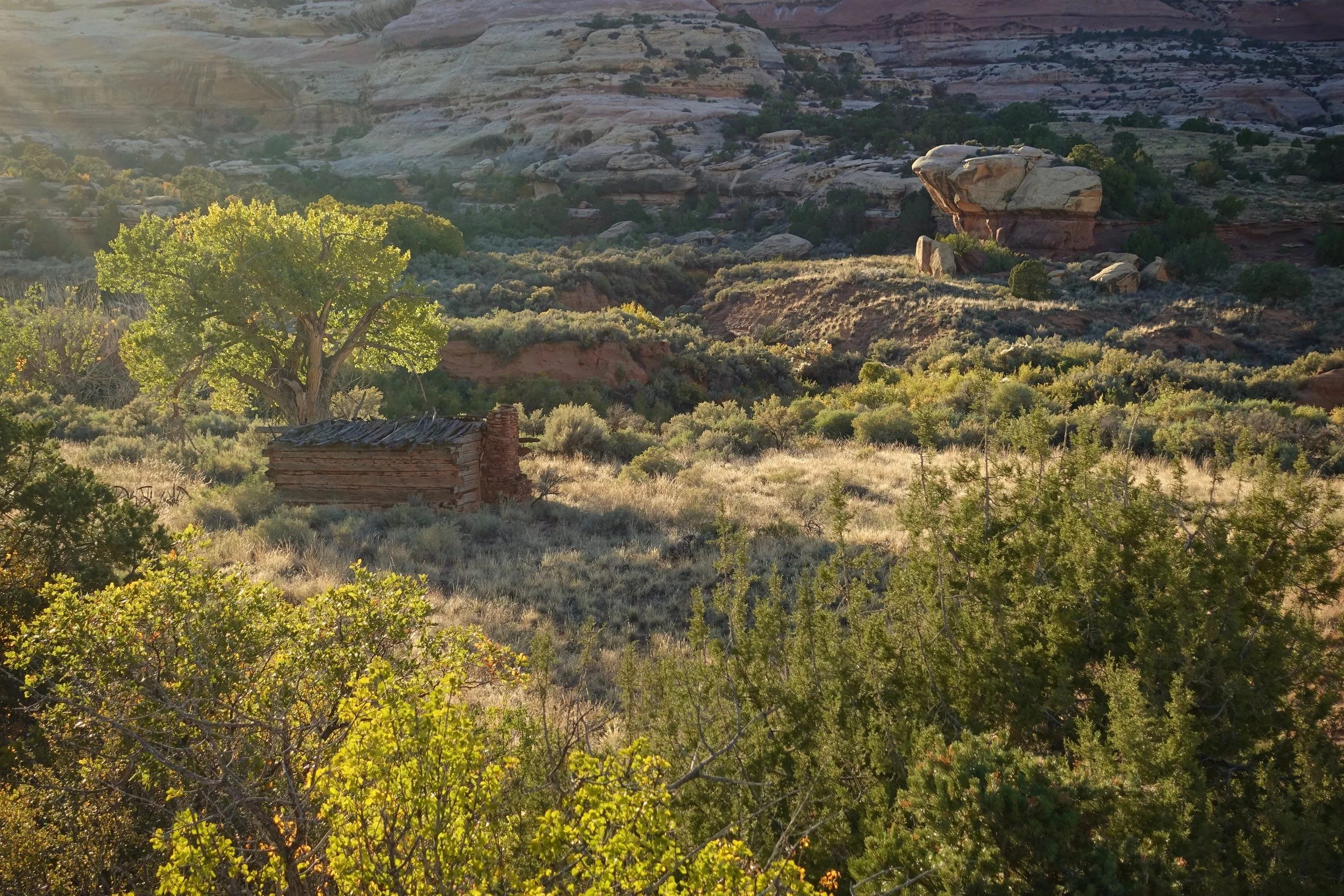
Kirk's cabin near the SC1 campsite
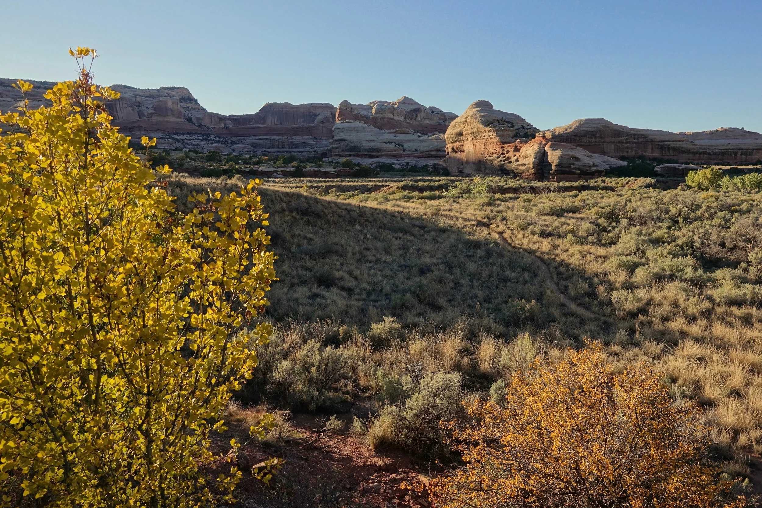
Late evening at the final campground in early October
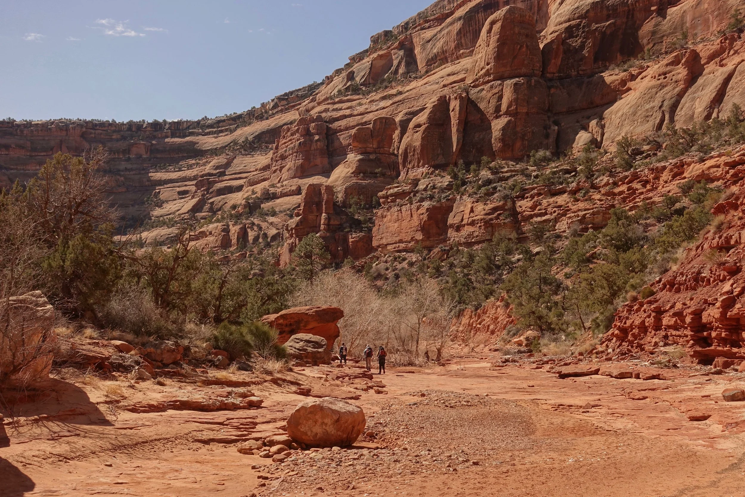
Fish and Owl Creek Canyon
I walked the Fish/Owl Creek Canyon loop clockwise, going down into Fish Creek on the first evening (18 mile loop)
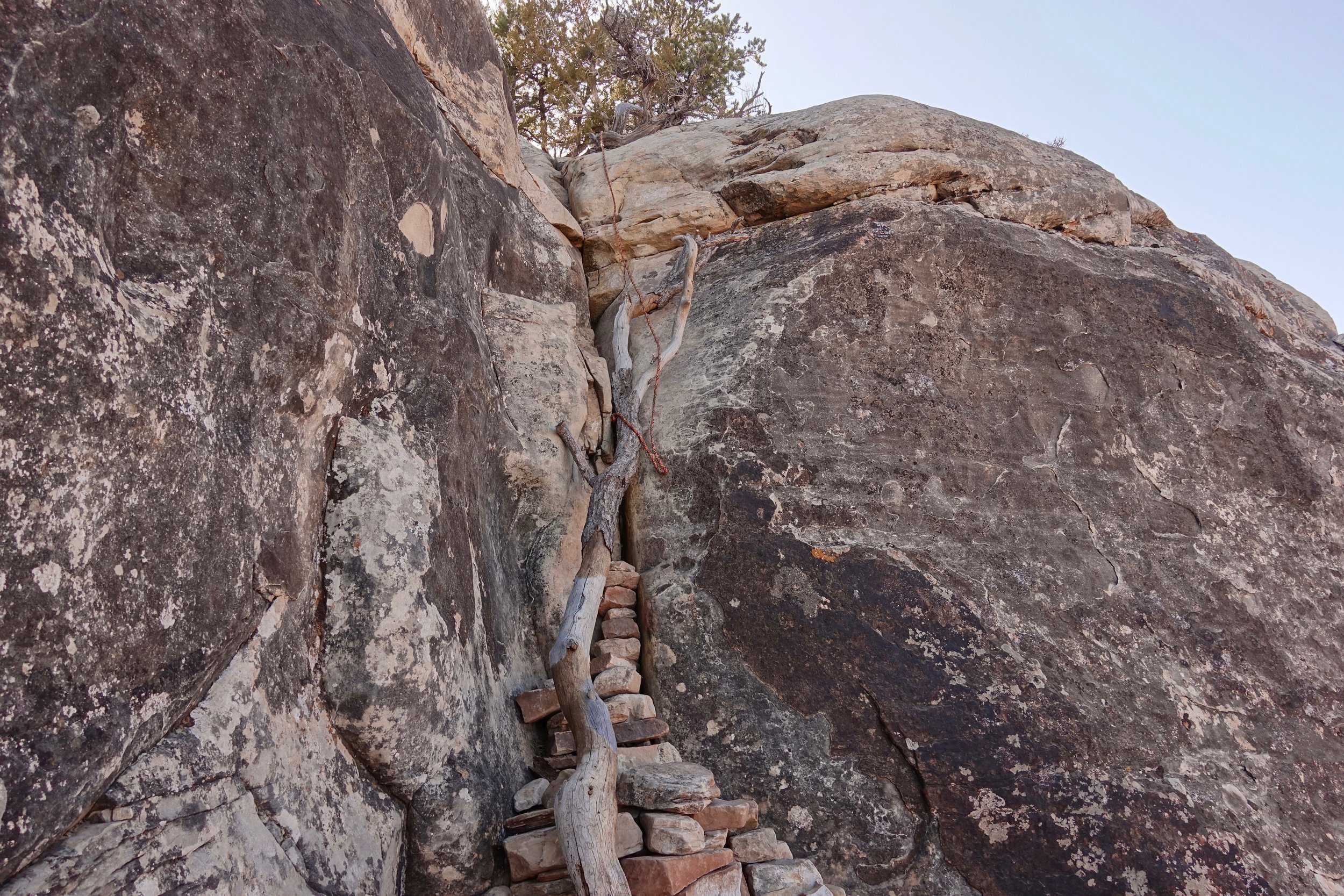
There is one short drop on the descent, but with the tree branch and some footholds in the rock it's not too bad
A permit is required to walk in the canyons, so I chose to do the walk at a relaxing pace spending two nights camping. Keep in mind that not every trail down there is for this loop - there are often cairns leading into side canyons. Water is mostly on the western side closest to the official trailhead in both canyons, completely dry in the east when I visited in mid-March during the spring runoff.
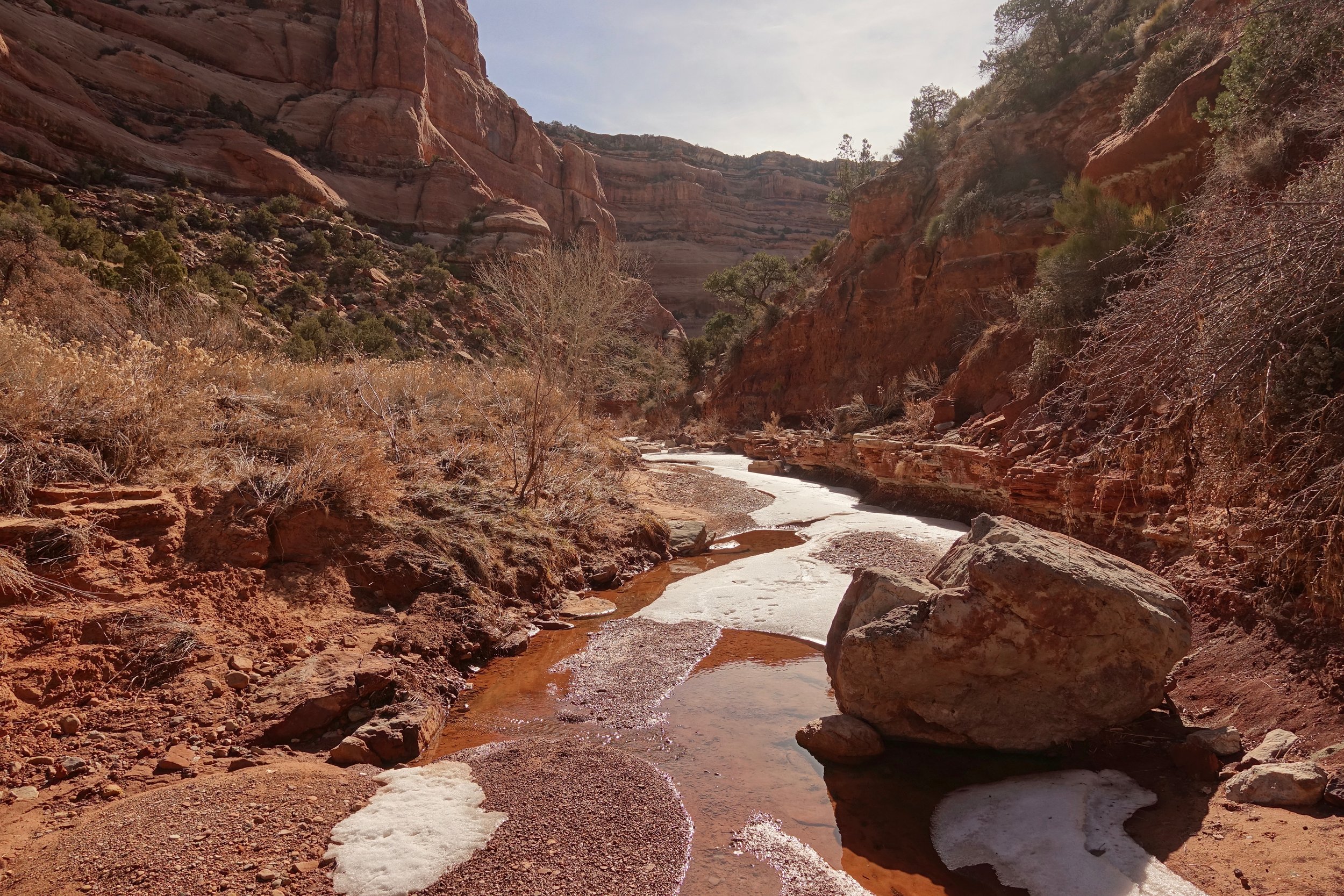
The leftover snow made the walking easier at times
Reservations were close to full when I booked the permit, but I only saw one group of hikers. The cold nights in March keep the crowds away before the busier season in April
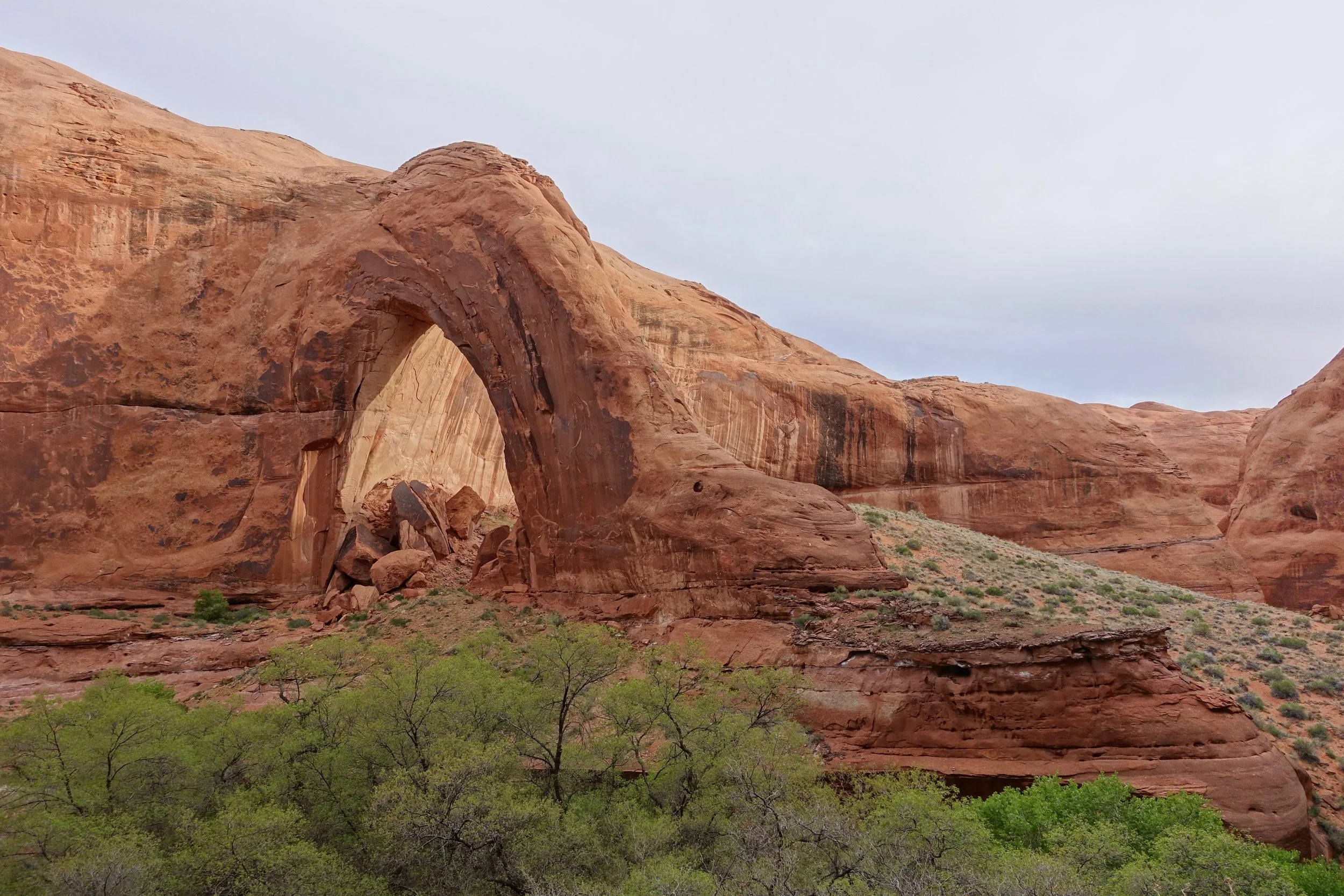
Nevills Arch - the gem of Owl Creek Canyon