Chile and Argentina
Fitz Roy
Torres del Paine
Easter Island
Dientes Circuit
Cerro Castillo
Parque Patagonia
Parque Lauca
Patagonia South
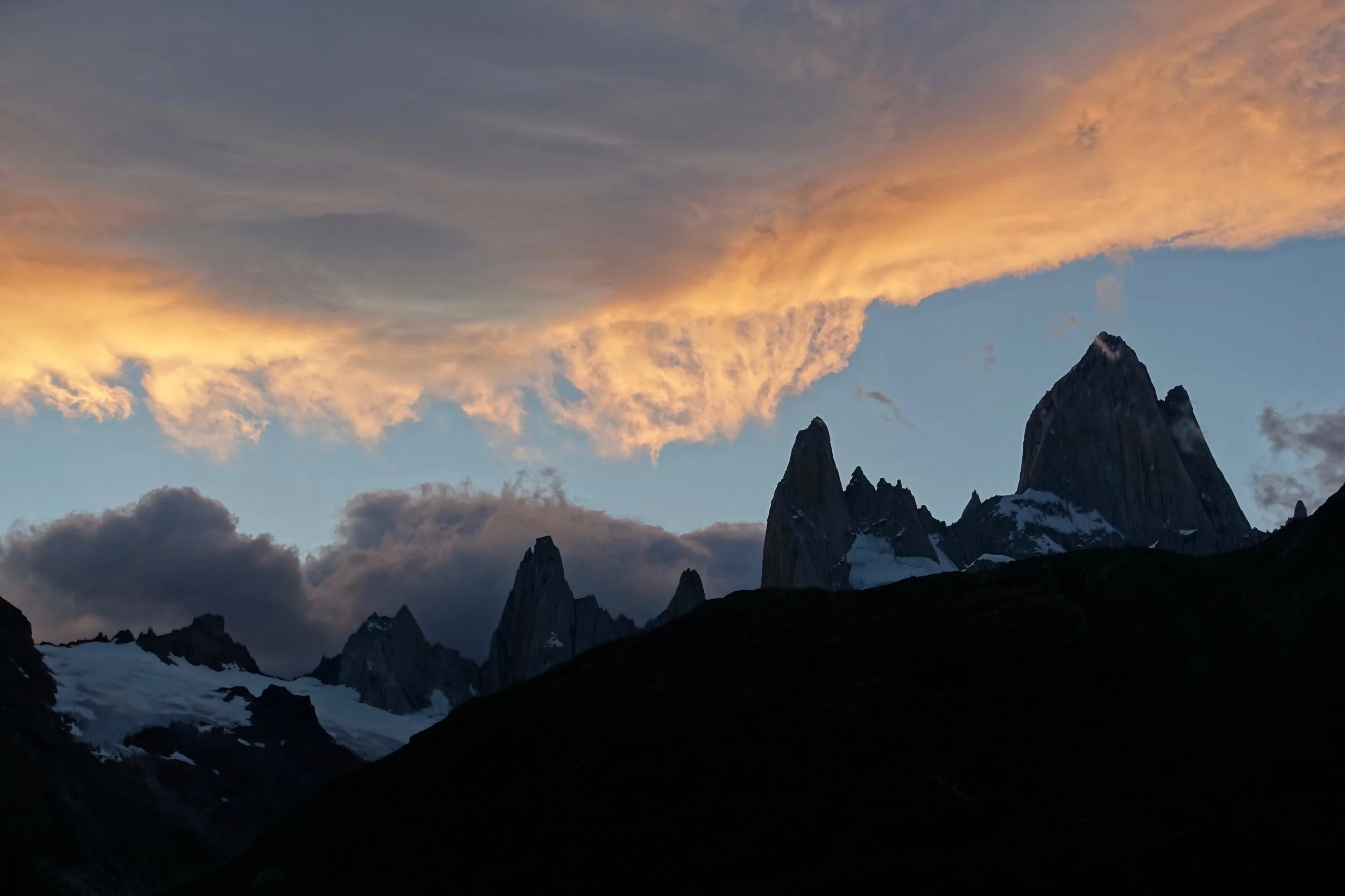
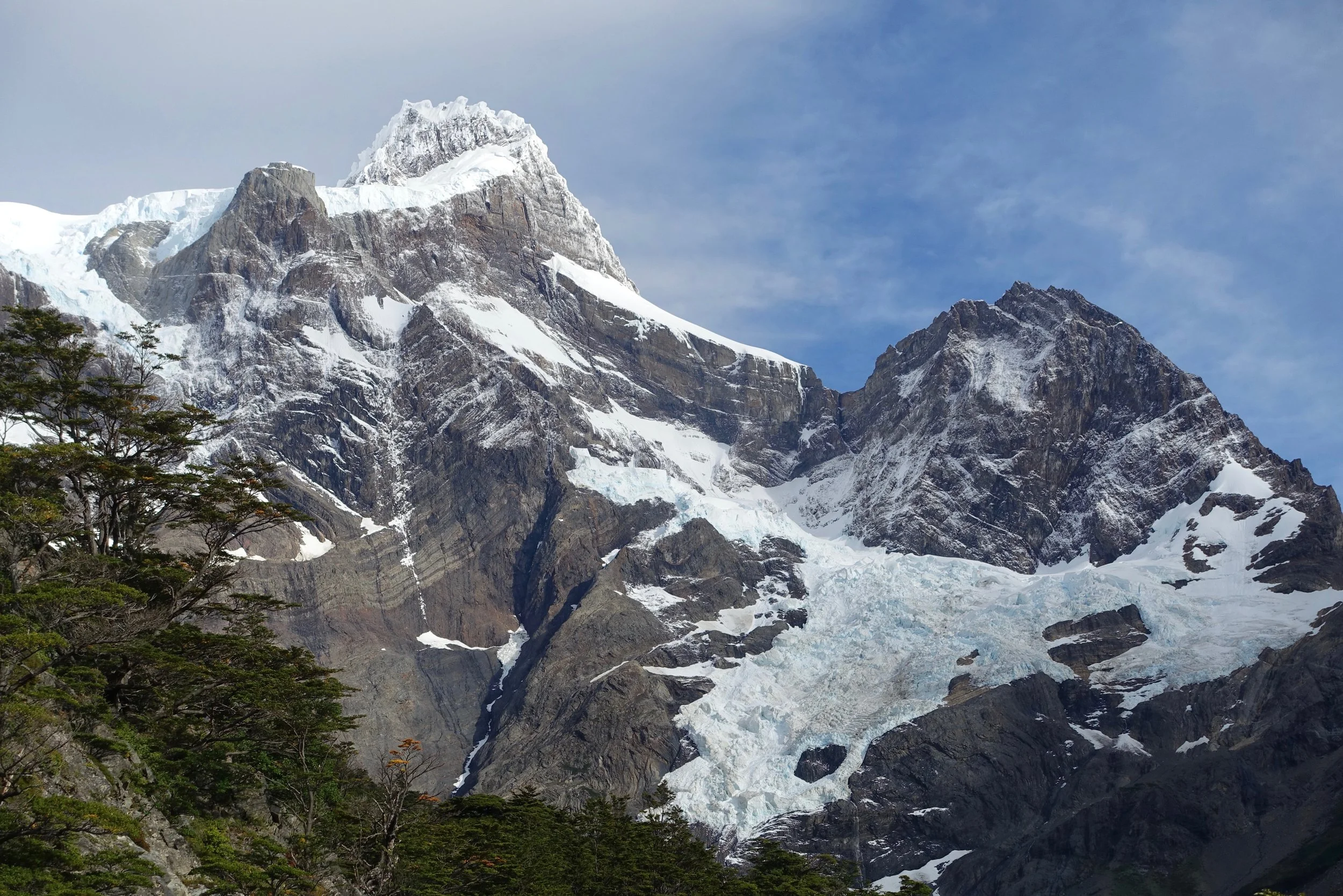
Mount Fitz Roy
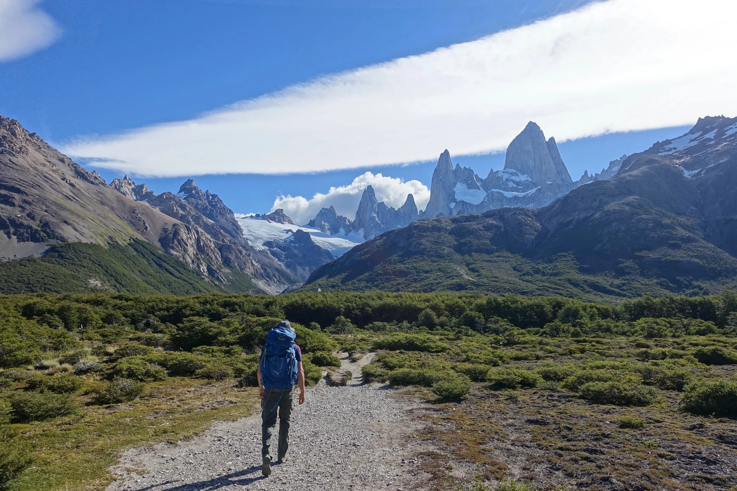
The best experience in Patagonia is hiking in the El Chalten region around the Mount Fitz Roy in Argentina. The hiking is relatively easy to Laguna de los Tres and Laguna Torre (10-15 miles)
Starting the trek to Laguna de los Tres from El Pilar Hosteria is possible with a shuttle from town
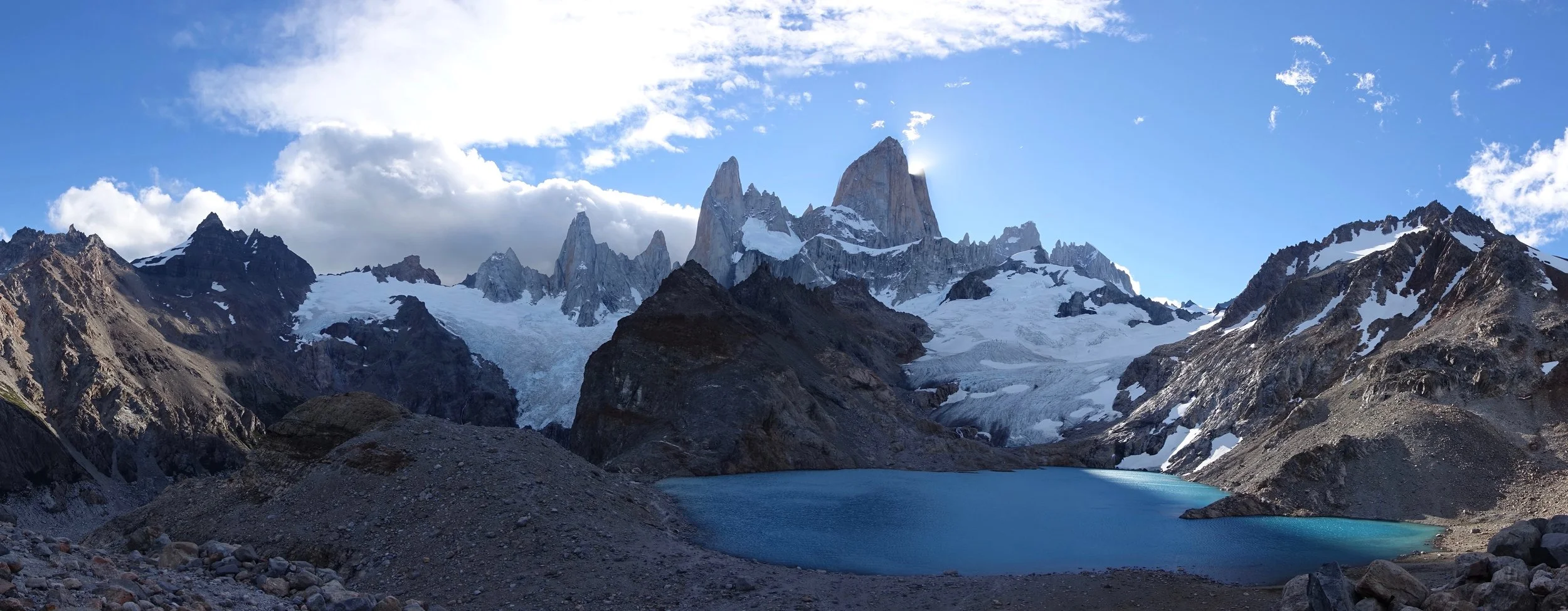
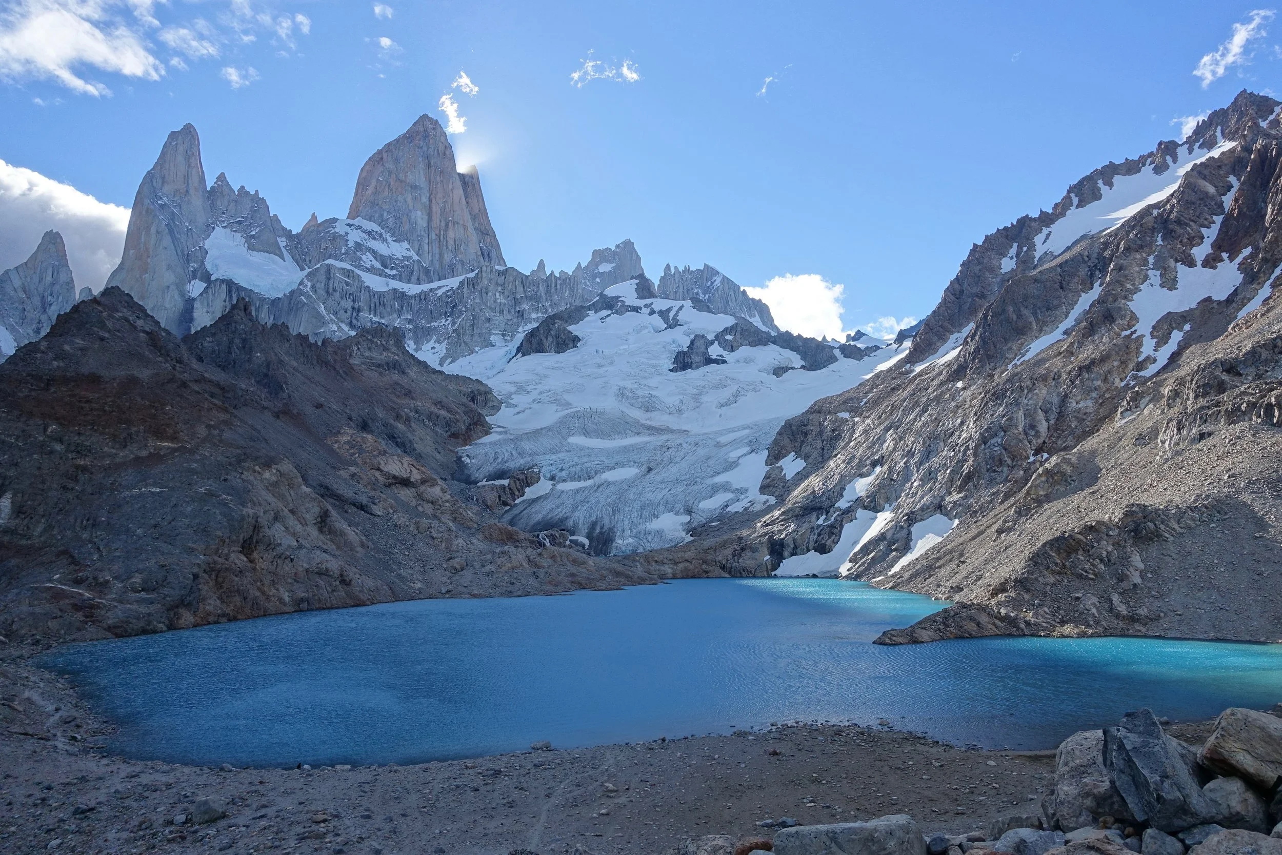
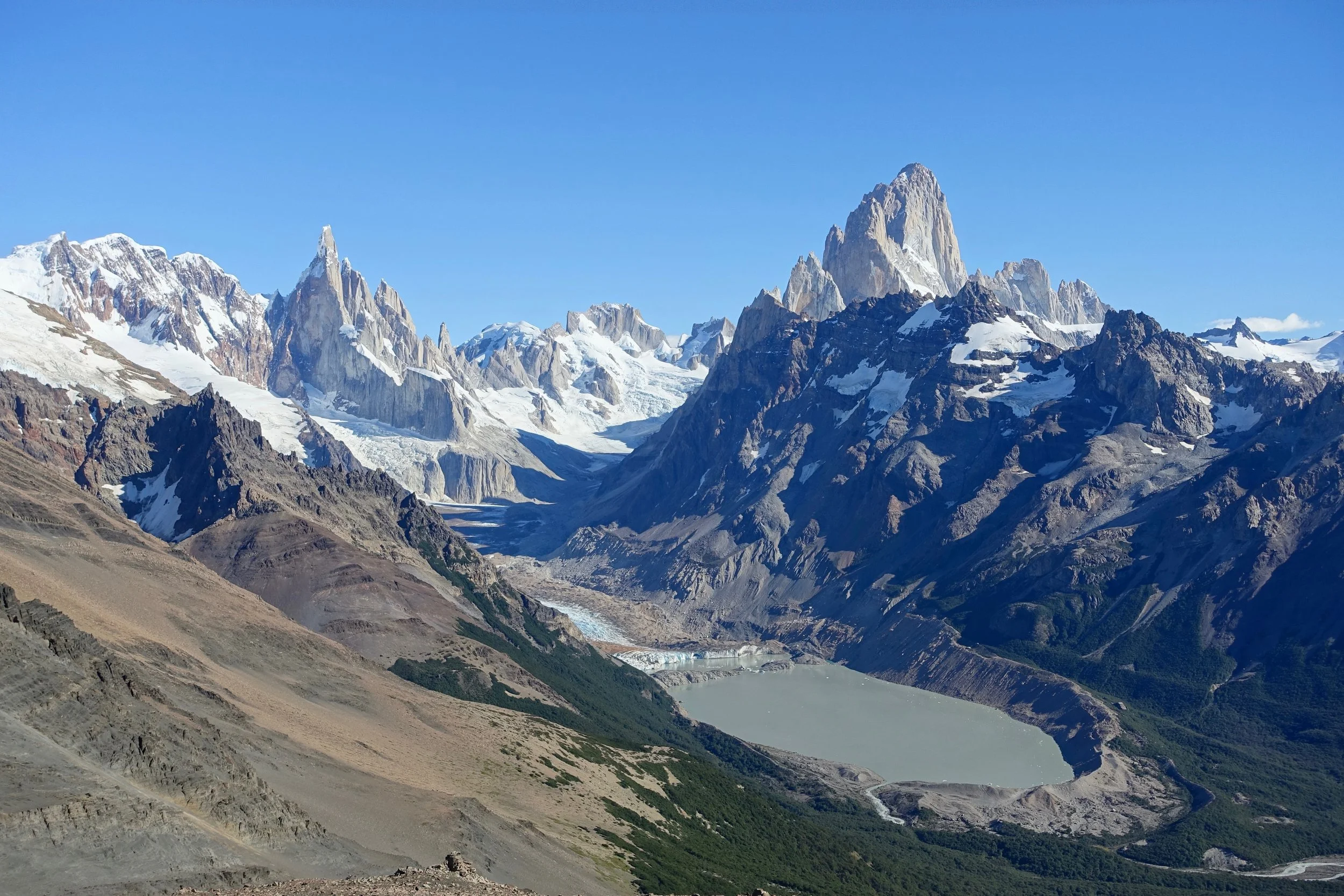
Laguna de los Tres
Combining Laguna de los Tres with Laguna Torre as a short backpack is possible although both can be completed as dayhikes
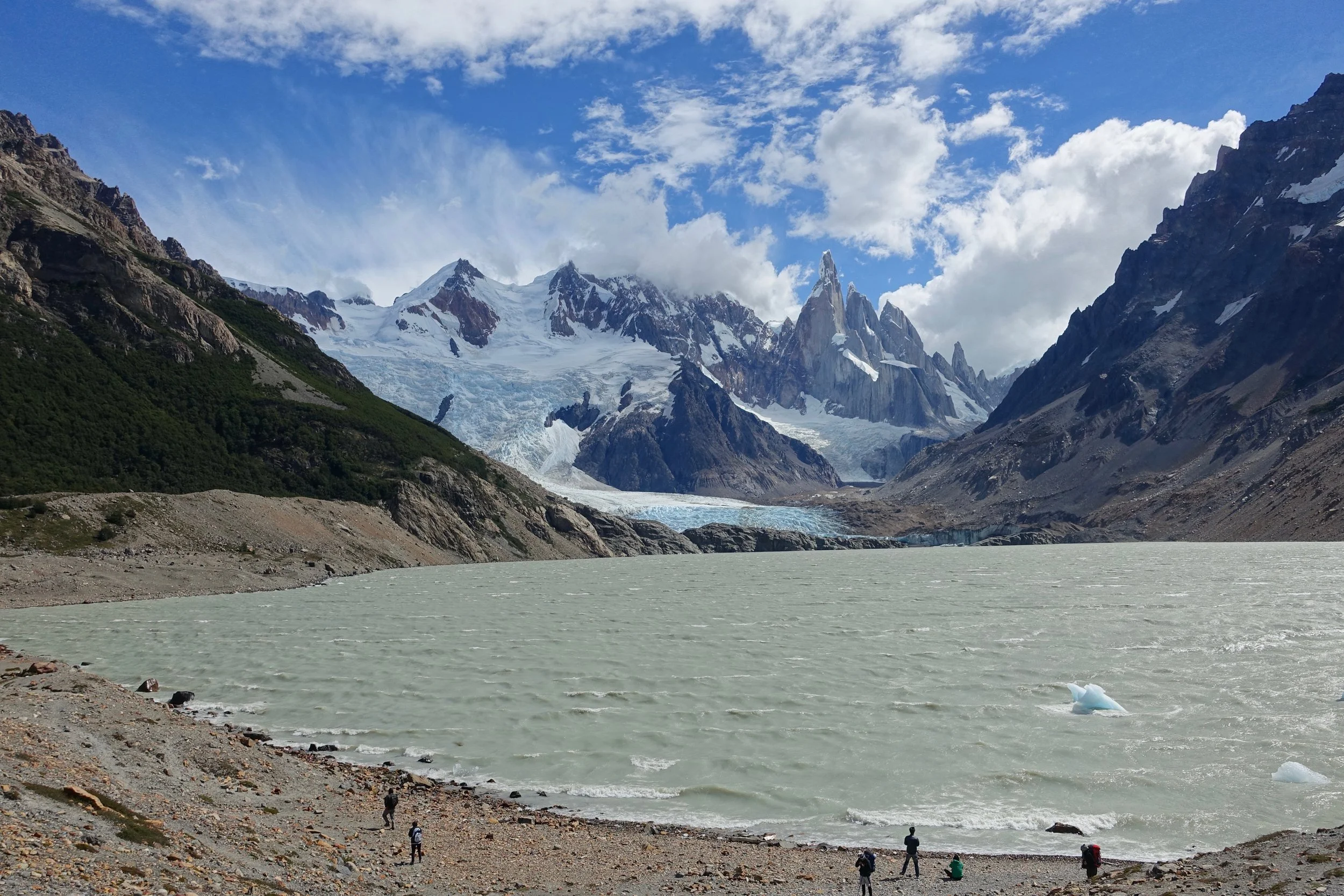
Laguna Torre
The lesser traveled of the hikes in the El Chalten region is to Loma del Pliegue Tumbado (12 miles, 3300 ft gain)
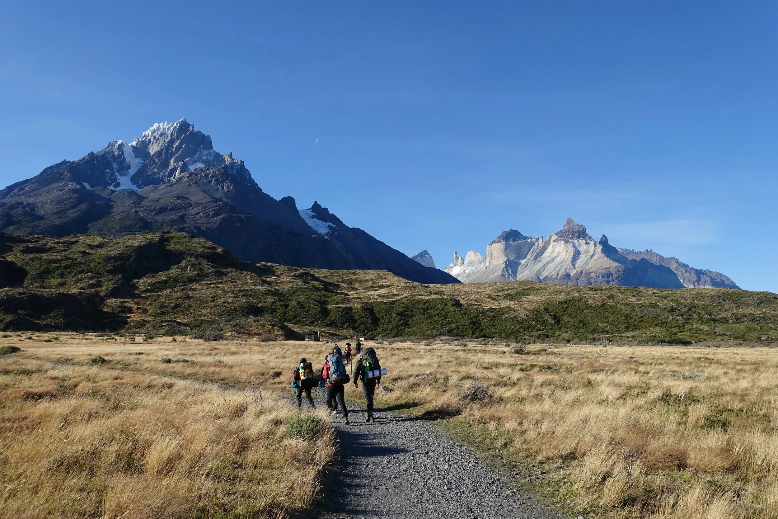
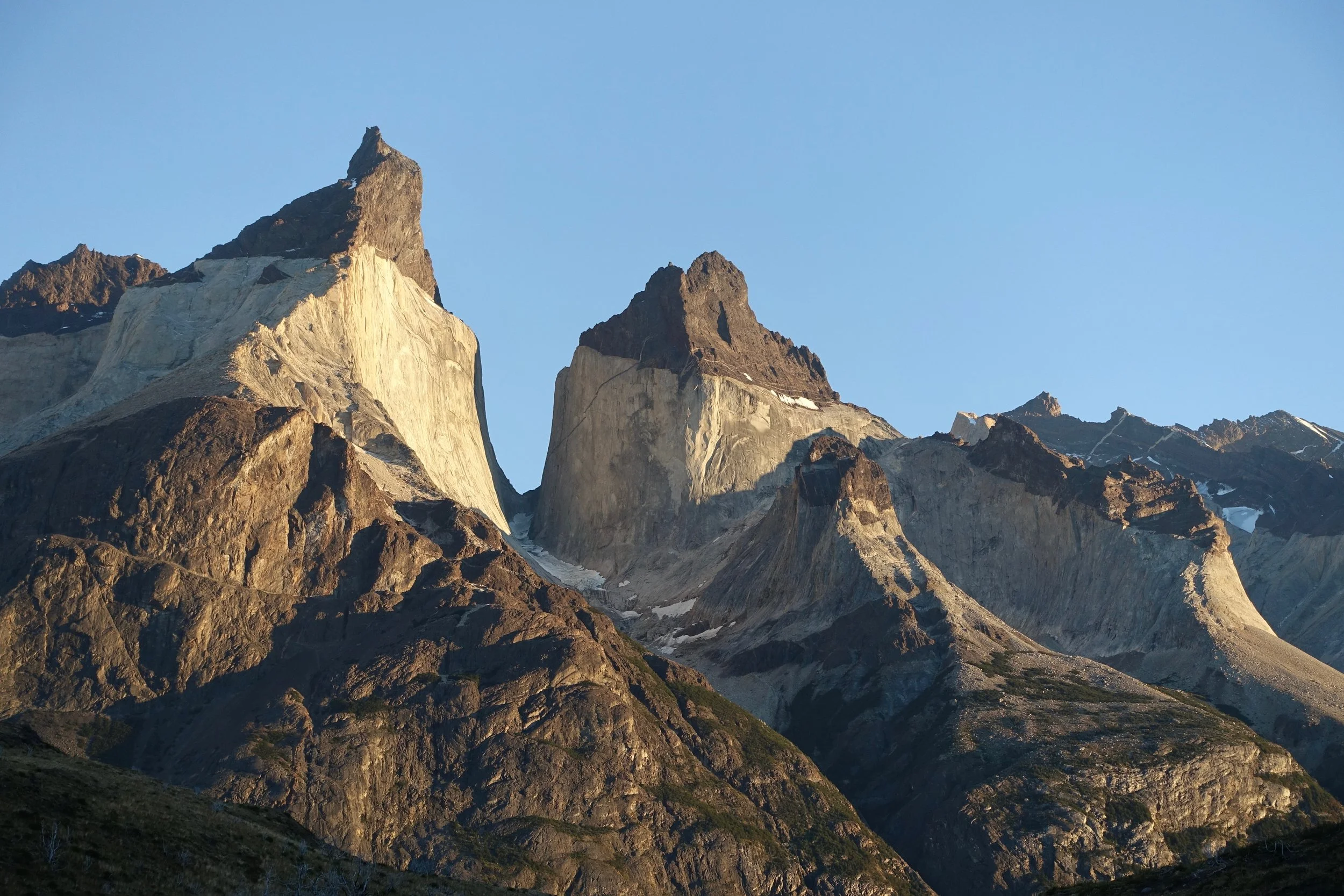
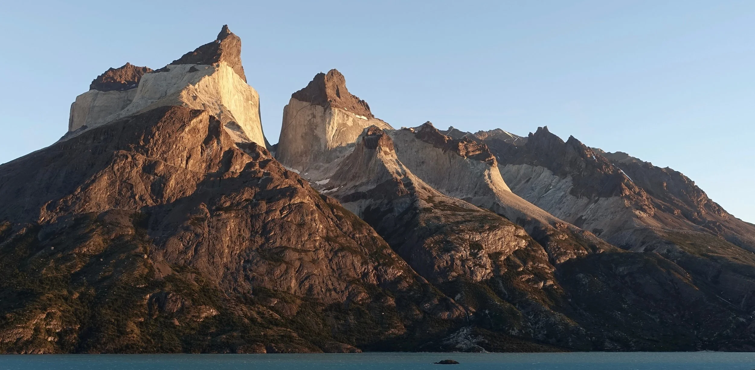
Torres del Paine
Torres del Paine is other popular area that represents Patagonia on the Chilean side of the border
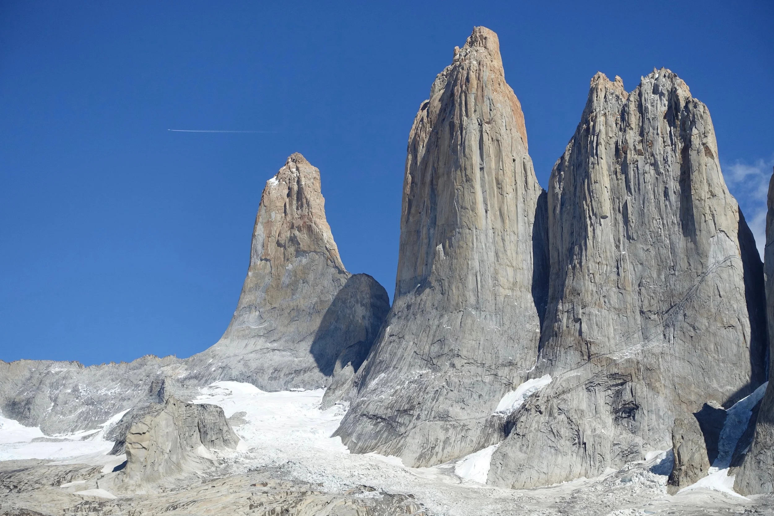
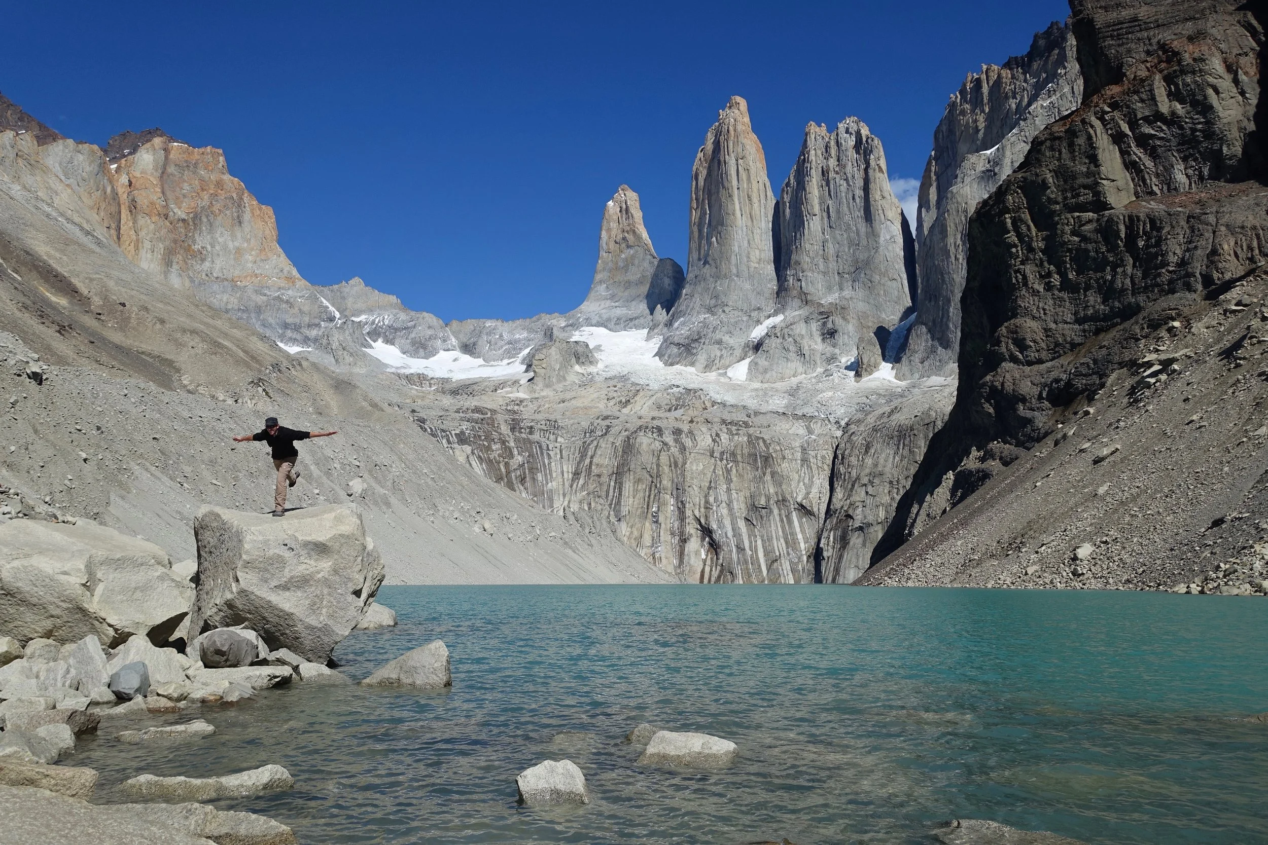
The base towers hike and a shorter hike to see the Cuernos of Paine were my two favorites in the park
A day hike from Refugio Paine Grande up the French Valley is possible by taking the evening Catamaran the night before the hike (16 miles)
Mirador Frances is the highlight here, about halfway up the French Valley to Mirador Britanico
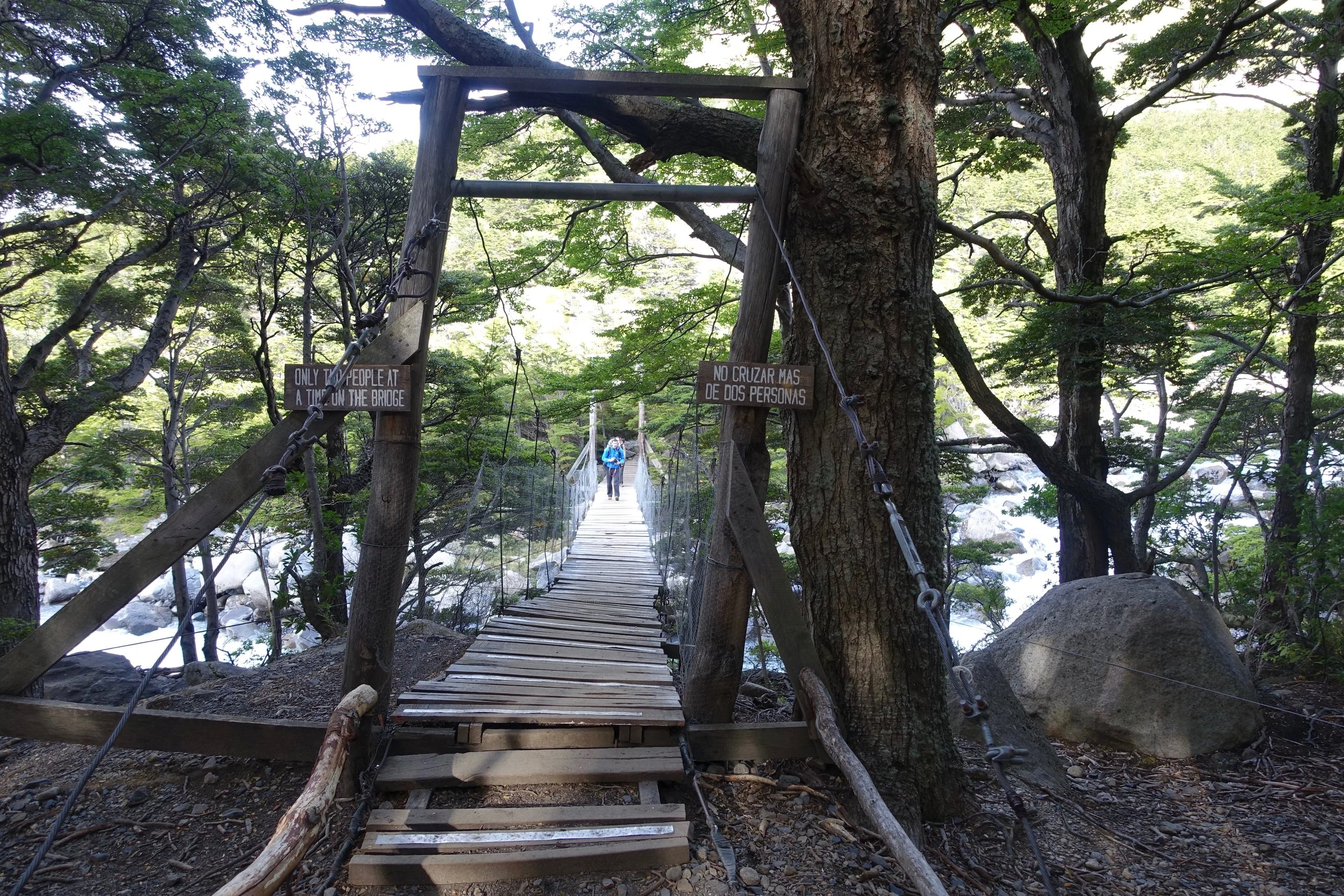
Bridge on the way to the French Valley
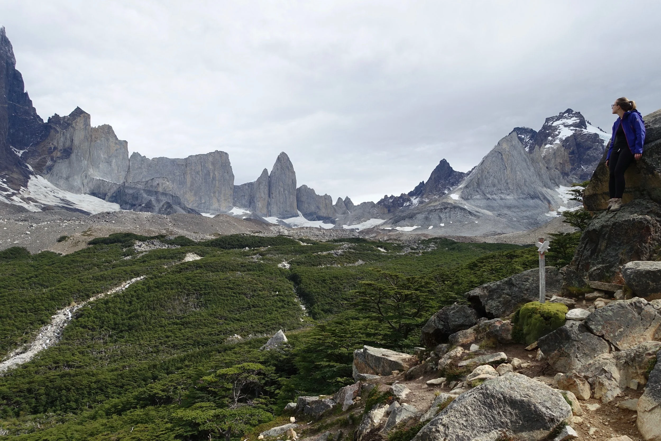
Mirador Britanico
There is also a short hike that offers views of the "cuernos" or horns of Paine from across the lake that starts at Salto Grande
I had difficulty getting permits and completed the "W" walk as separate day hikes camping in the areas near the hotels. Pre-bookings would be advised if wanting to walk the "O" or "W" circuit
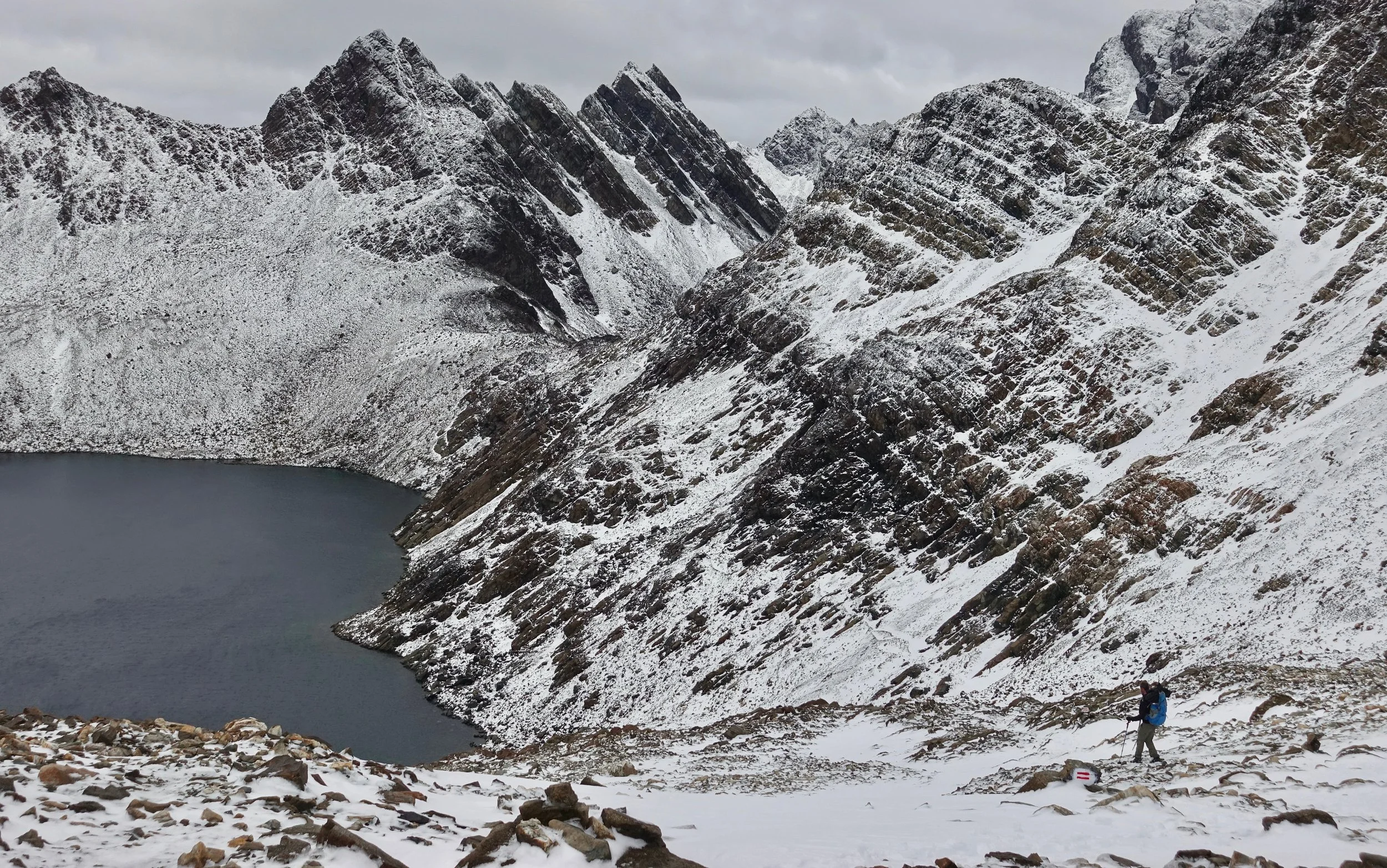
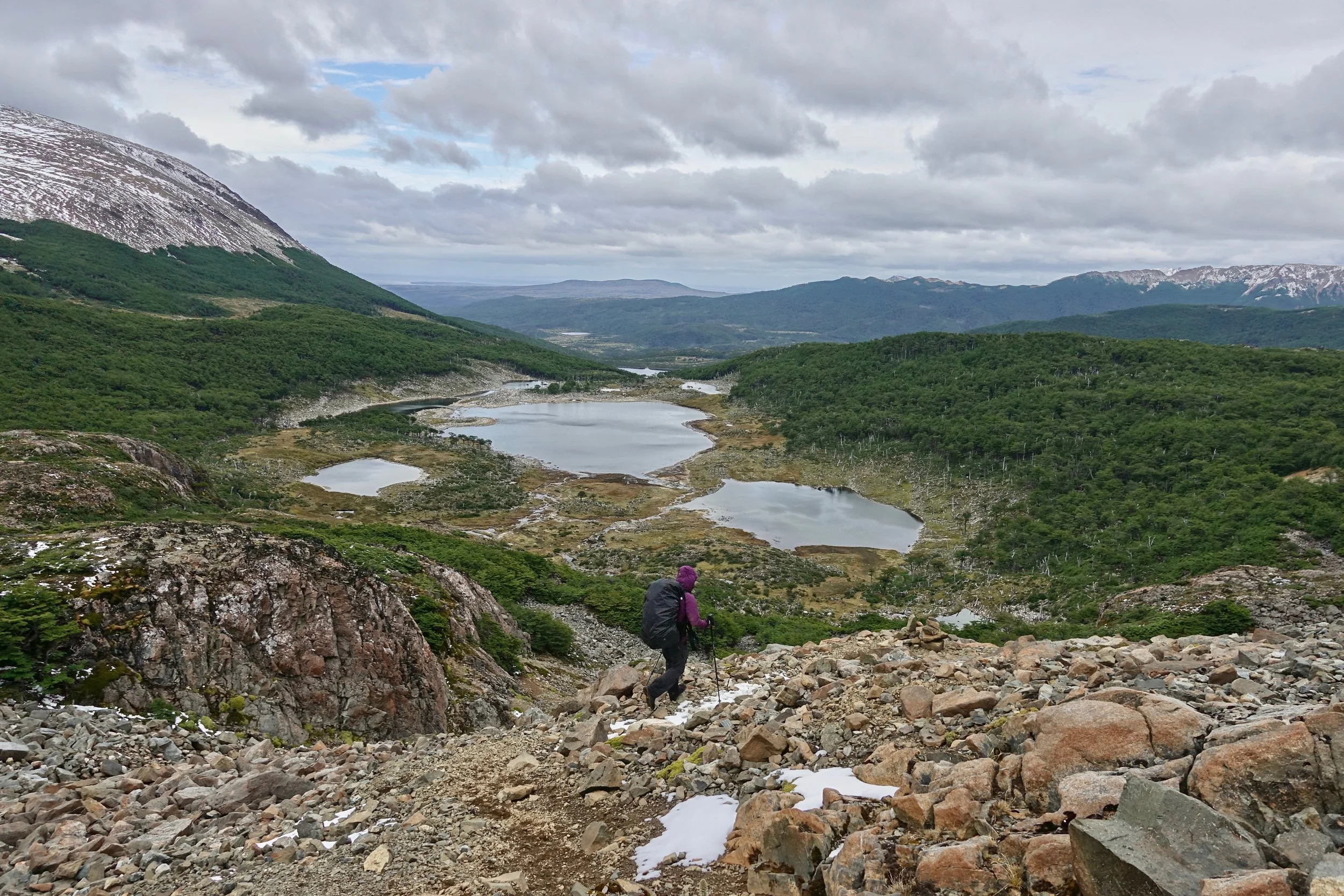
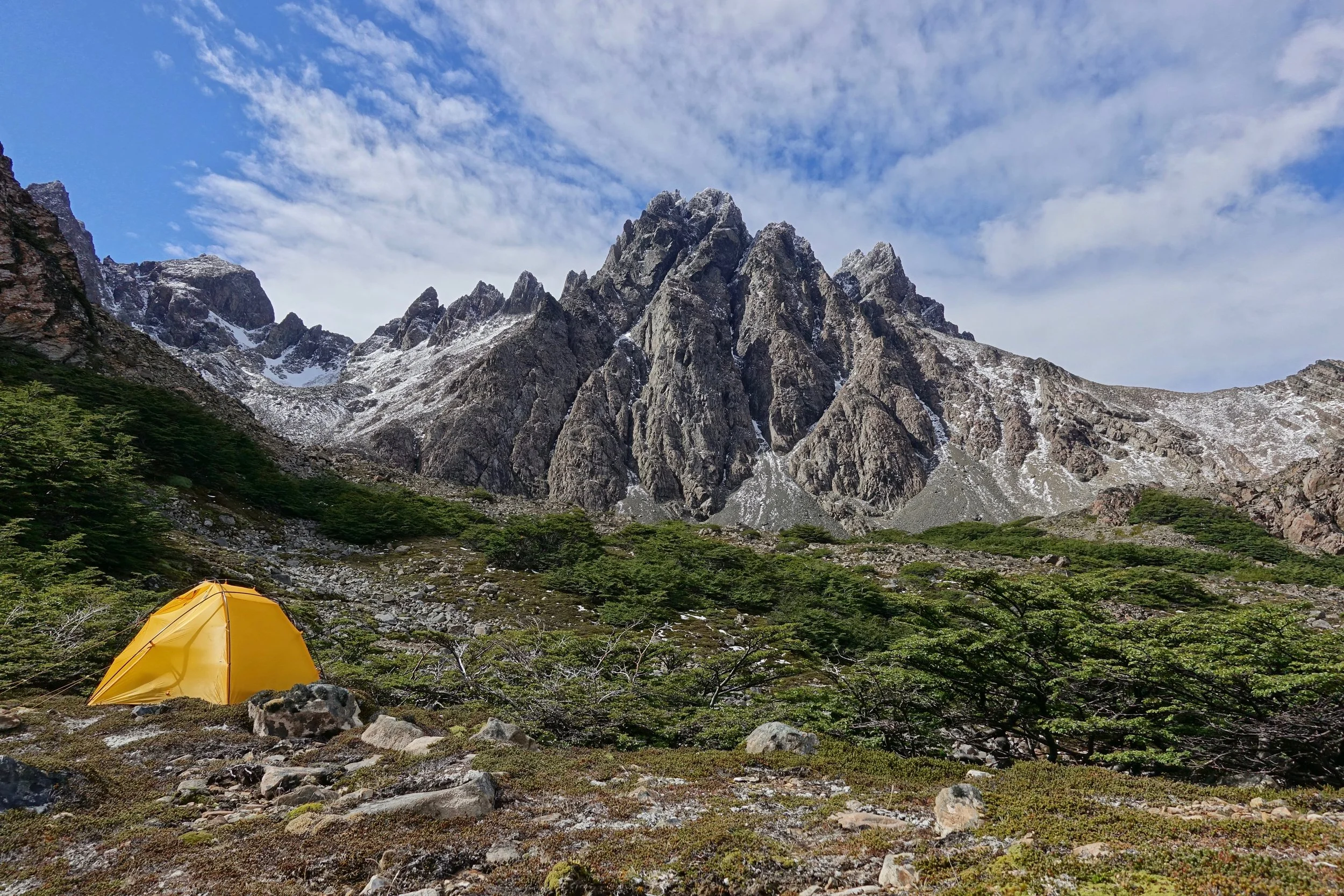
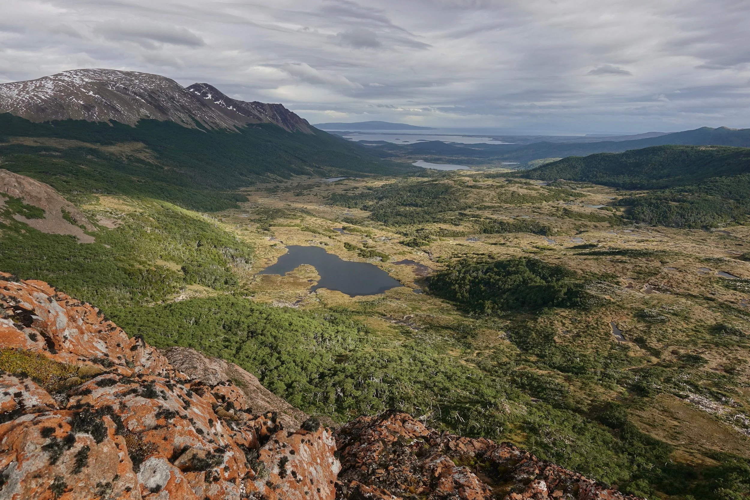
Dientes de Navarino Circuit
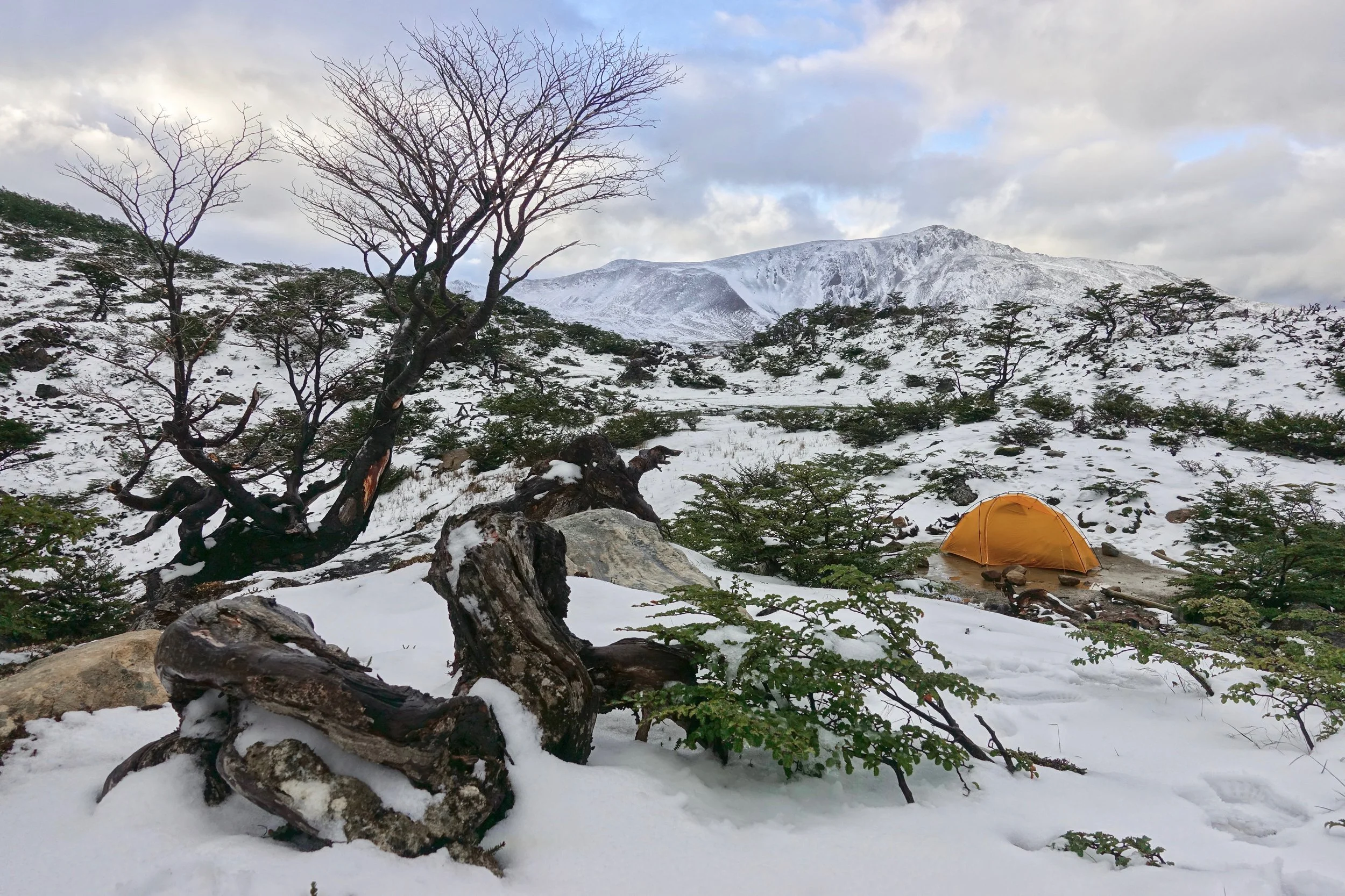
A more remote experience can be found further south on Isla Navarino walking the Dientes Circuit (33 miles, 6500ft elevation gain). The boat transfer fee from Ushuaia keeps some from doing the walk
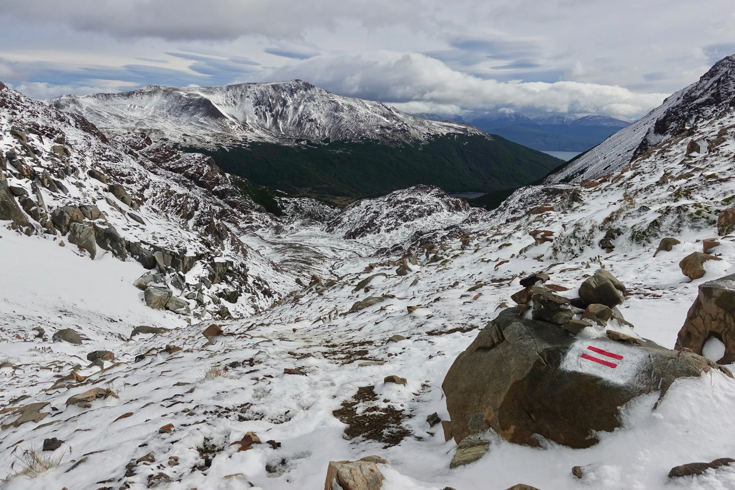
The track is well marked with red horizontal slopes, visible even with the snowfall
Trail between Paso Australia and Paso de los Dientes during a mid-summer snowstorm
Most of the snow had melted by afternoon
My favorite area of the walk was around Laguna de los Dientes
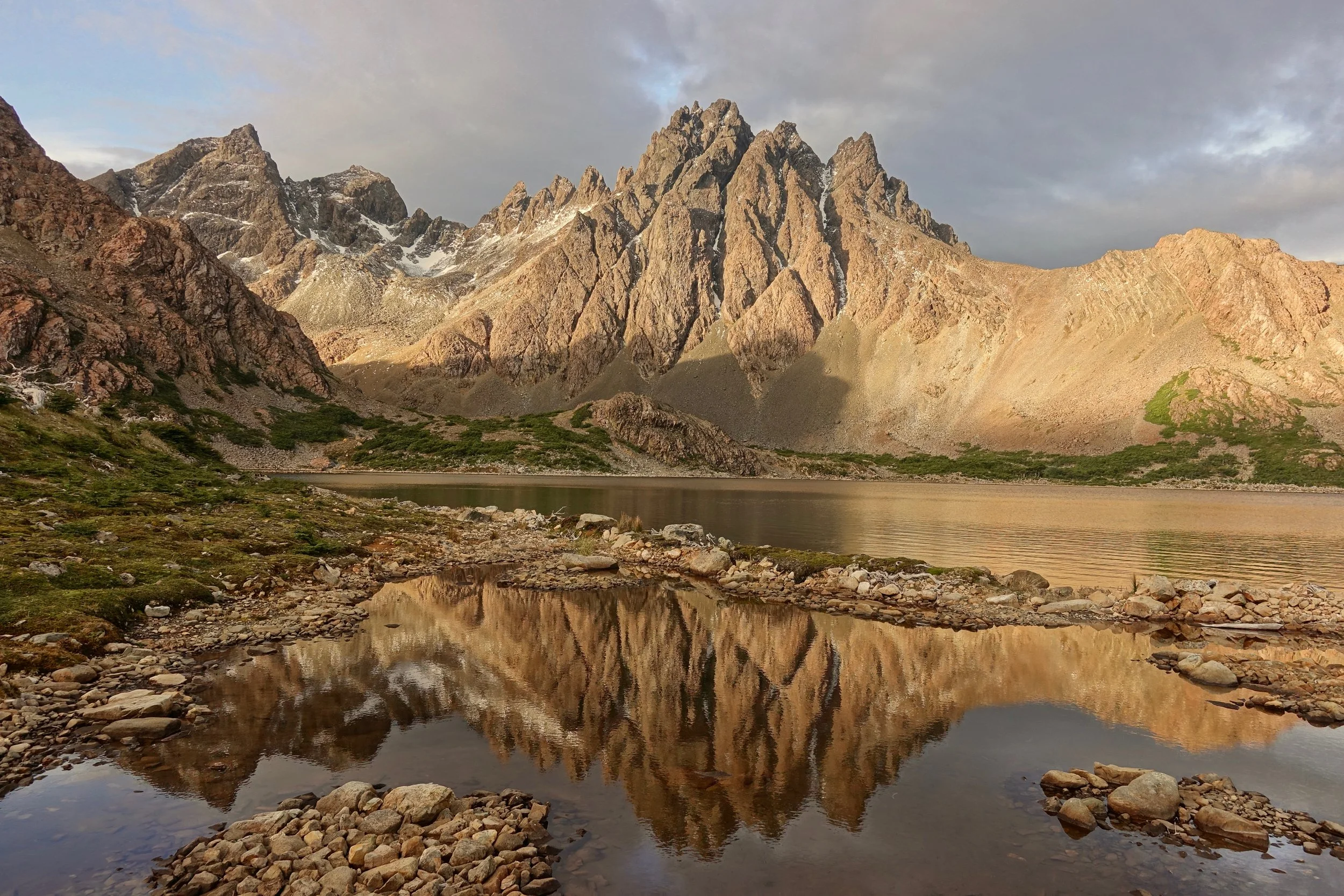
Late evening at Laguna de los Dientes
Above the valley
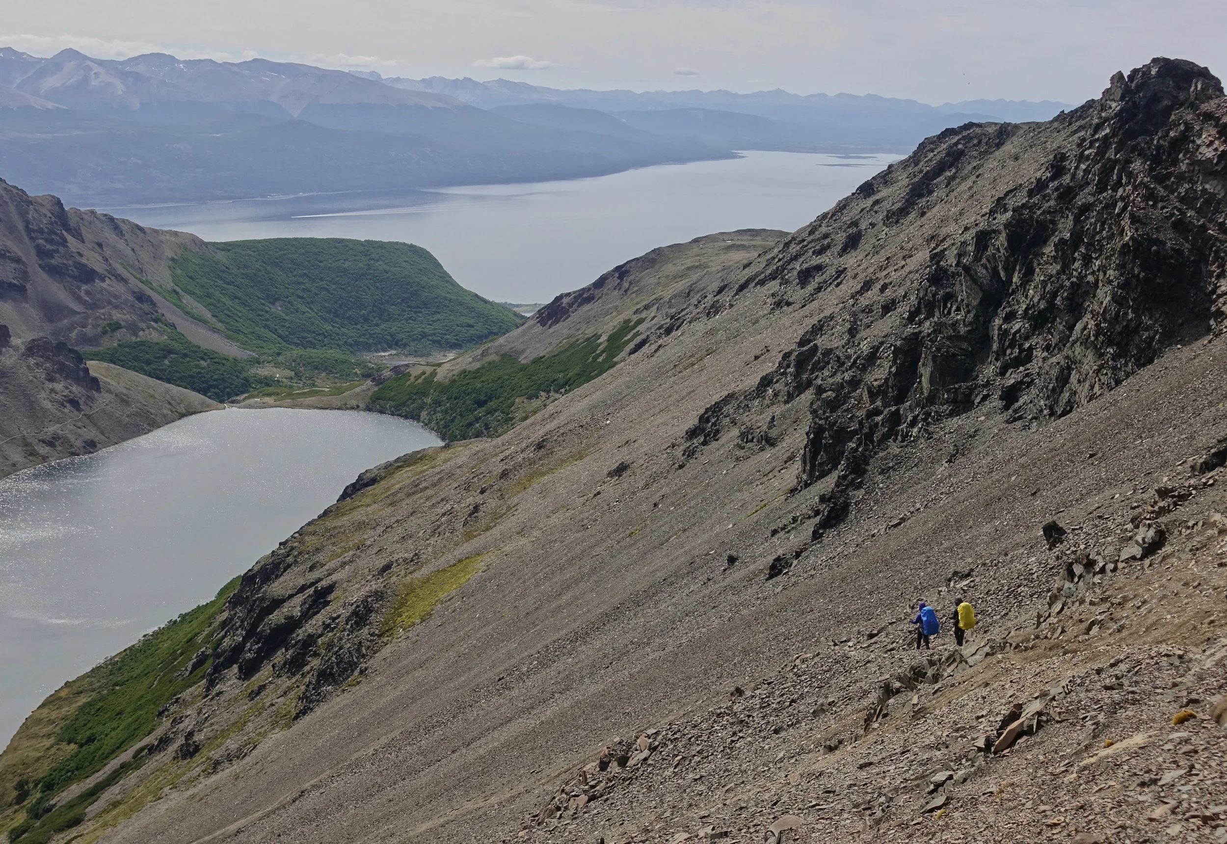
All downhill from Paso Virginia, once the road is reached there is a five mile walk back to Puerto Williams
Easter Island
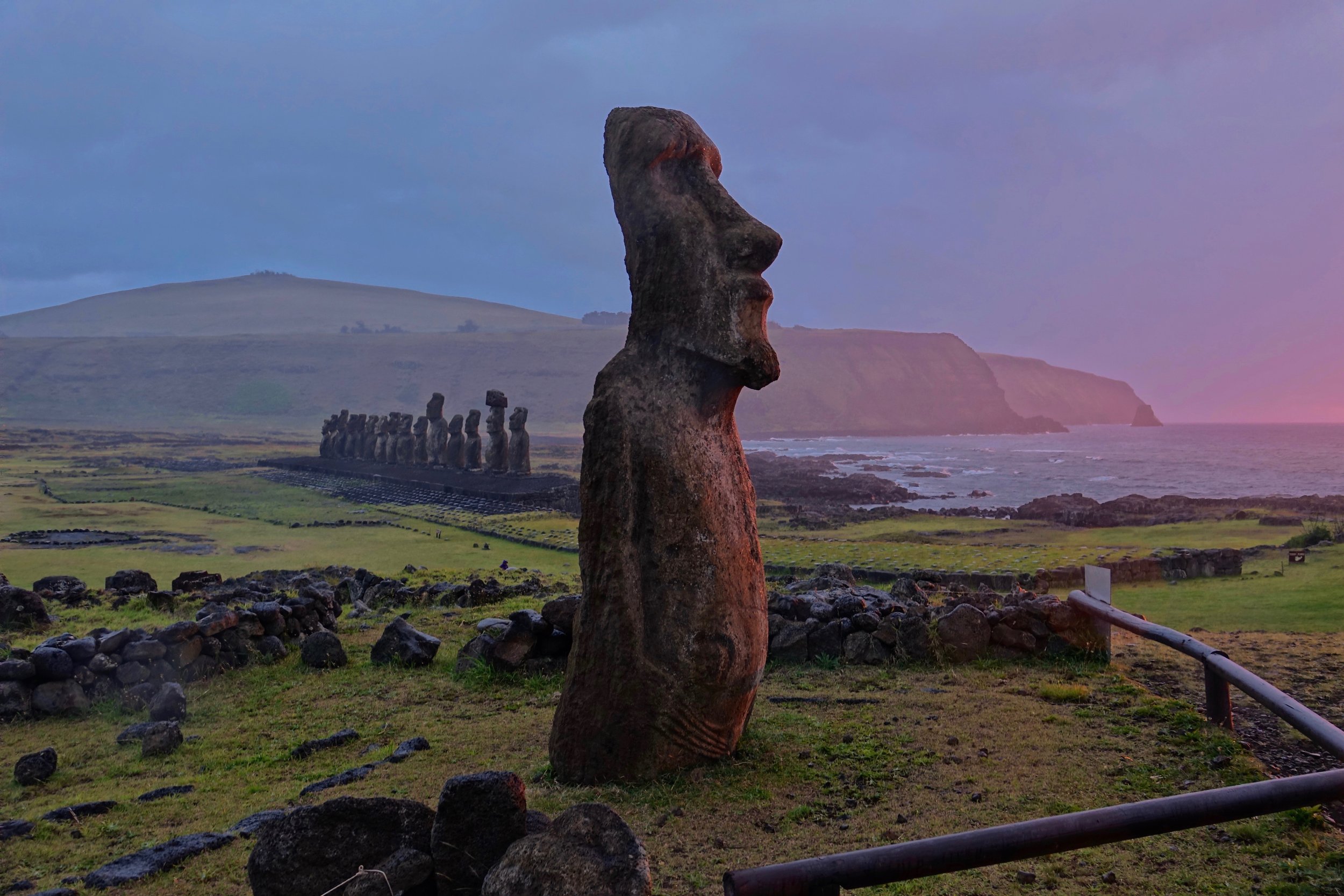
In December I walked around Easter Island with overnight stops in the town of Hanga Roa and the campground at Anakena Beach (30 miles). The walk is mostly on roads with some trails on the western side of the island
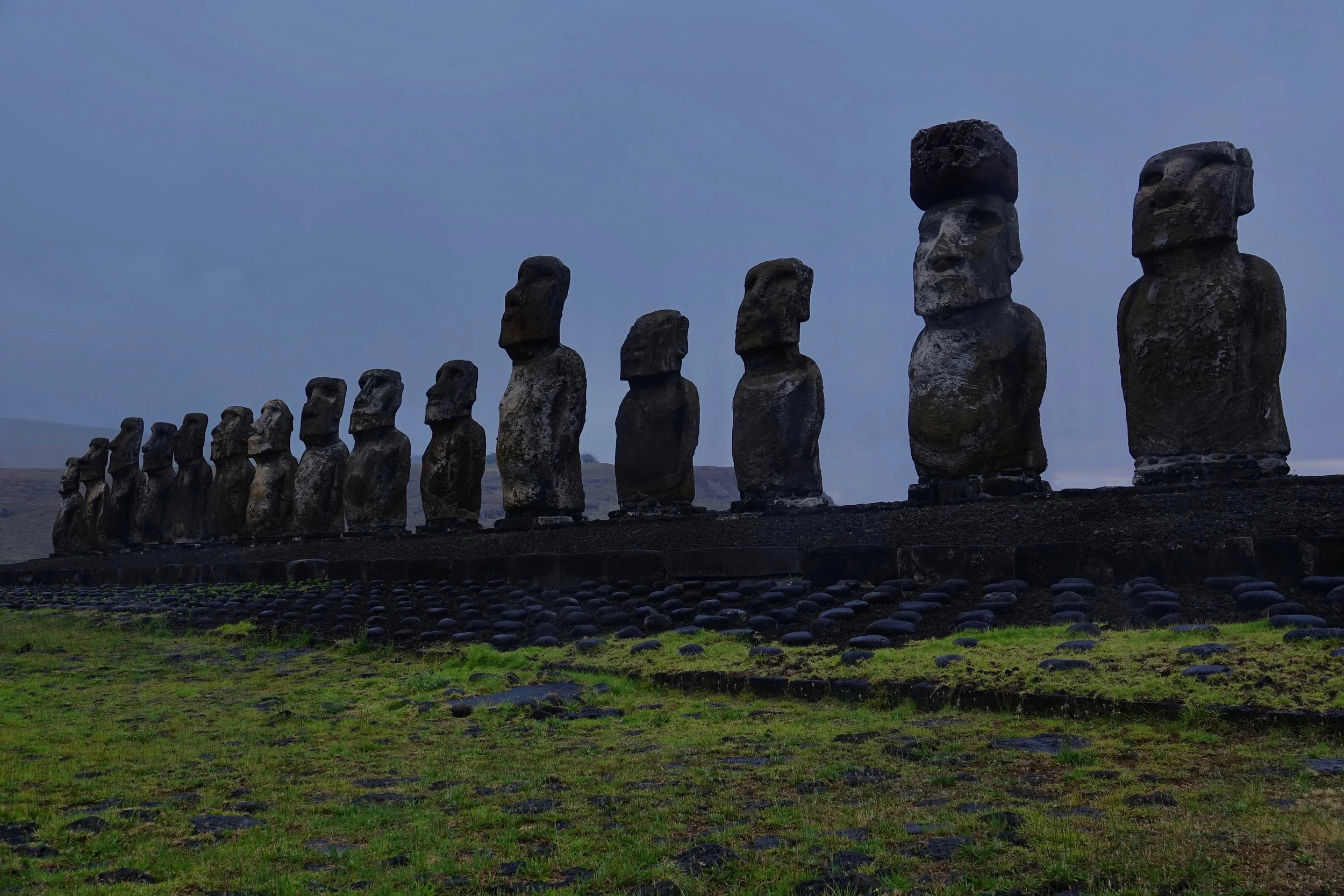
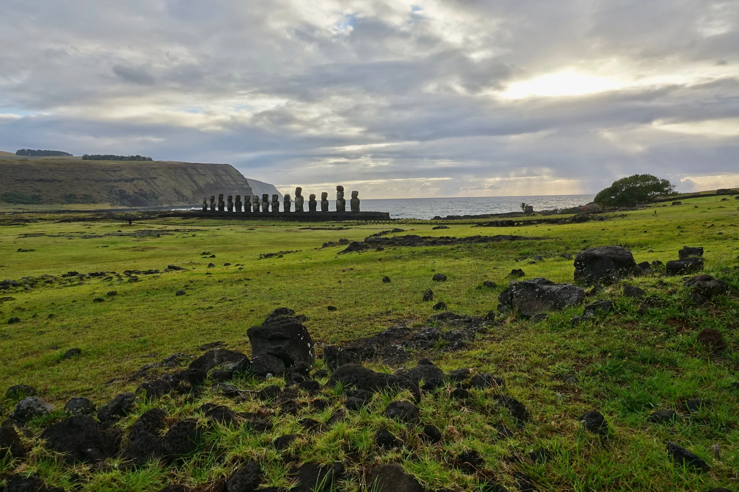
Tongariki is the only site on the island that can be visited early in the morning. I walked here in the dark from the Anakena campsite
I stayed here for a few hours photographing the changing conditions
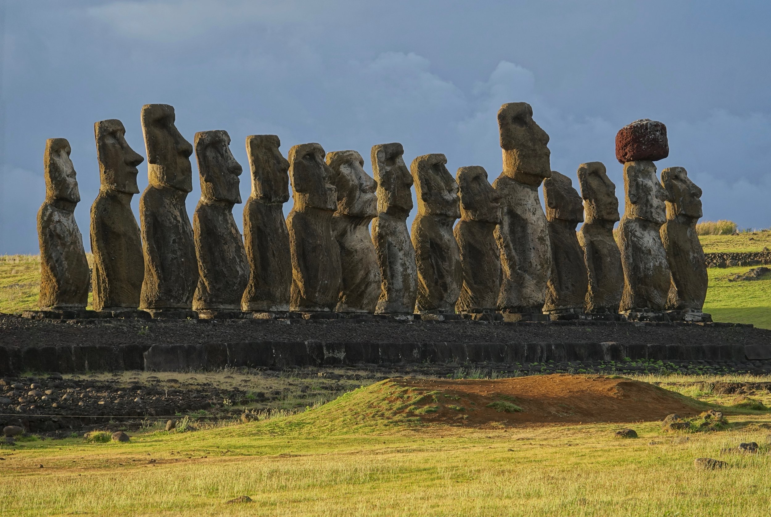
Tongariki backlit from the morning sun
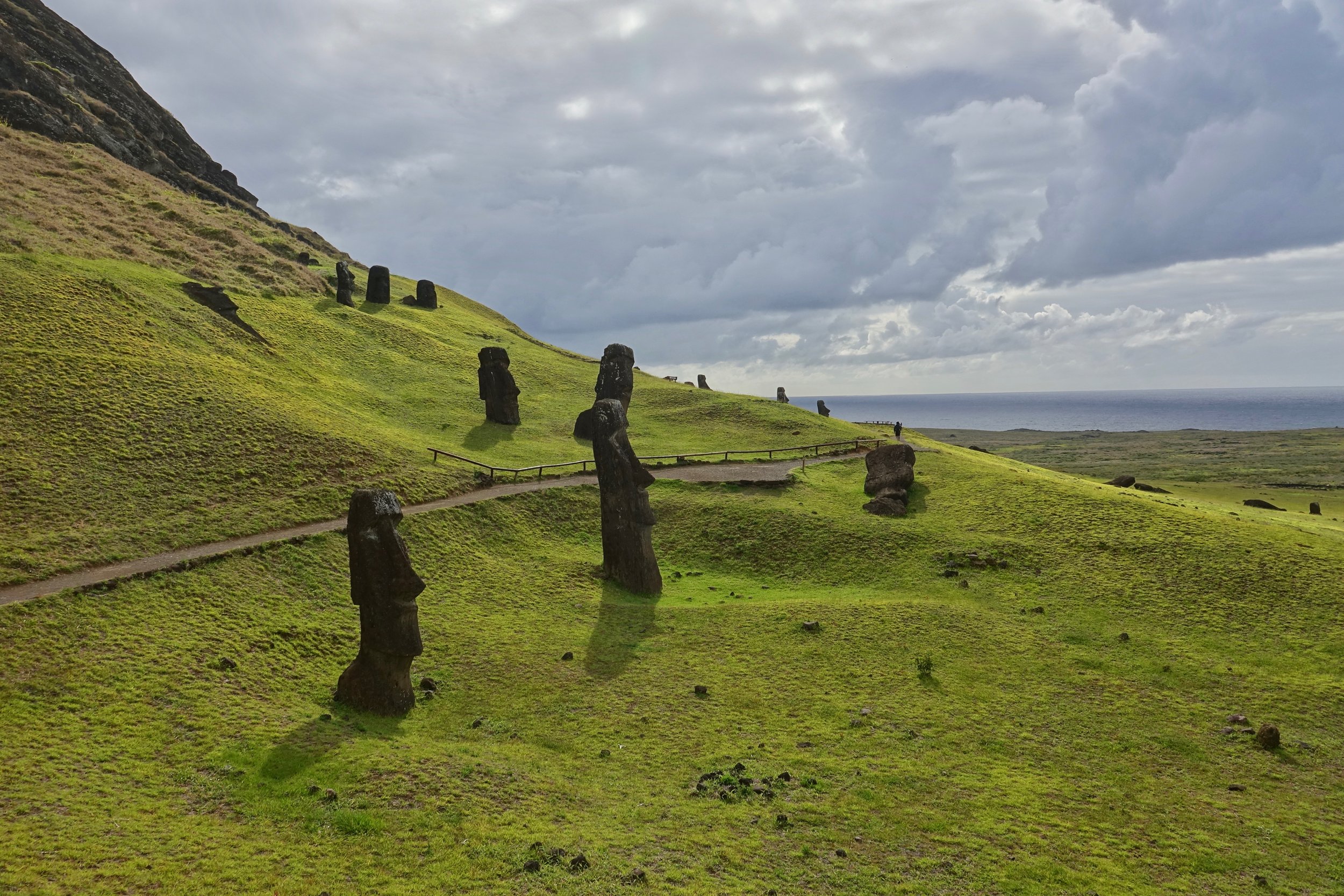
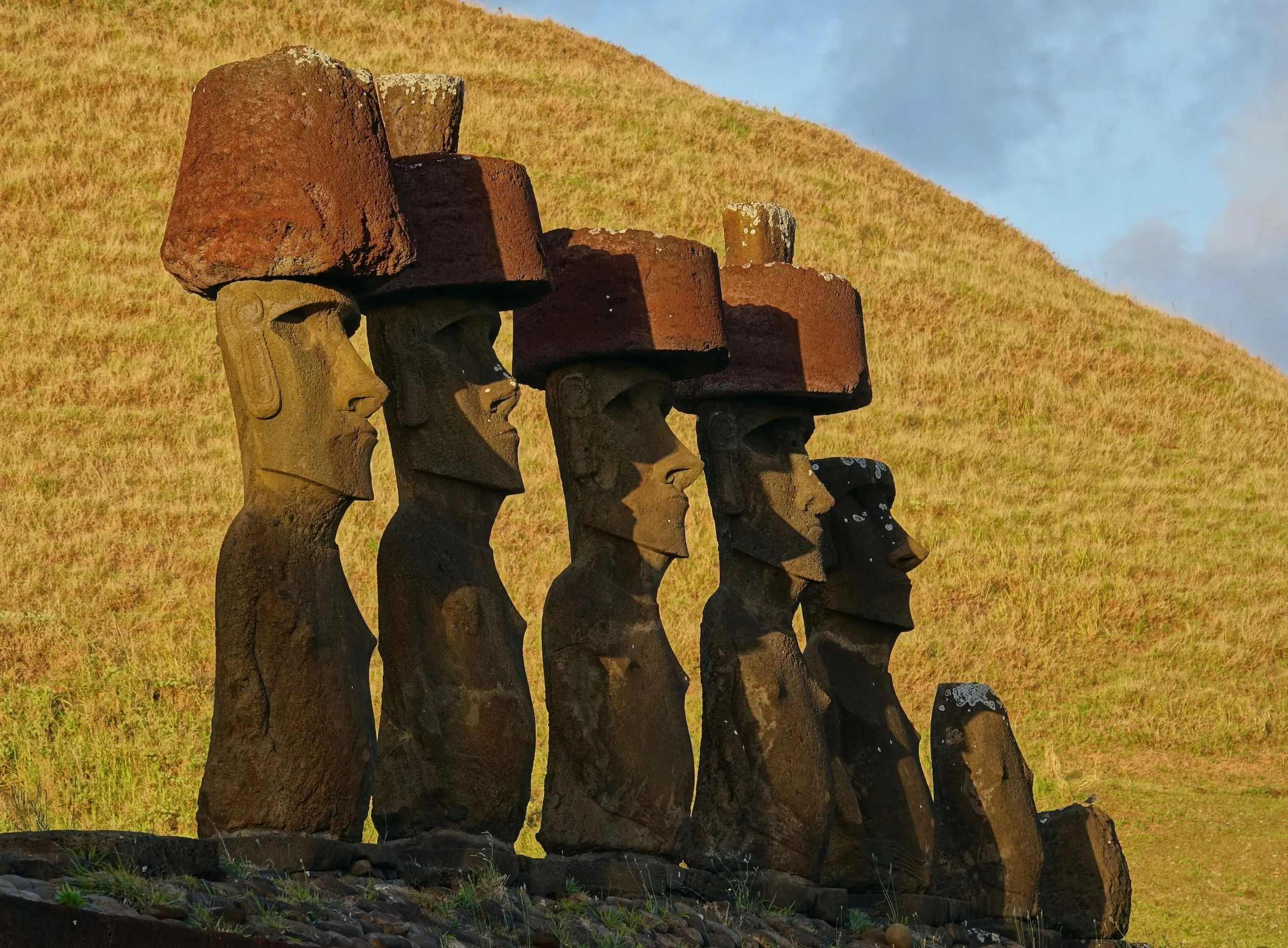
My favorite place on the island was Rano Raraku. The majority of the moais were carved from the rock on this crater. The leftovers here were never taken to the coast for display
An unfinished carving on the mountainside
This one perhaps too large to move at 70 feet long and 200 tons, double the size and weight of any moai on the coast
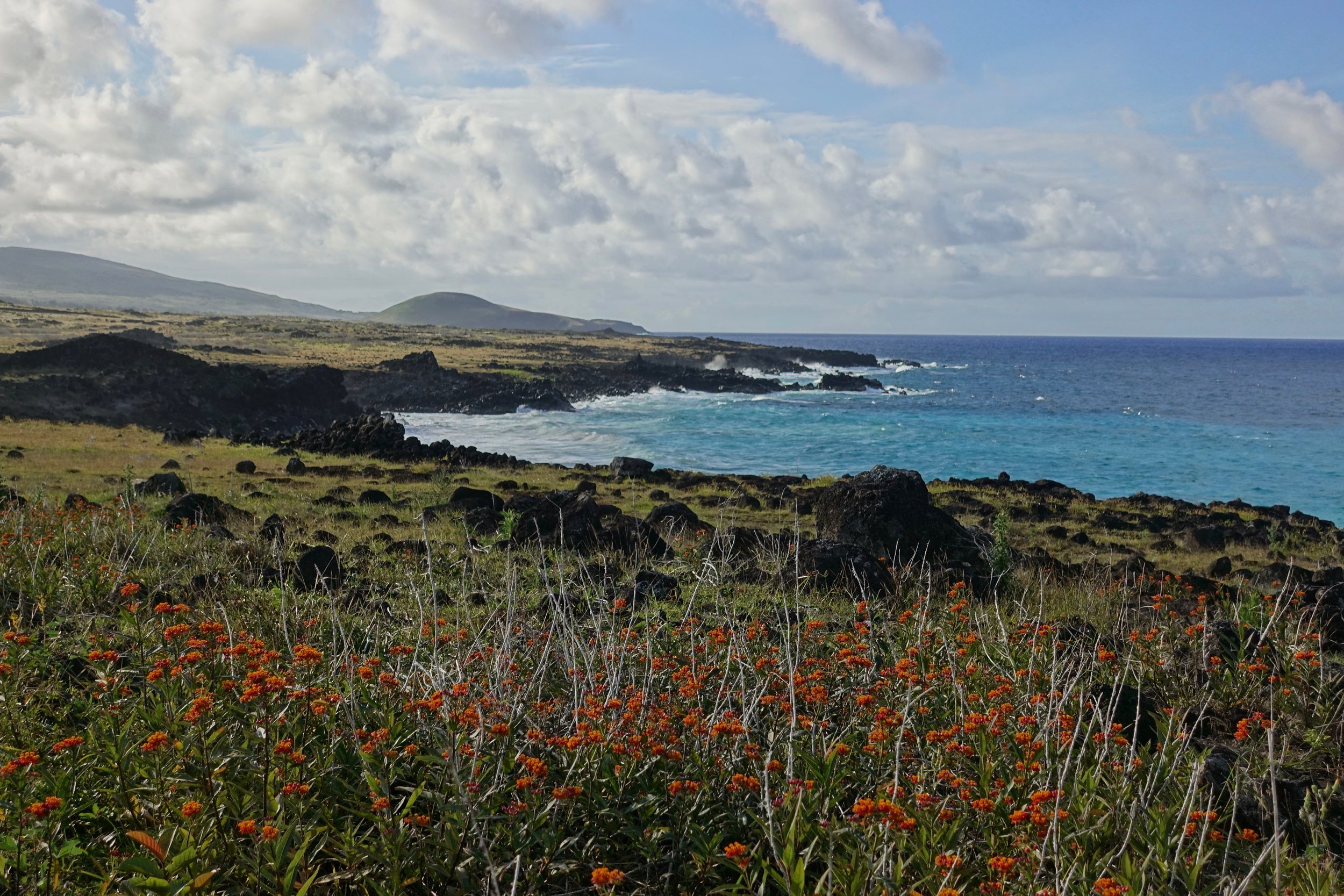
Walking along the northern coast
Ahu Nau-Nau
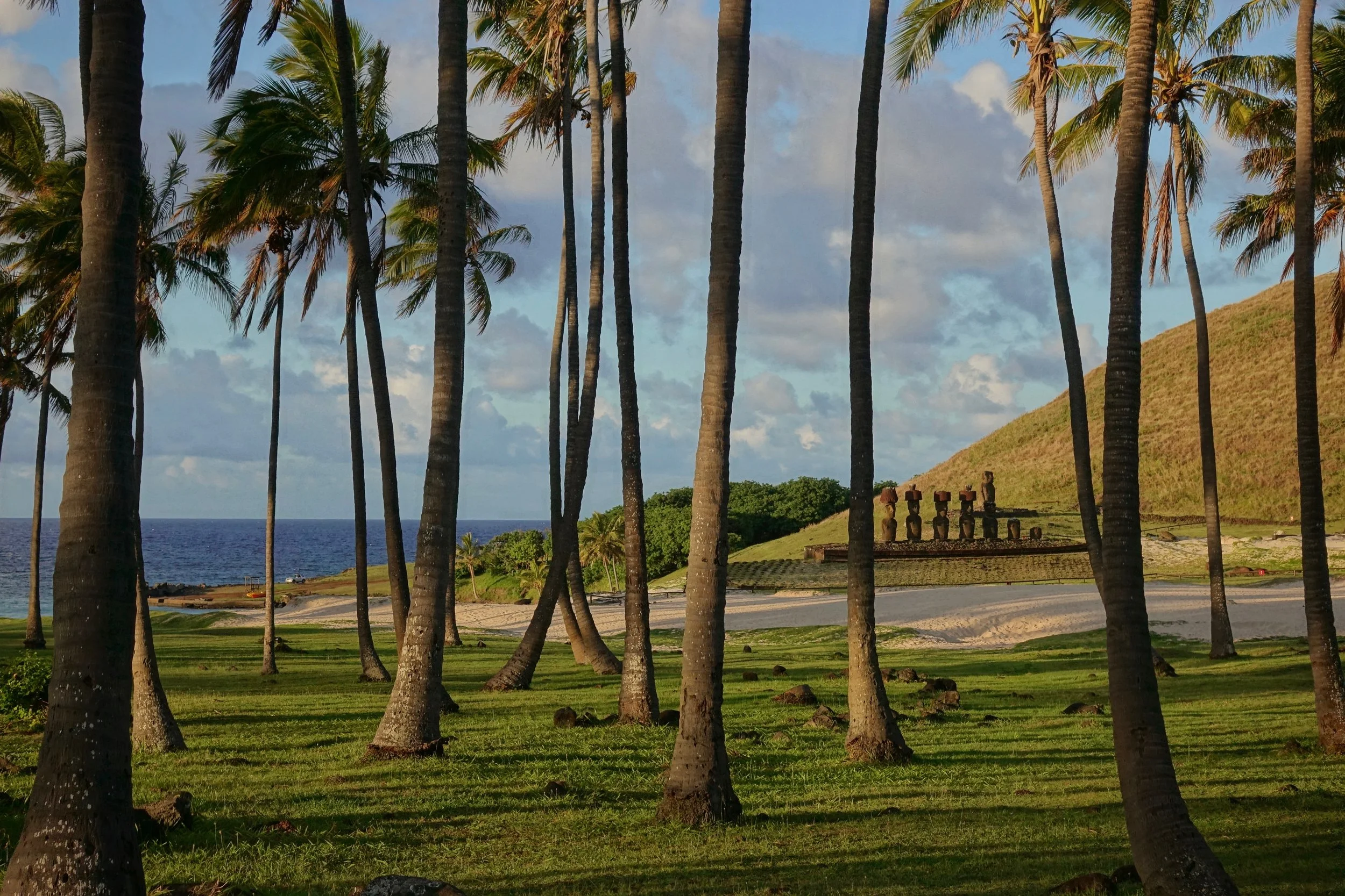
Anakena is the only place to camp outside the town of Hanga Roa. Wild camping is not possible on the island, the rangers/police checked with me several times to see where I was going when walking along the road
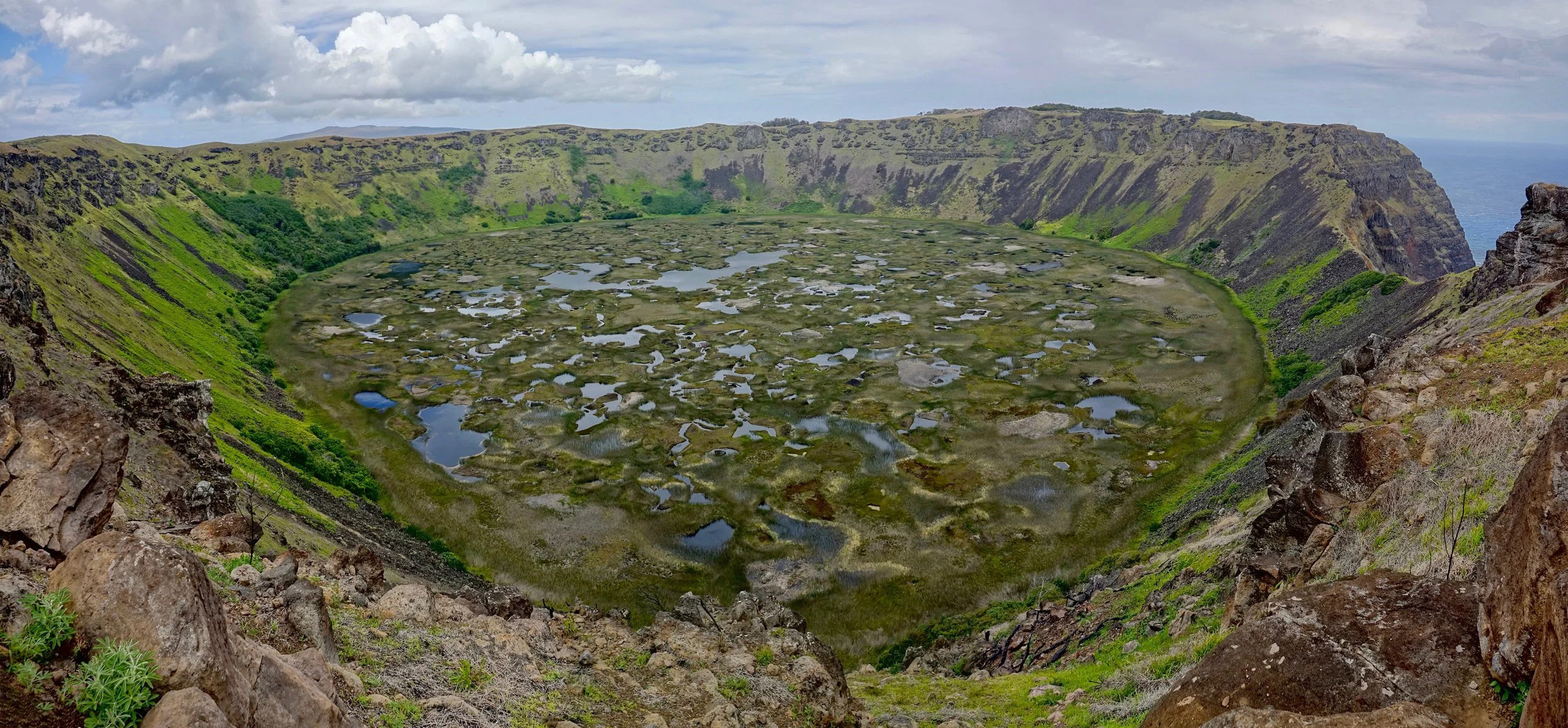
Crater Lake of Rano Kau on the south of the island
Patagonia Aysen
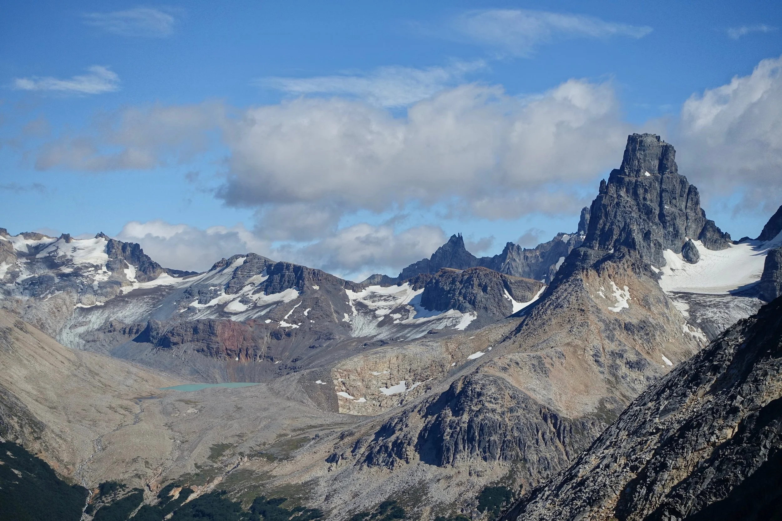
Cerro Castillo
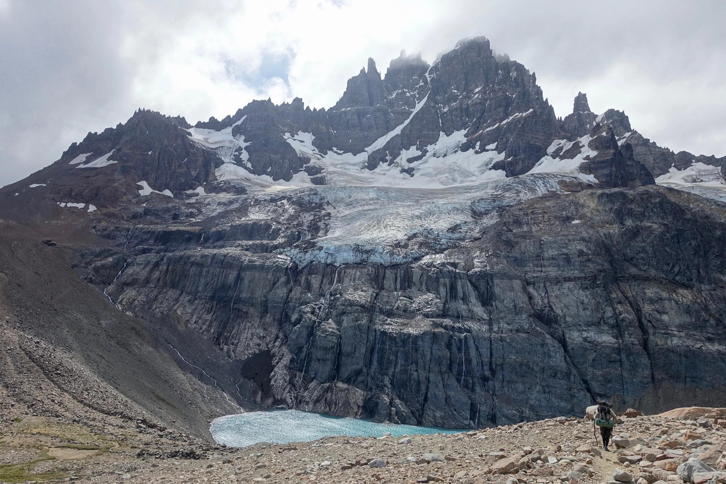
I did the a three day loop in Cerro Castillo National Reserve, starting and ending in town. A longer version of the hike is possible but would require hitchhiking
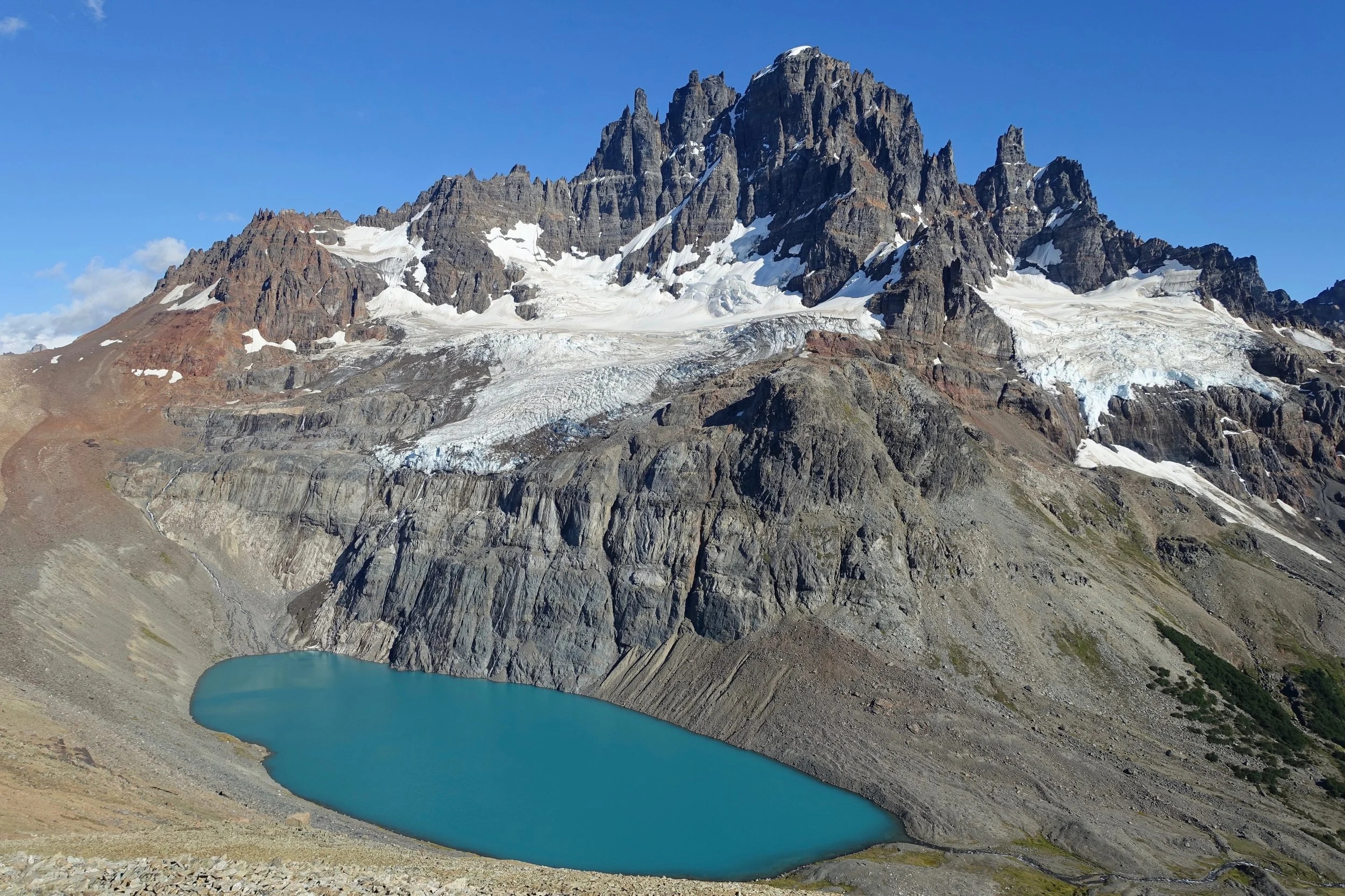
Cerro Castillo aka “Castle” Mountain
The west side near Laguna Duff is worth visiting and has better campsites for windy days
Parque Patagonia
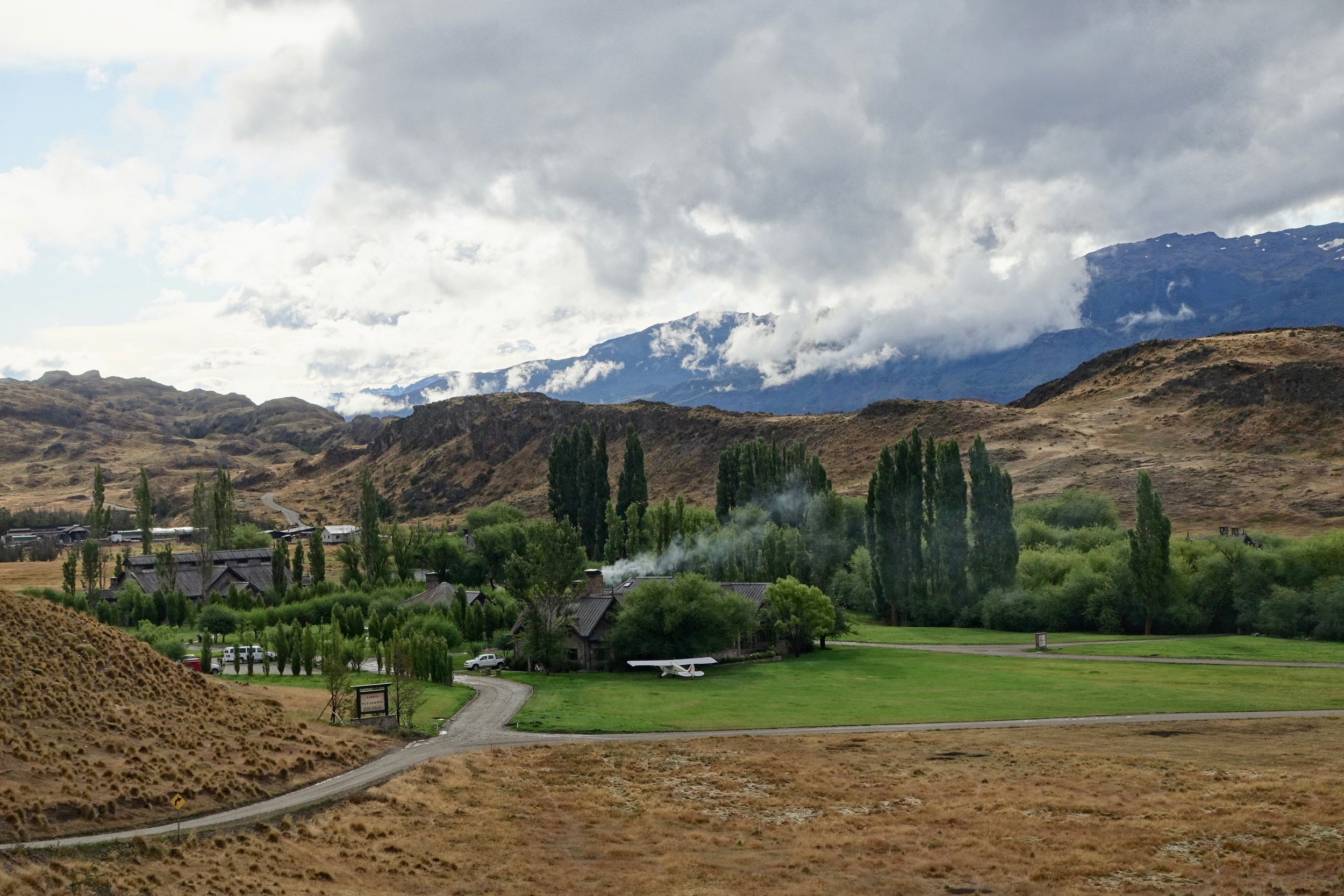
I visited Parque Patagonia during its first summer open to the public (2015-2016). It was not very crowded, most of the people at the campsite were volunteers for Conservacion Patagonia.
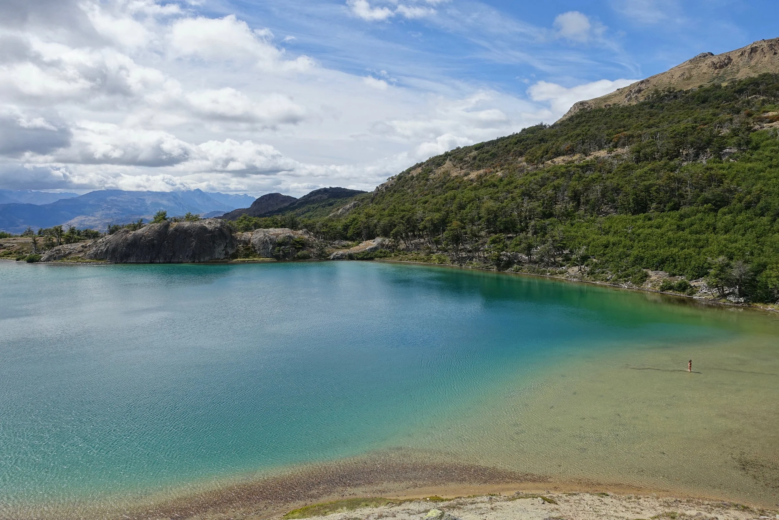
I did dayhikes on the Lagunas Altas trail, the Aviles Valley, and to the Rio Baker Confluence
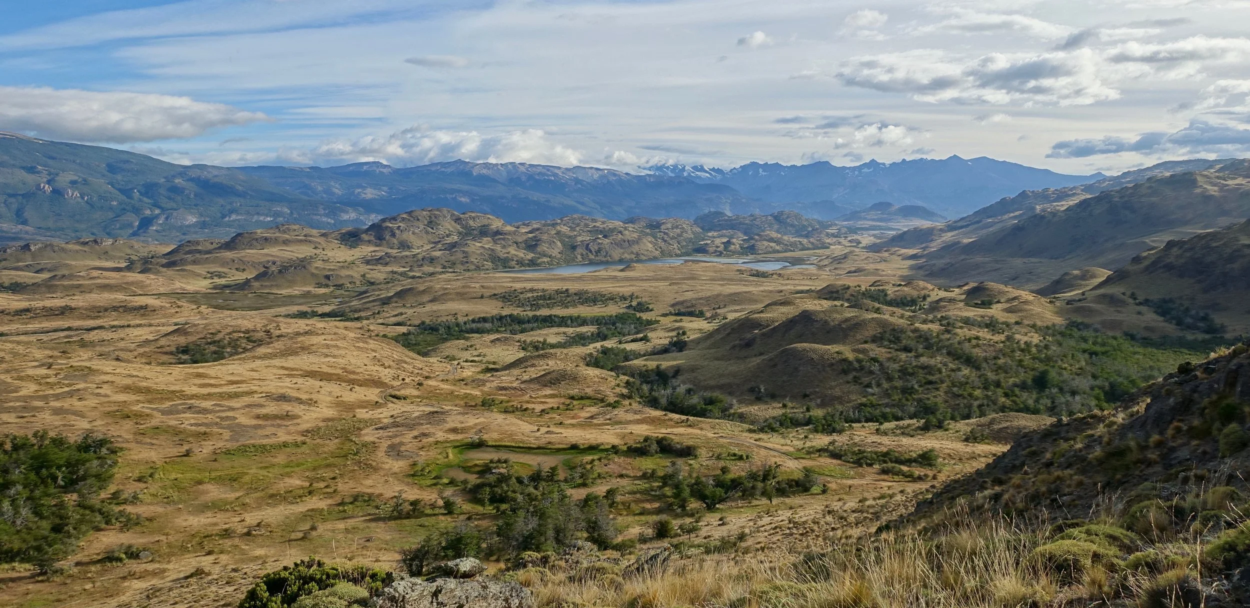
Chacabuco Valley from the Laguna Altas Trek
Chile North
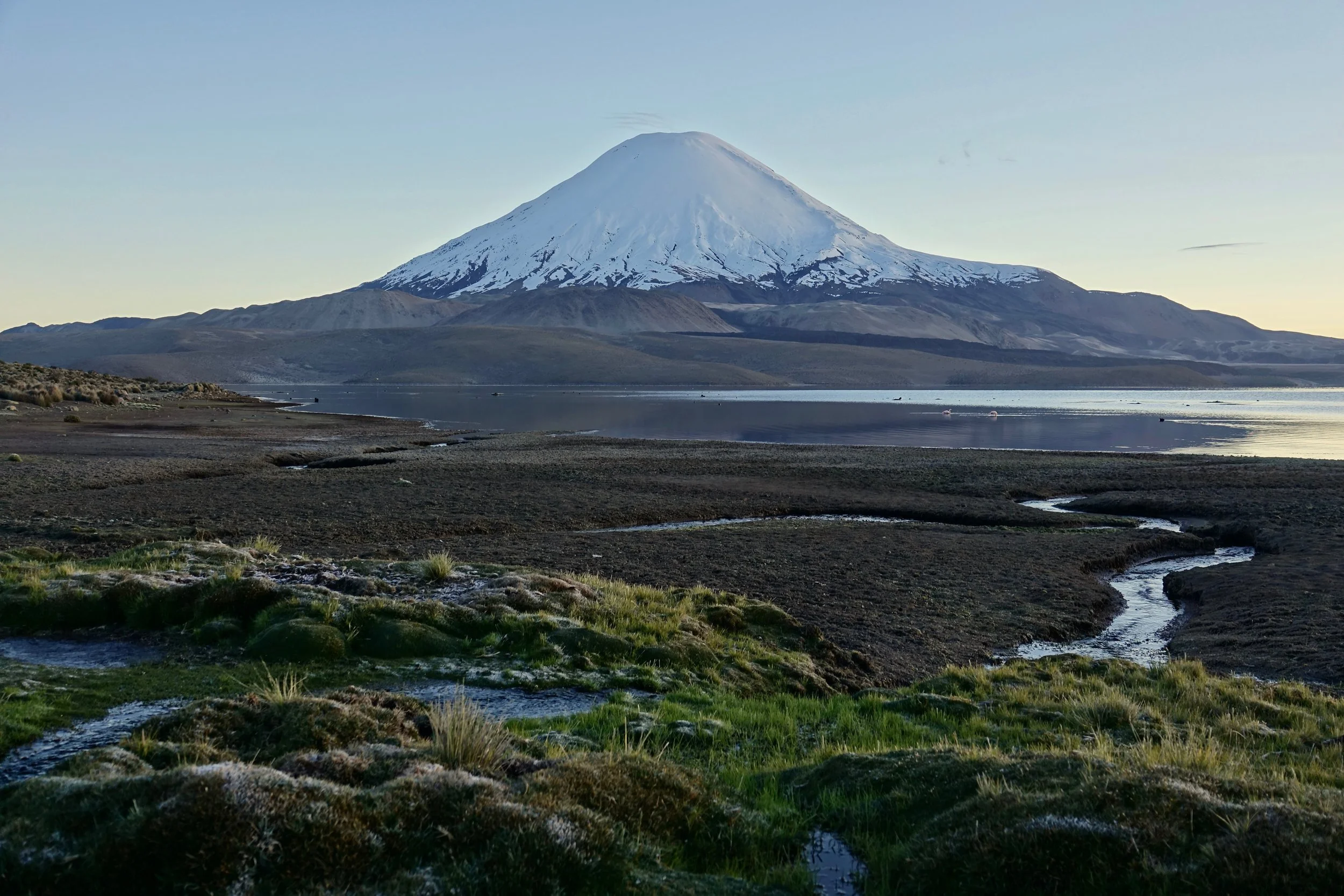
The two main lakes in Lauca National Park revolve around Volcano Parinacota (20,900ft)
The route I took started in Parque Lauca and ended at Laguna de Huasco, camping along the way near the car in the evenings
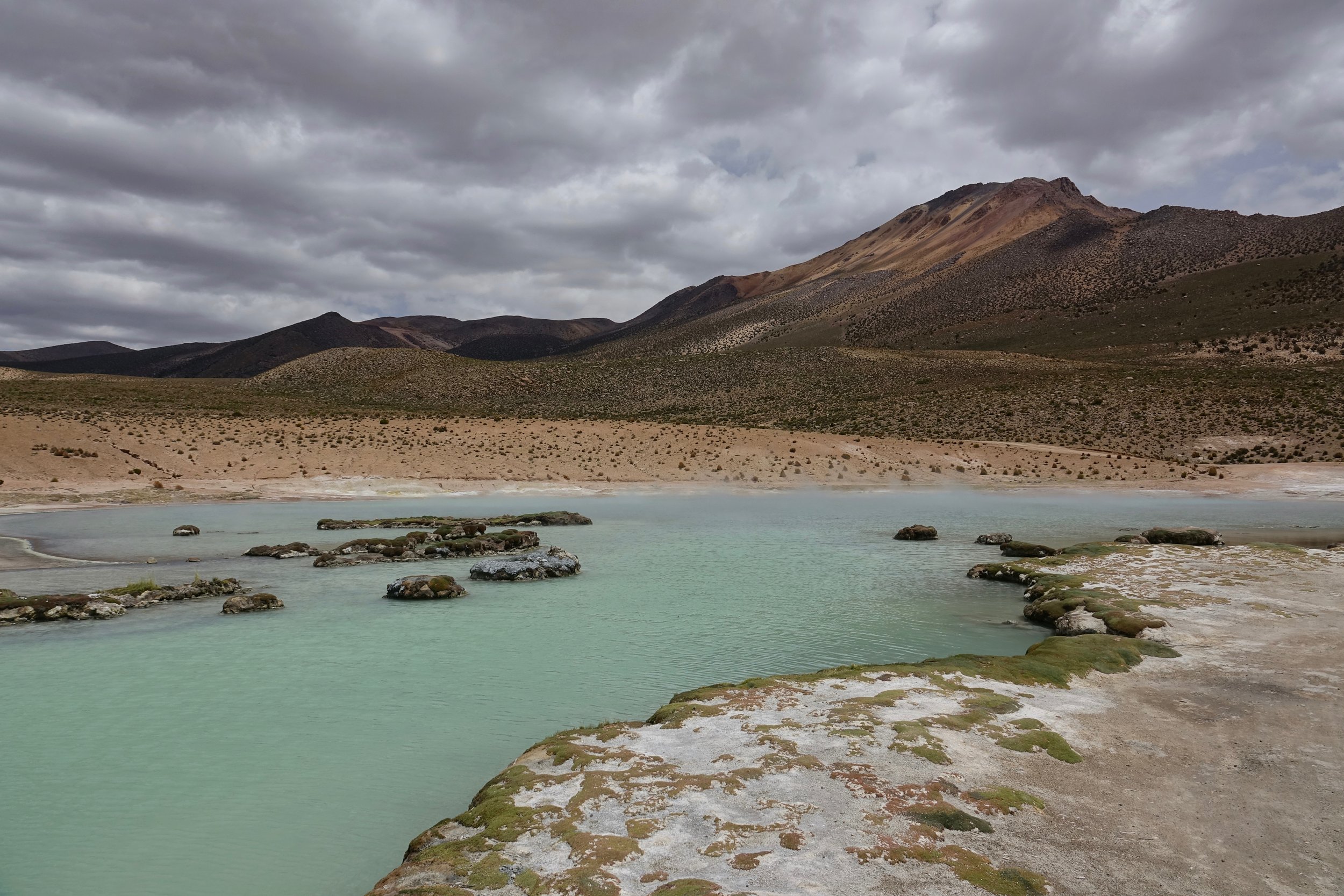
There were hot springs along the route which were marked on the map I purchased at the airport in Santiago
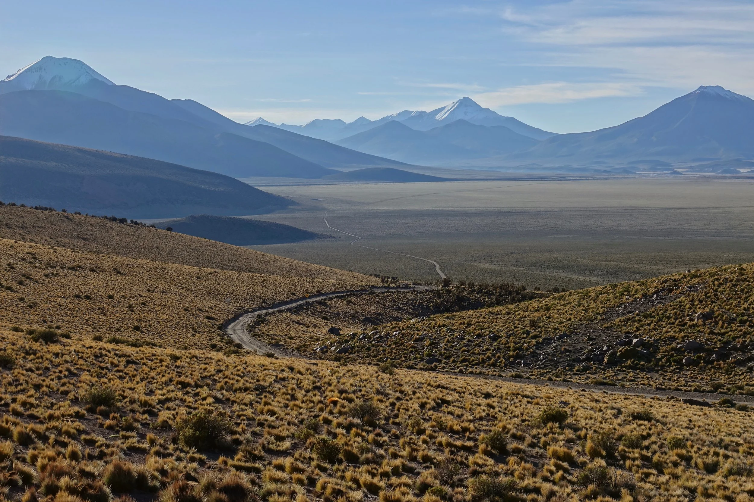
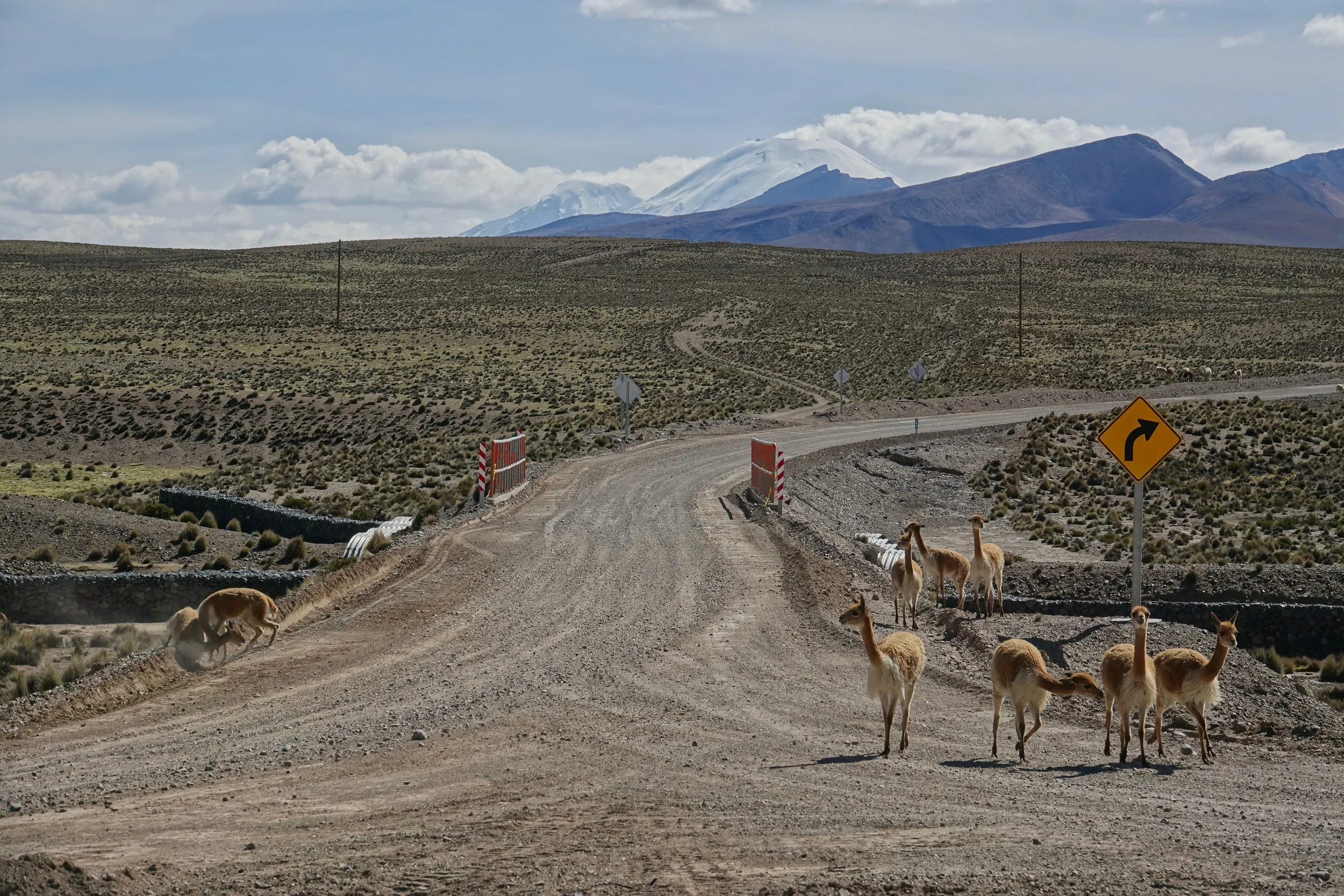
The most beautiful section of road was through Parque Volcan Isluga

Flamingos getting a running start at Laguna de Huasco

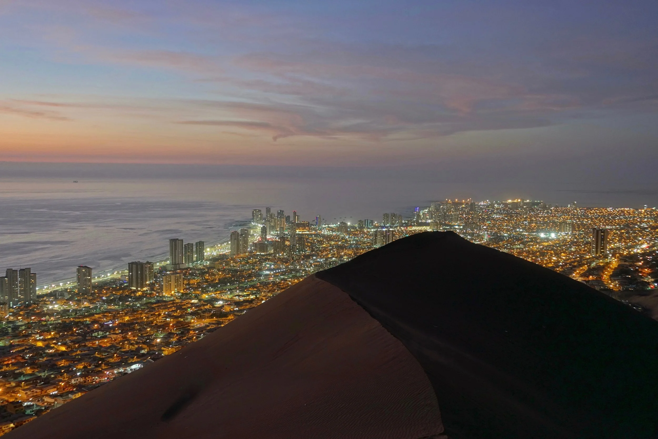
Cerro Dragon above the city of Iquique. The road here from the altiplano in the east drops 14,000 feet over less than a 100 miles.
I started and finished the trip at the Iquique airport, while no rental car company offered extra gas tanks with their trucks, they were easy to find at almost every Copec gas station in Iquique and Arica