Arizona
Havasu Canyon Trail
Paria Canyon
El Pinacate y Gran Desierto de Altar
Superstition Mountains
Organ Pipe Cactus National Monument
Kofa Wildlife Refuge
Sedona/Prescott area hikes
Saguaro National Park
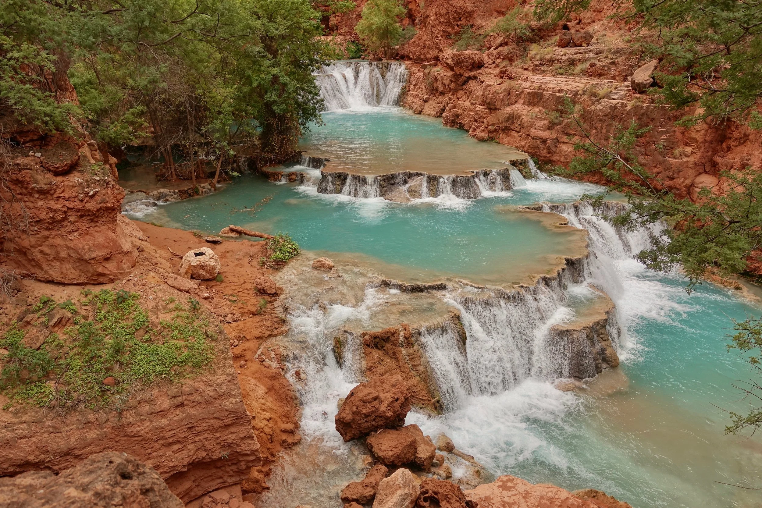
Havasu Canyon Trail
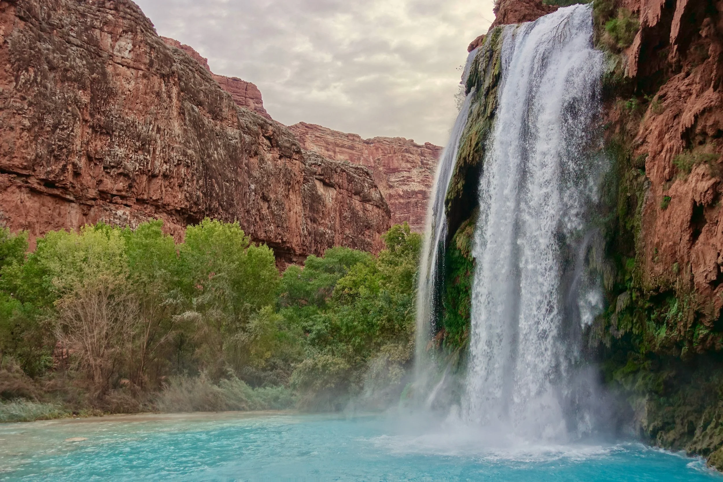
In late October I walked the Havasu Canyon Trail (3 days, 24 miles)
I grabbed a cancelled permit for the weekend while working a travel job in Flagstaff. There were many dates available for last minute bookings.
The Havasu Campground is located between the two major waterfalls. Overnight stays are required at either the campground or lodge to visit the falls.
The Supai village near the campground has a grocery store and restaurant along with a helipad. I took the helicopter out of canyon as the hike from the parking lot to the village is not worth repeating
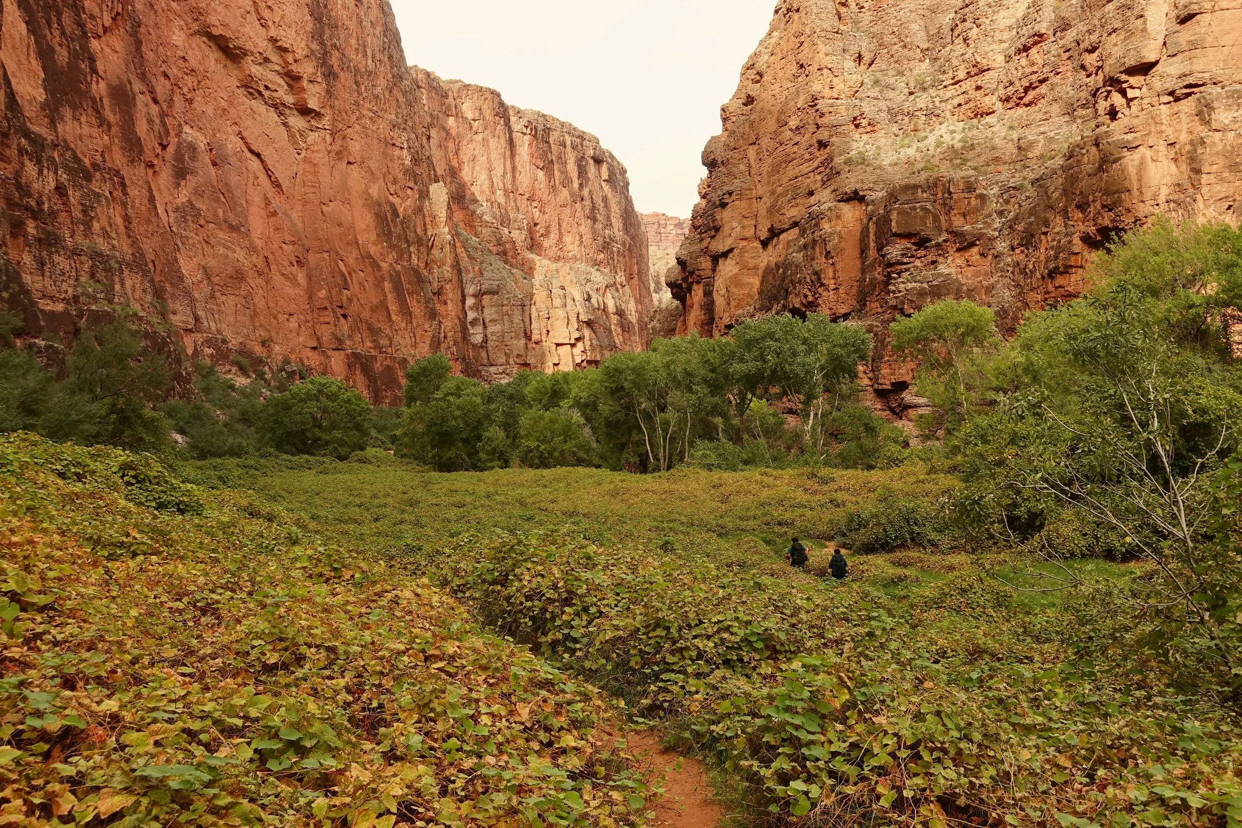
My favorite day was walking down to the Grand Canyon, where Havasu Creek meets the Colorado River
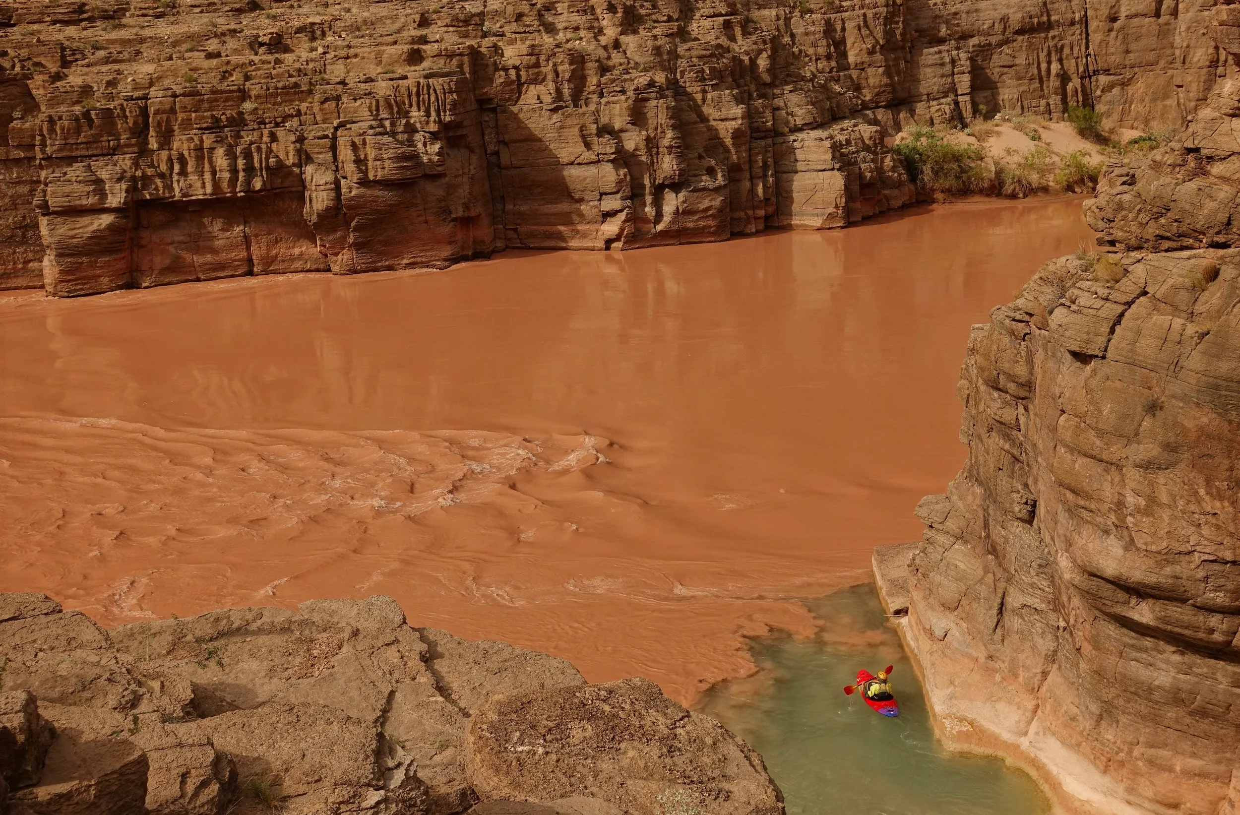
The "Confluence" at the Grand Canyon
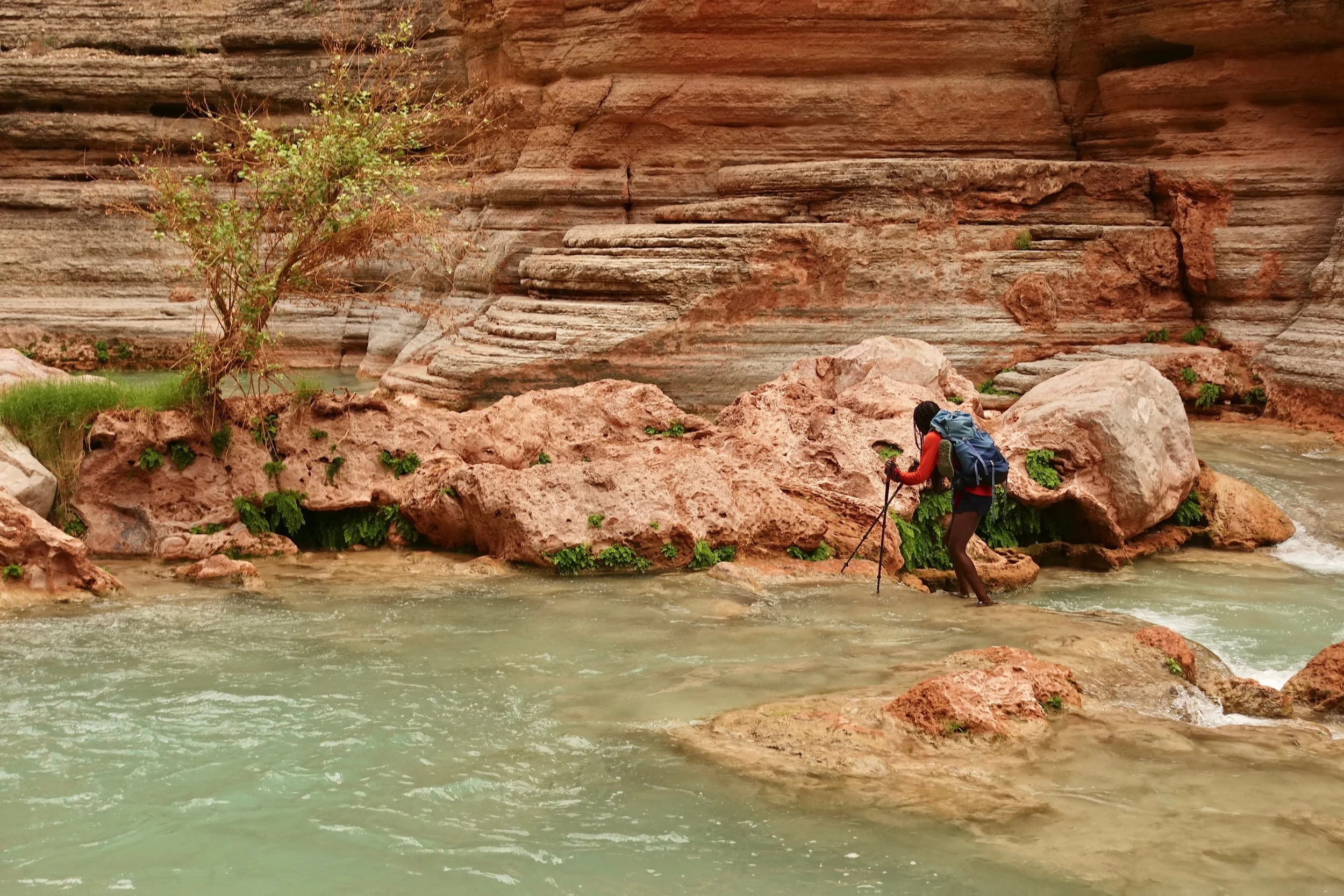
A somewhat adventurous trail with small climbs and frequent river crossings
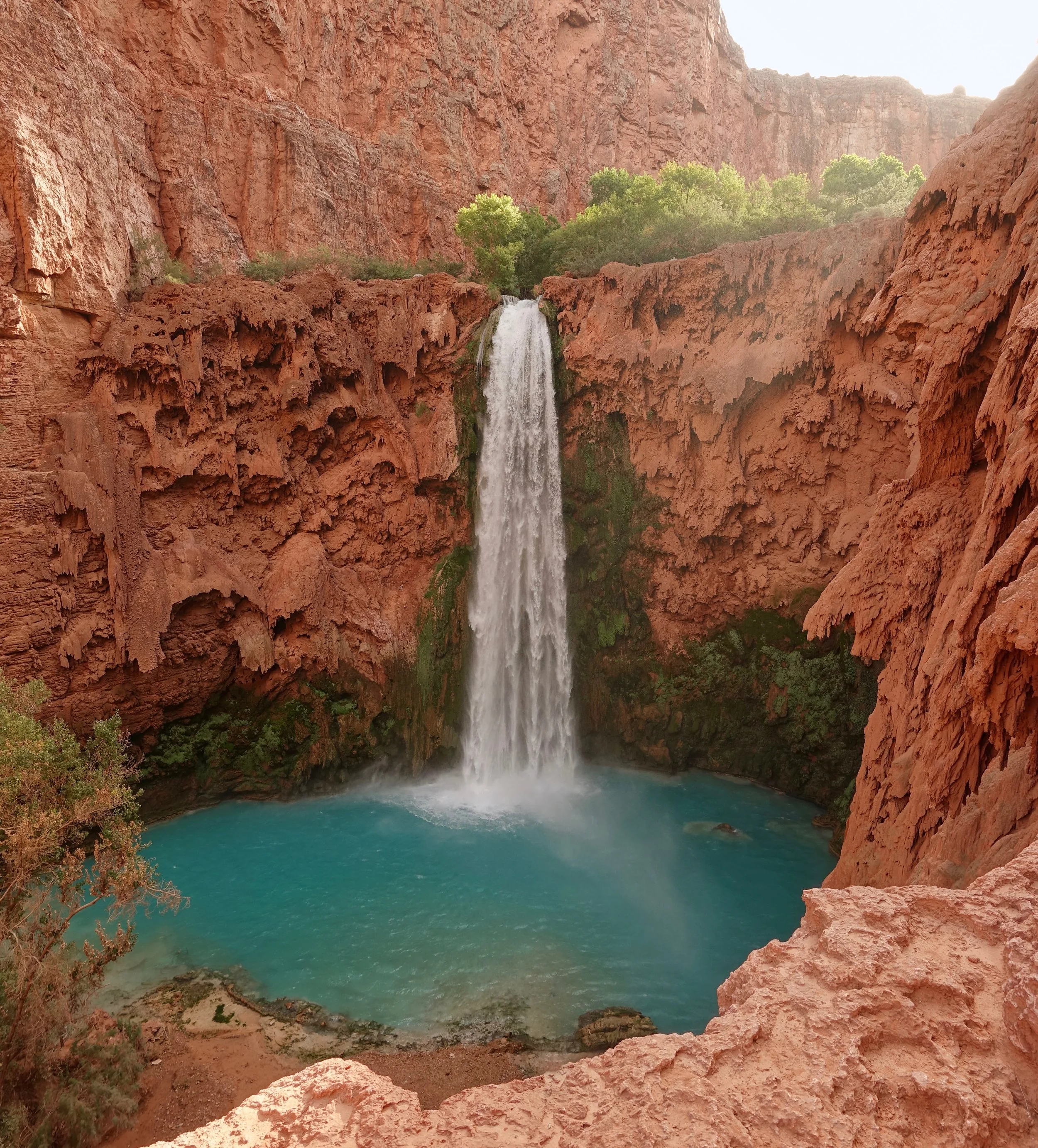
Mooney Falls
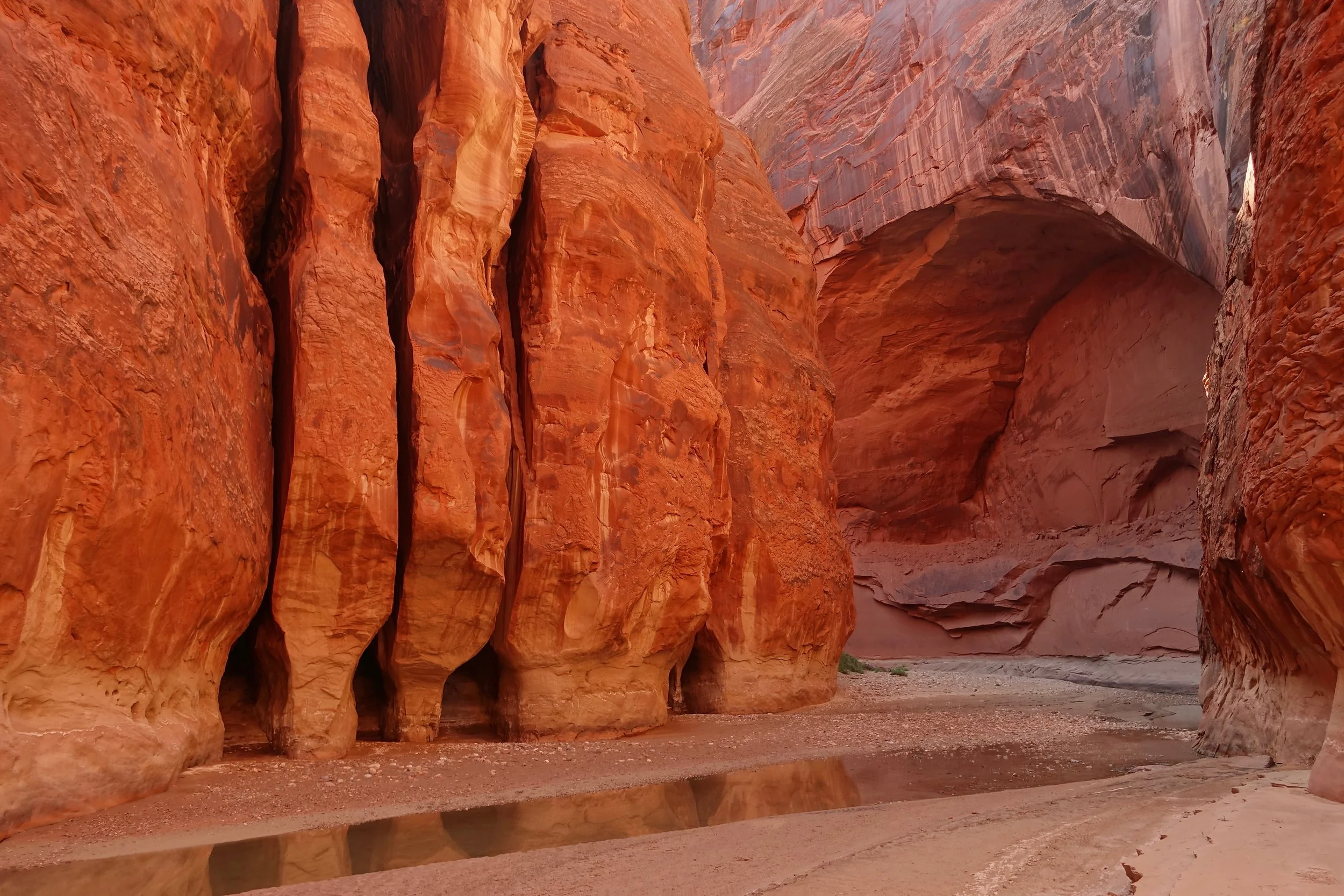
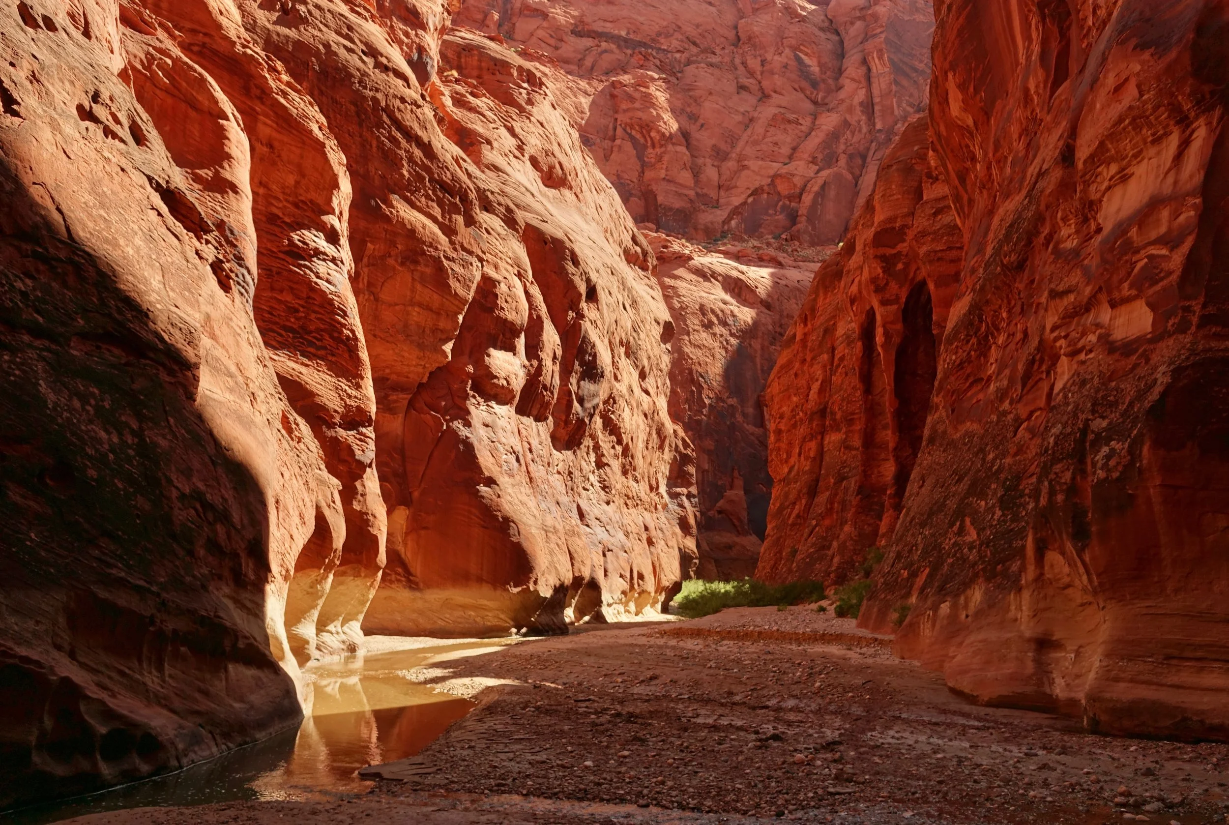
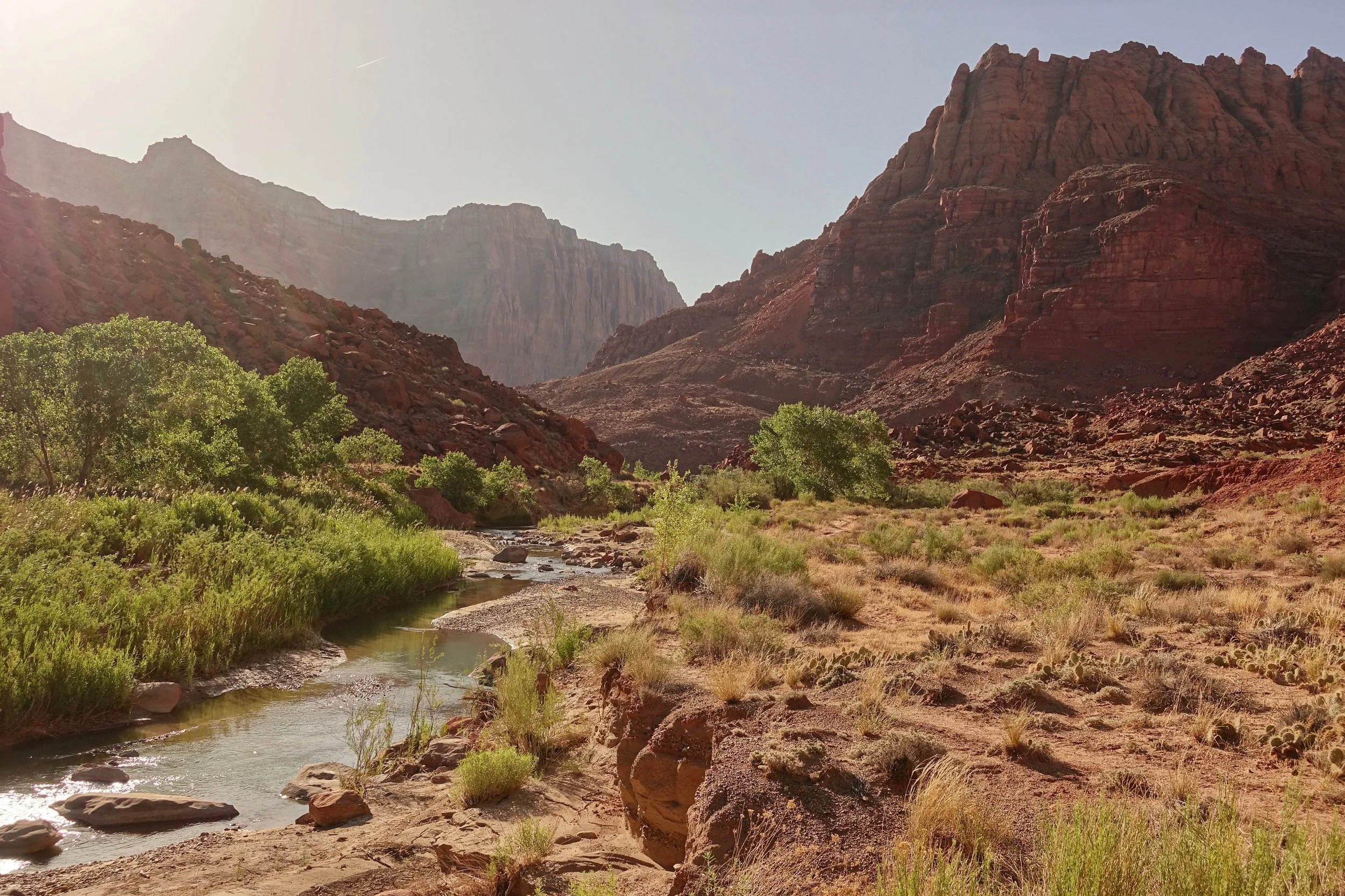
Paria Canyon
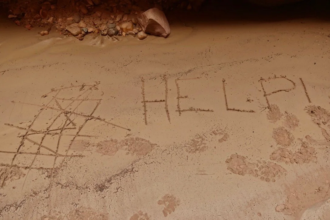
A flash flood turned most of the canyon into a river on my first attempt. I was in the middle of river when the flood hit and took the brunt of it. I remember two things -- wondering what the sound was behind me and then realizing what was happening as the water turned the corner and came my direction.
After getting to safety and collecting myself I decided to swim to Big Spring and waited a few days for slower moving water
On the second attempt the water was low with little challenge
I walked from White House to Lees Ferry one way with a side trip up Buckskin Gulch to the rockjam (40 miles, 3 days)
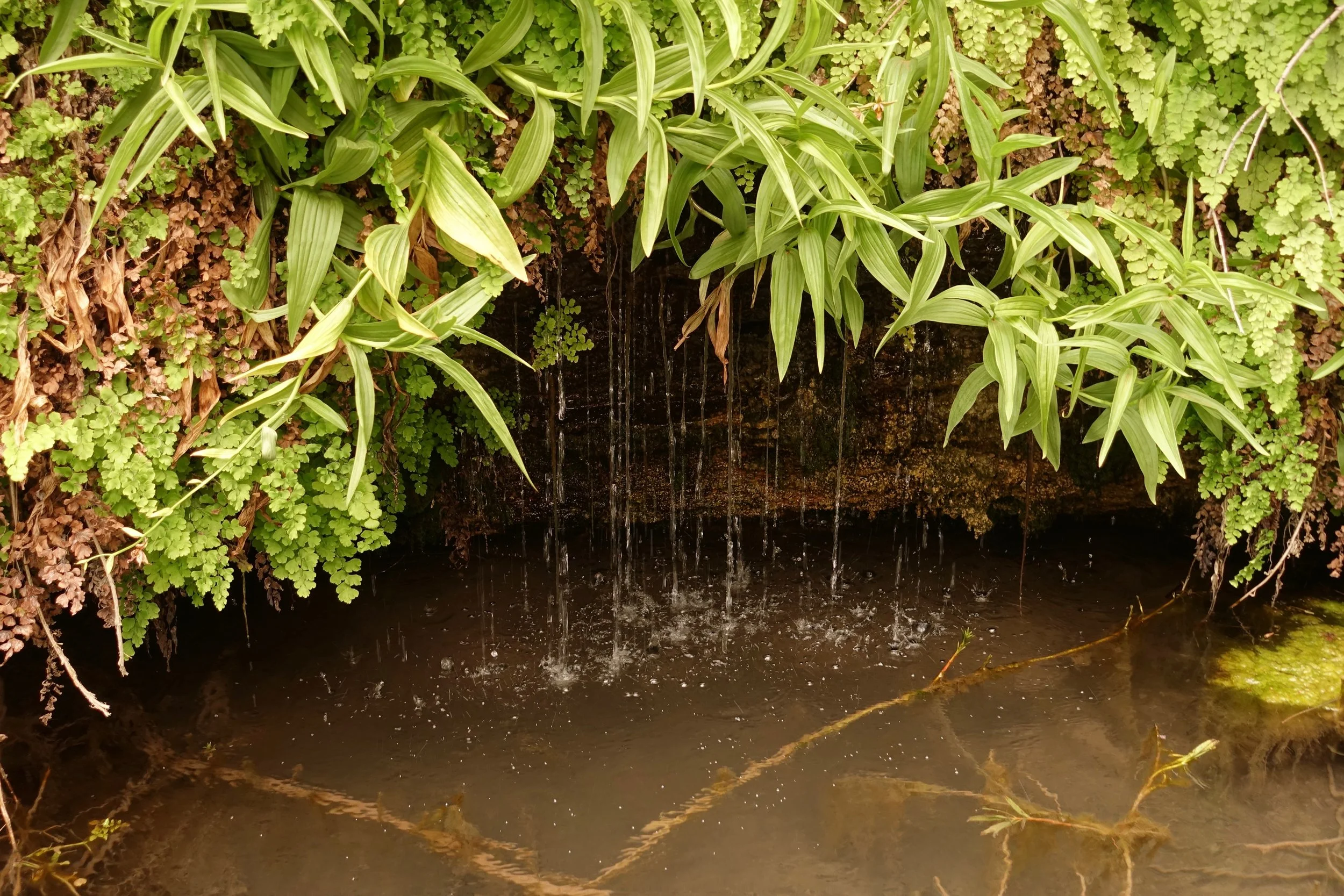
The springs are well labeled on the NatGeo map but less obvious on the trail. Would download a high resolution copy
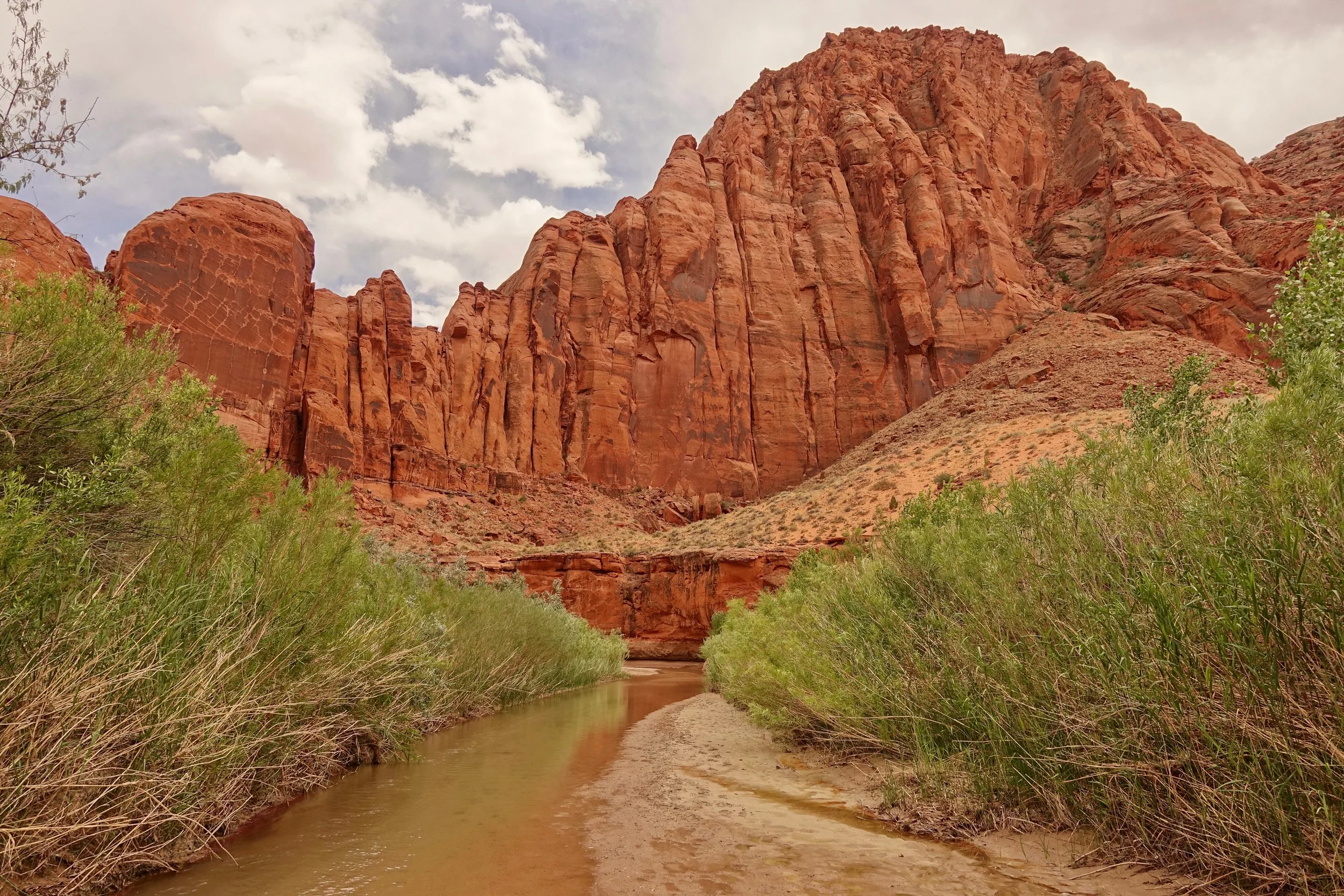
Walking in the river itself is often the best path to avoid the mud and brush
Heat becomes a factor on the final section between the final spring and Lee's Ferry
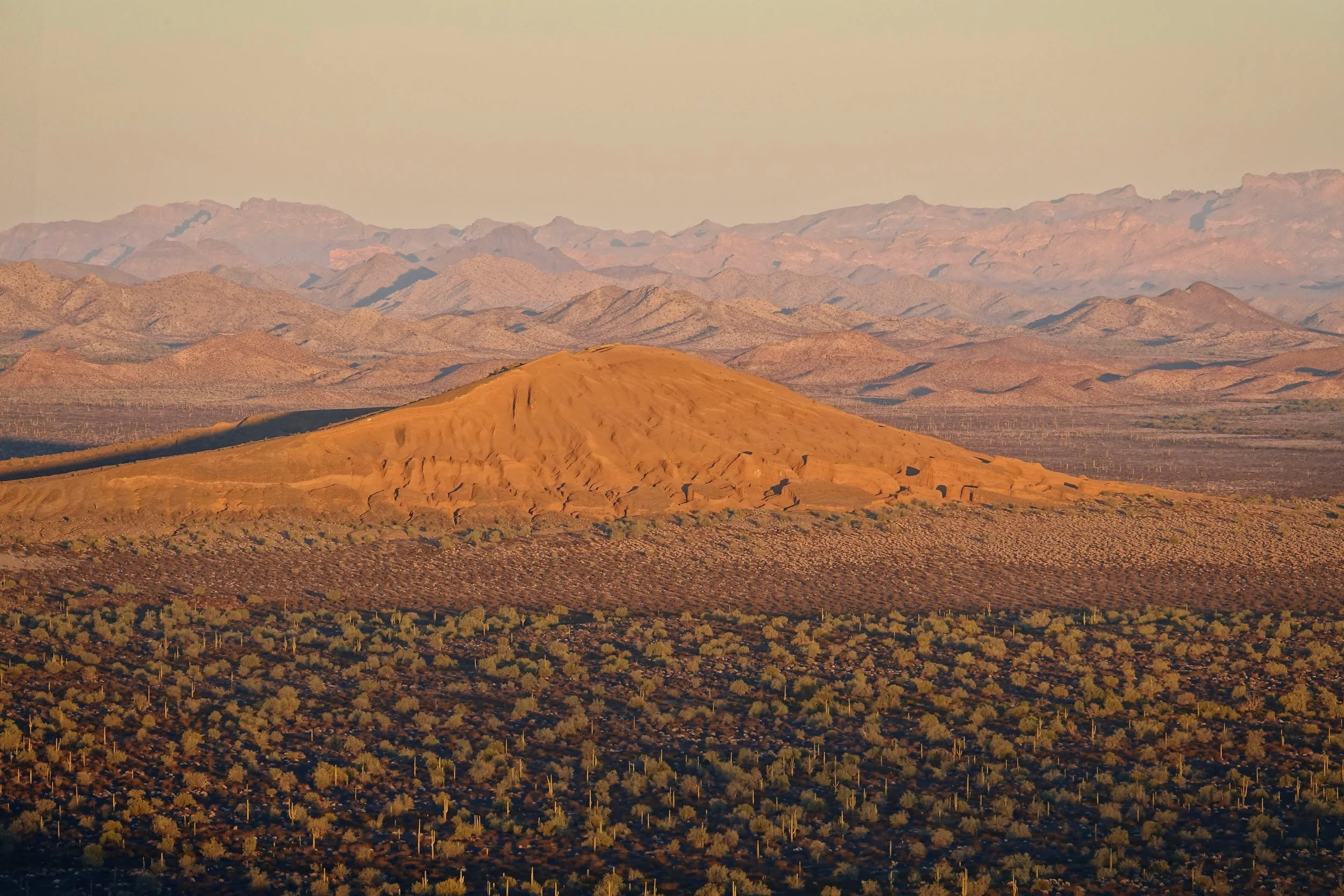
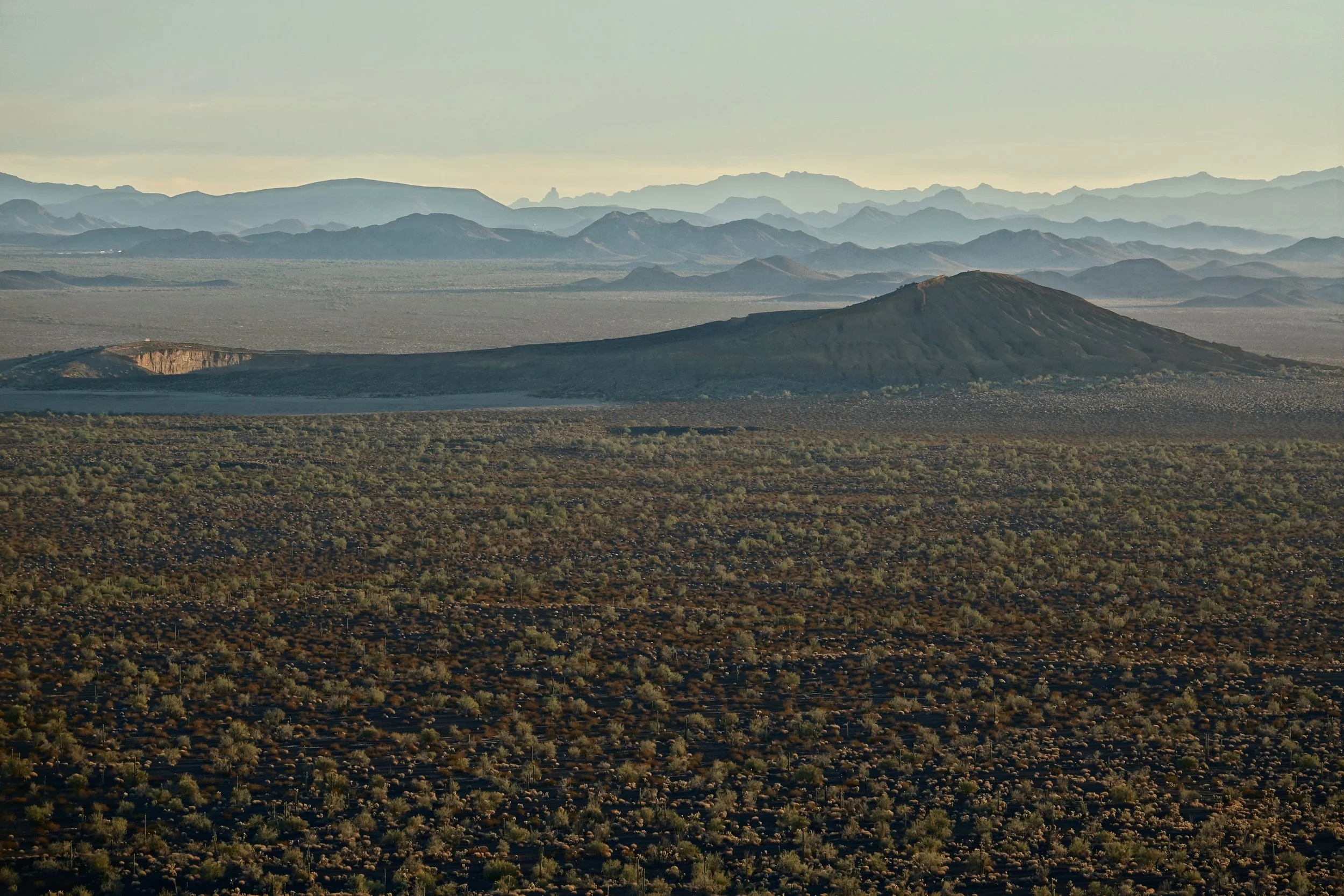
El Pinacate y Gran Desierto de Altar
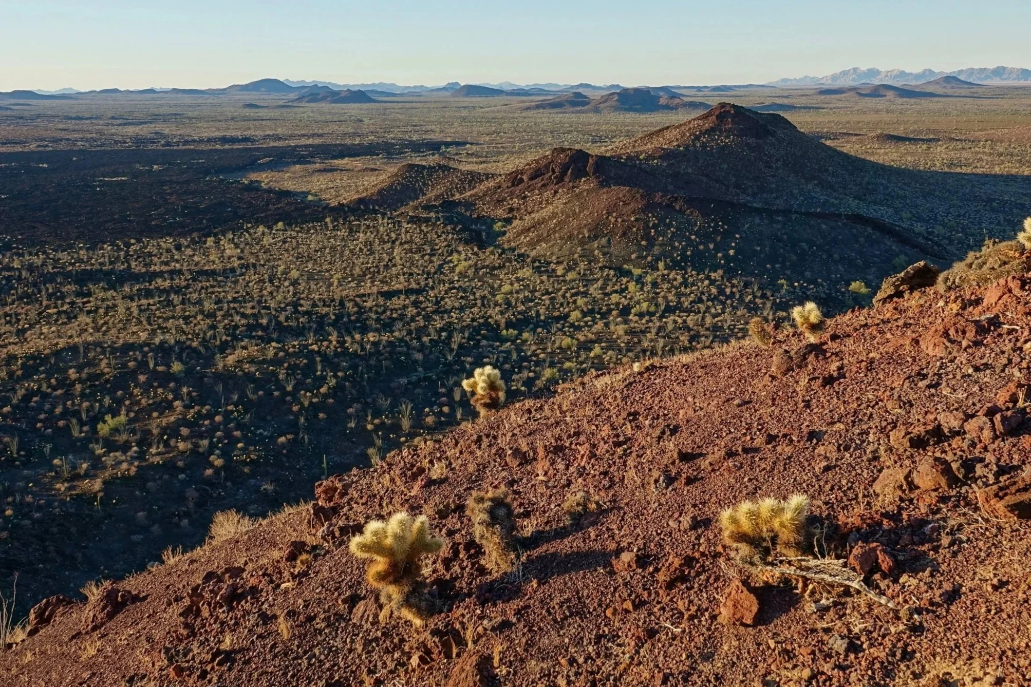
In December 2016 I jumped across the border to El Pinacate y Gran Desierto de Altar reserve in Mexico.
View from the cinder cone above the Tecolote camp, looking towards Cerro Colorado and the northern section of the park
El Pinacate is accessed by crossing the Sonoyta border station. About halfway to Puerto Penasco, there is a visitor station directly off highway 8. They accepted US dollars for the entrance fee. The reserve has a second campsite in the southern section called Rojo Cono, which has a longer 7 mile climb. A 4WD vecihle is needed to reach it
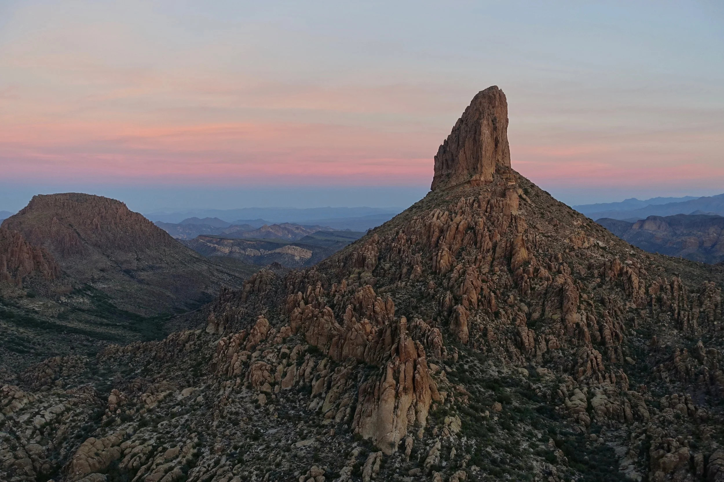
Superstition Mountains

The Peralta trail leads to Fremont Saddle with views of Weavers Needle. I completed the full loop here combining the Peralta trail with the Dutchman (20 miles, 2400ft)
There are some places labeled with names that sound like water sources on the map (Bluff spring, Whiskey spring, etc), but there was no water on the loop during my hike
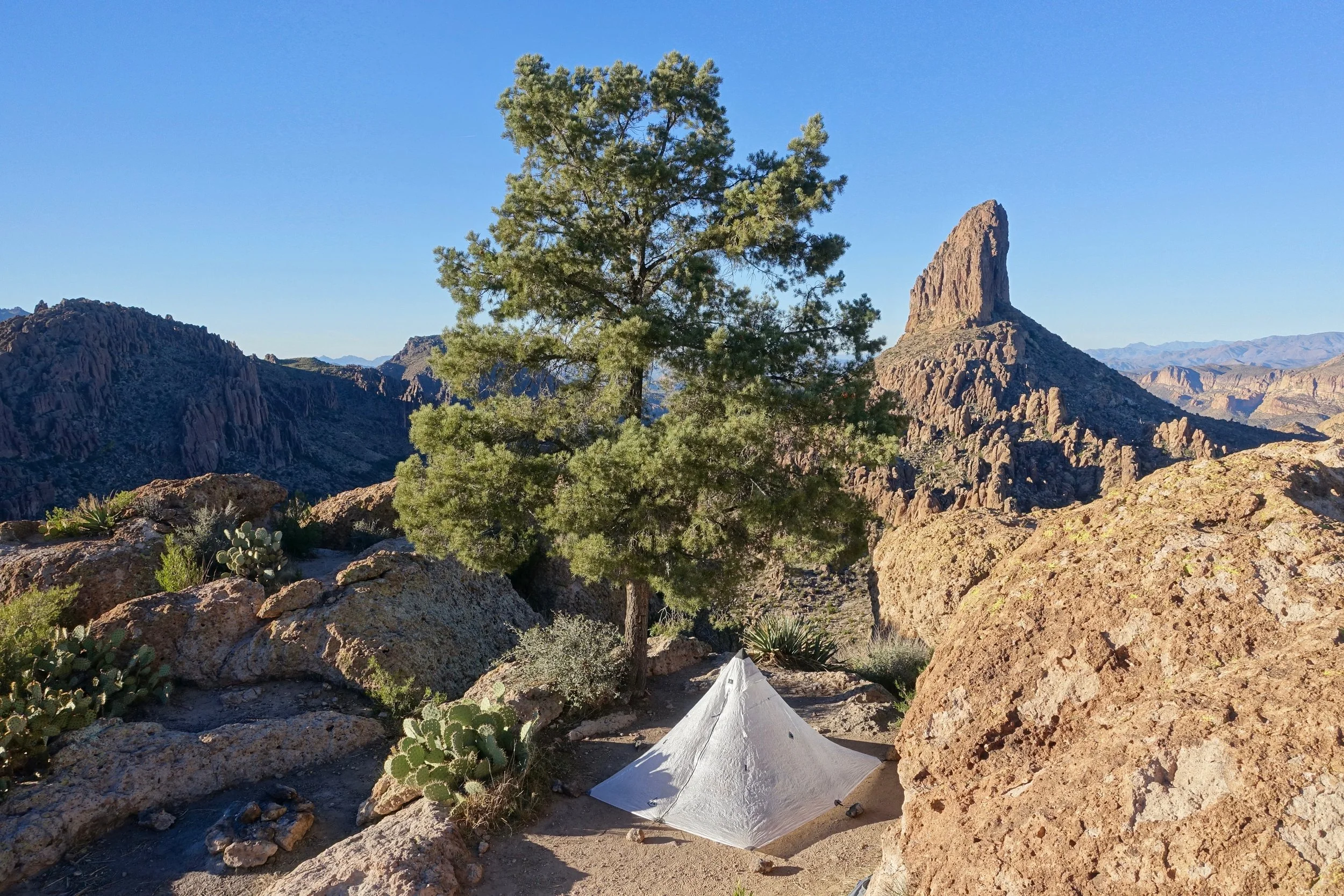
Camp near Weavers Needle
Organ Pipe Cactus National Monument
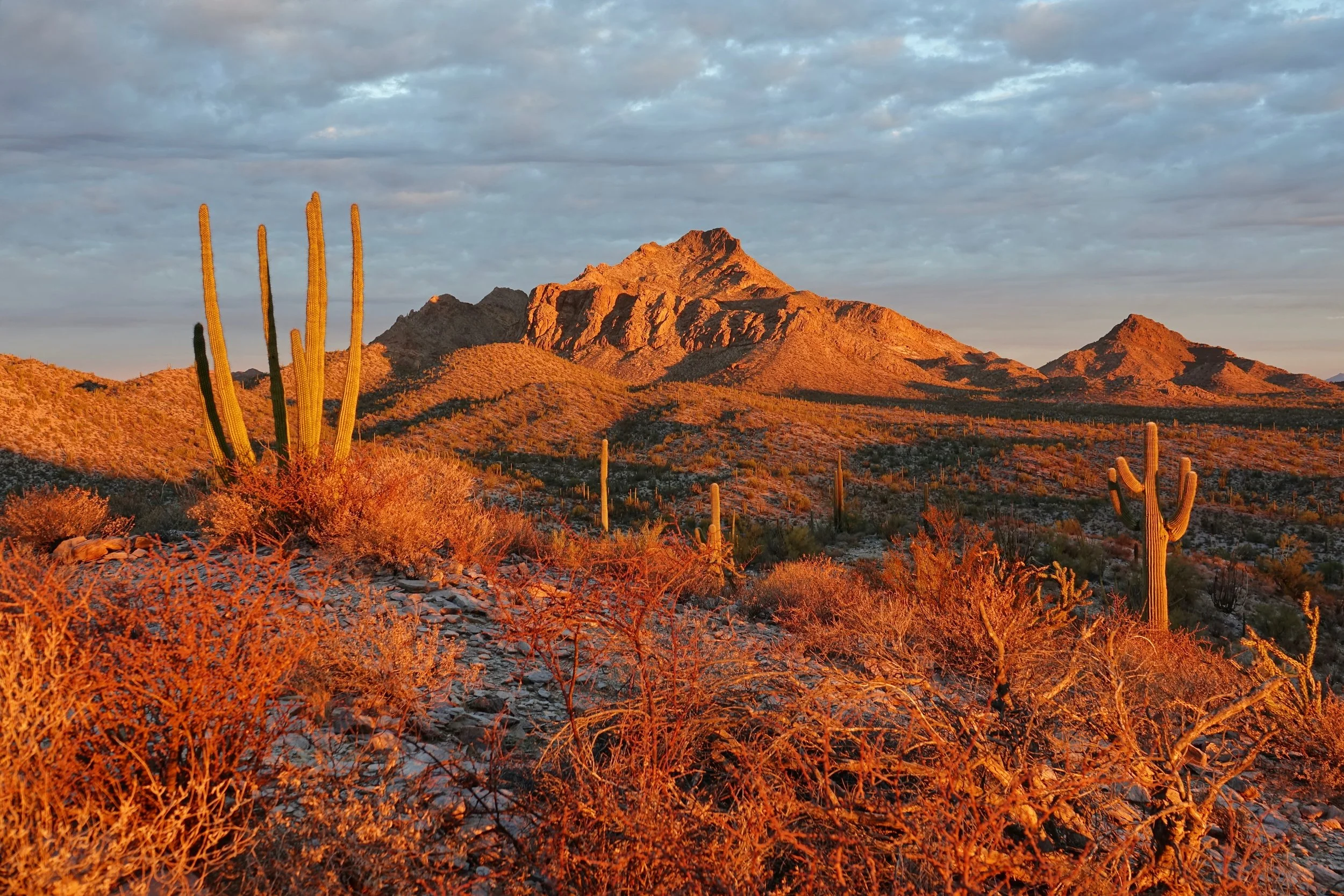
The western section of Organ Pipe is more remote, with a long drive around Puerto Blanco and also the longest hike in the park around Senita Basin (~11 miles from Red Tanks trailhead)
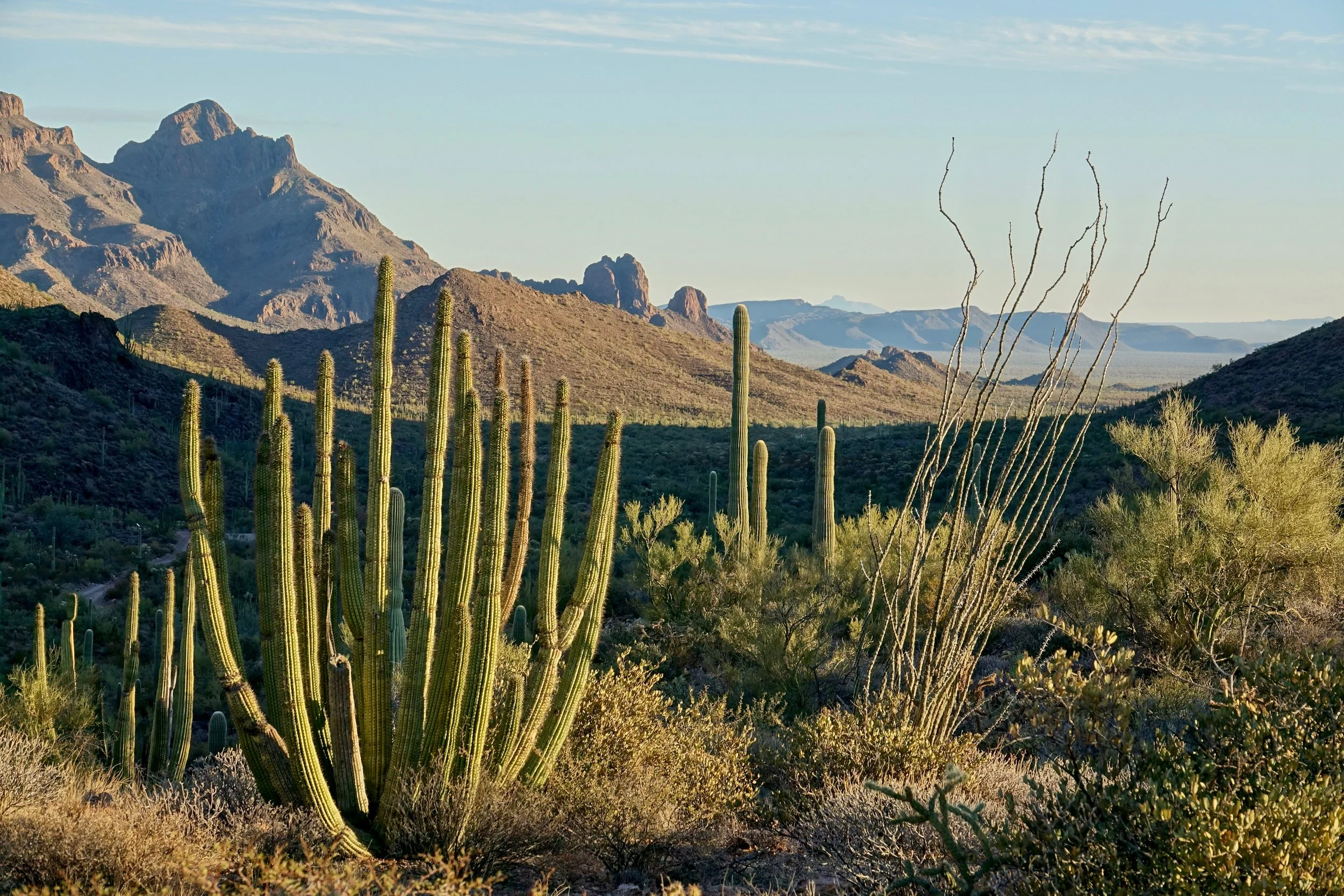
In the eastern section, I camped at Alamo Canyon and drove the Ajo Mountain loop
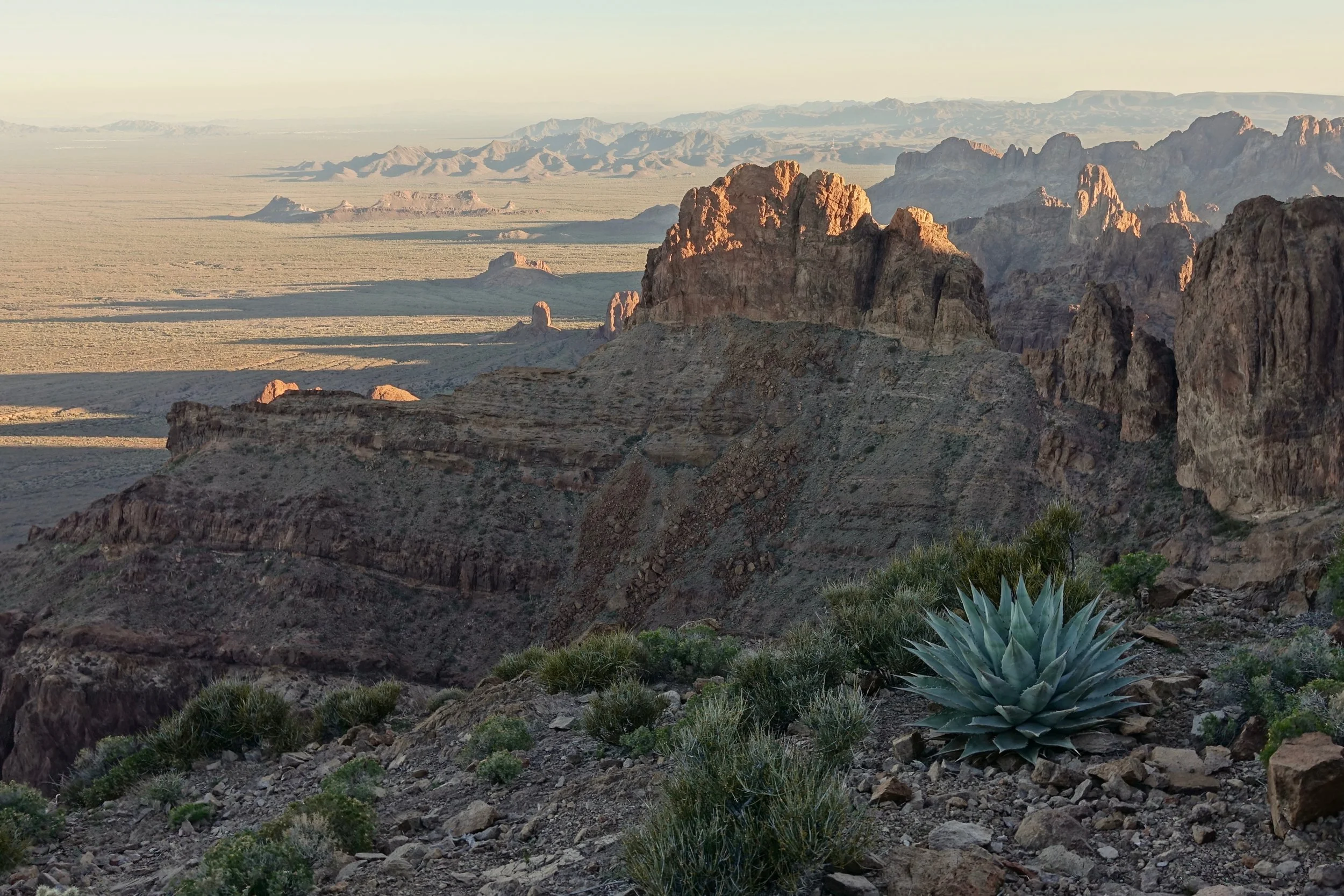
Kofa Wildlife Refuge
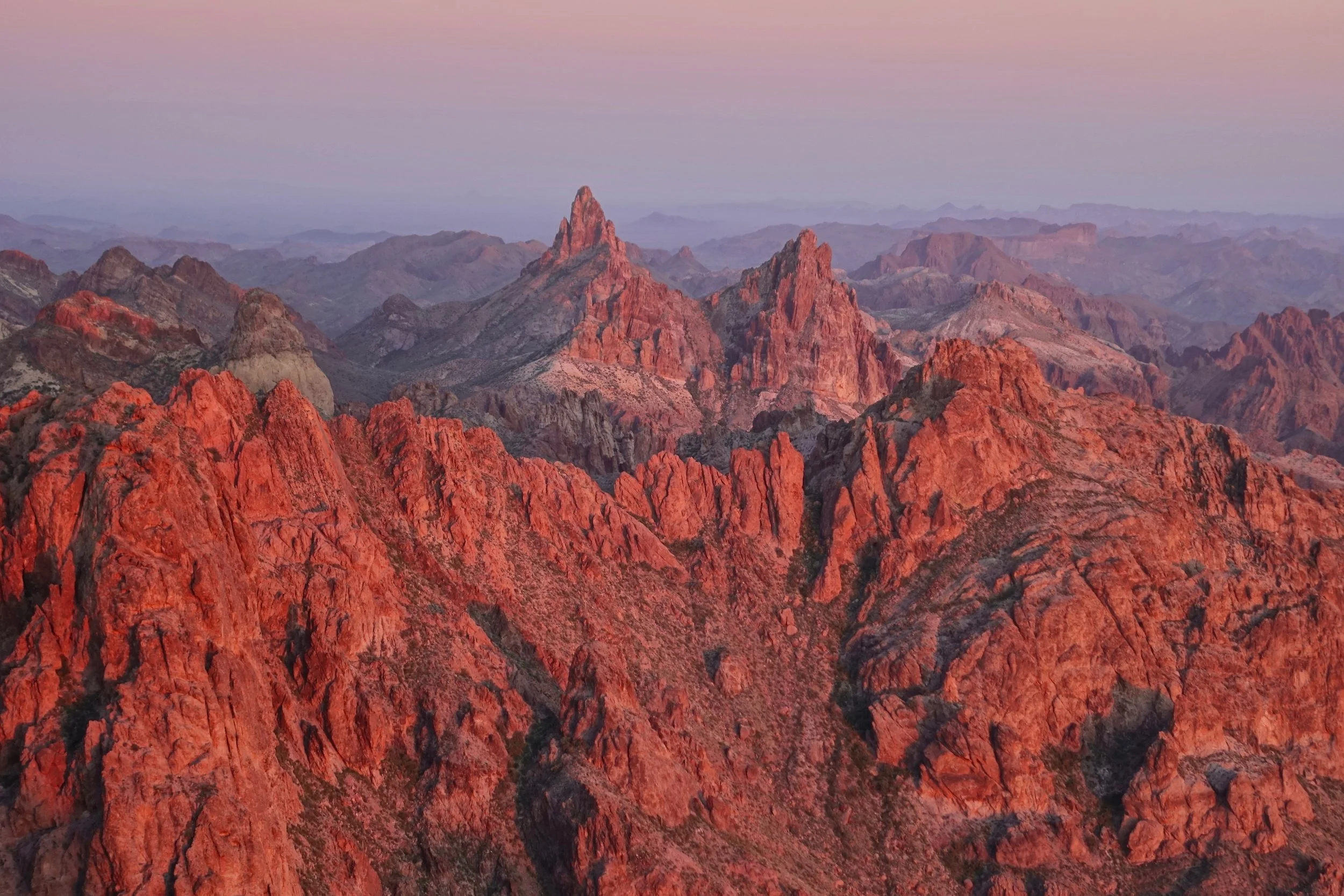
View from the summit of Signal Peak looking east over the Kofa mountain range
I camped in one of the alcoves on the west side of mountain to avoid the wind on the summit
Sedona Hiking
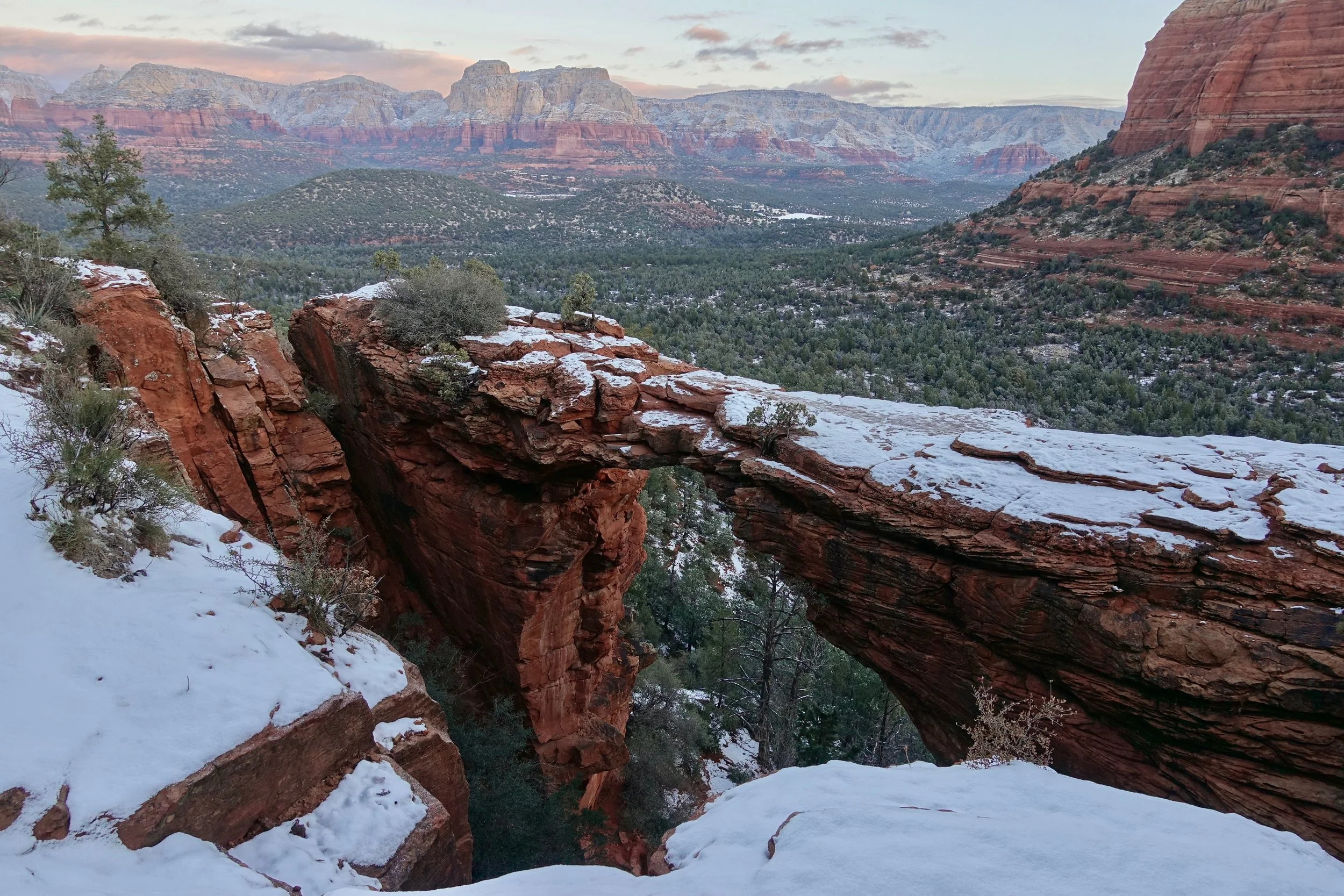
I hiked almost every trail in Sedona during a work assignment. Devils Bridge being my favorite. Also worth getting an elevated view (Wilson or Bear Mtn). And doing a valley walk (Courthouse Butte or Cathedral Rock). For an off trail experience - Munds Mountain. Primarily walked here during the winter, Sedona is a fight for parking in the spring and fall
Alstrom Point
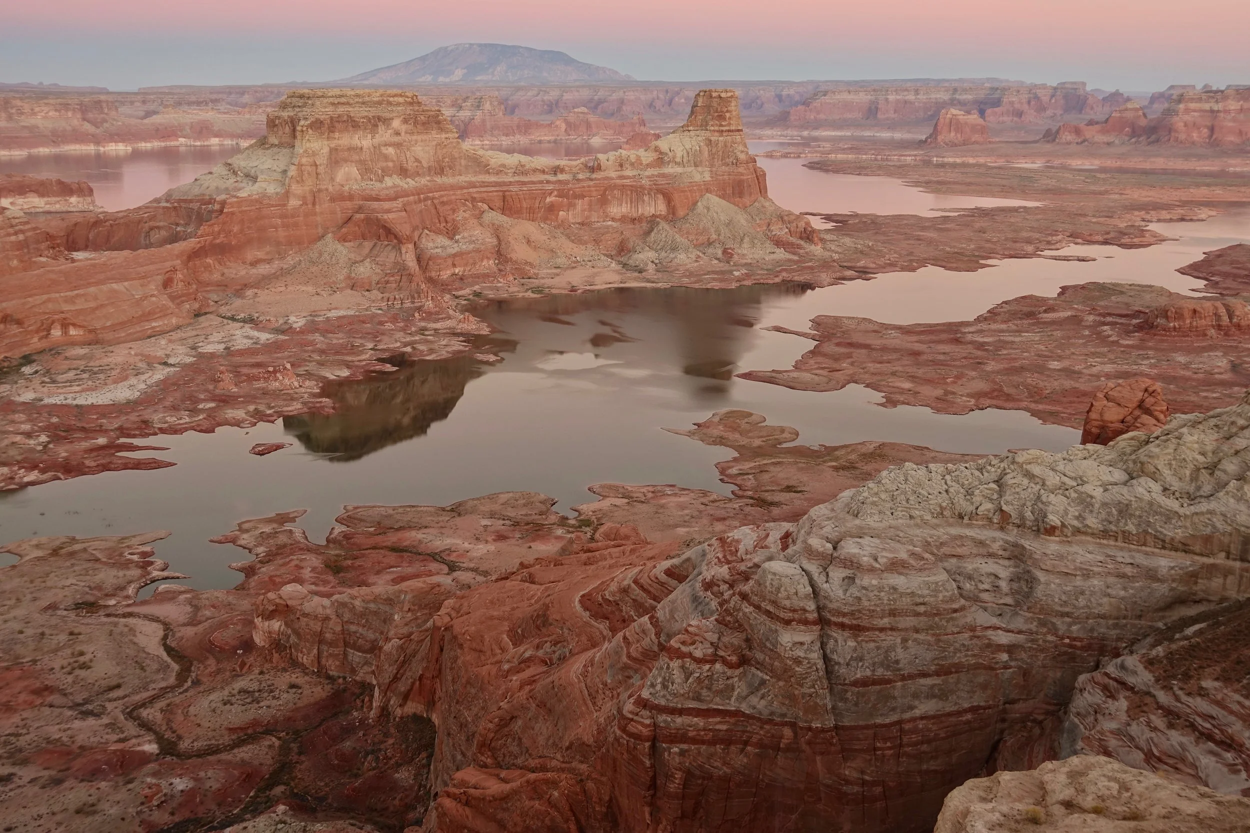
A short walk north of Page to Alstrom Point. I brought backpacking gear as the final mile is difficult even by Jeep and camped at one of the several sites. A high clearance 4x4 is necessary to reach the parking area
Prescott Area
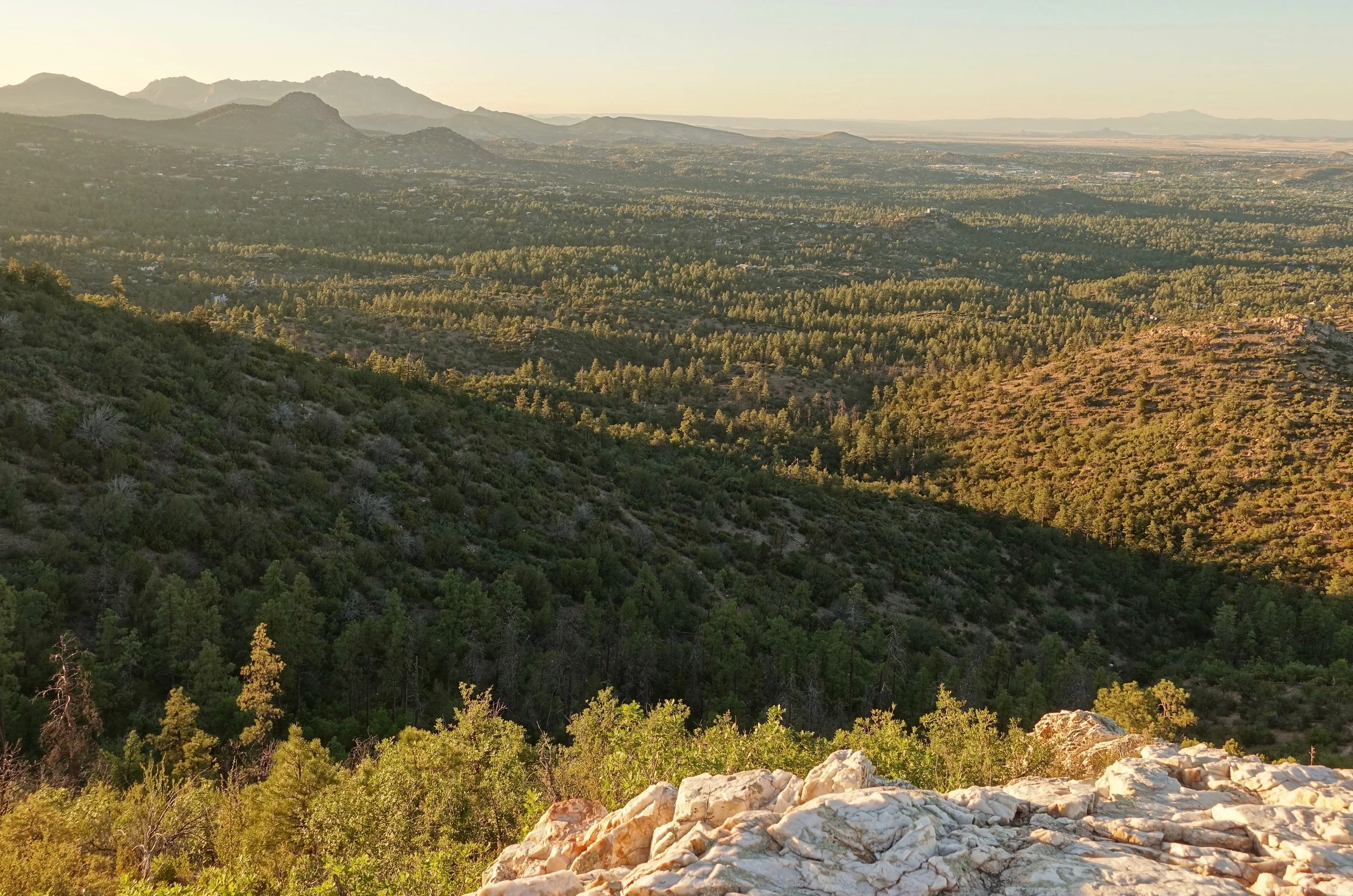
Also walked a good amount around the Prescott area. Quartz Mountain, Thumb Butte, Willow and Watson Lakes and the Granite Mountain Wilderness.
Saguaro National Park
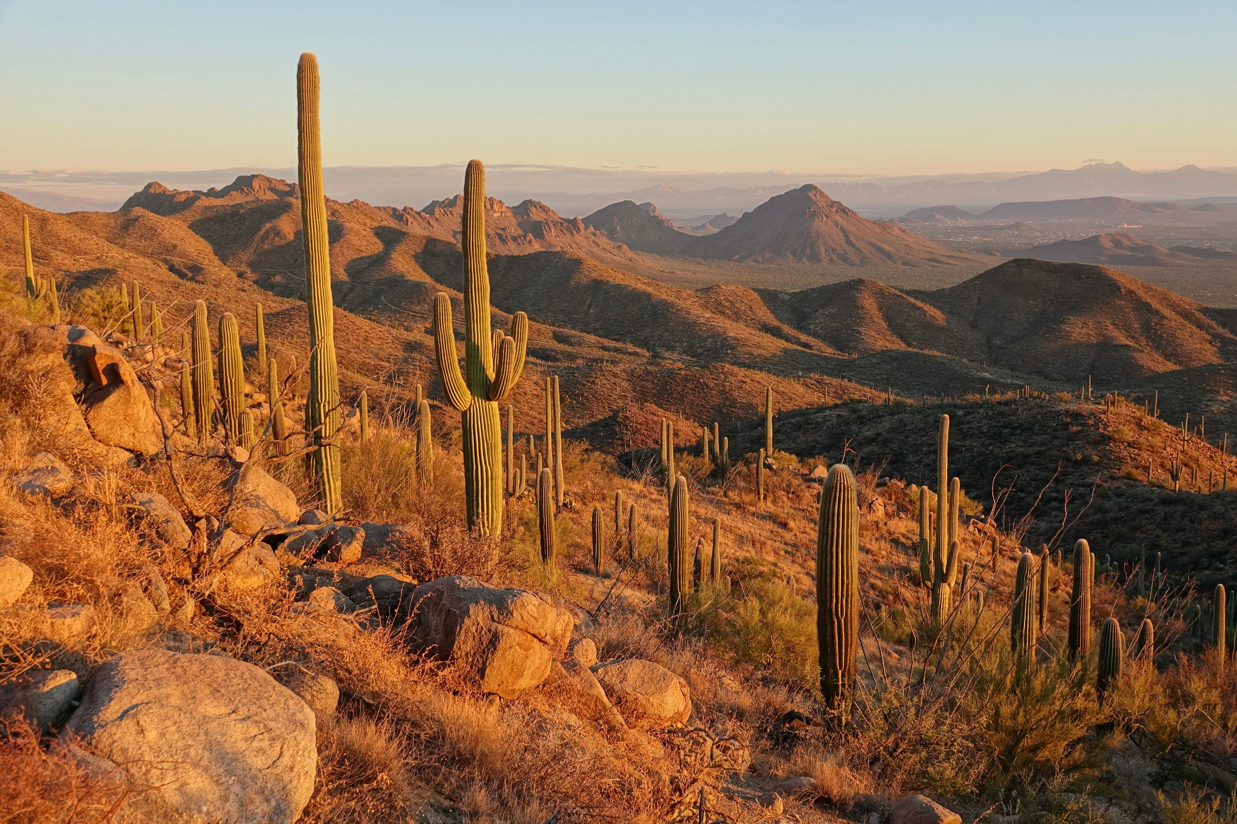
The trails in Saguaro West are basically several different ways of climbing Wasson peak. The larger and more extensive trail system for backpacking is found in Saguaro East, which I hope to visit on a return trip. The King Canyon-Hugh Norris loop includes the summit of Wasson peak (8 miles, 2000ft return)