Iceland
Fimmvorduhals Trek
Landmannalaugar
Hornstrandir Nature Reserve
Skaftafell National Park
Snæfellsnes Peninsula
Jökulsárgljúfur
Storurd
Glymur Waterfall
Thrihnukagigur
Kerlingarfjoll
Fimmvorduhals and Landmannalaugar
The Fimmvorduhals trail goes from Thorsmork from Skogar with a return bus ride (18 miles)
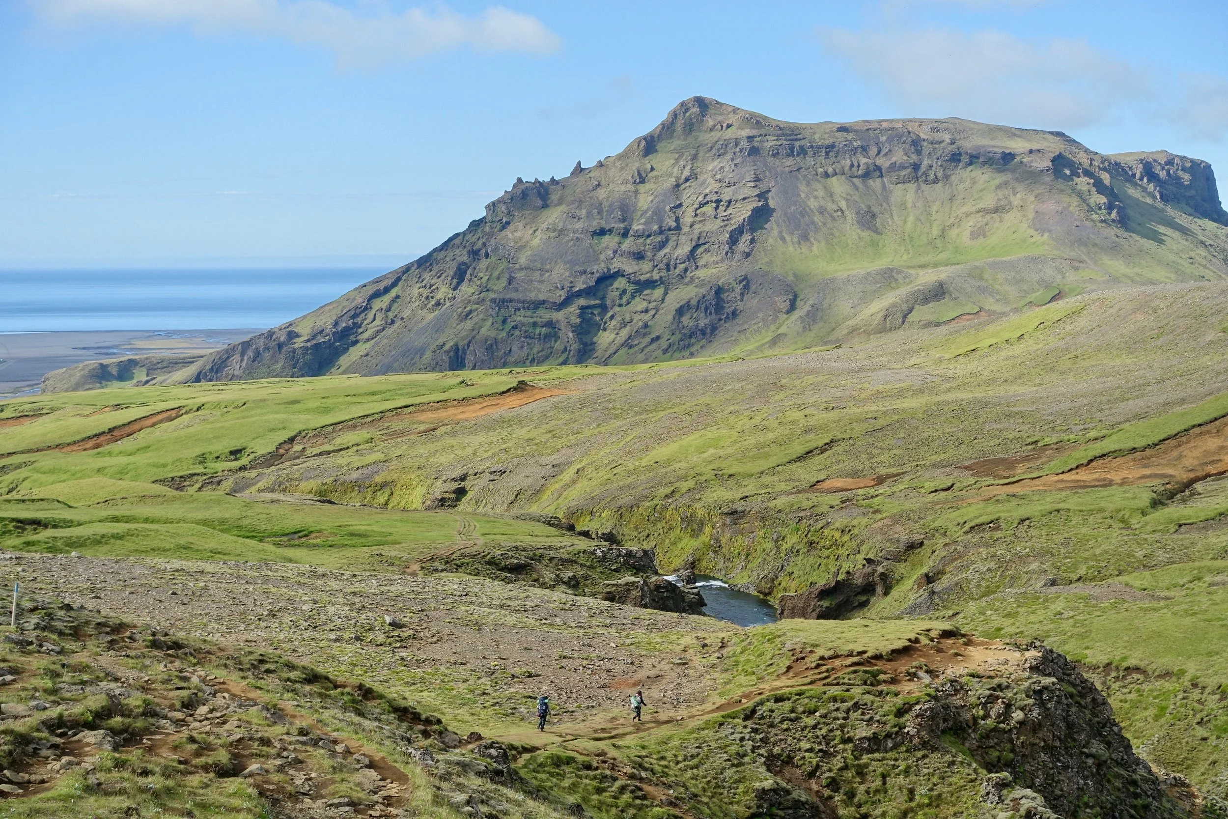
Climbing from the ocean
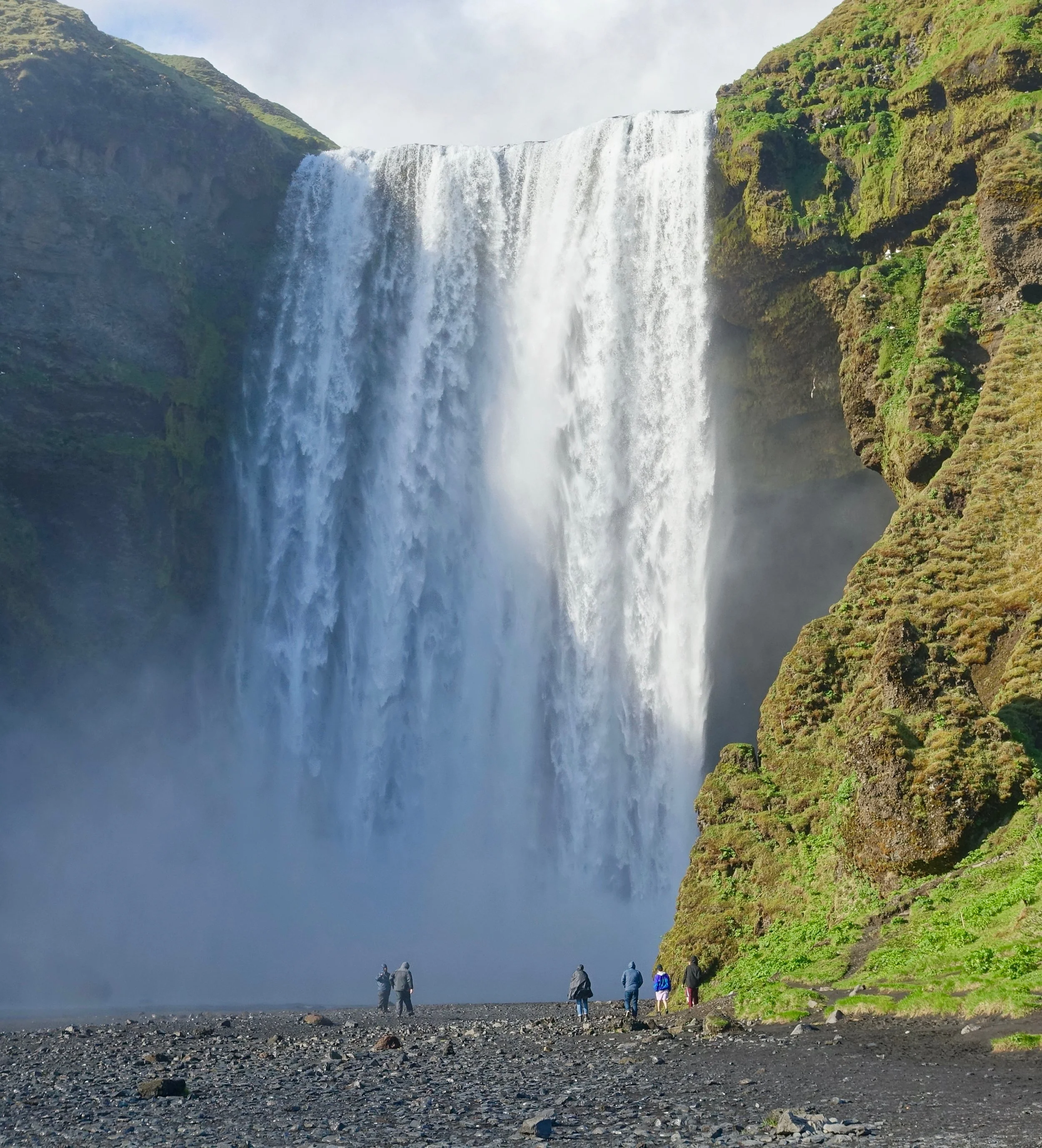
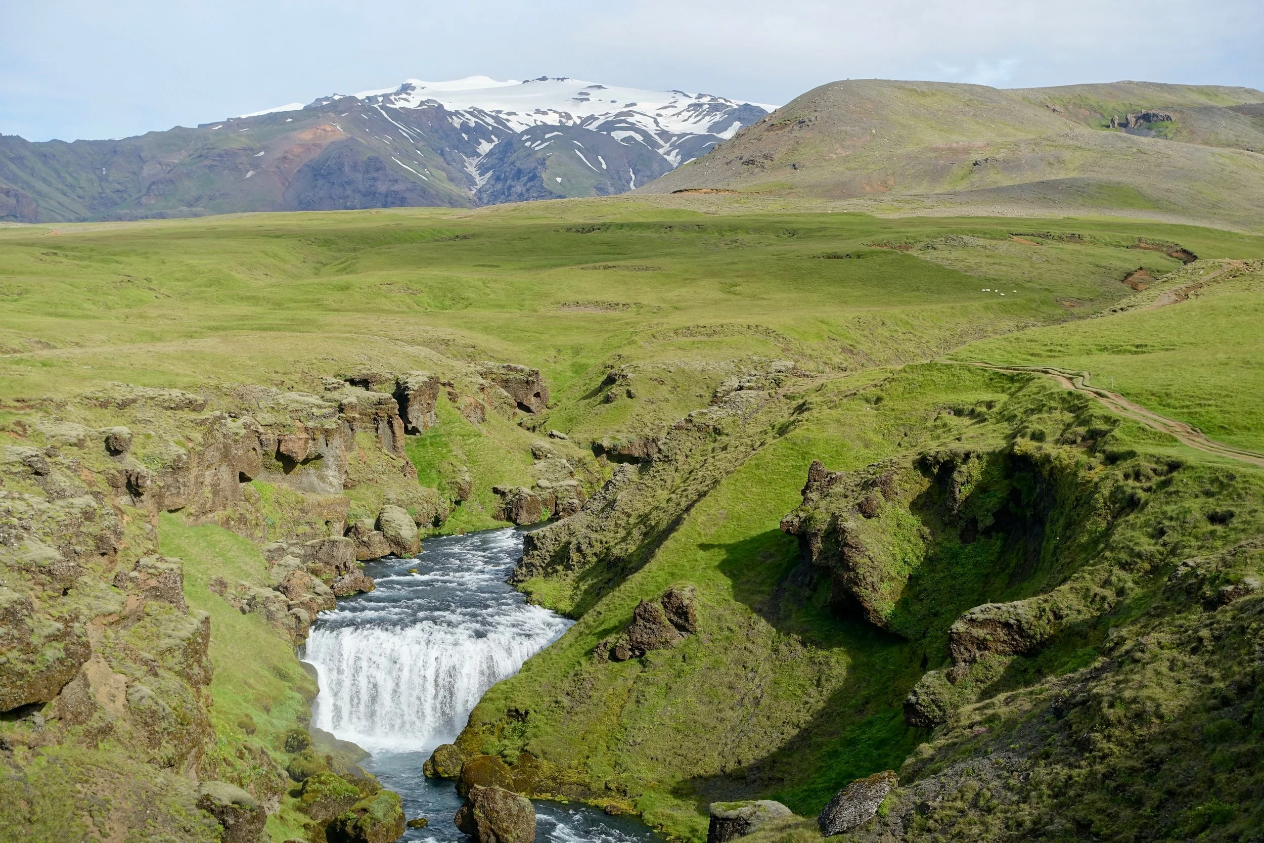
There seemed to be an impressive waterfall at every turn
The trail went along the river with an elevated view during the climb
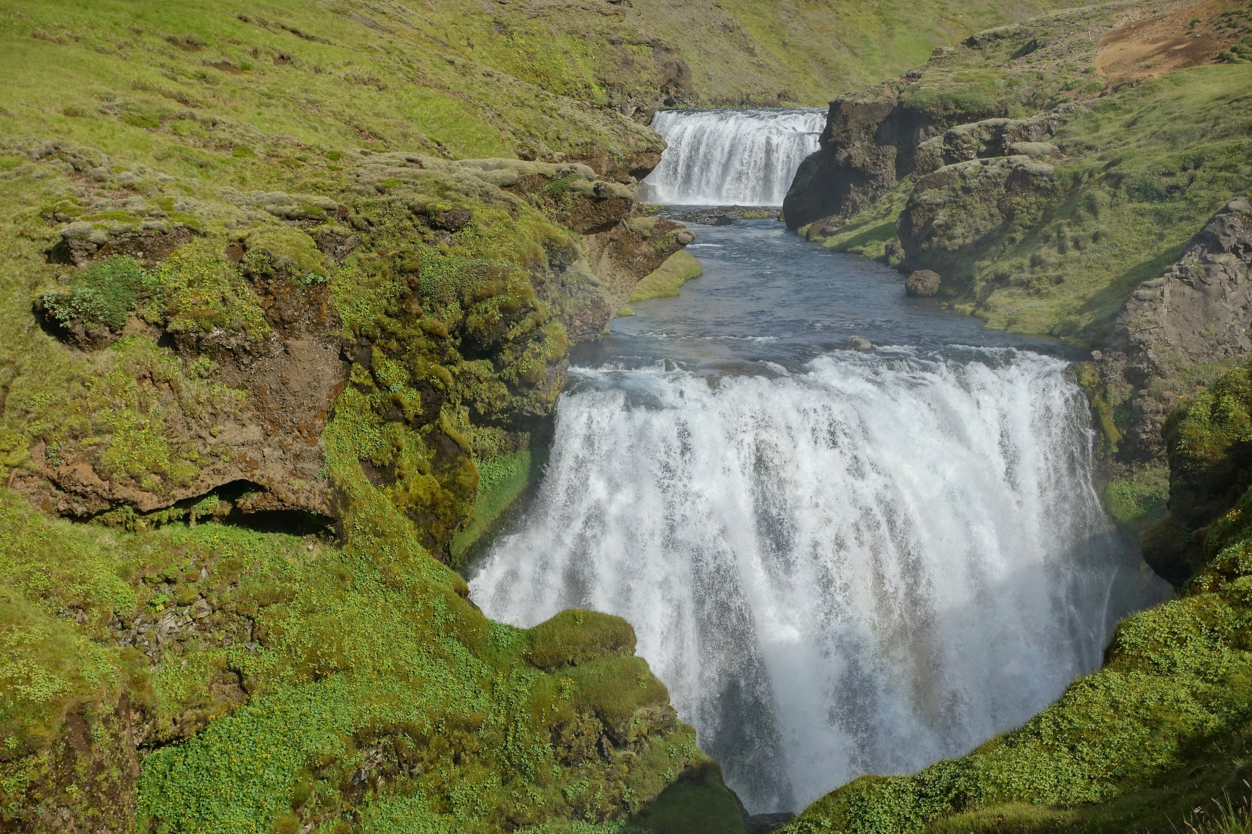
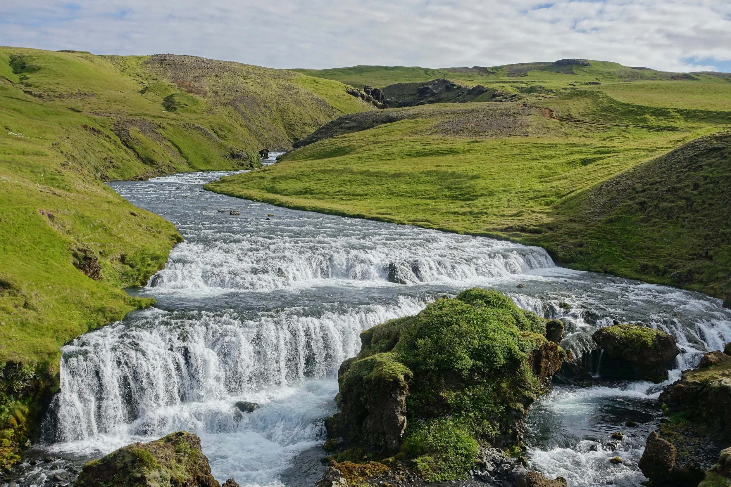
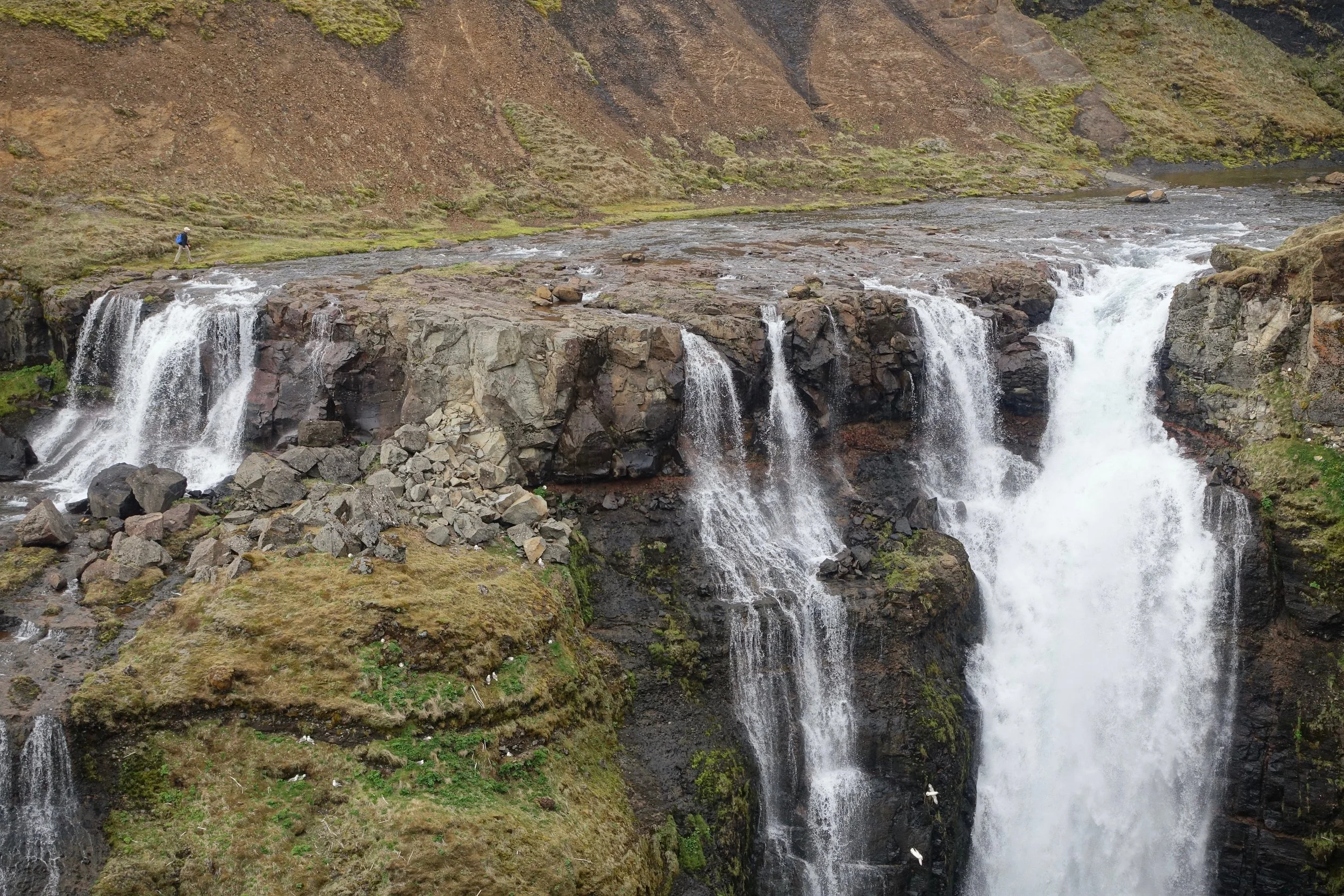
Double waterfall
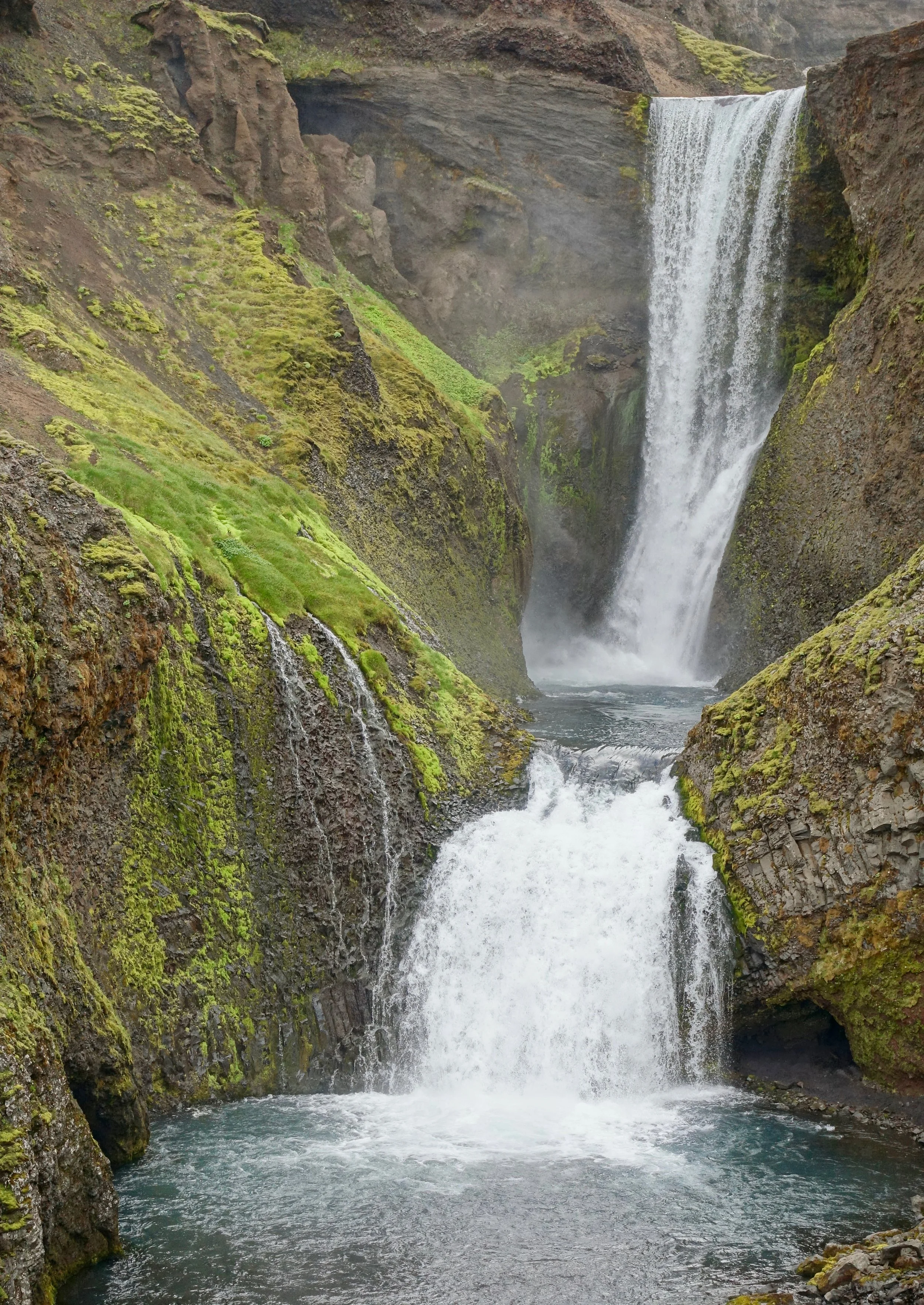
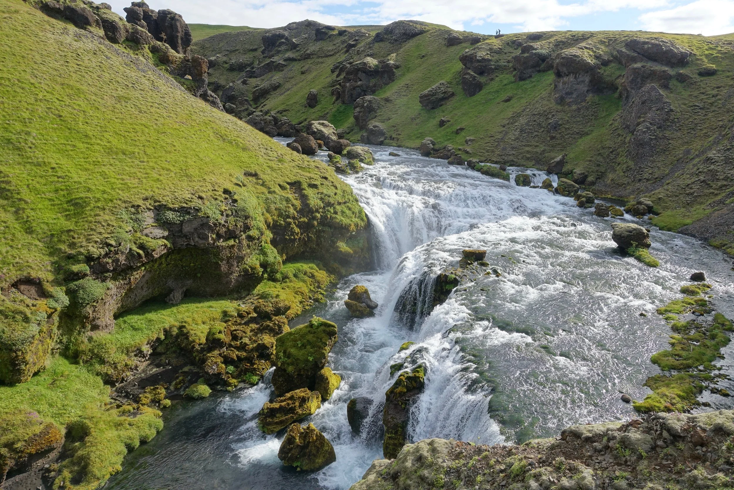
Another double waterfall

Looking towards Eyjafjallajokull volcano
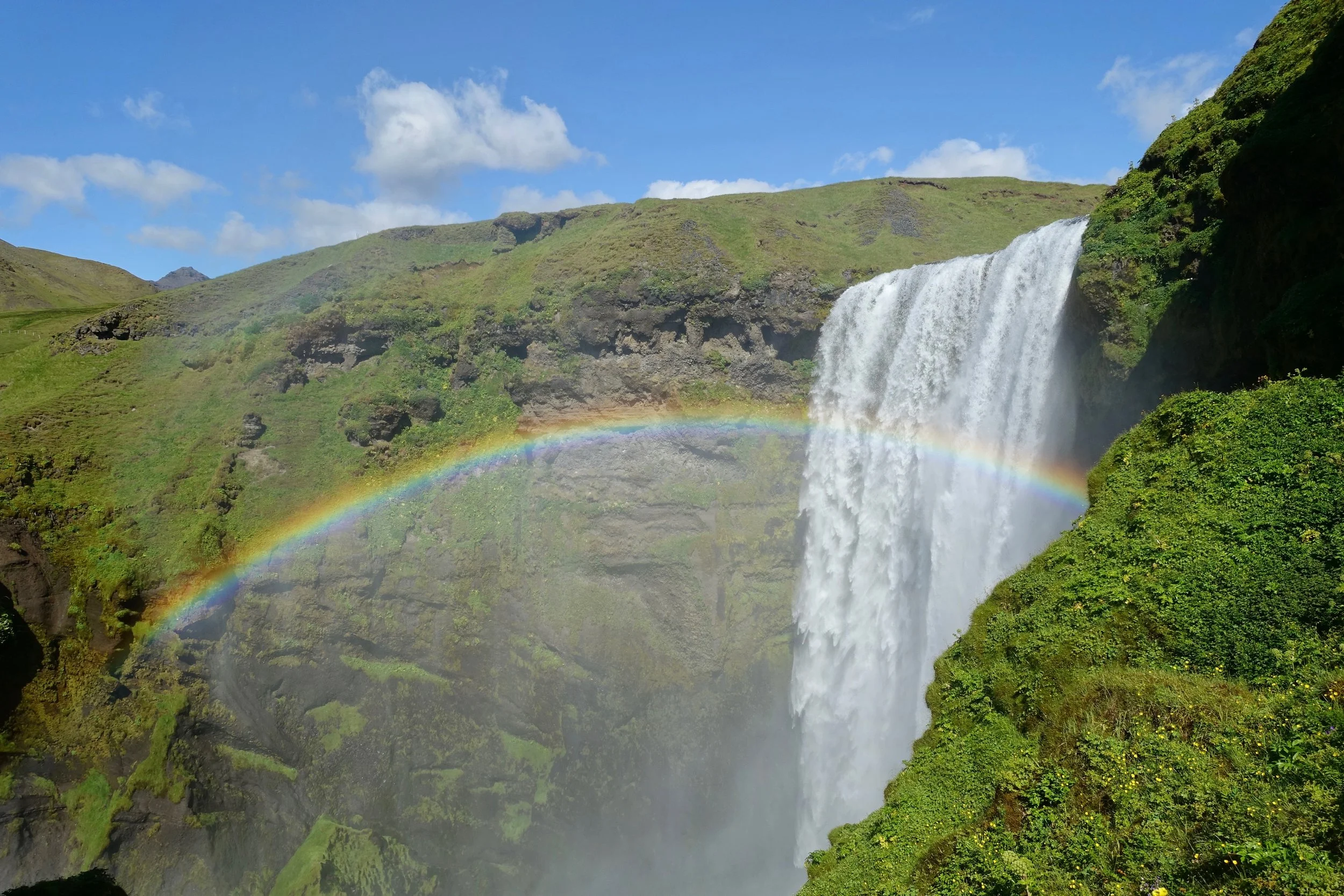
Rainbow across Skogafoss
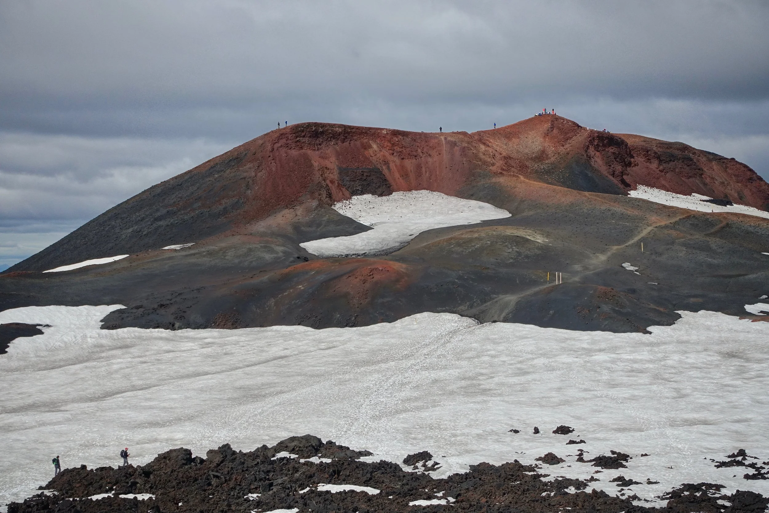
The Magni crater pictured here is only five years old, created during the 2010 volcano eruption that shut down air traffic in Europe
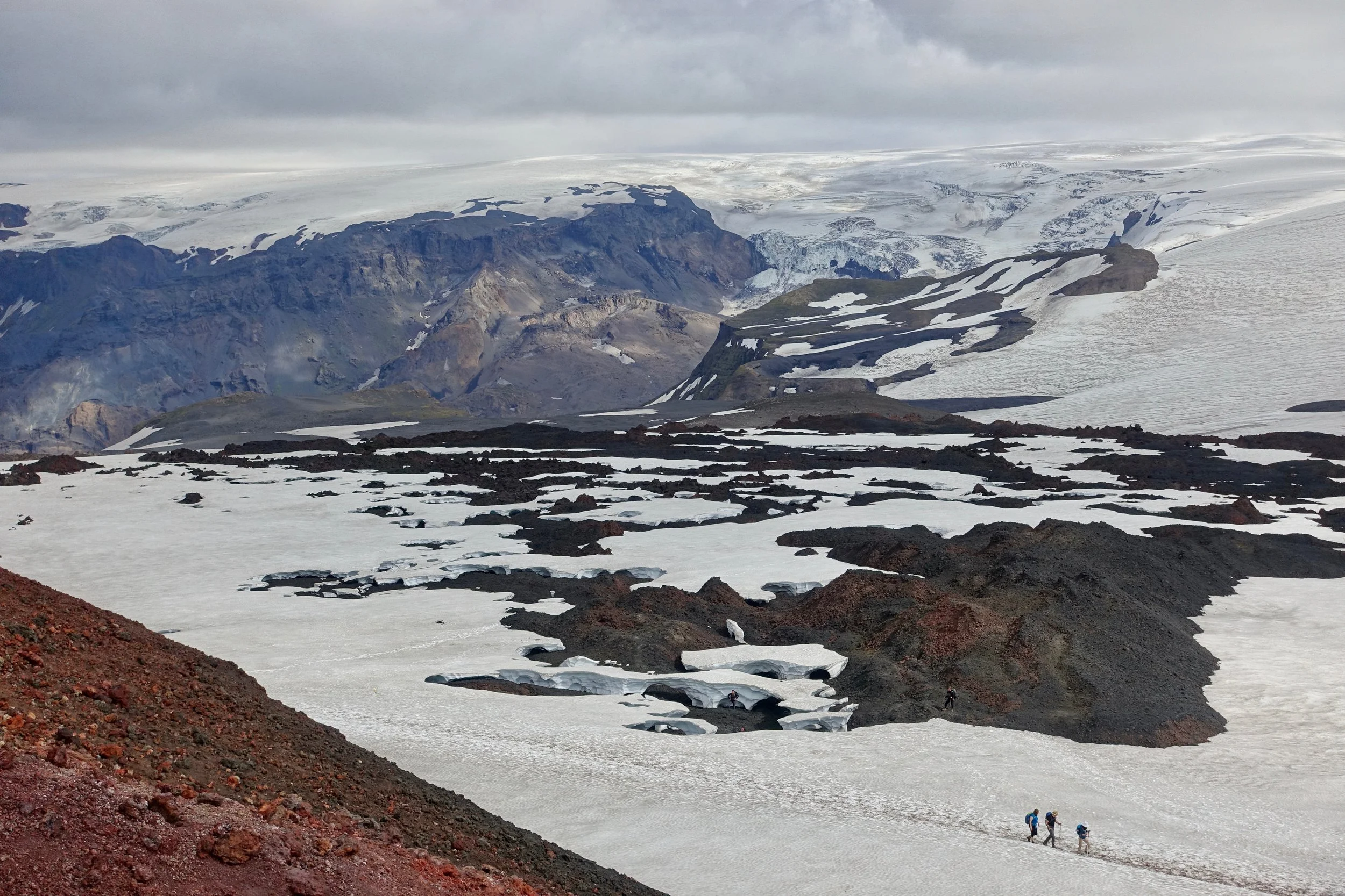
Snow was covering the upper section of the trail near the Fimmvorduhals pass
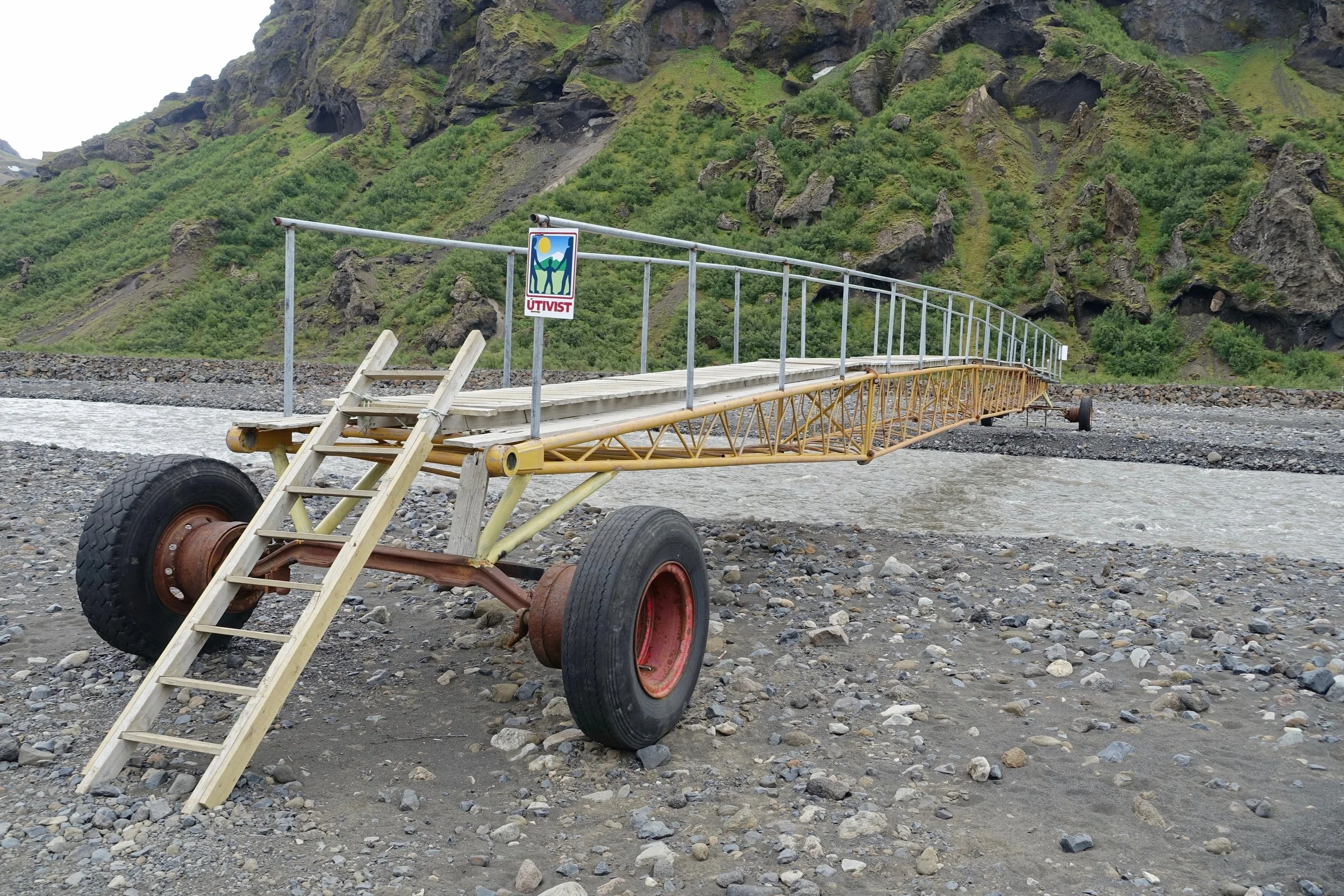
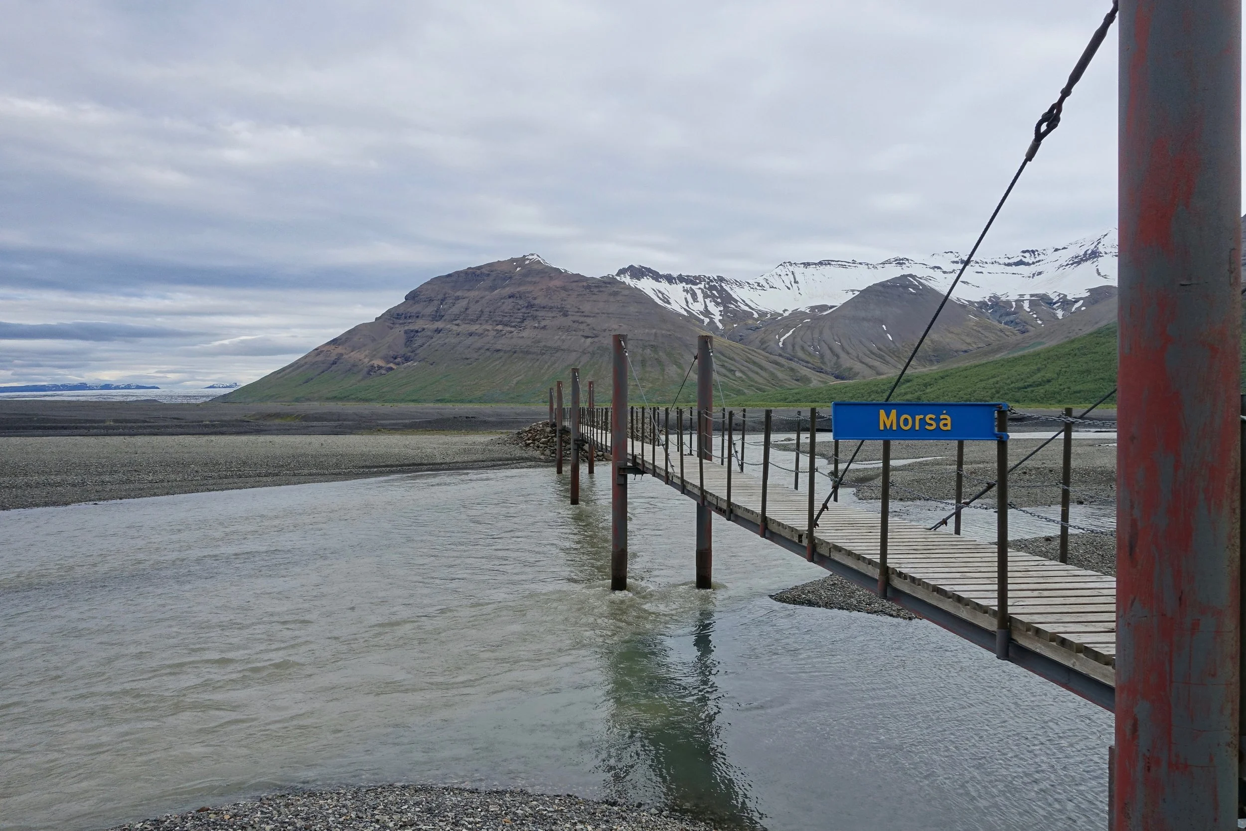
Mobile footbridge on the Krossa River
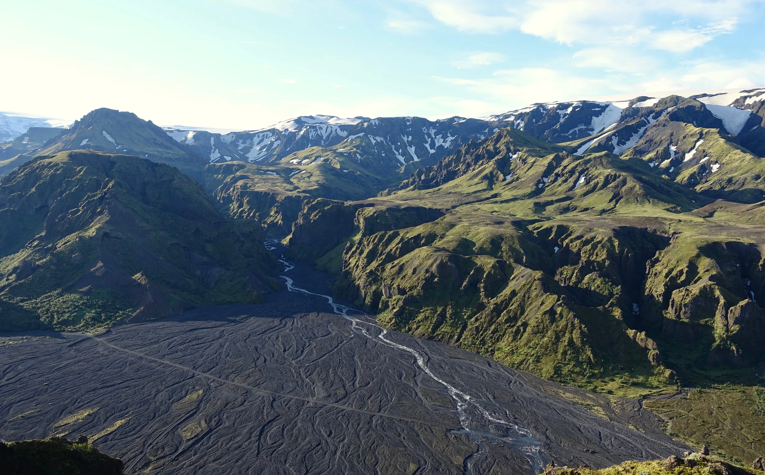
Thorsmork from Valahnukur
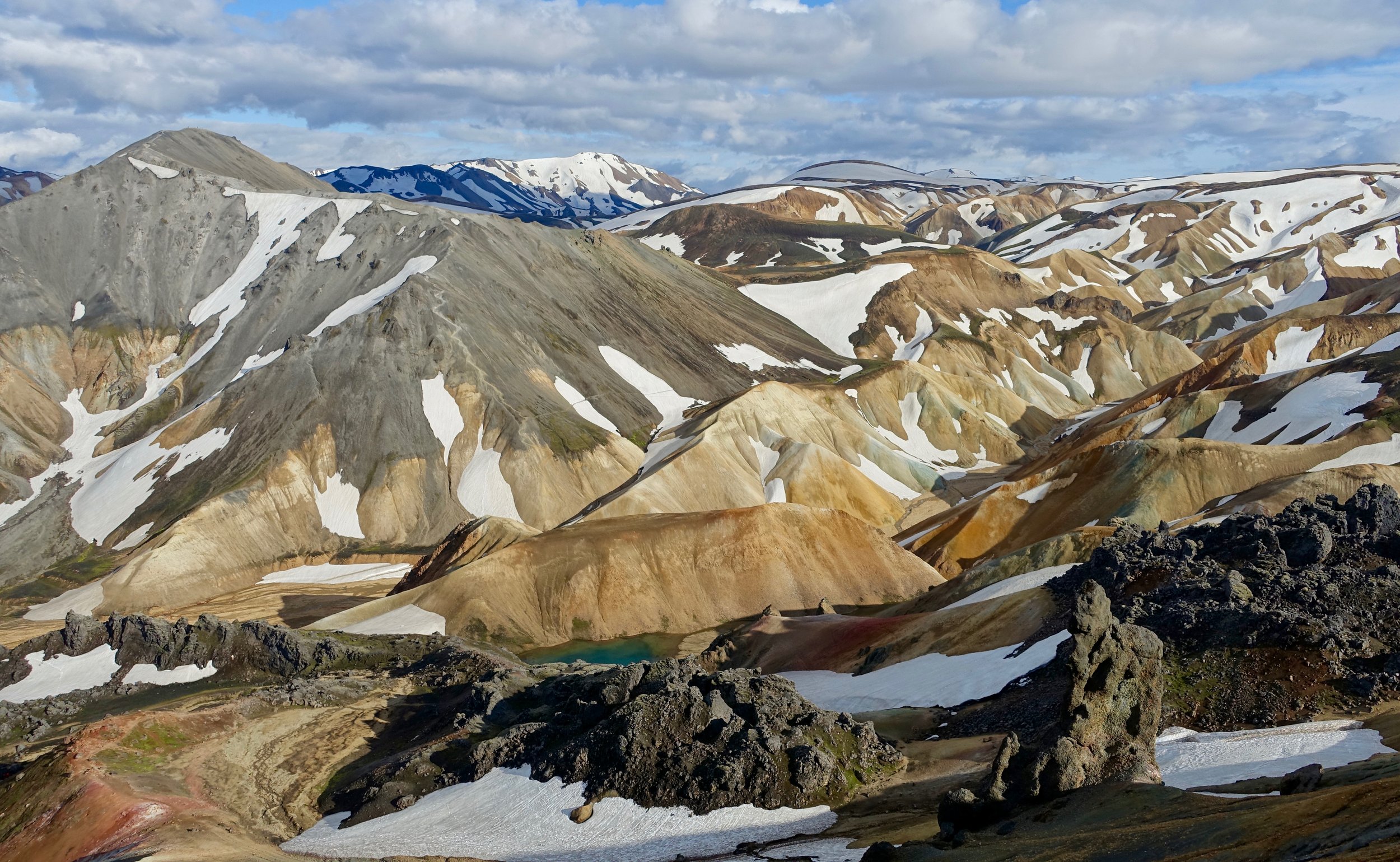
Landmannalaugar from Brennisteinsalda summit
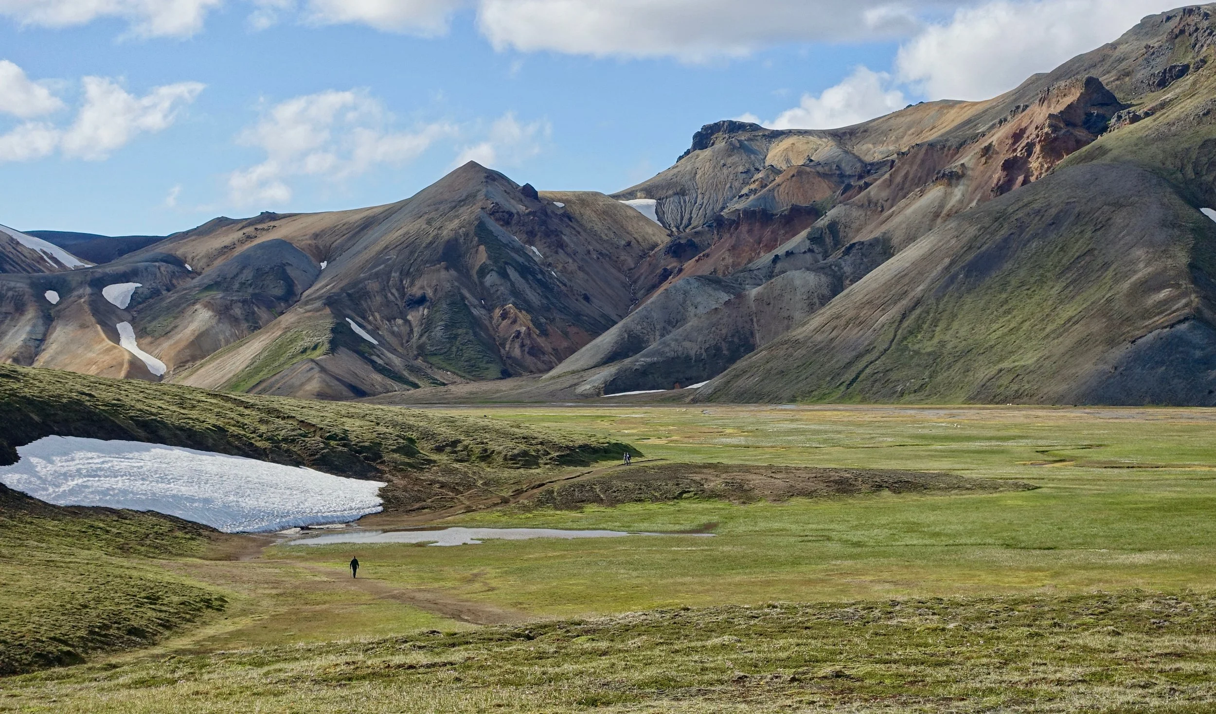
A climb of Blahnukur and Brennisteinsalda can be done in a five mile loop
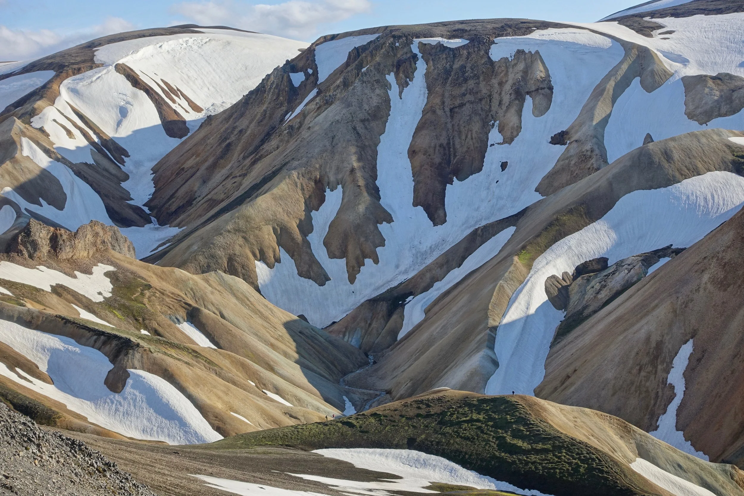
The unique snow covered hills of Landmannalaugar
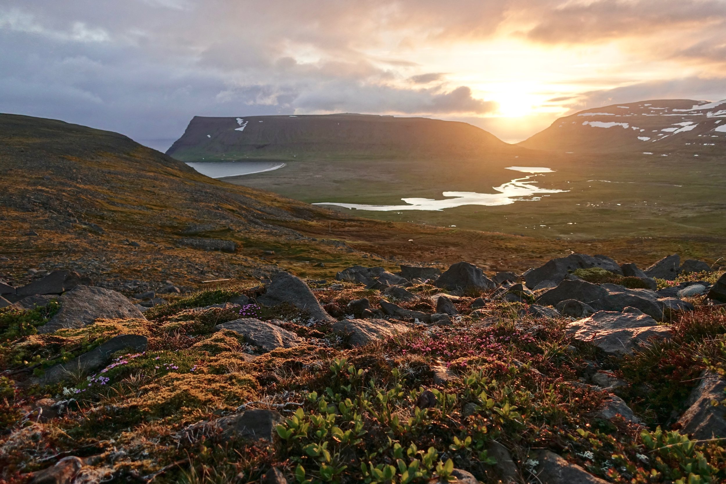
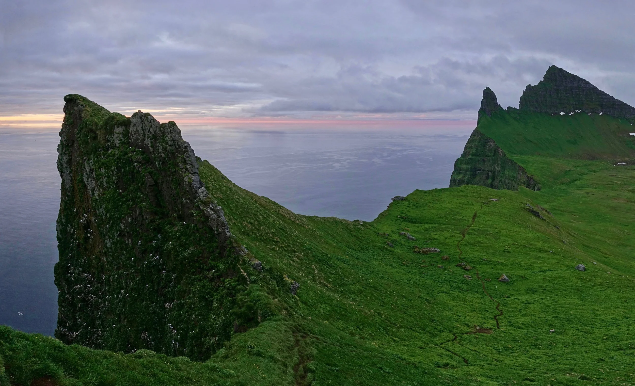
Hornstrandir Nature Reserve
The Hornstrandir Nature Reserve can only be accessed by boat from Isafjordur. I started at Saebol and hiked for seven days around the peninsula before being picked up at Hornvik
Sunset over Rekavik bak Latur and the Stakkadalur valley

Looking east towards Haelavik from Almenningaskard Pass
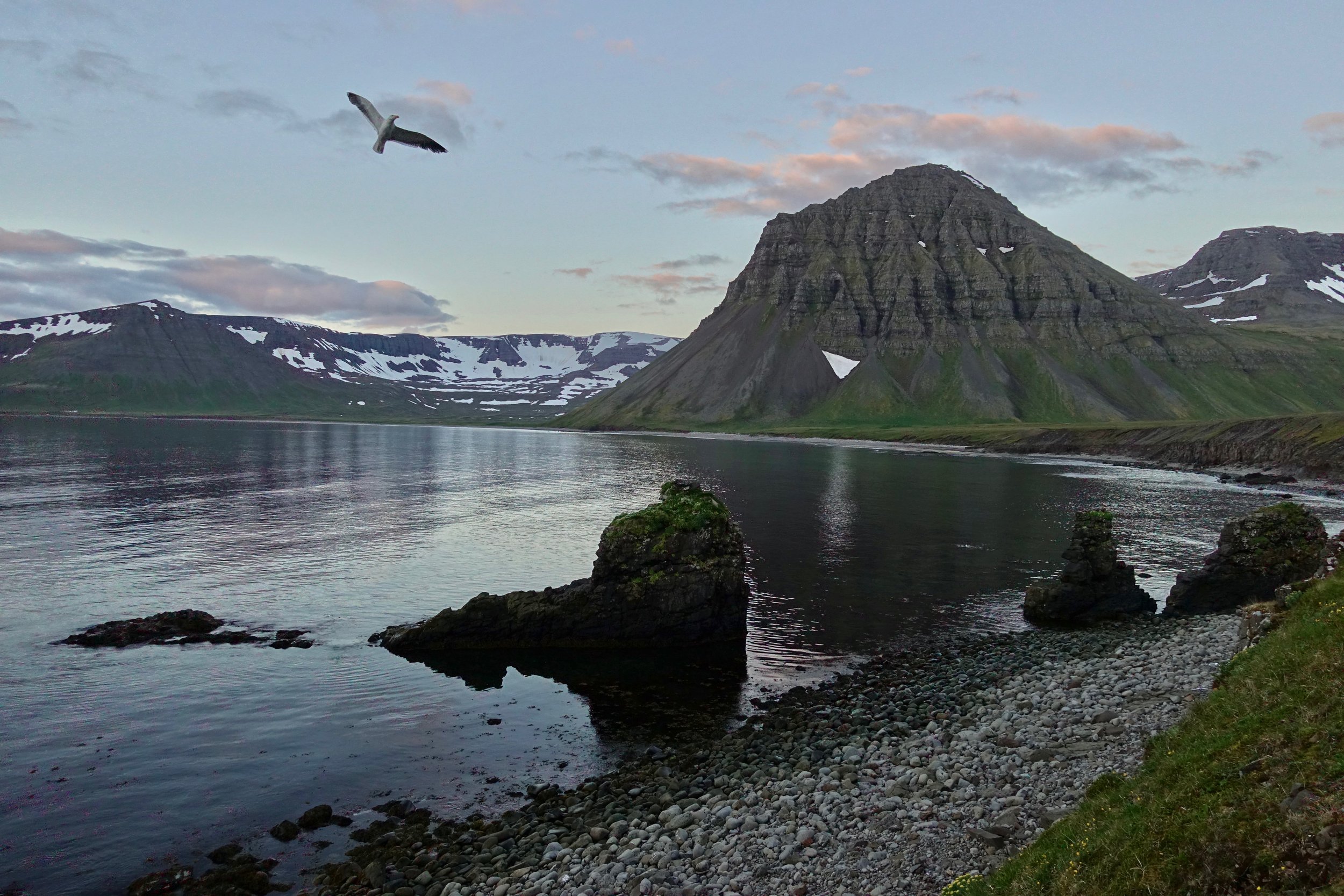
I walked around the bay on a calm night and enjoyed the evening before camping at Budir
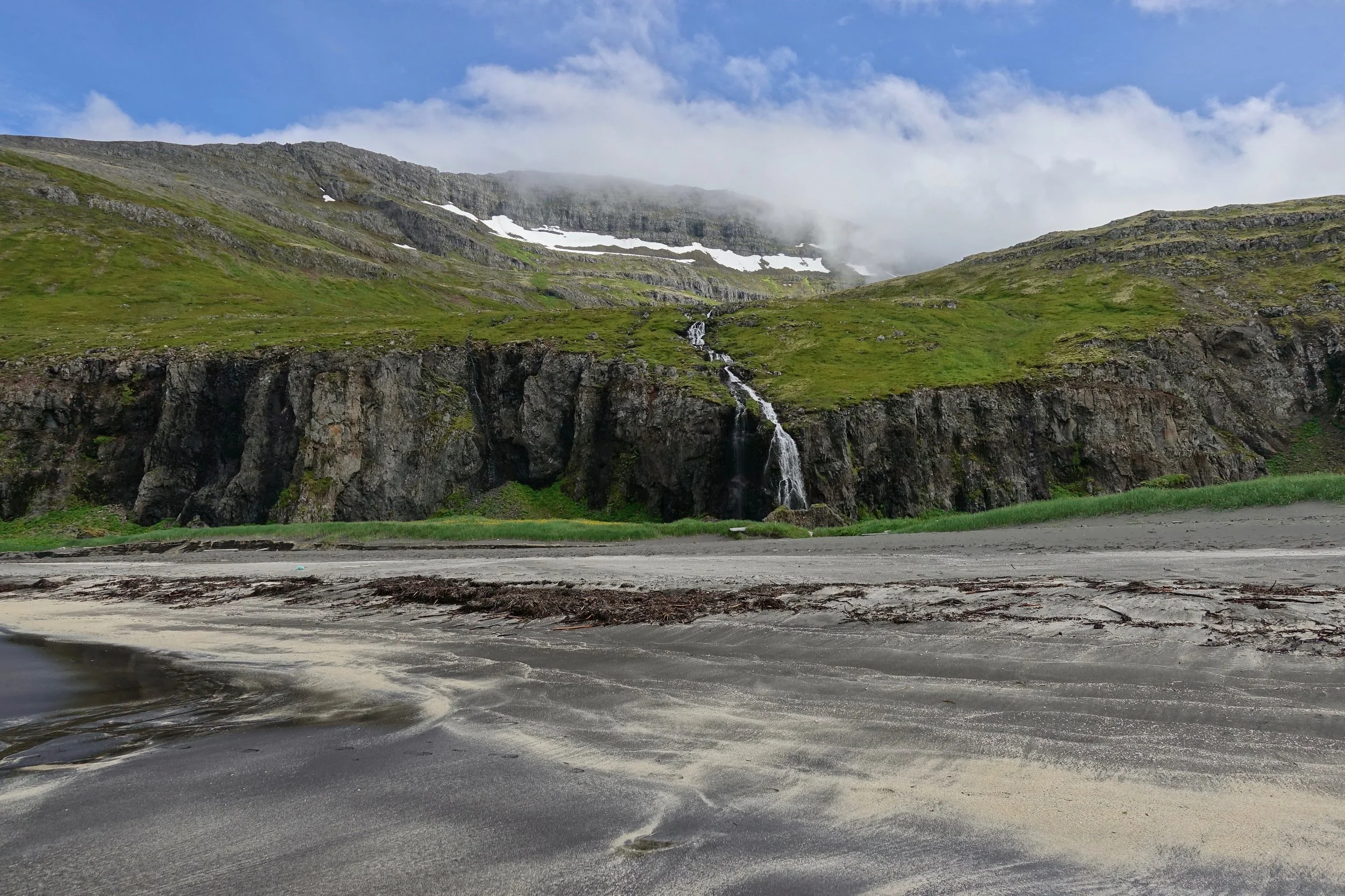
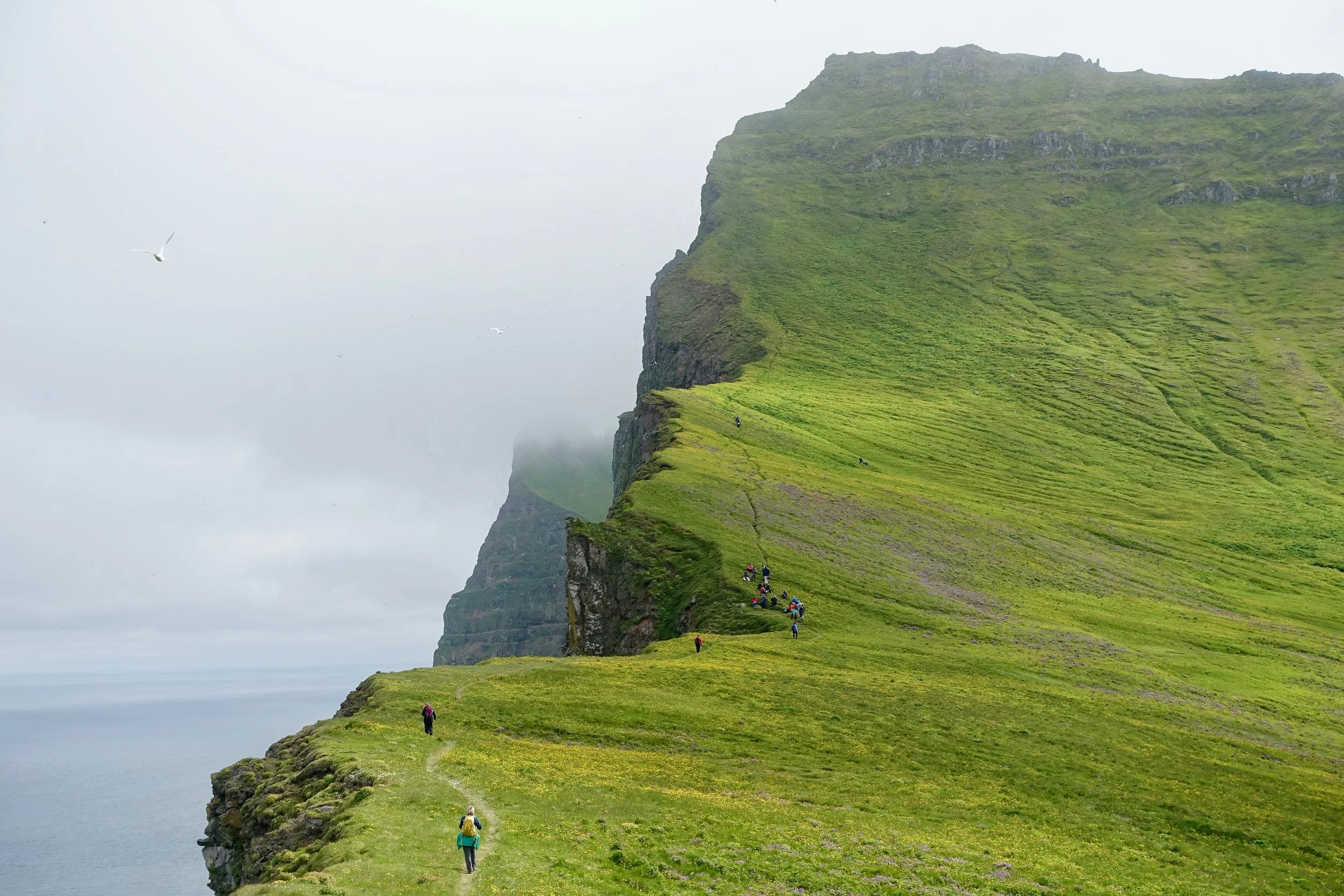
The trail along the east coast is maintained and easy compared to the western side of the reserve. There is quicksand on some of the river crossings
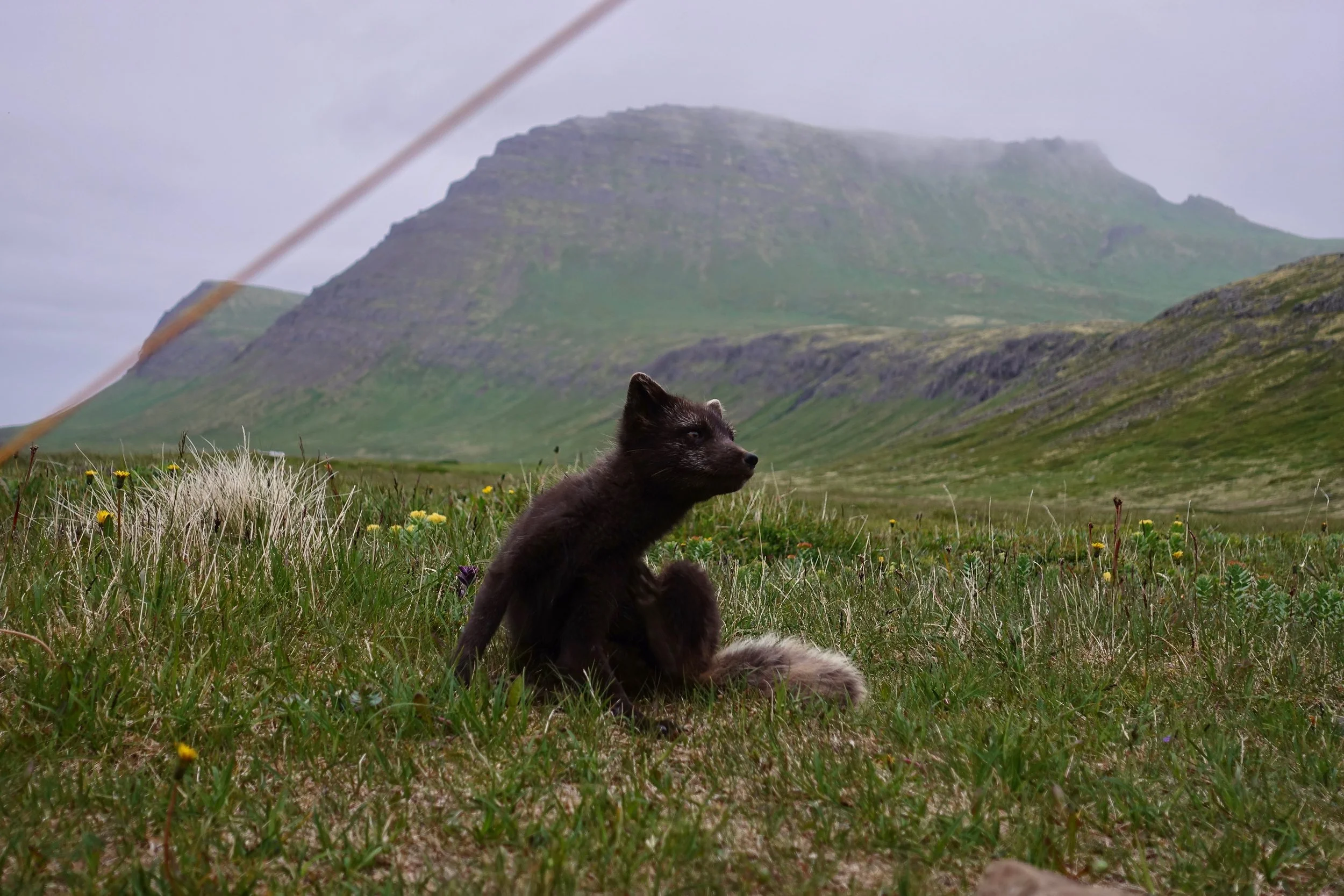
An arctic fox approached the tent while I was eating dinner
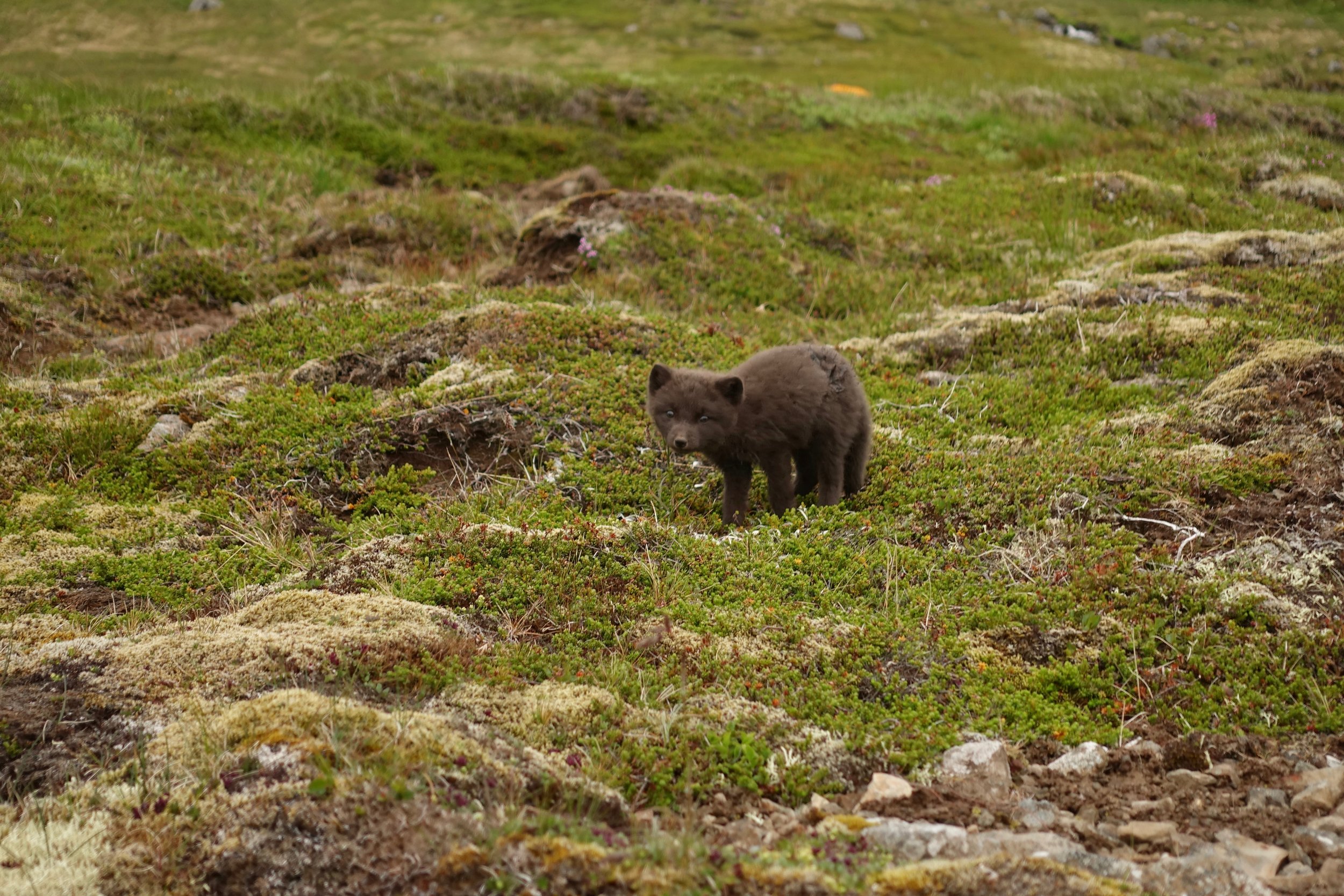
There was a den near the campground with four little ones. The Hornvik area has the highest density of arctic foxes in the world
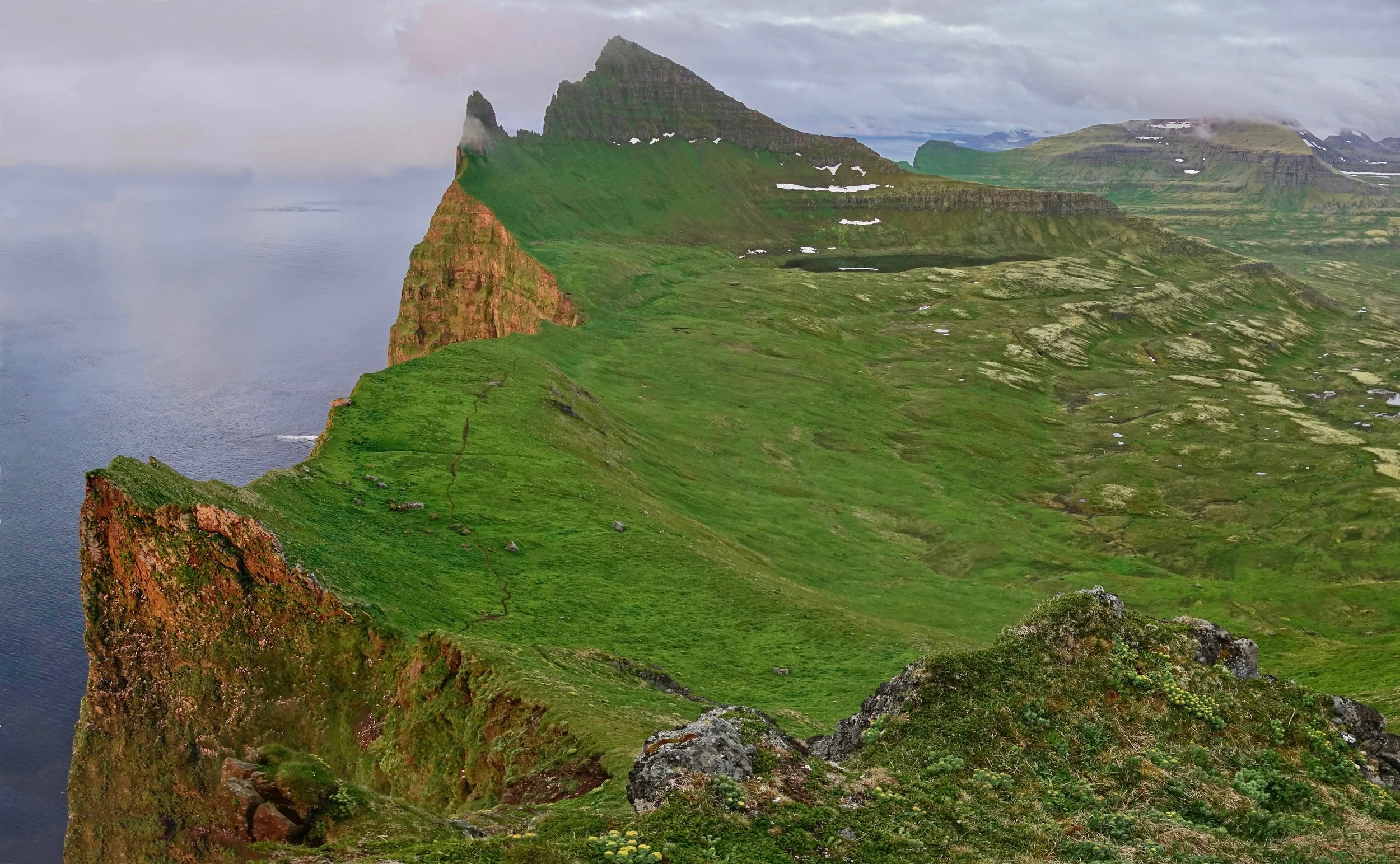
The steep cliffs in Hornbjarg are remarkably easy to climb with permanent footsteps in the grass. The wind shifted on the final day to bring more favorable visibility (wind from the northeast typically means fog)
The midnight sun giving a red glow to the Hornbjarg cliffs near the end of June
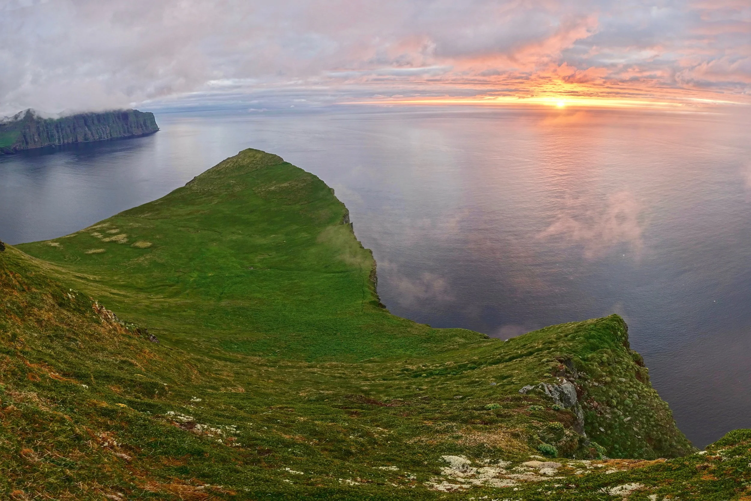
Sunset from Midfell overlooking the Horn. Horn meaning corner in Icelandic
Kalfatindar and the Hornbjarg cliffs at one o'clock in the morning
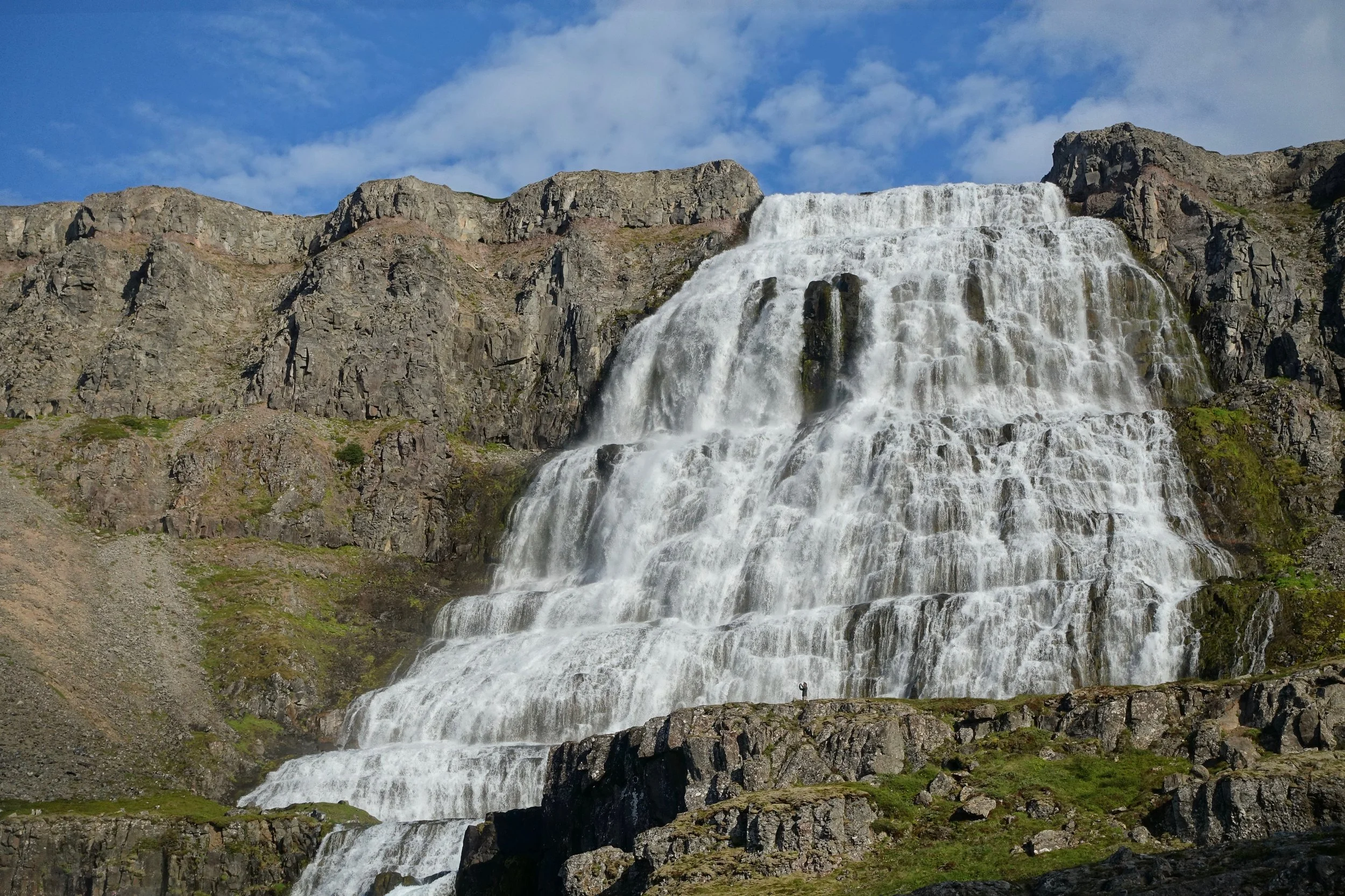
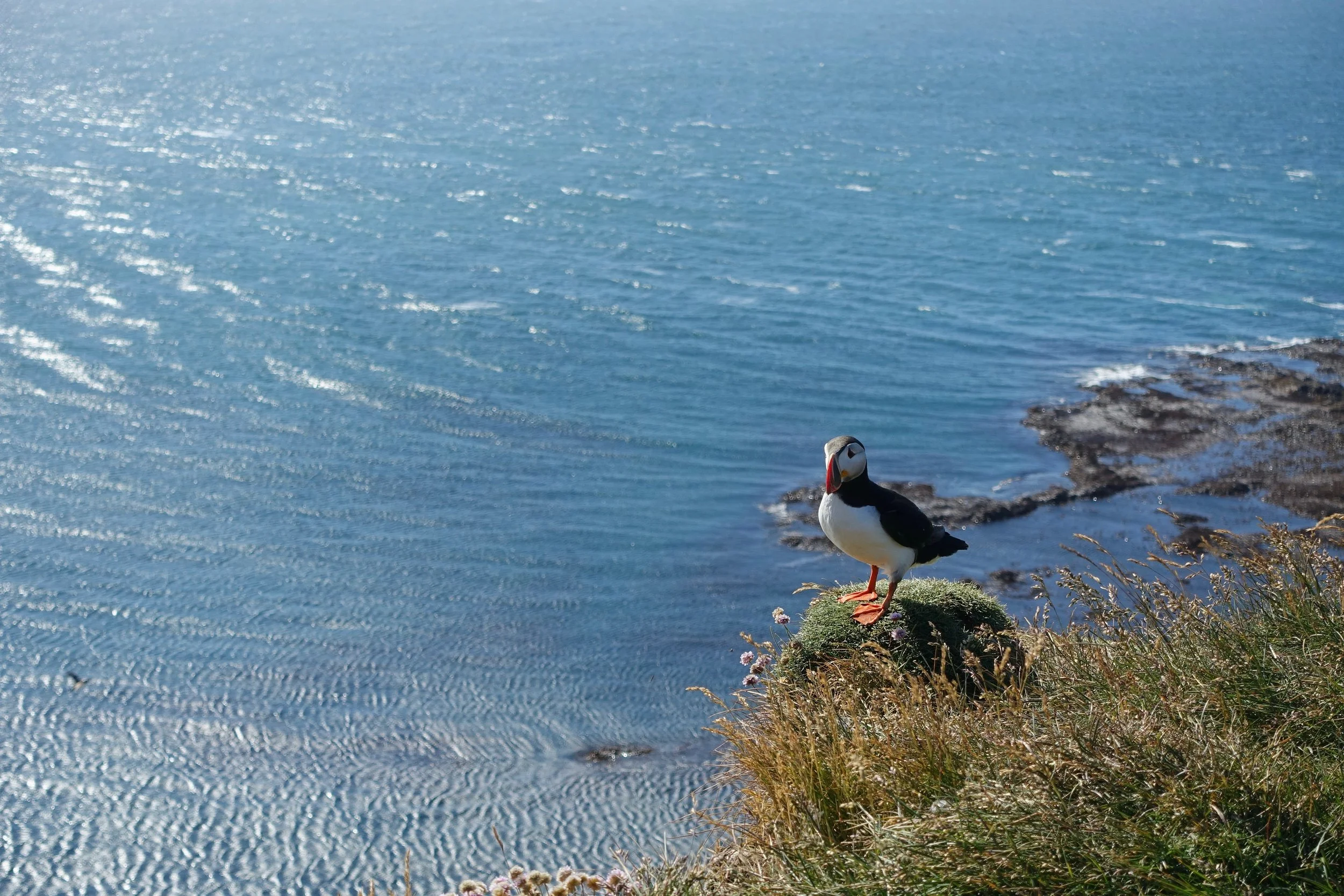
The other extended stops in the Westfjords were the Dynjandi waterfall and the Latrabjarg bird cliffs.
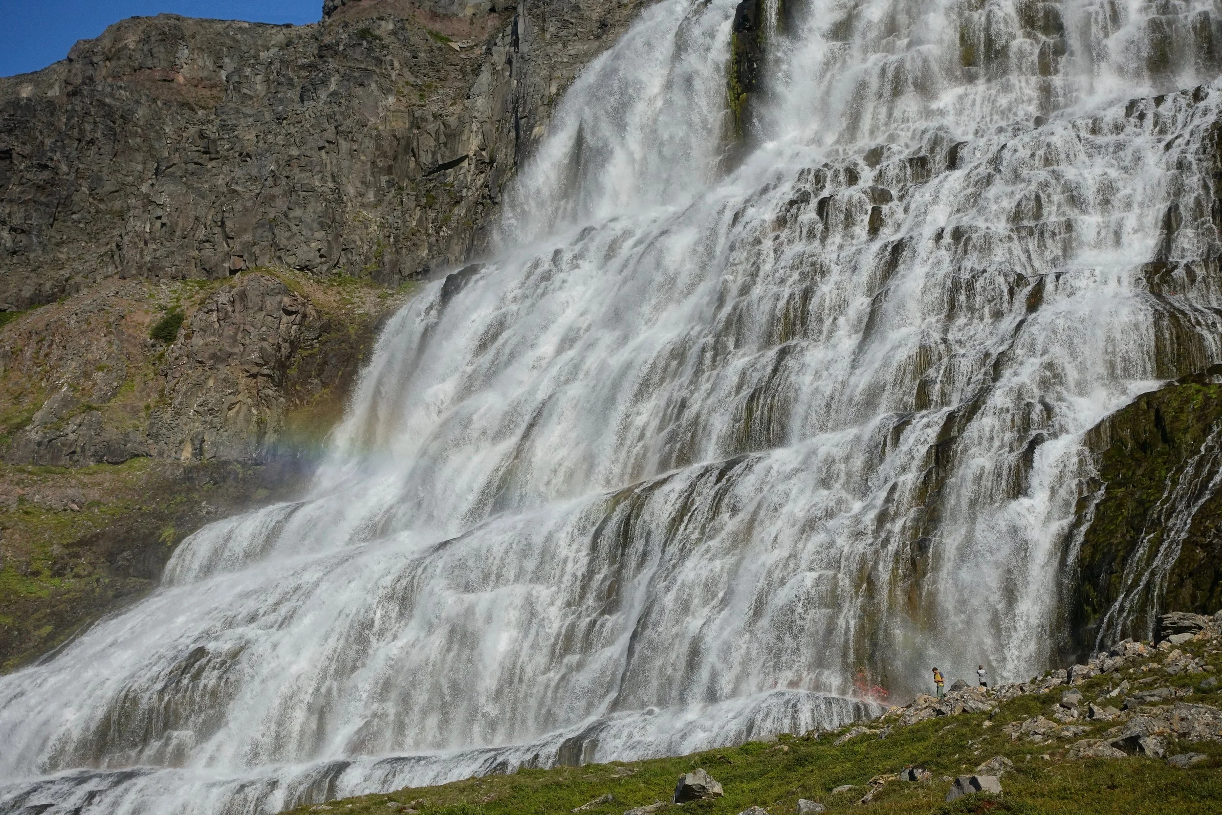
Dynjandi waterfall
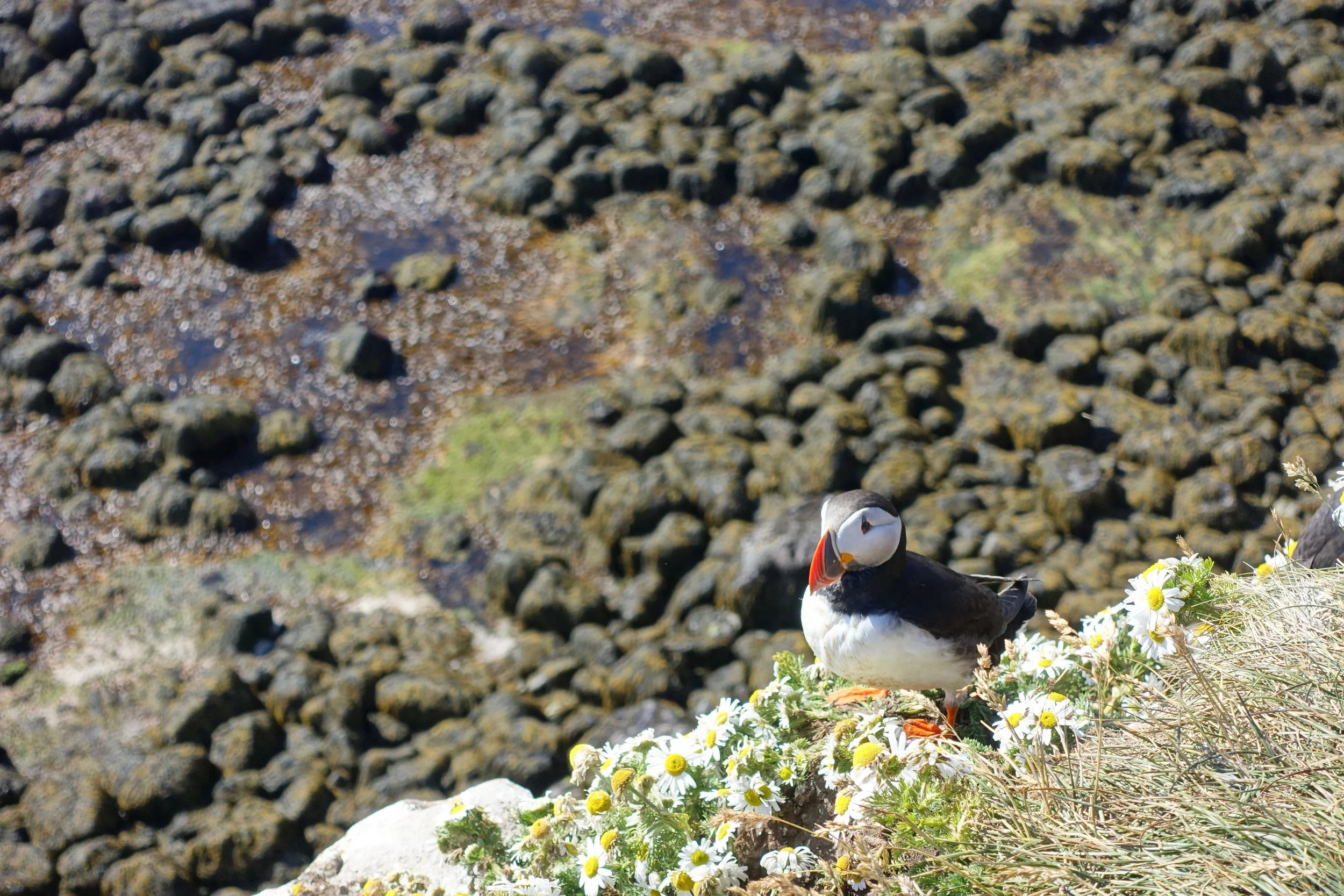
Puffins have burrows dug into the edge of the Latrabjarg cliffs
Skaftafell
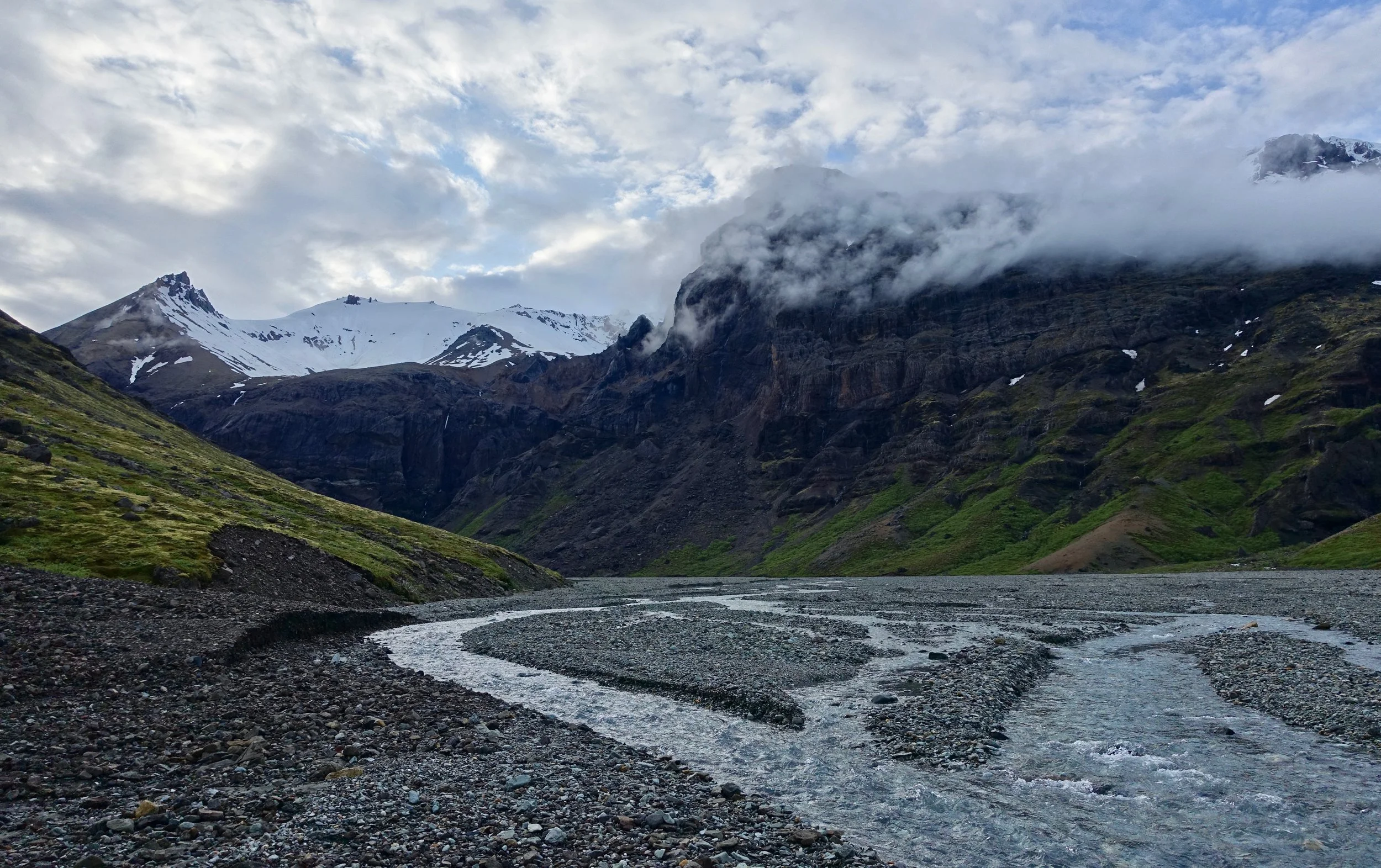
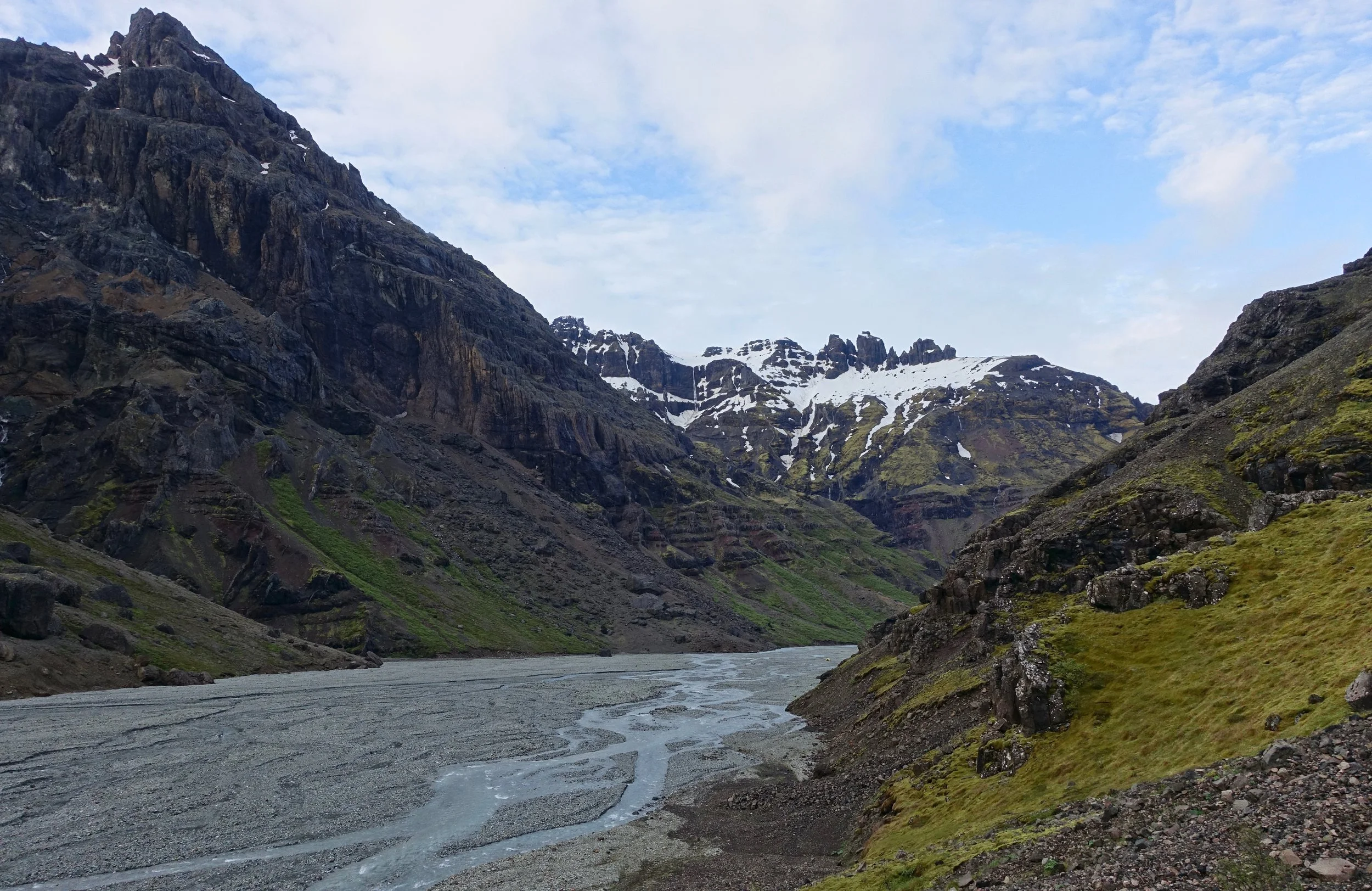
I did an overnight hike in Skaftafell through the Morsardalur Valley and camped in the Kjos Valley (17.5 miles return)
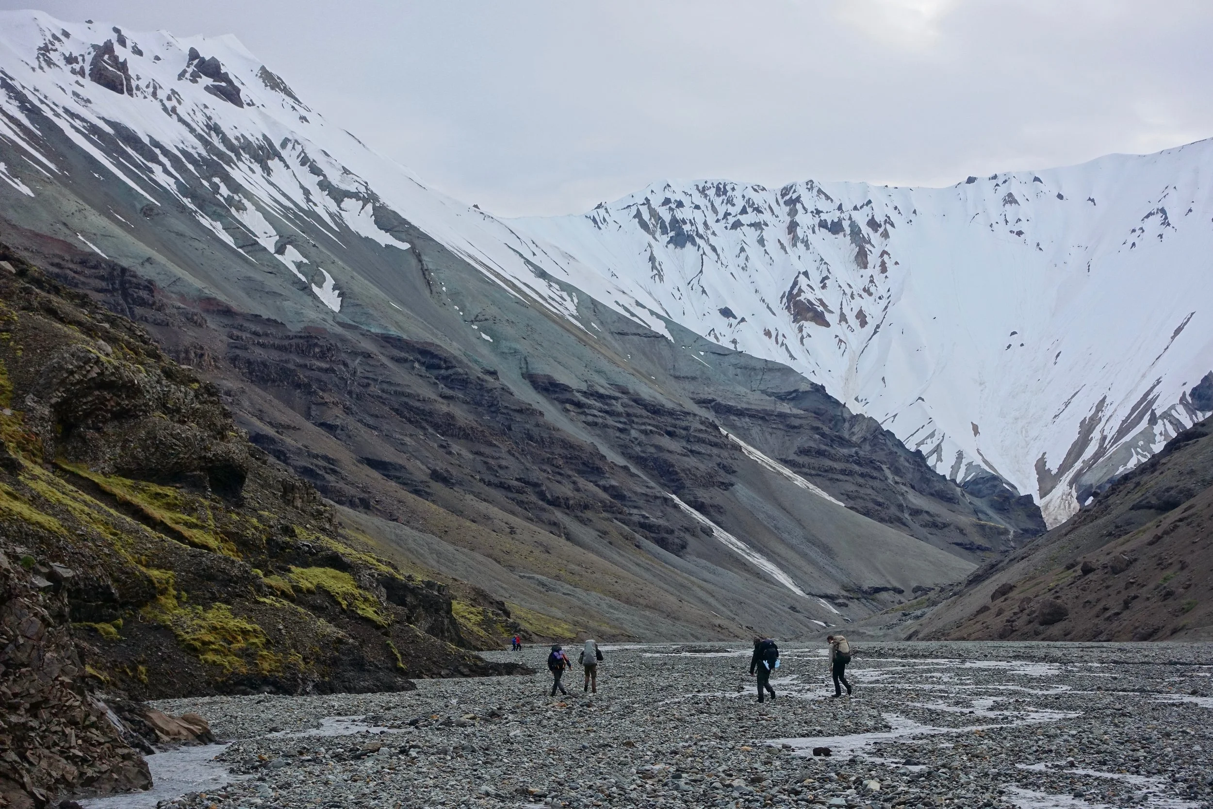
Walking back in the Kos Valley to select a camp for the night
Braided river of the Kos Valley
Bridge at the Morsa River
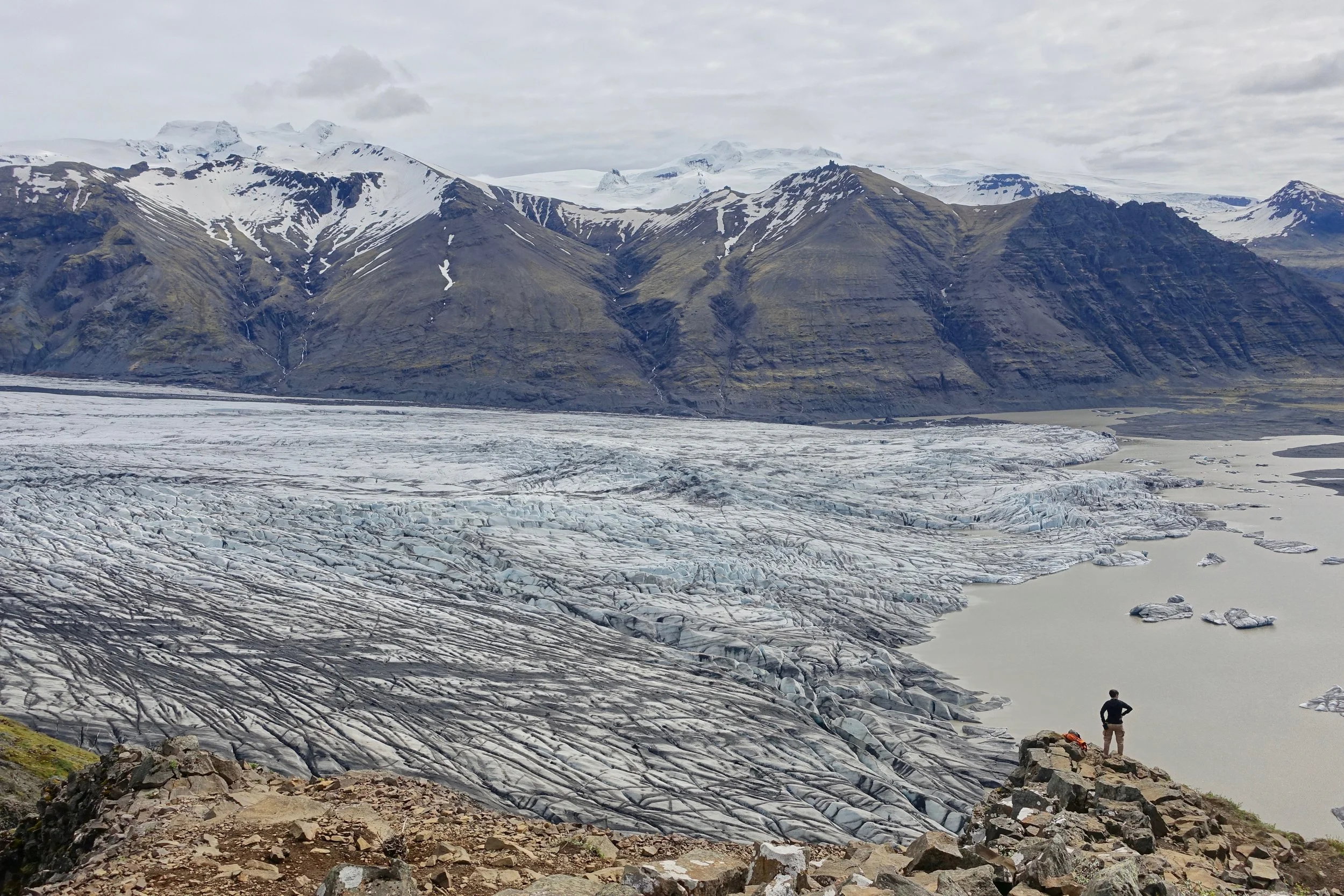
Skaftafellsjokul Glacier on the return hike to the trailhead
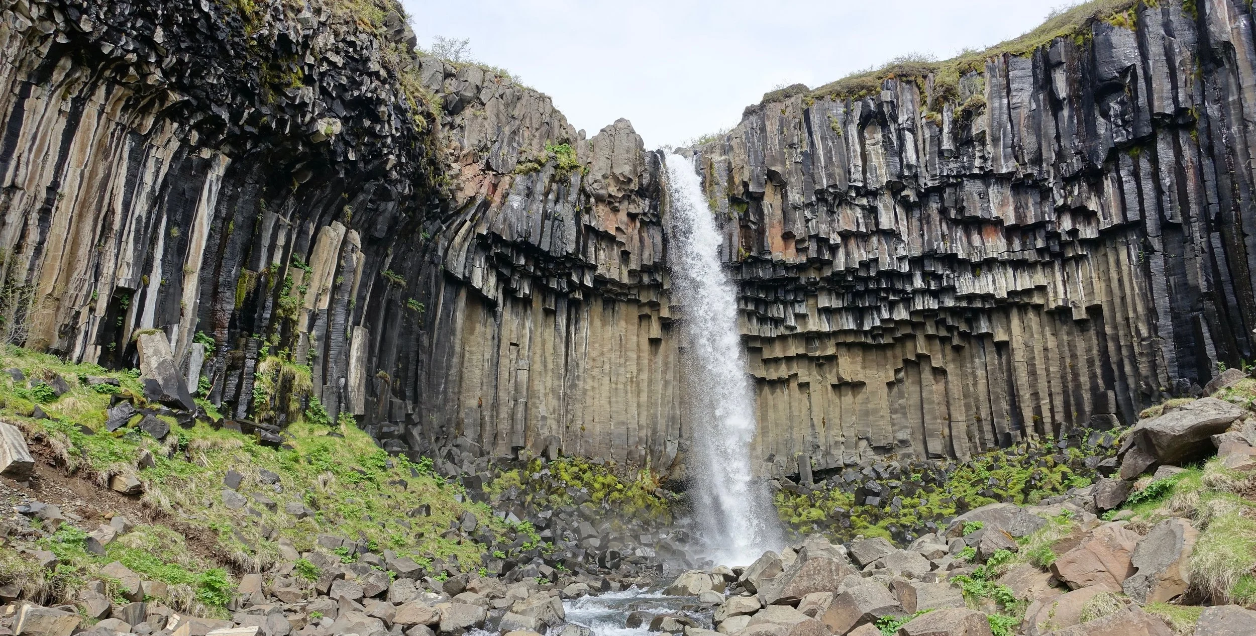
Svartifoss
Dayhikes in Iceland
Snæfellsnes Peninsula
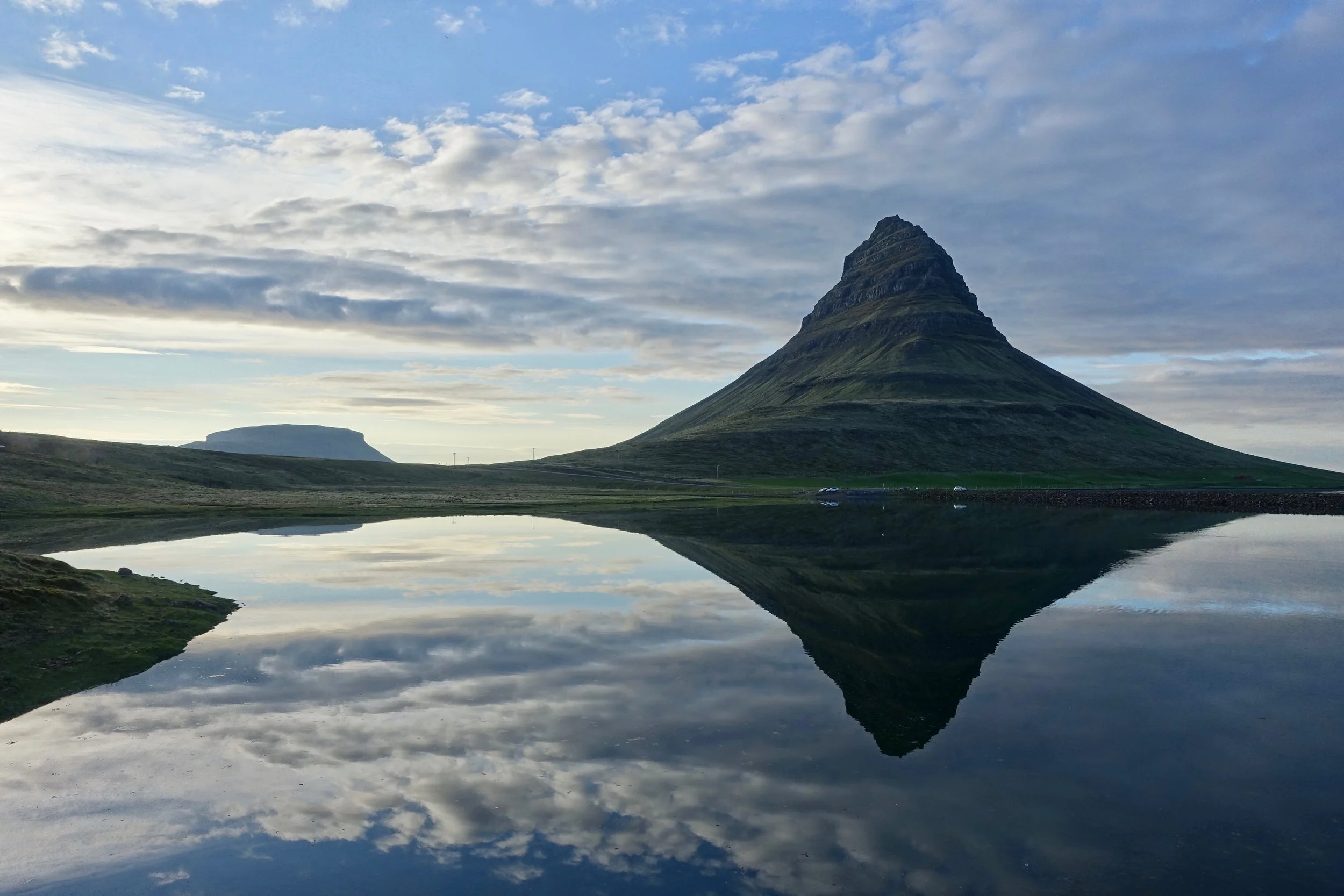
The drive along the northern peninsula from Berserkjahraun to Grundarfjordur is very beautiful with Kirkjufell being a highlight
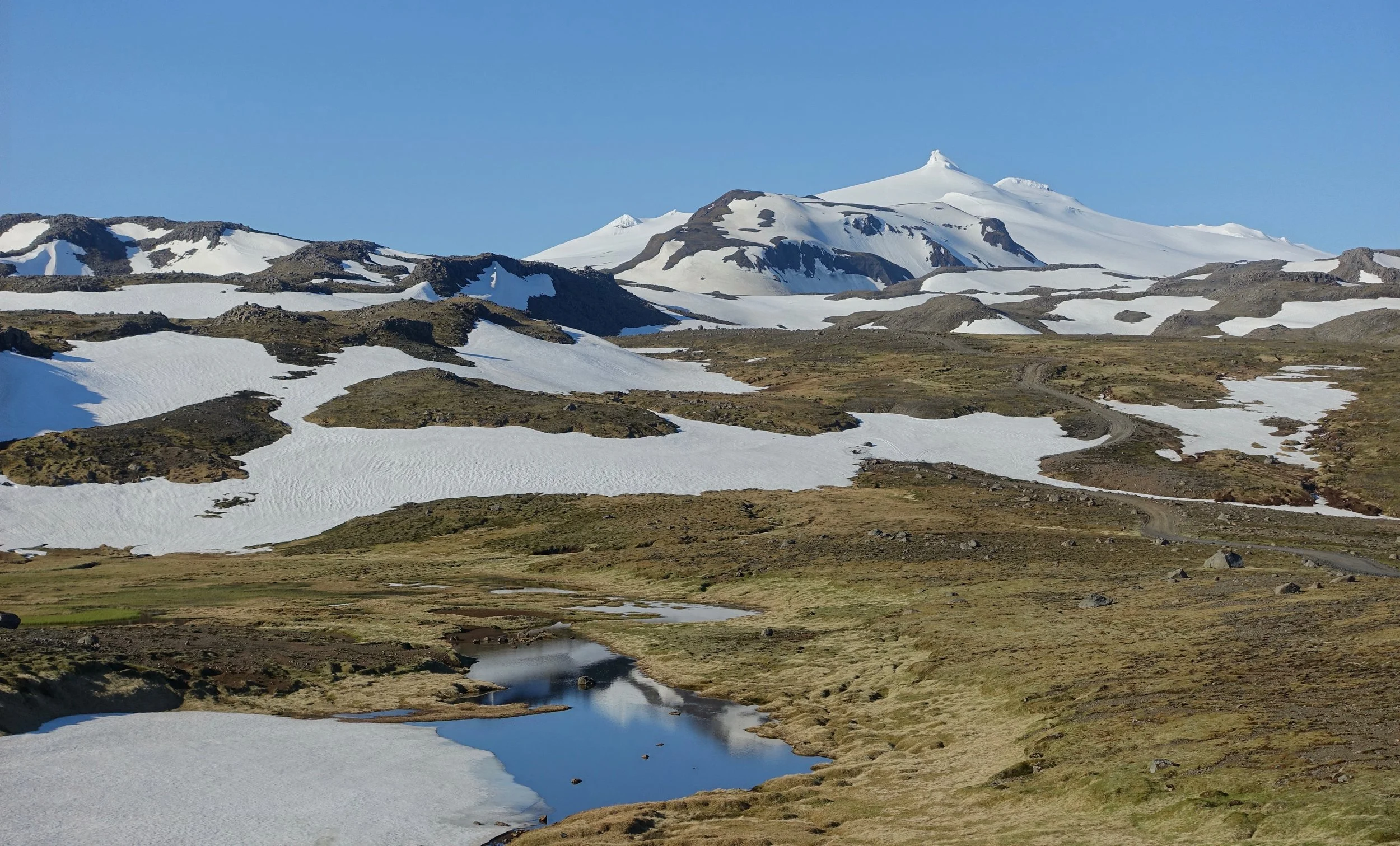
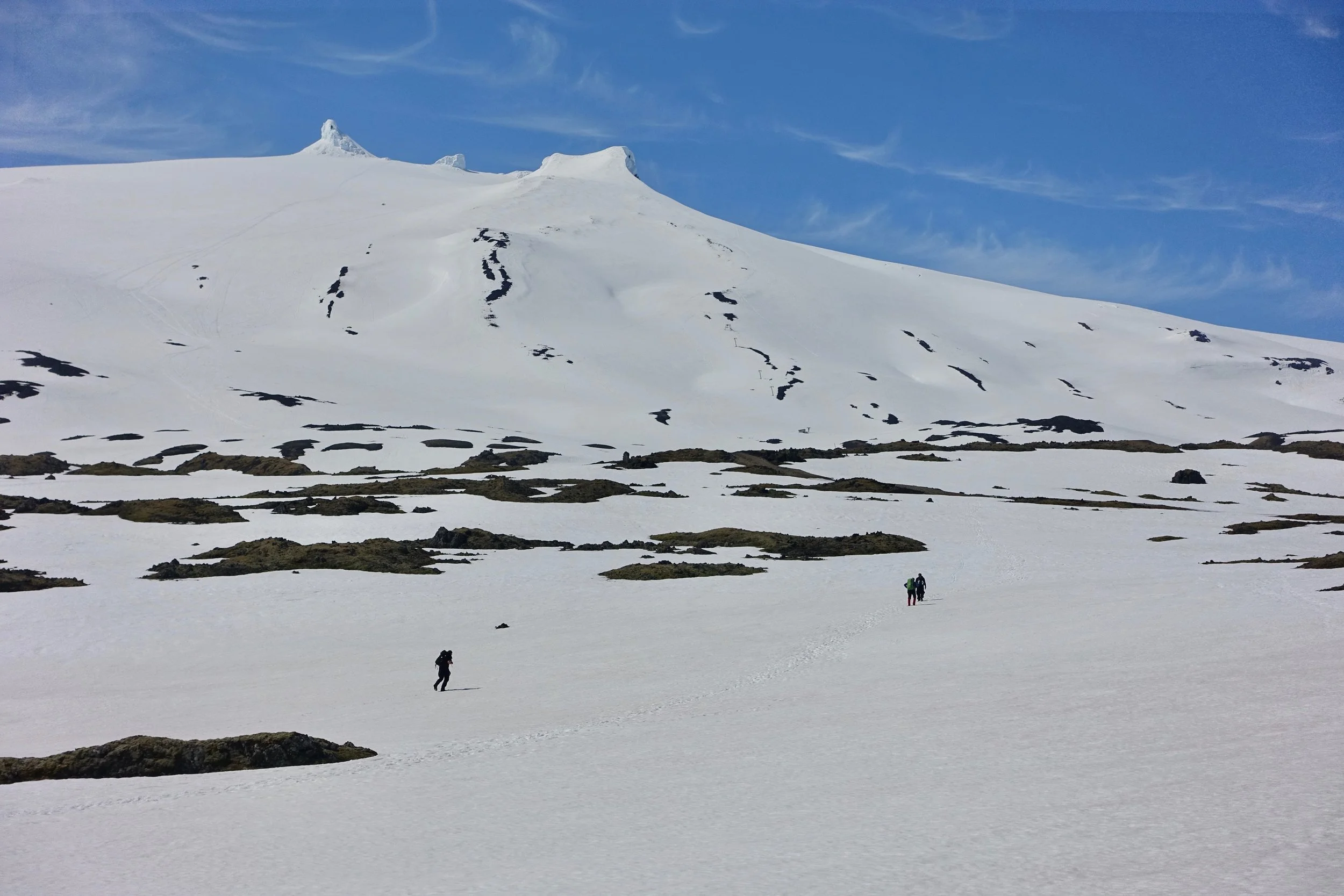
The best hike here was along gravel road 570 that passes through the center of the peninsula near Sneafellsjokull (13 miles)
The road was still snow covered which kept traffic low
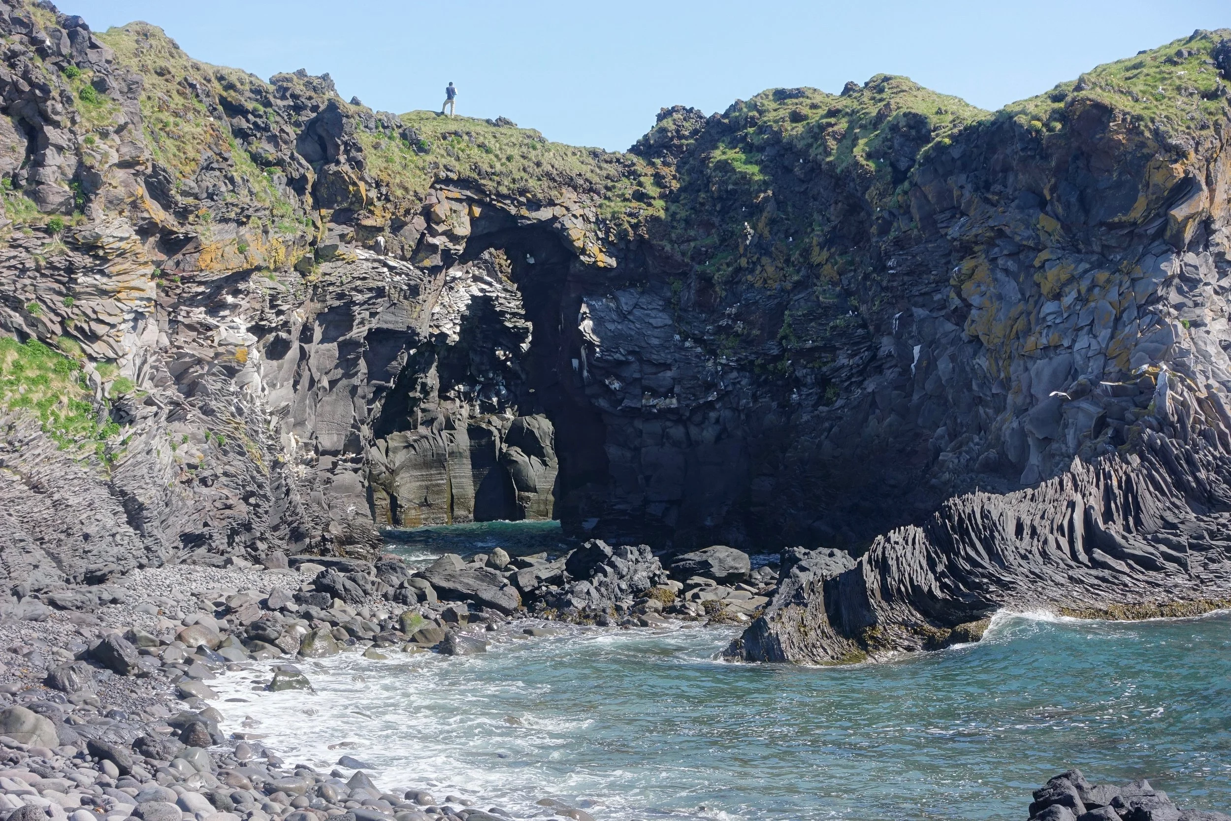
The other hike on the peninsula was an easy coast walk from Hellnar to Arnarstapi (3 miles)
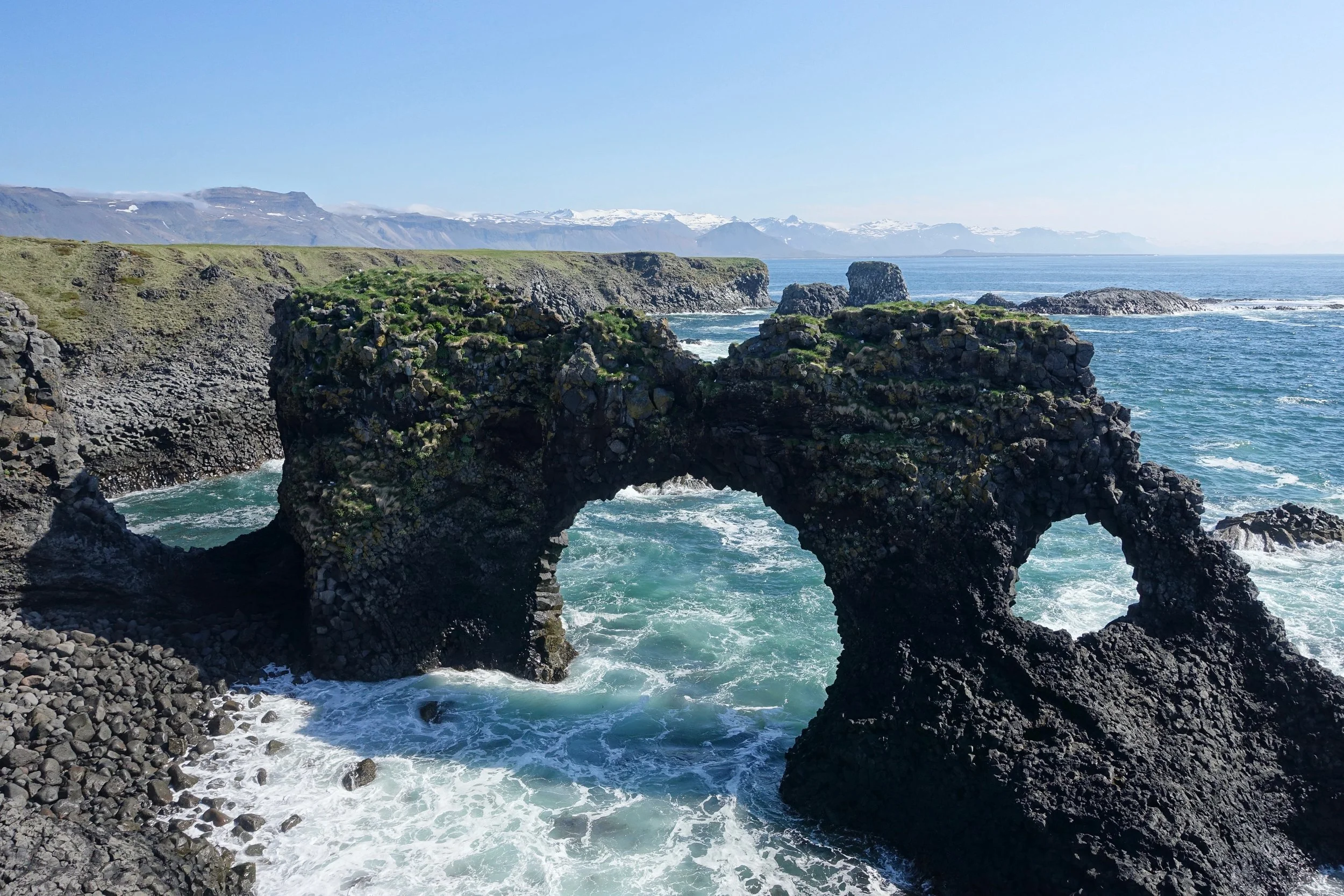
Gatklettur Arch
Jökulsárgljúfur
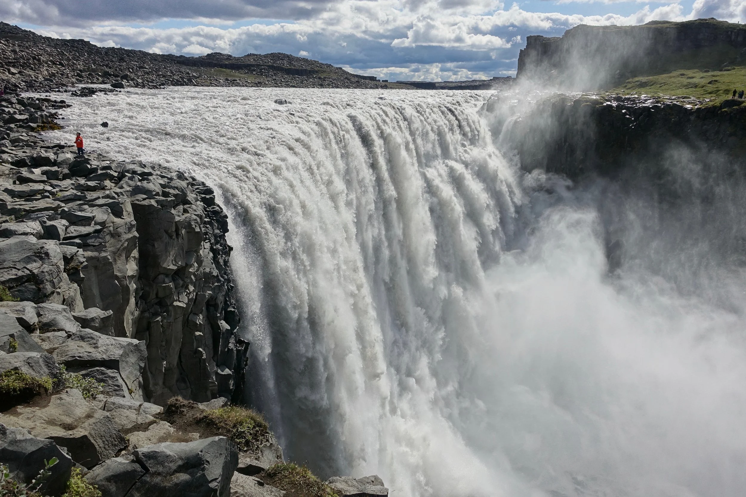
Dettifoss is the waterfall from the movie Prometheus and the most powerful waterfall in Europe. Best viewed from the eastern side (Road 864)
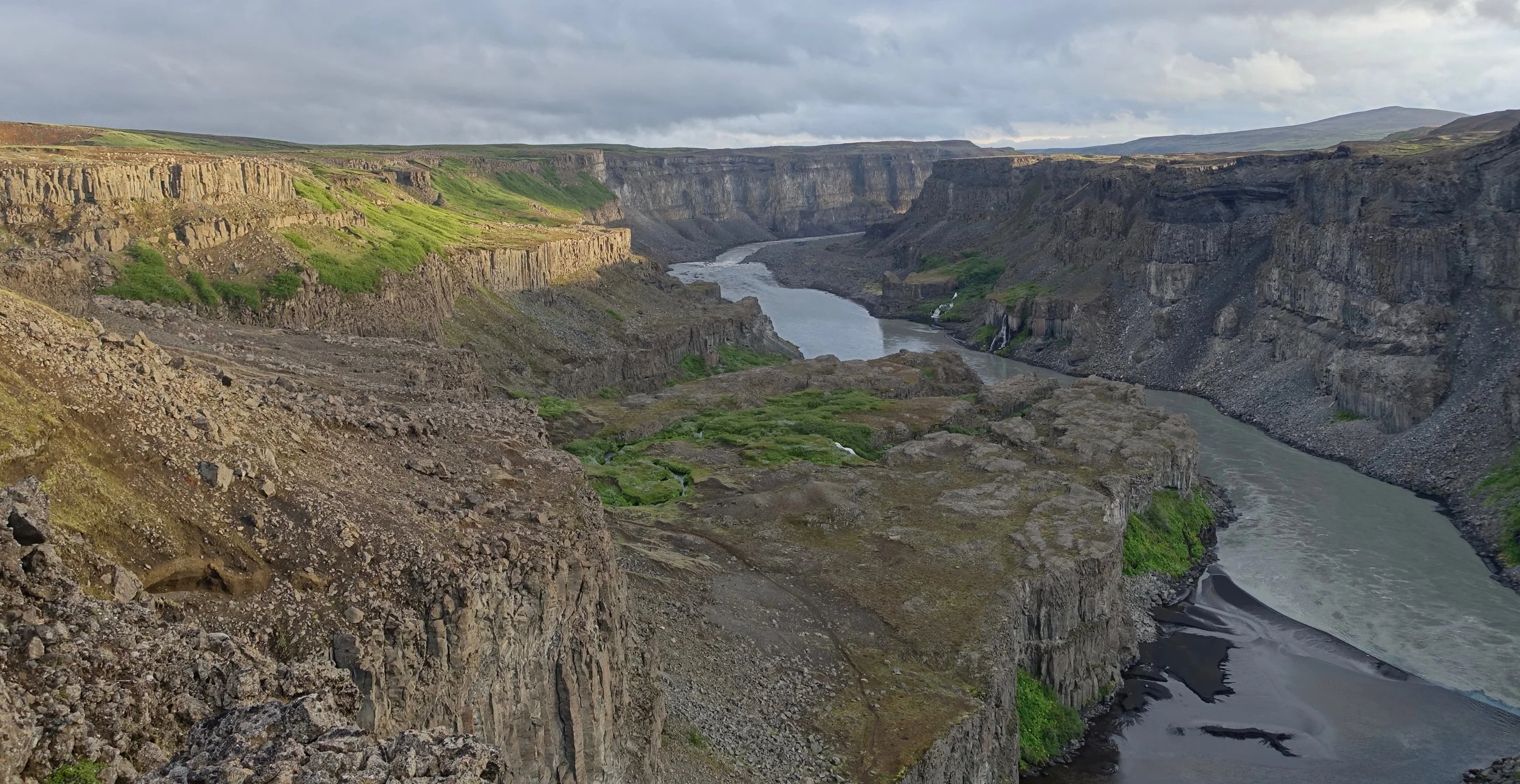
I also hiked along the Jökulsárgljúfur canyon and did a walk to Klappir aboved Asbyrgi Canyon
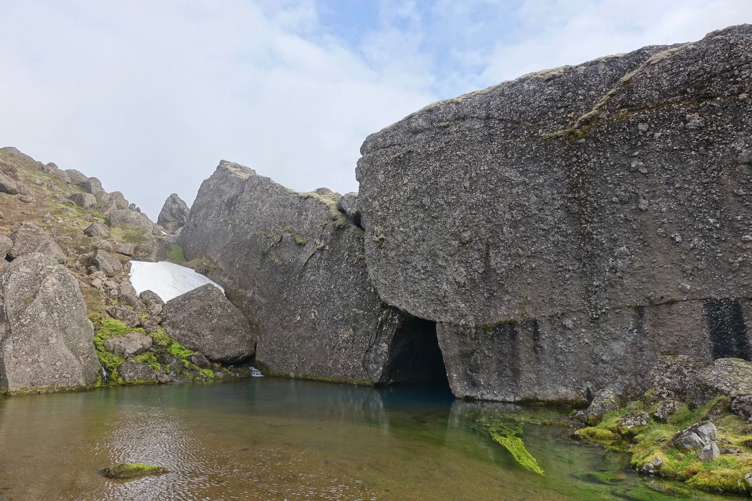
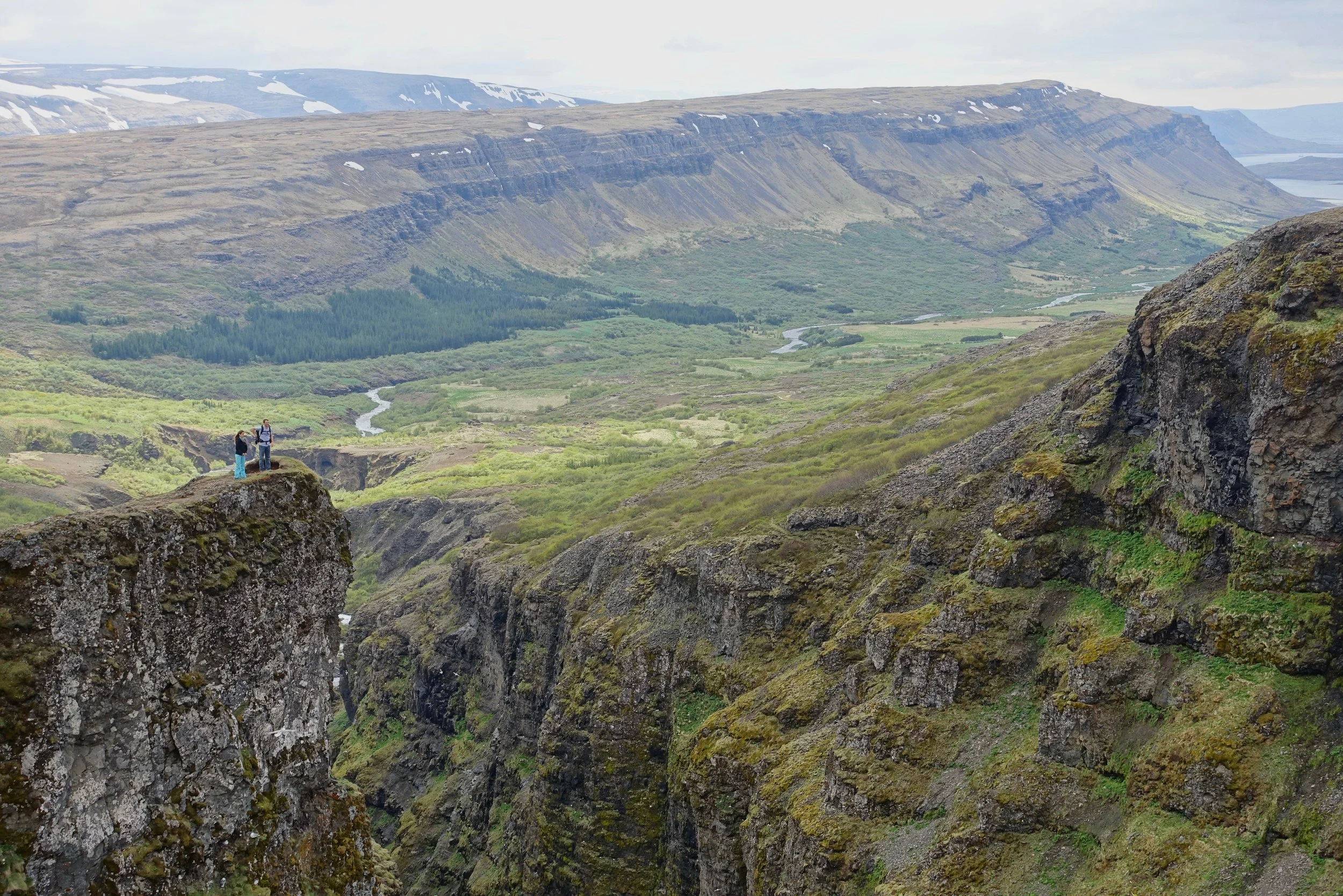
Storurd
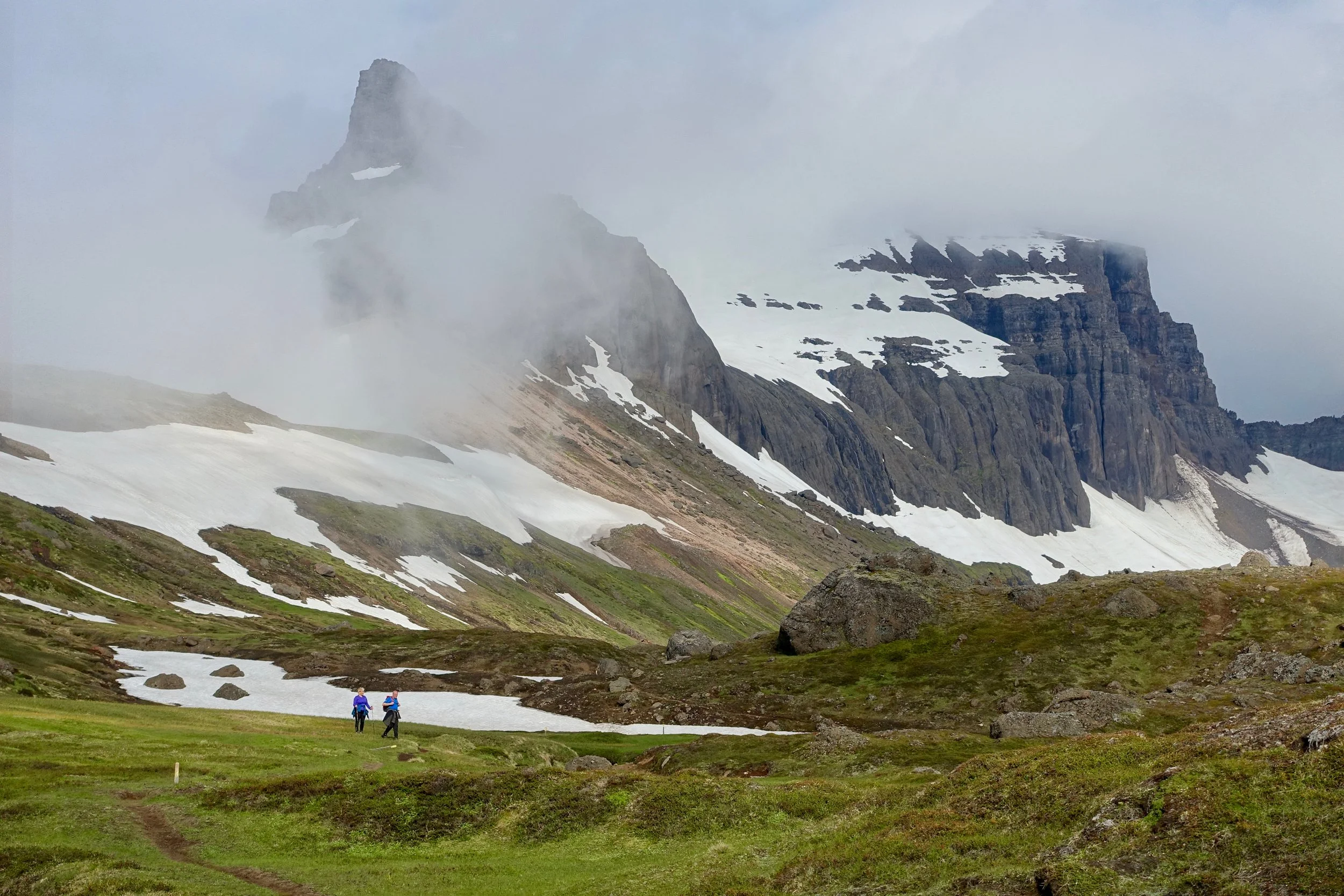
The Vatnsskard trailhead was in covered in fog so I took the lower trail both ways (9 miles return)
Storurd or "big rocks" is the result of a collapsed mountain
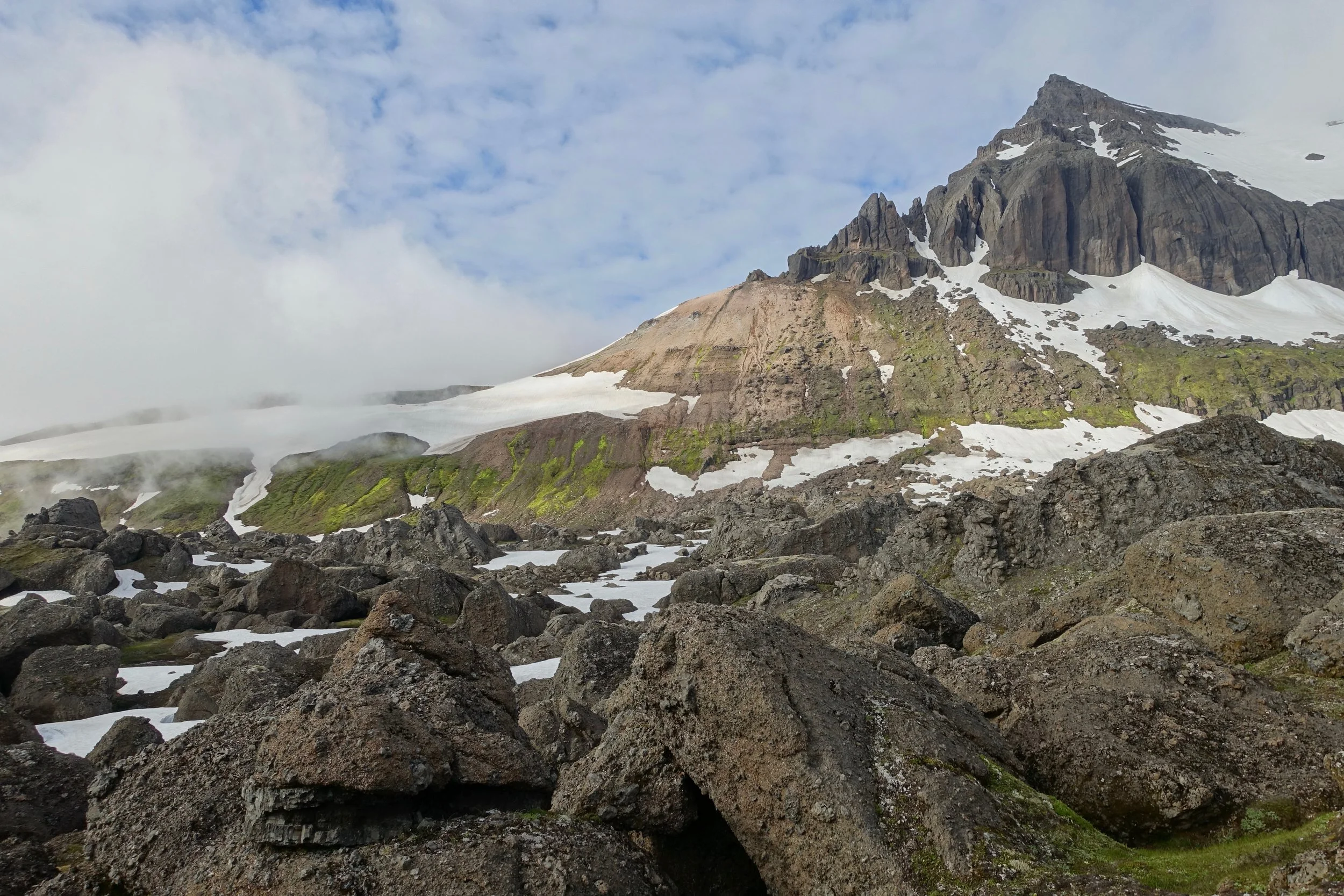
The U-shape in the mountain is the source of the boulders
Glymur Waterfall
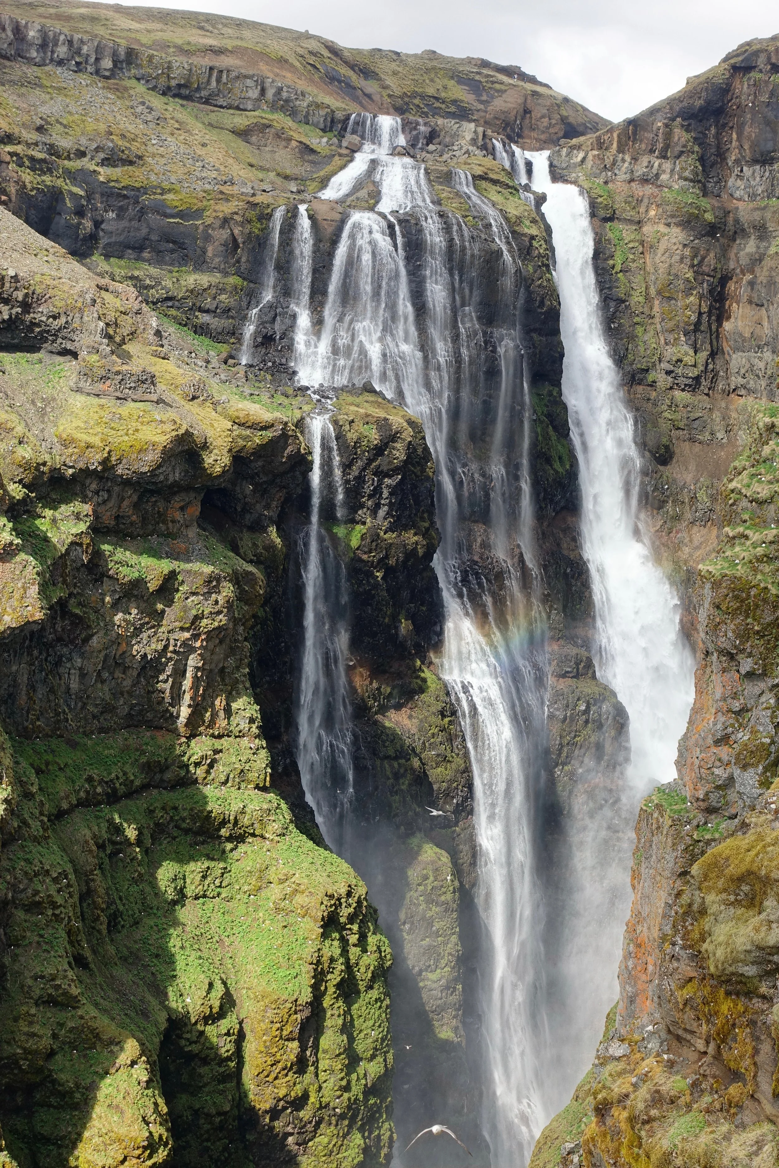
Glymur is Iceland’s tallest waterfall
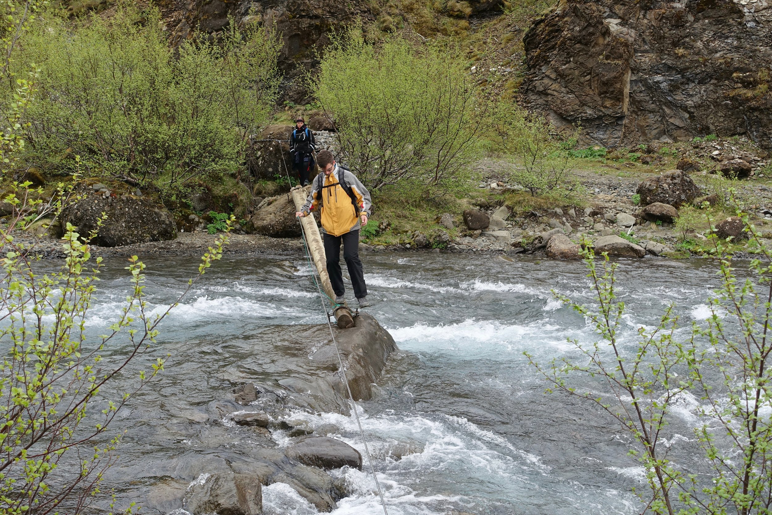
River crossing on the approach hike
Hiking up the right side of the canyon gives the best view of Glymur (5 miles)
The full loop is highly recommended and requires a river crossing on the plateau above the falls
Thrihnukagigur
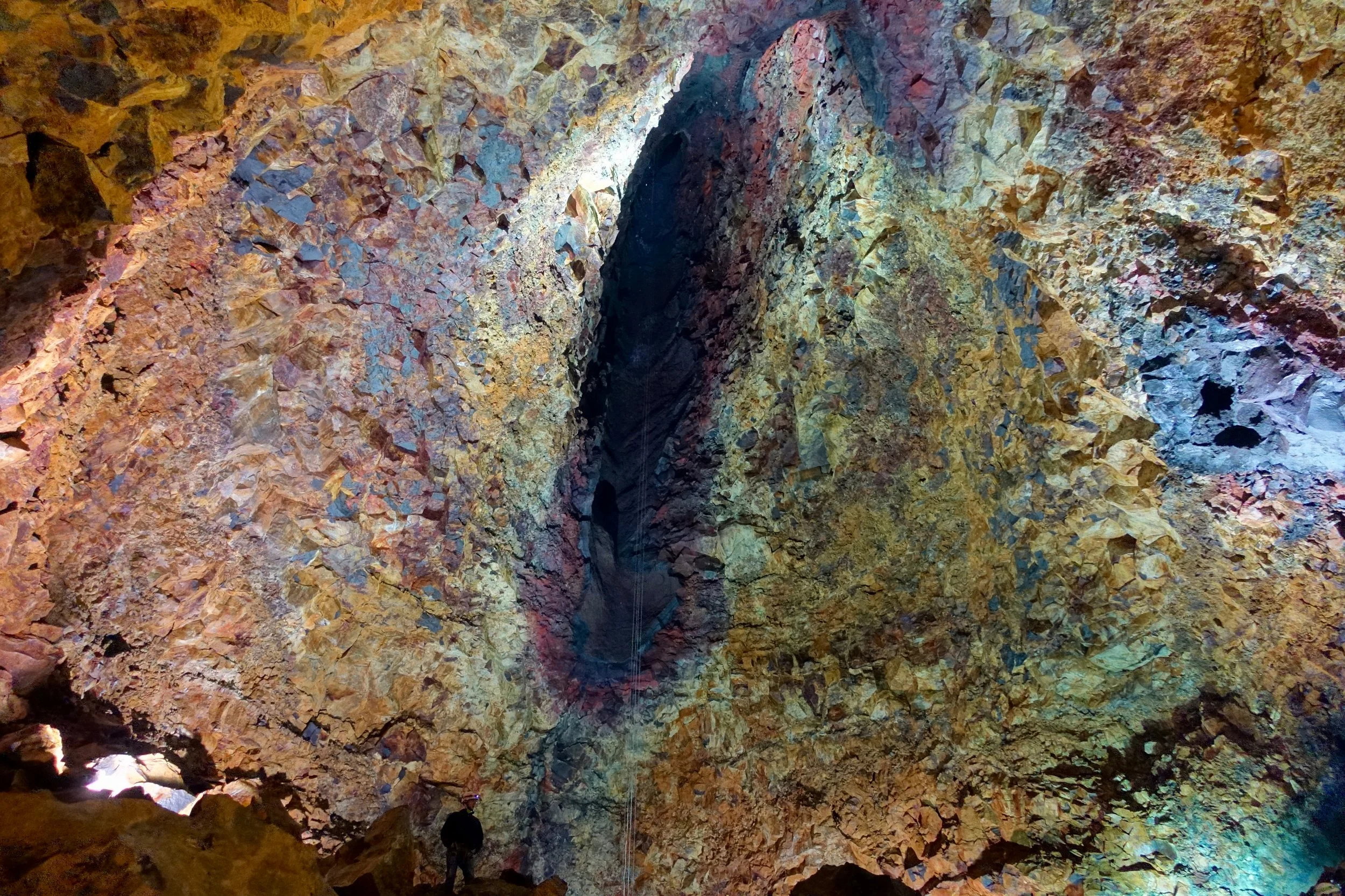
Thrihnukagigur is the only known volcano that has left behind a chamber. The rocks are actually multi-colored here
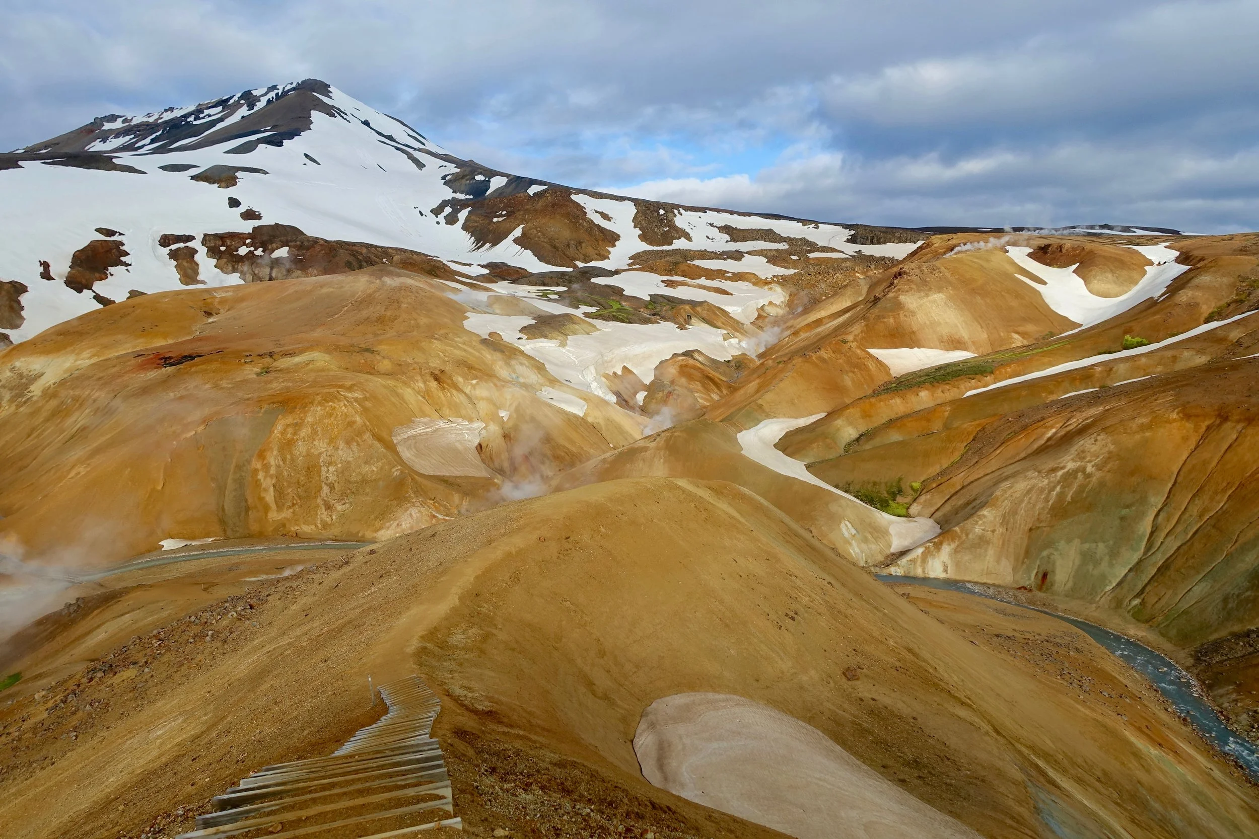
Kerlingarfjoll
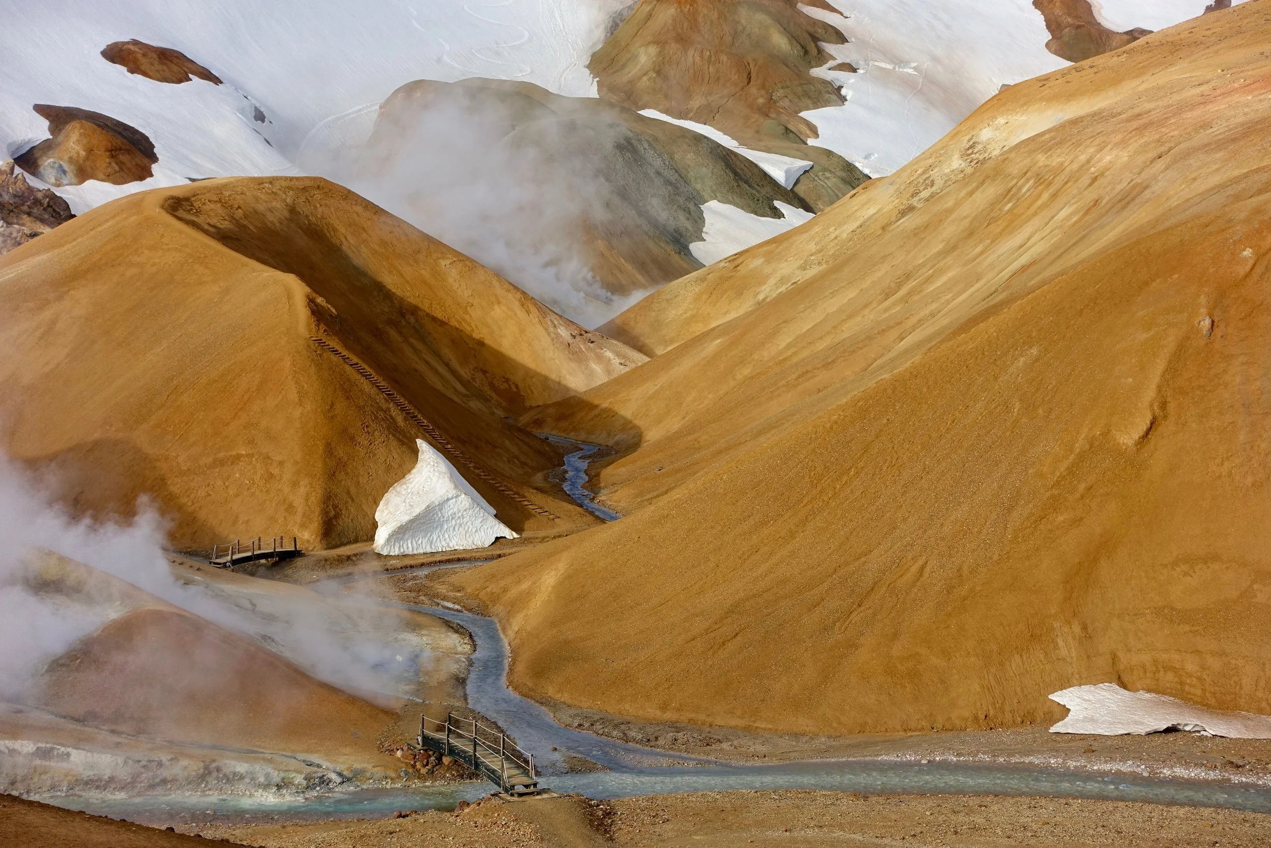
Kerlingarfjoll has a short loop around the caramel colored area of Hveradalir, which from the campsite can be reached by 4x4 (10 min) or by foot (3 miles)
The Icelandic stew and apple pie at the campsite was welcoming