Coastal California Hiking
Lost Coast Trail
Redwood Coastal Trail
Santa Rosa Island
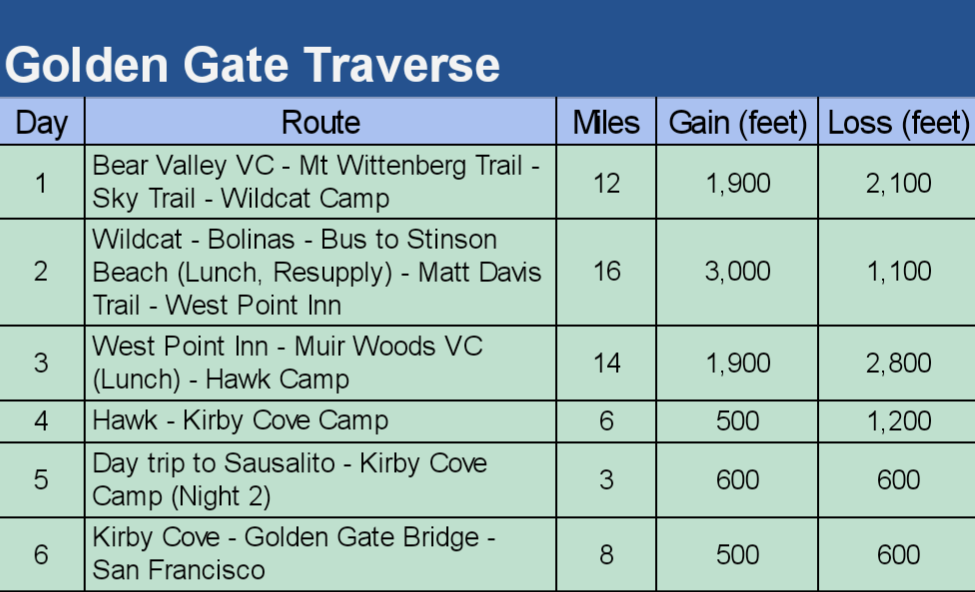
Golden Gate Traverse
Big Sur
Lost Coast Trail
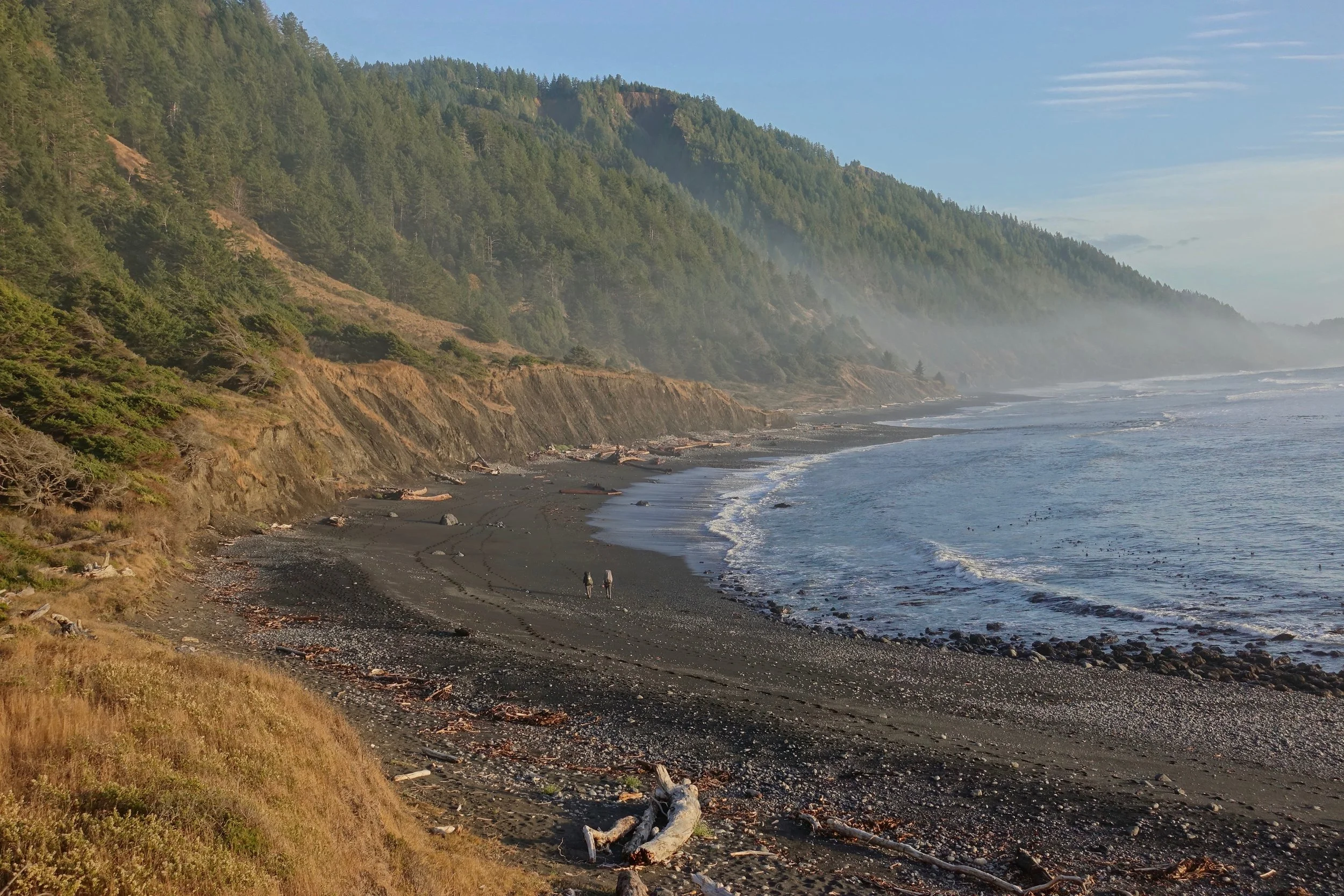
In late October I walked for four days from Mattole to Shelter Cove along the Lost Coast in Northern California (25 miles one way)

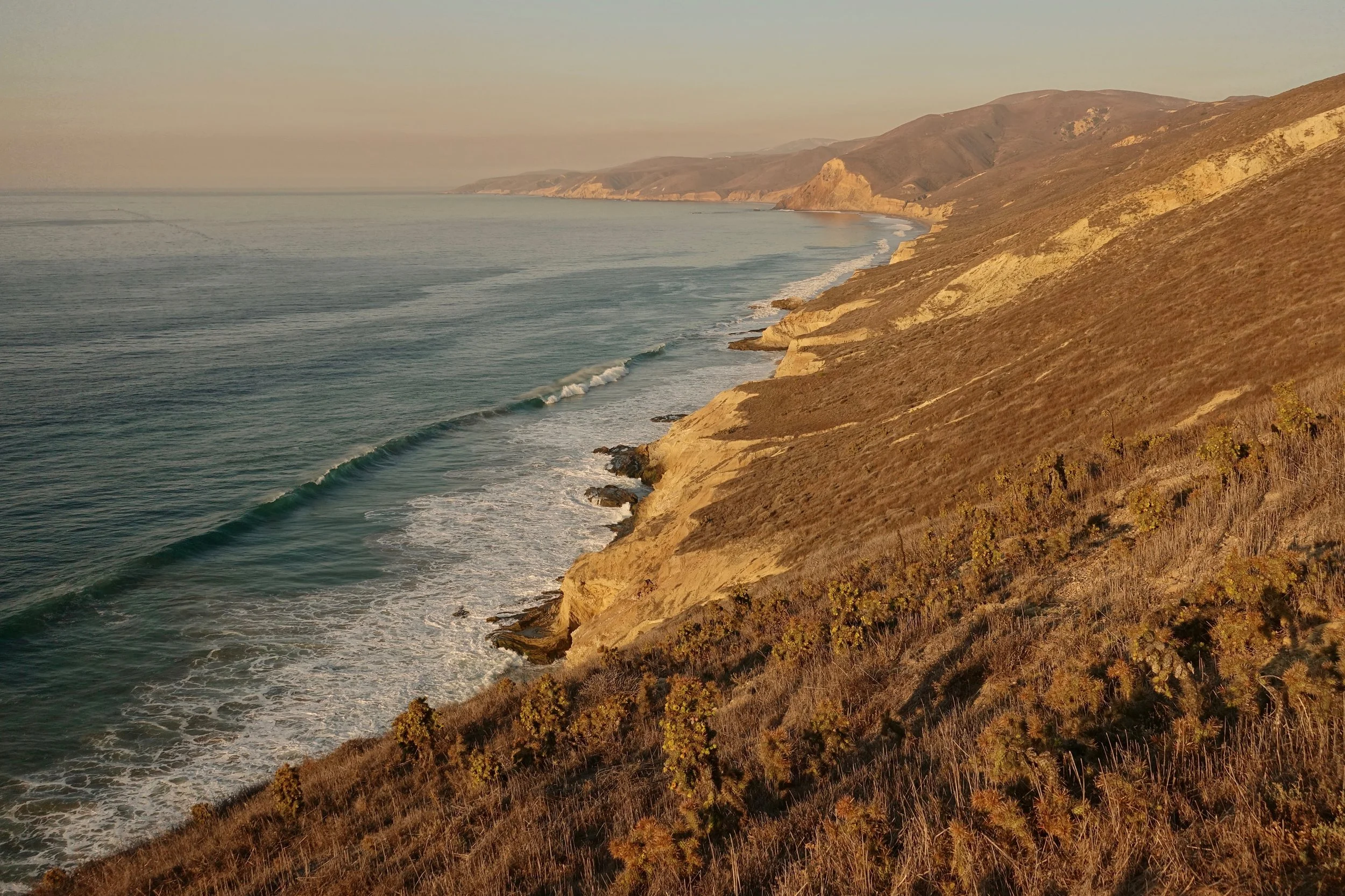
Overlook of the first tidal zone
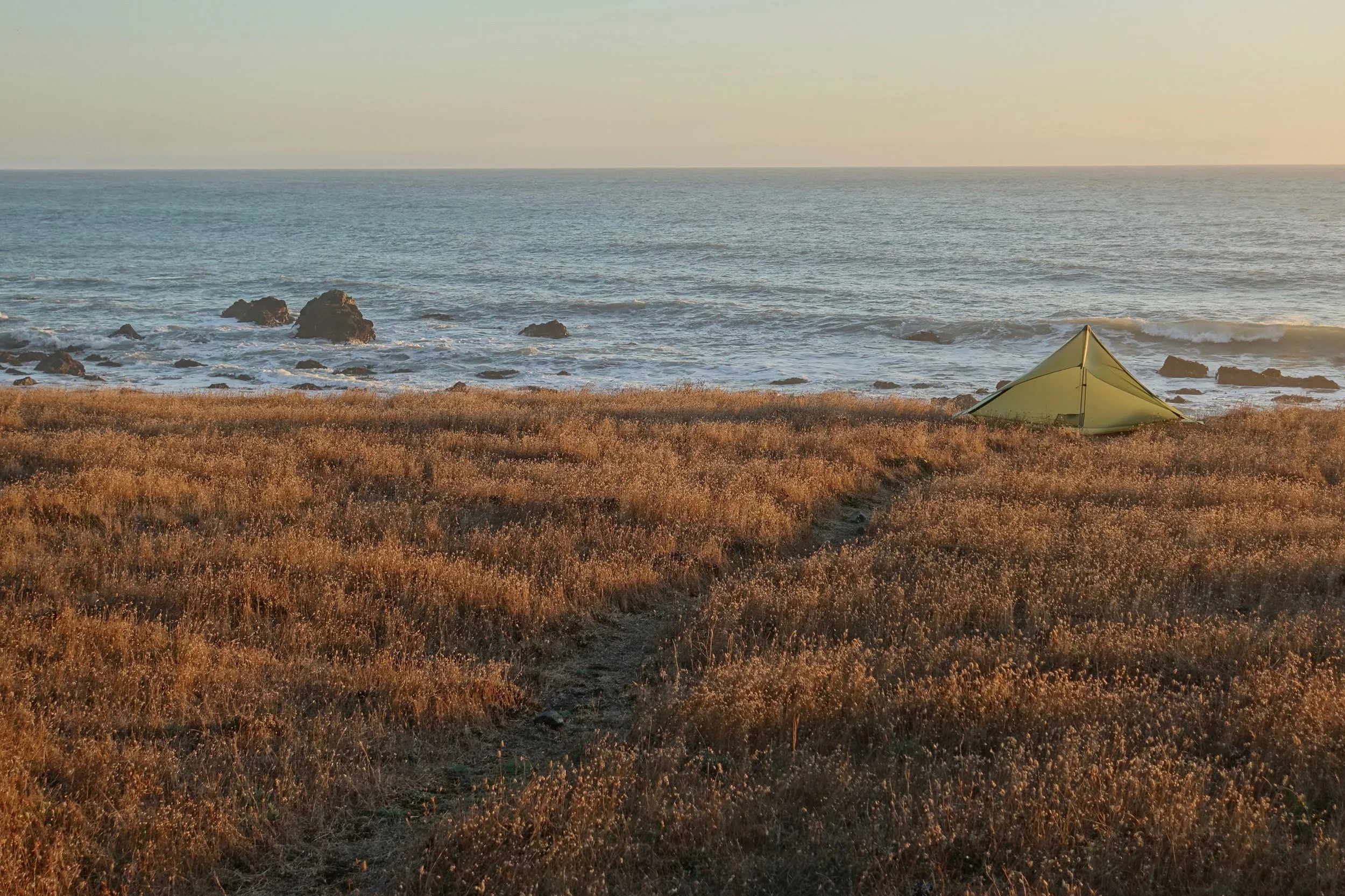
The weather was better on the second half of the hike with more summer-like conditions. With shorter days in October I walked until sunset through the Spanish Flats and camped near Kinsey Ridge
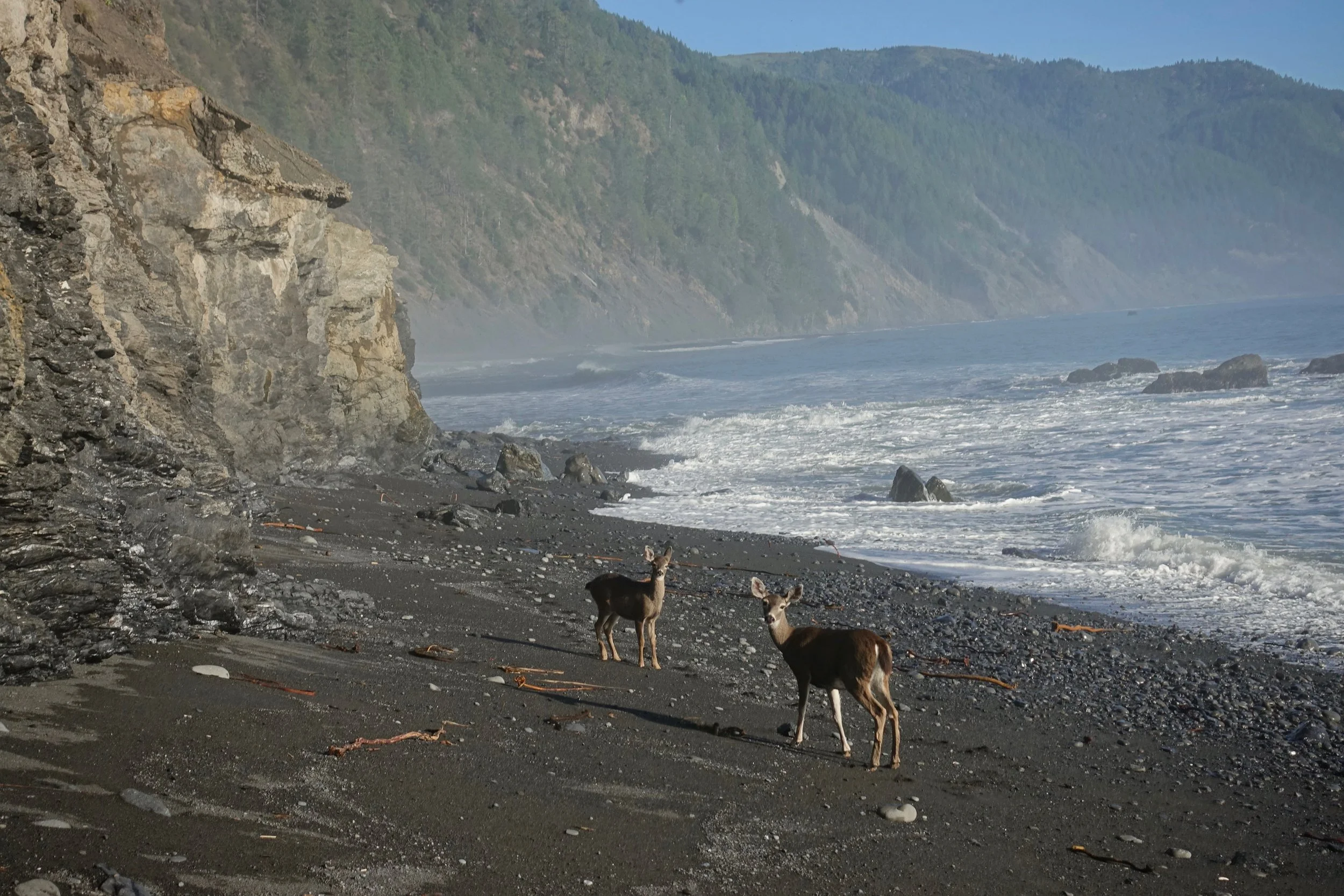
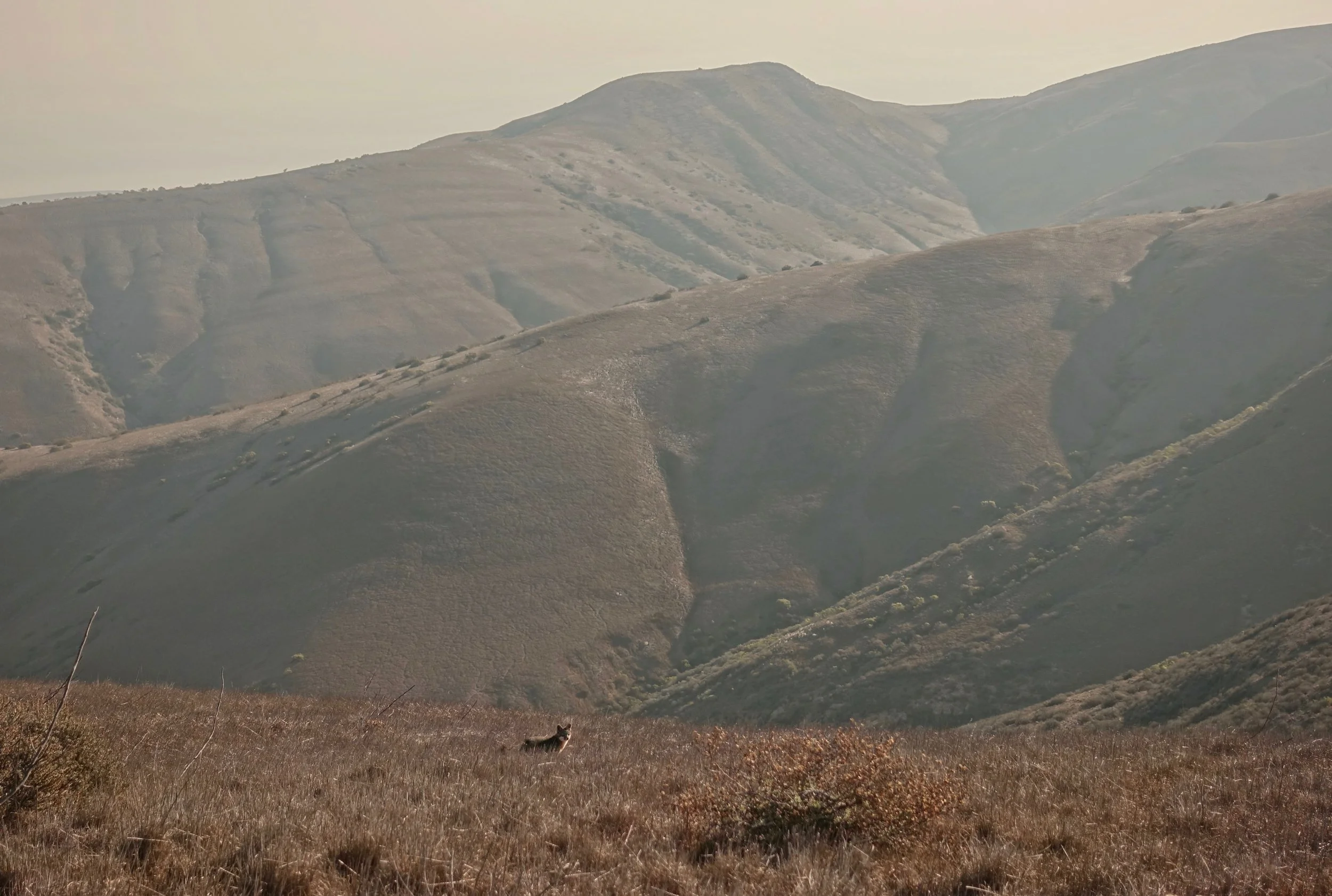
Lots of wildlife on the Lost Coast, bear canisters are even required to backpack this section
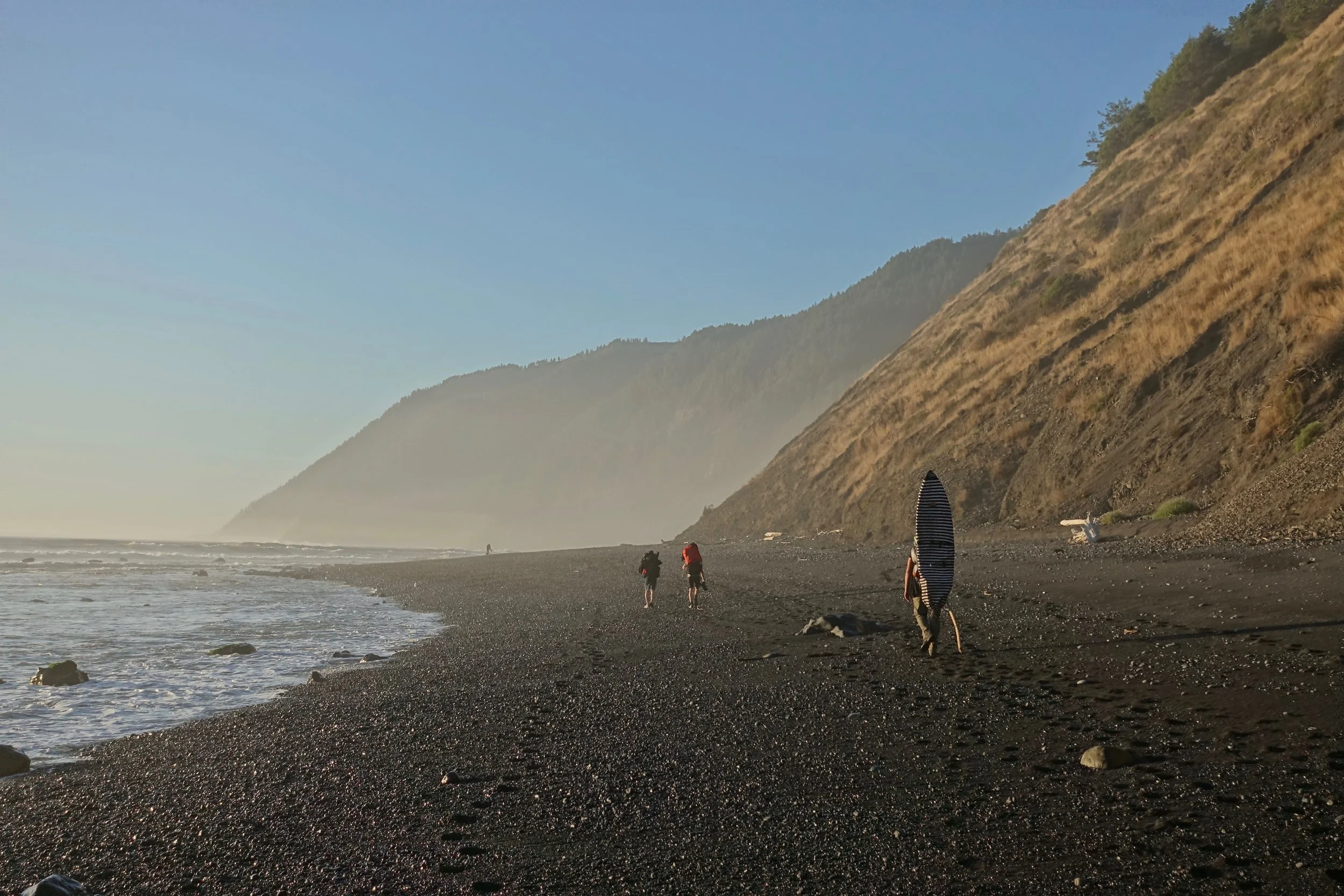
Surfer making the long walk to Big Flat, supposedly one of California's best surfing areas
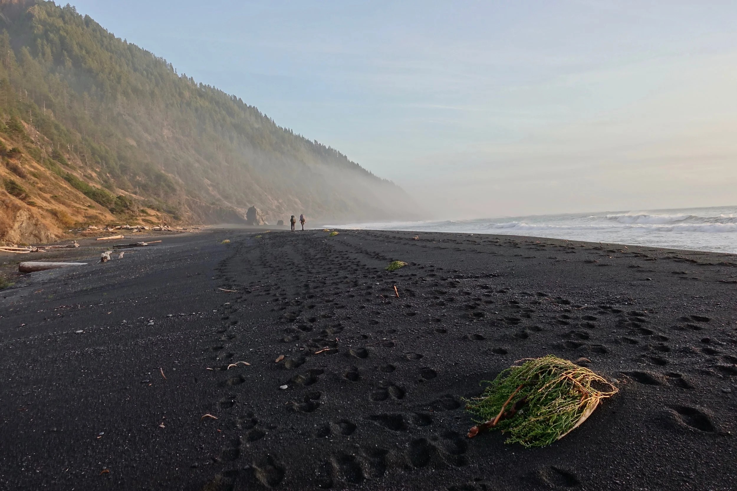
Black Sands Beach
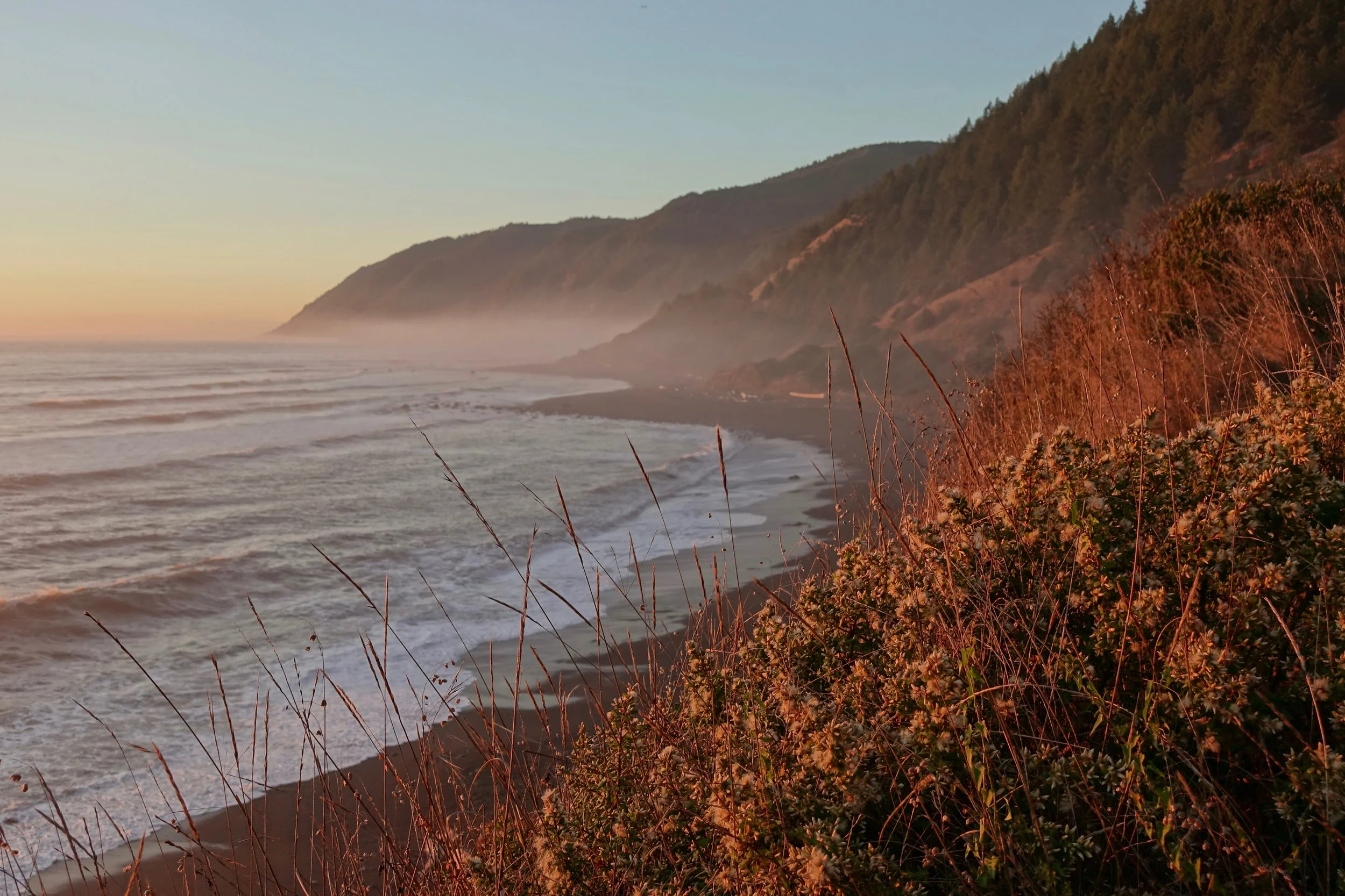
Sunset along the Lost Coast
Redwood Coastal Trail
The Redwood Coastal Trail combines forests and beaches from Orick to Crescent City (90 miles, 5 days). The trails are busy and I caught a bad string of weather, but still overwhelmingly found this walk to be one of my favorites in the lower 48. The Redwoods are just that impressive
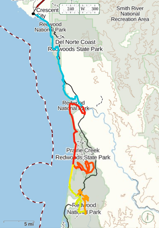

Logistics are simple with an excellent transport system between the parks. The Mill Creek Trail in Jedediah Smith Park was closed for renovation in 2021. If done again I would start the hike in Orick and replace Elam Camp with an extra night in Crescent City to complete some trails in Jedediah
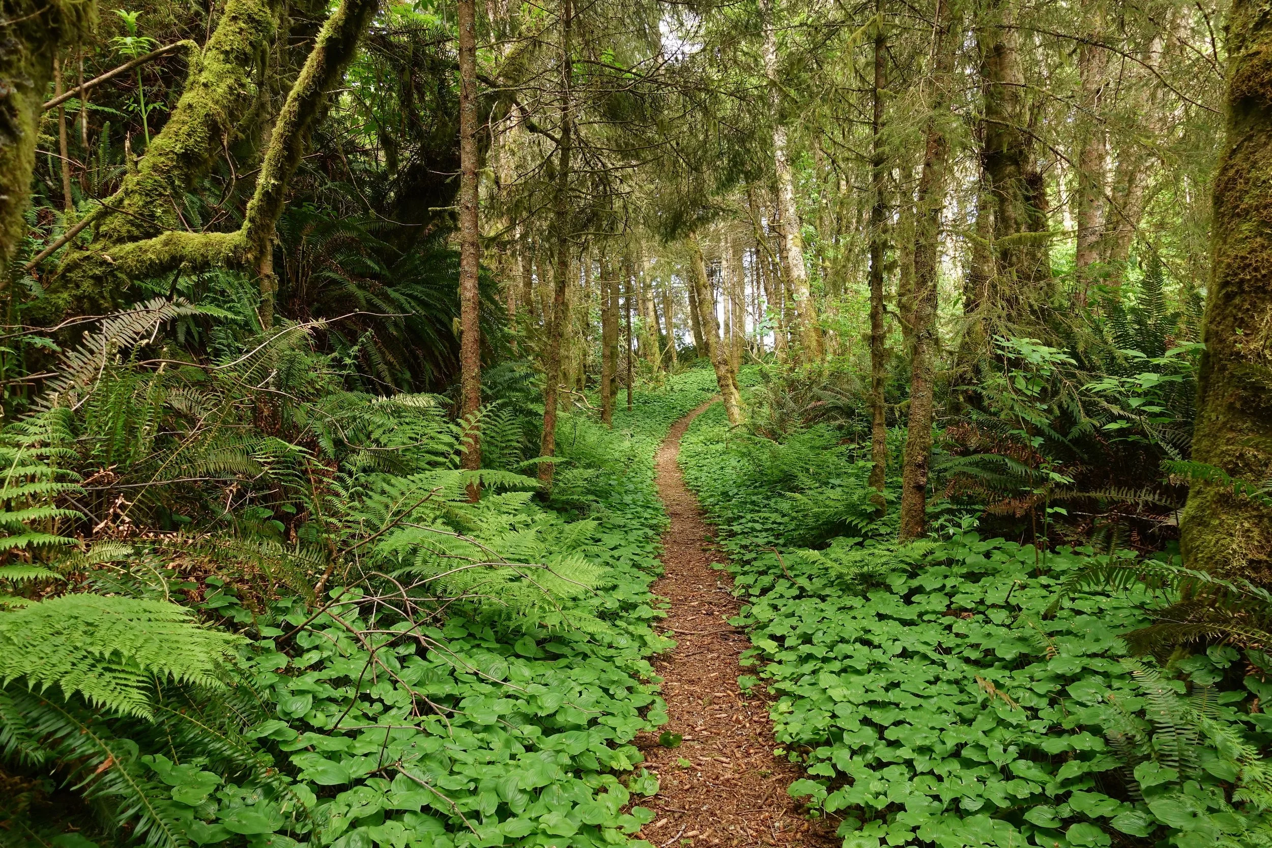
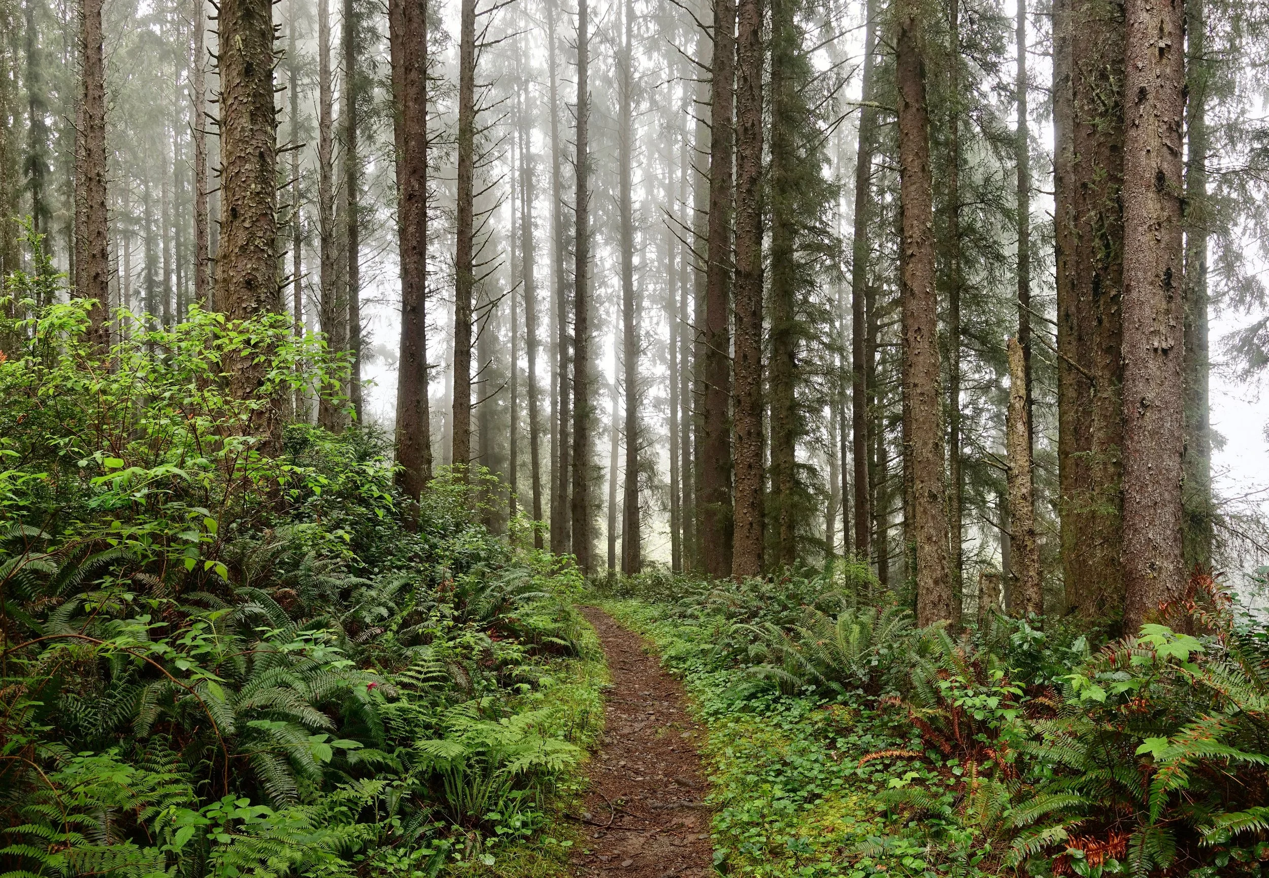
My favorite section of the coastal trail was from Klamath to Crescent City. The old growth forest north of the DeMartin camp, a bear encounter on the Last Chance section and the general lack of hikers in the area helped it stand out
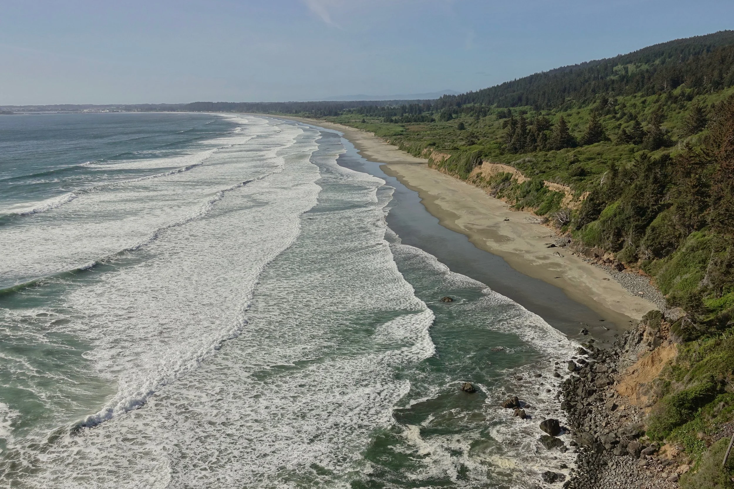
Nice weather on the final beach walk to Crescent City
Channel Islands
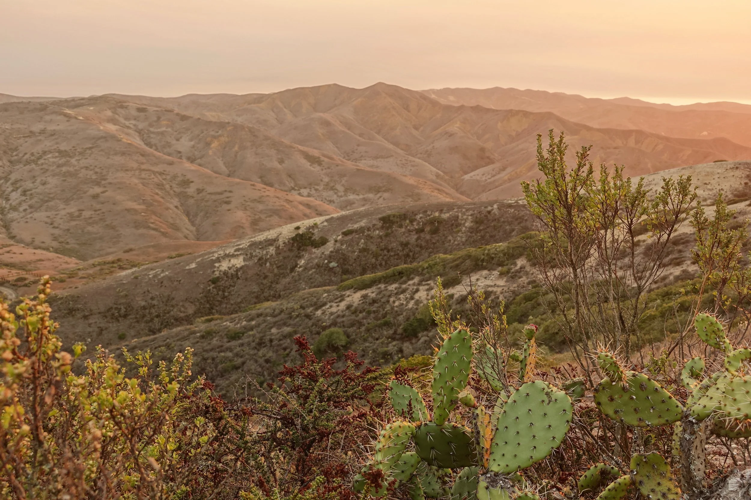
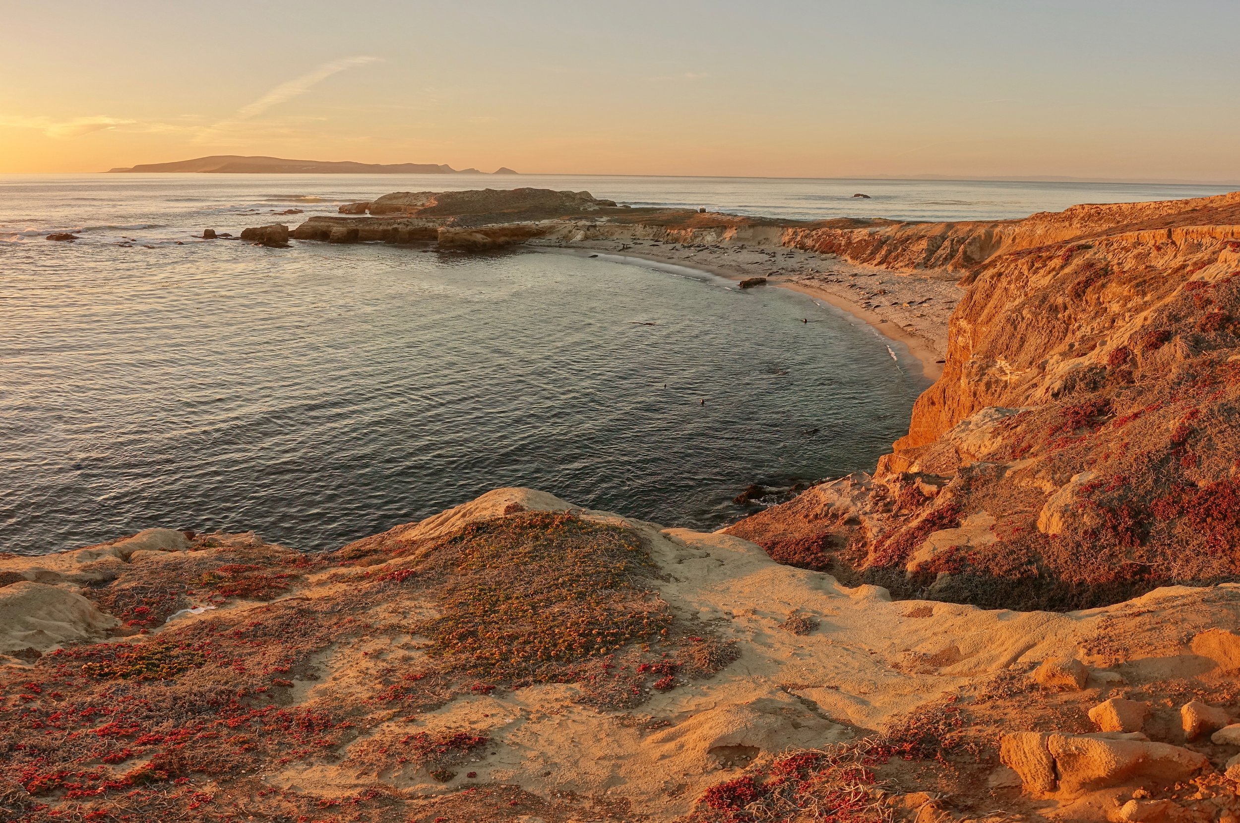
I walked around Santa Rosa in Channel Islands National Park for 6 days in late October. The island allows for backcountry camping which ultimately gave it the nod over Santa Cruz Island
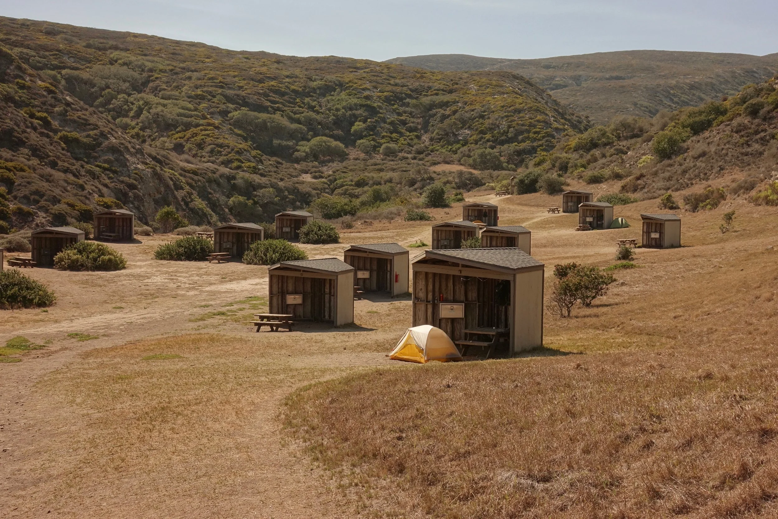
I stayed at the main campground before going to the backcountry. For the southwest quadrant all water must be carried so I wanted the food to be lighter with 3 days of water needed for the walk down Smith Highway
The southern coastline from a hillside near East Point
The island foxes are seen mostly in the mountains. The main campground has "fox boxes" for food storage. Bear canisters are recommended but not required for the backcountry. I did not see any foxes on the beaches so bringing a canister might be overkill
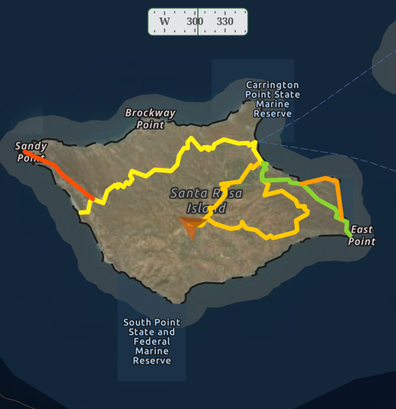
There were 3 walks that I did around the park:
-East point/Skunk Point loop
-Sierra Pablo/Soledad/Black Mtn loop
-Southwest backcountry camping with a side trip to Sandy Point (3 days)

The terrain is volcano-like in the center mountain region with little vegetation
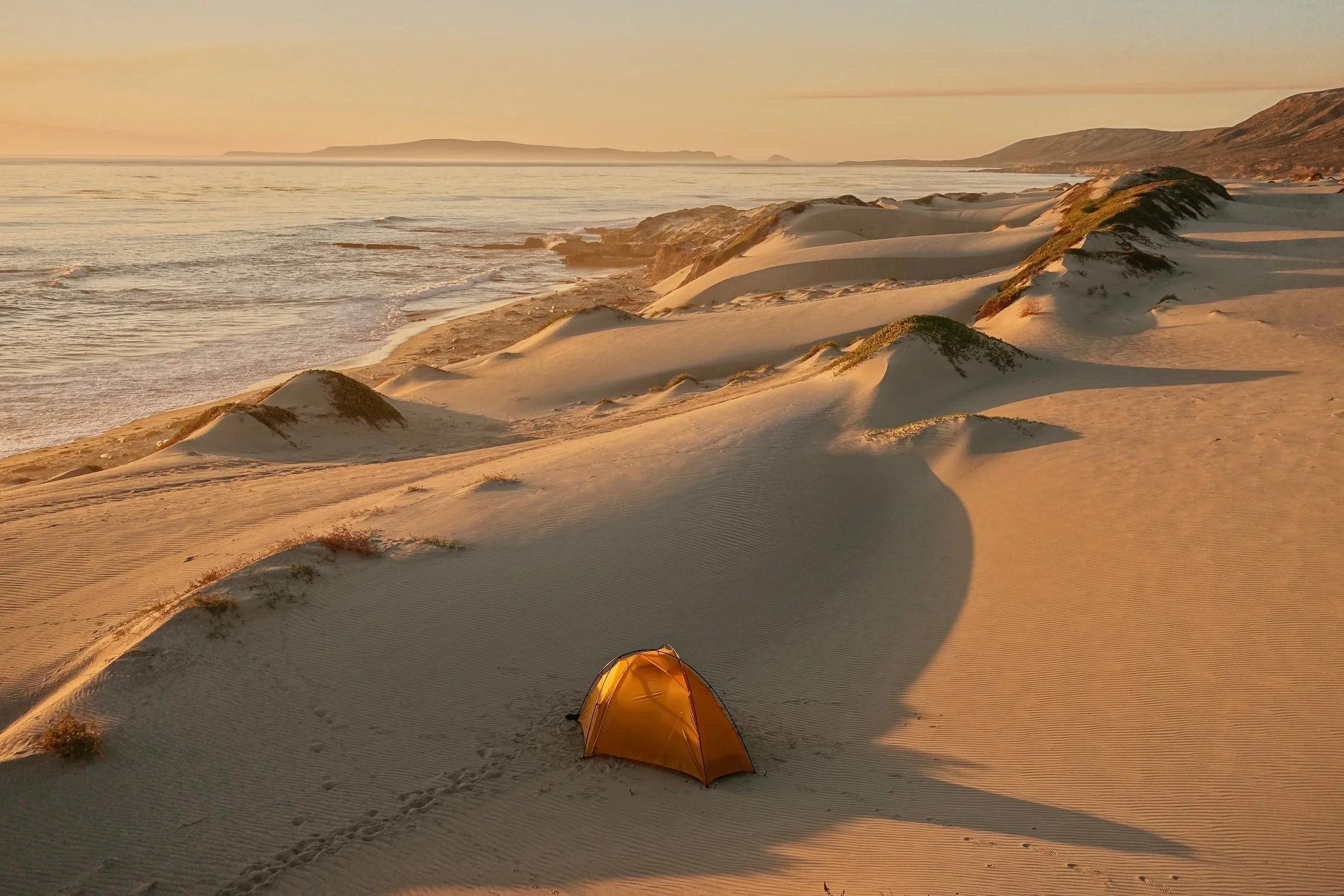
Camping in the southwest - the sun sets on this side of the island in October
Sandy Point at sunset
Golden Gate Traverse
The Golden Gate Traverse pieces together campgrounds from Point Reyes to San Francisco (60 miles, 4-6 days)
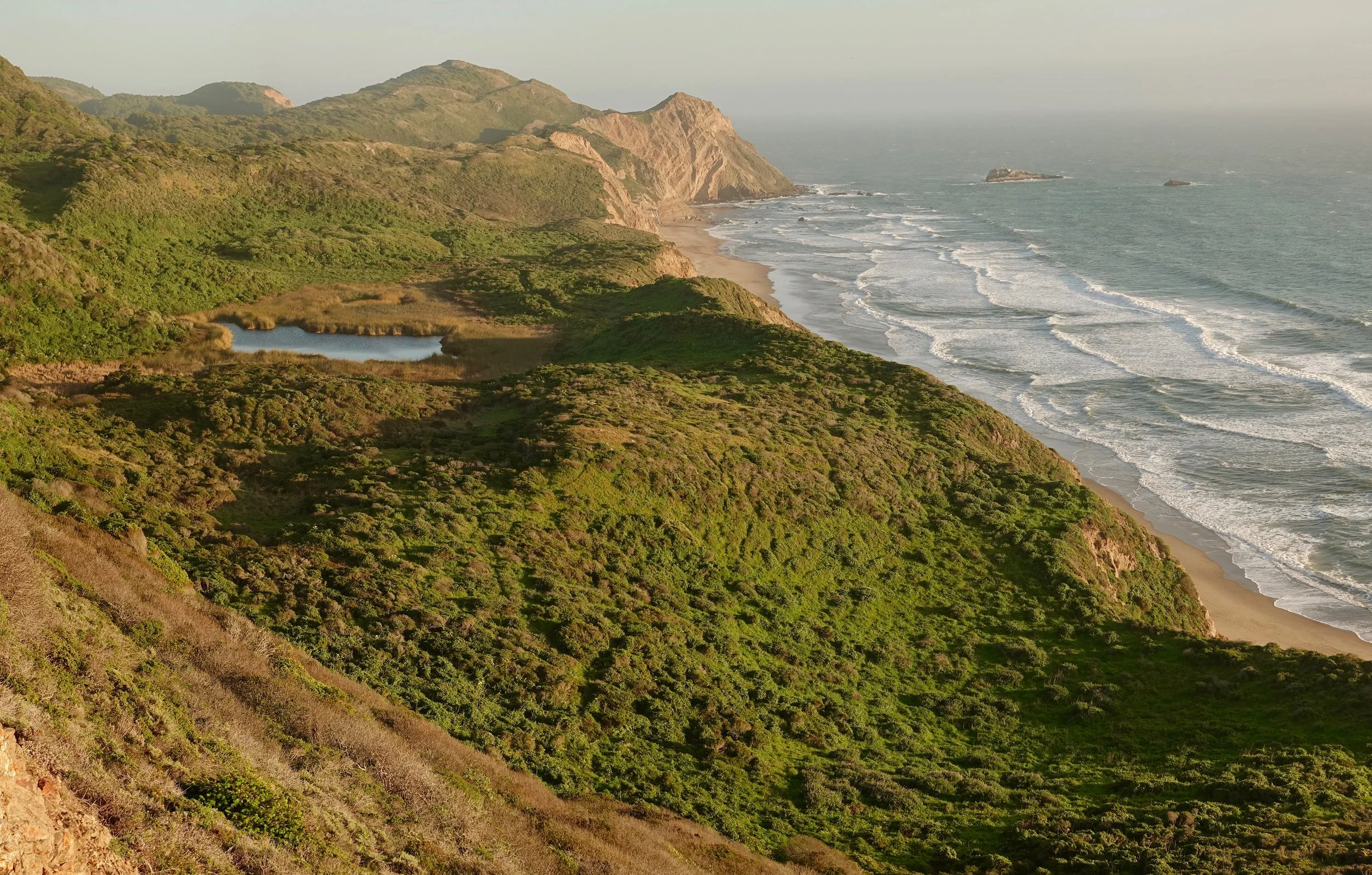
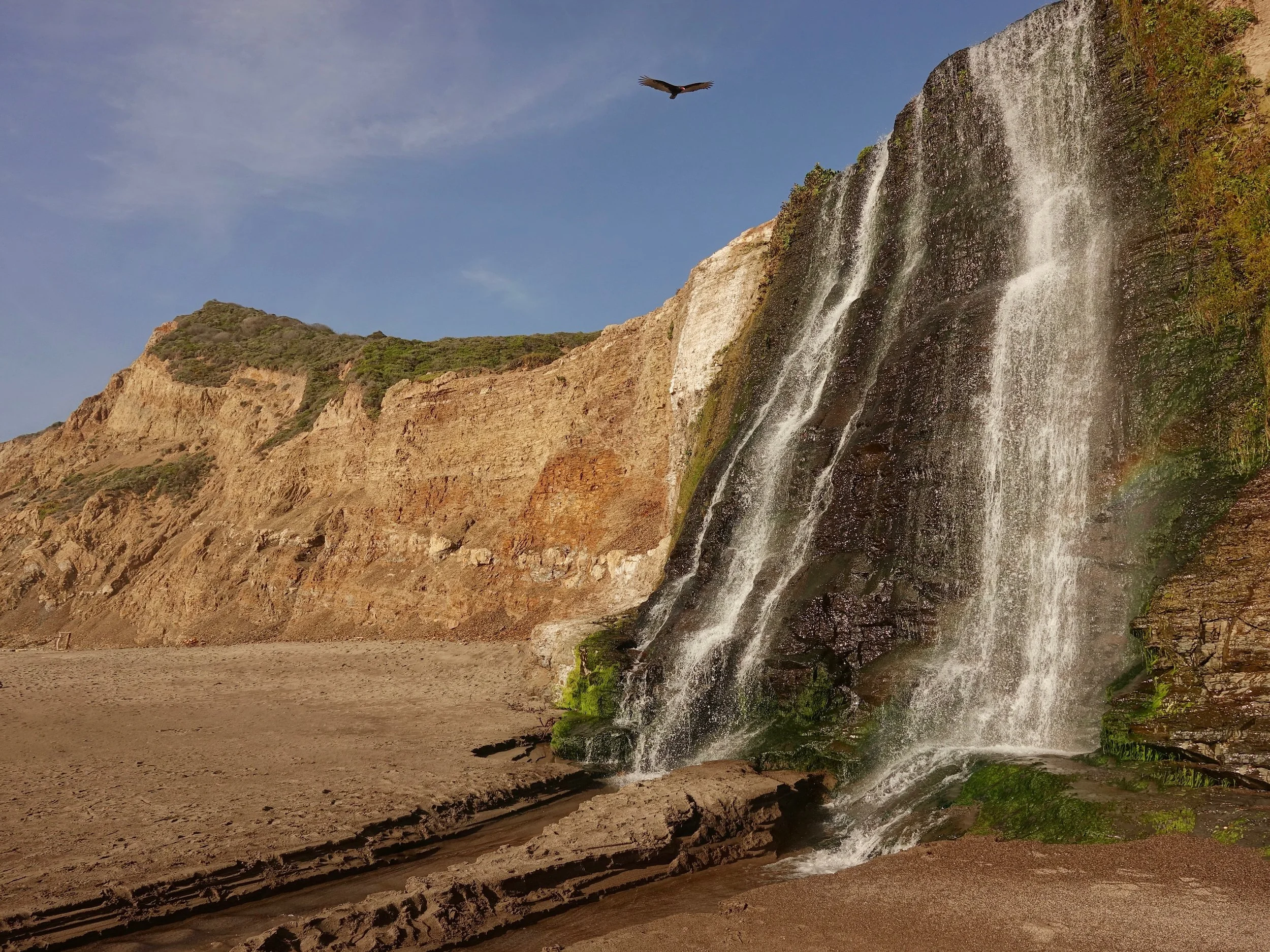
The walk starts at one of the better spots on the California coast with a night at the Wildcat Campground. Alamere Falls was running and the hills were green with the recent spring rainfall
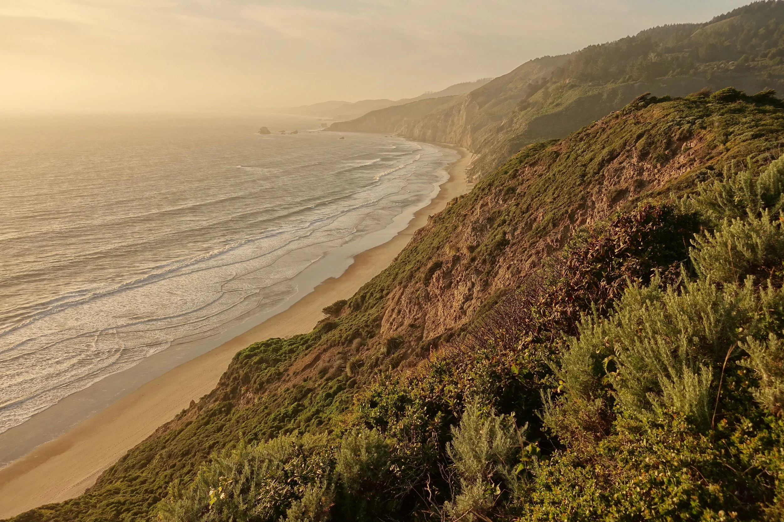
Sunset over Wildcat Beach
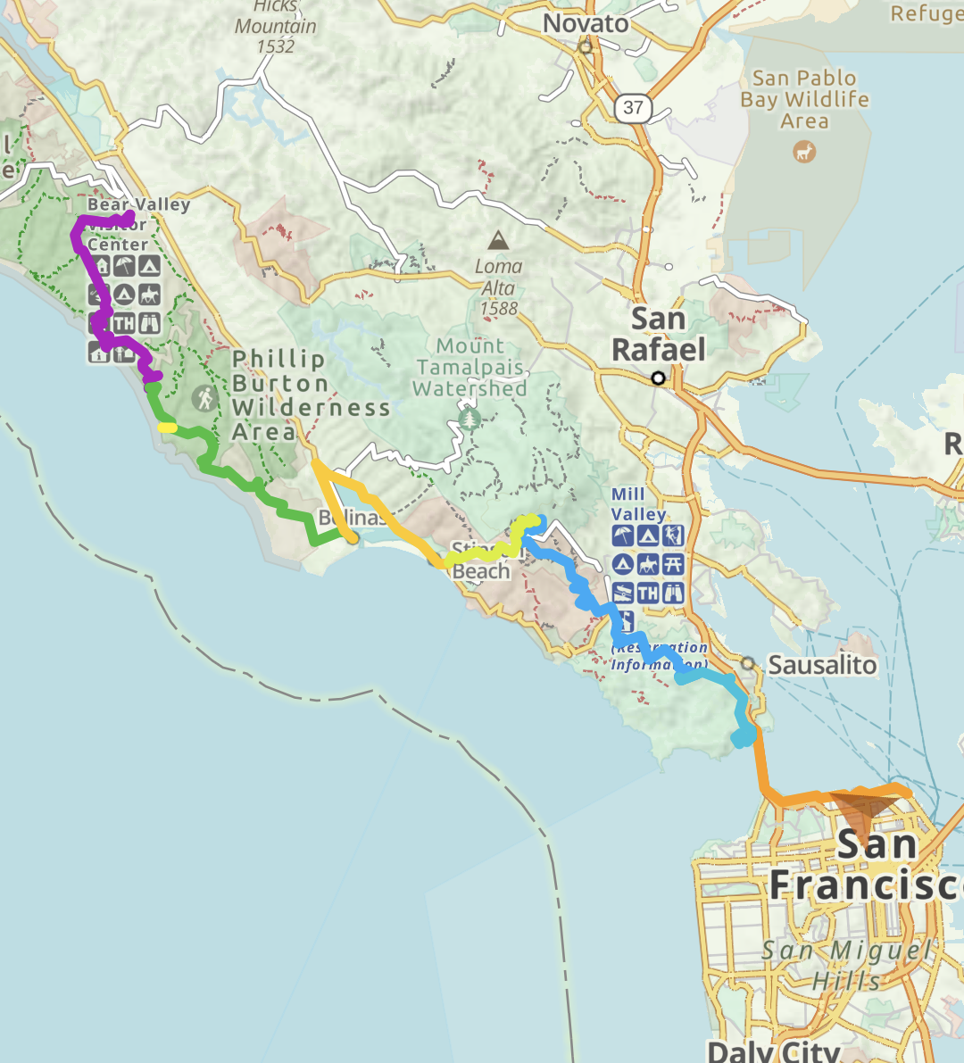
Golden Gate Traverse Overview Map
Bear Valley Visitor Center has good public transport and was chosen as the starting trailhead accordingly. The limiting factor in the route is the difficulty in reserving the campgrounds. Wildcat and Kirby Cove must be grabbed the moment they are released online. I may have been lucky with West Point Inn as it just reopened post-COVID and locals did not seem aware. The walk-in only campgrounds at Pantoll or Bobcat seemed large and would be alternates to West Point Inn
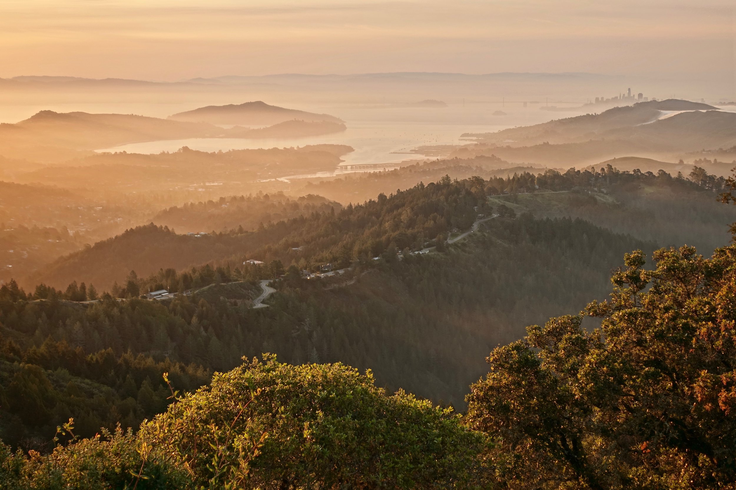
Sunrise from West Point Inn. Part of the excitement on this section is seeing the San Francisco skyline get closer each day as progress is made
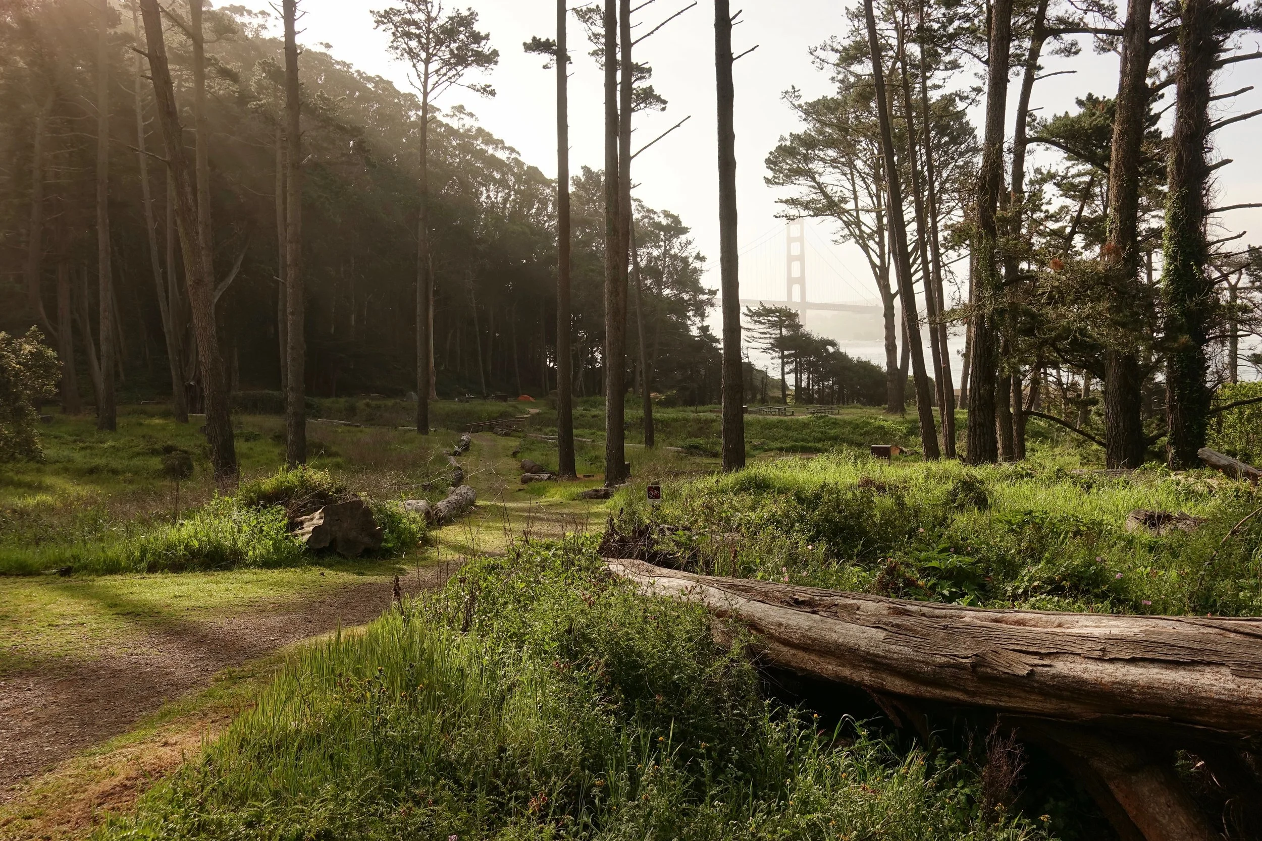
I stayed two nights at Kirby Cove campground to increase the chances of a clear night without fog
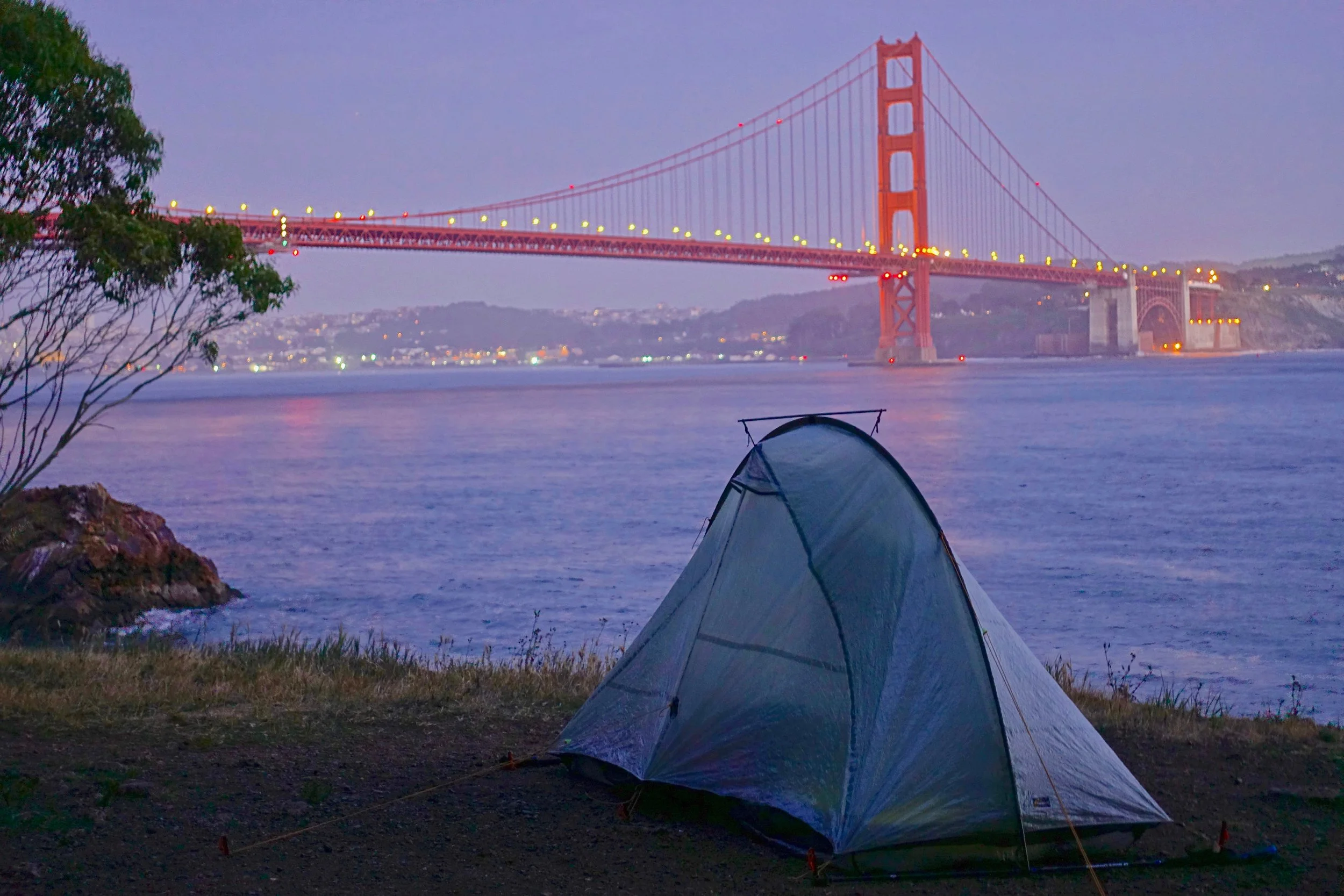
The 001 campsite at Kirby Cove with a view of the Golden Gate Bridge
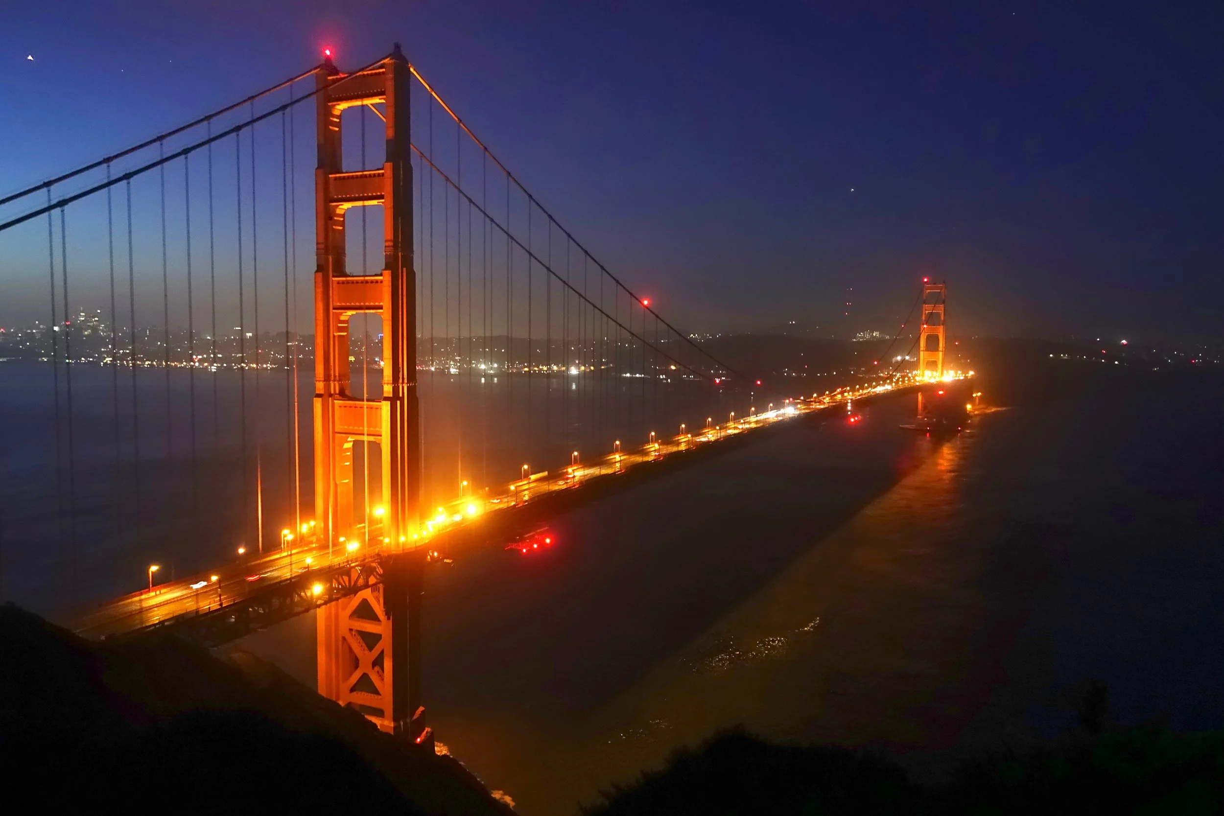
The best view is probably from the high point directly off the road. The weather was clear in the morning so I walked up from the campground early for sunrise
Big Sur

The Timber Top campsite on the Boronda Trail is one of the better ones I have found, overlooks the coast and likely you will have it to yourself since there is no water and a 2500 ft climb. The trailhead is not marked off CA-1, there is a green gate between the Coast Gallery & Cafe and the Torre Canyon Bridge

There are three worthwhile short hikes to waterfalls on the Big Sur Coast: McWay Falls, Limekiln Falls and Salmon Creek Falls