North & South Dakota Hiking
Badlands Traverse
Centennial Trail
Maah Daah Hey Trail
Centennial Trail
Maah Daah Hey Trail
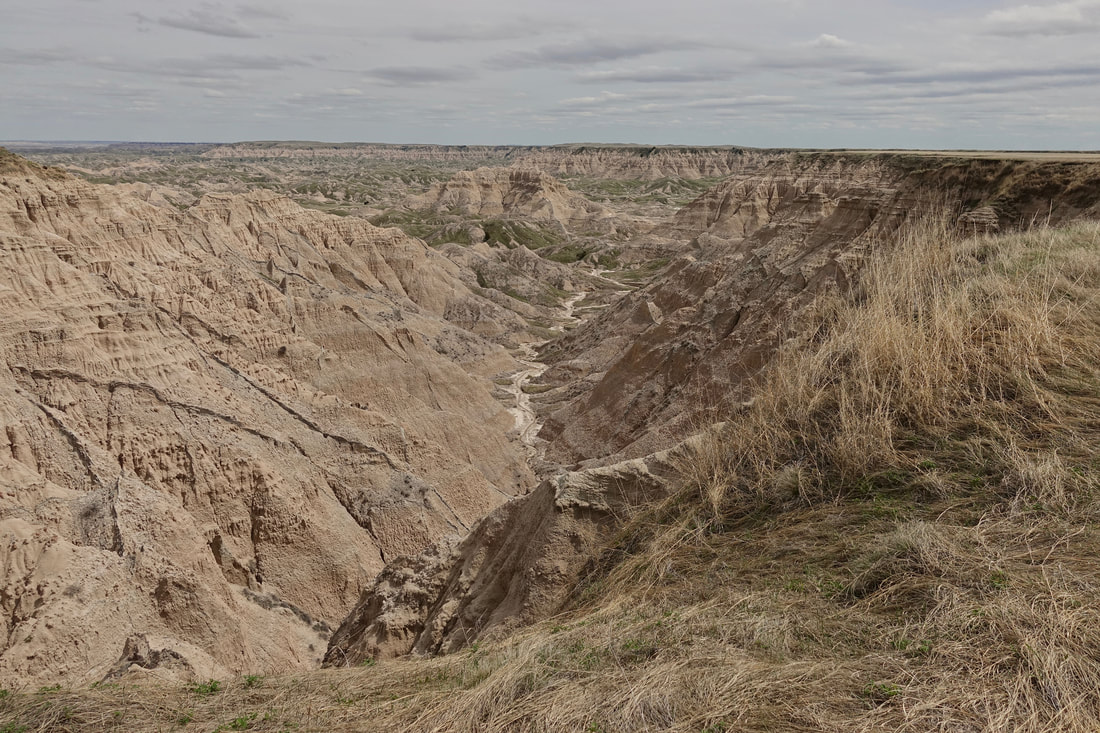
Badlands National Park
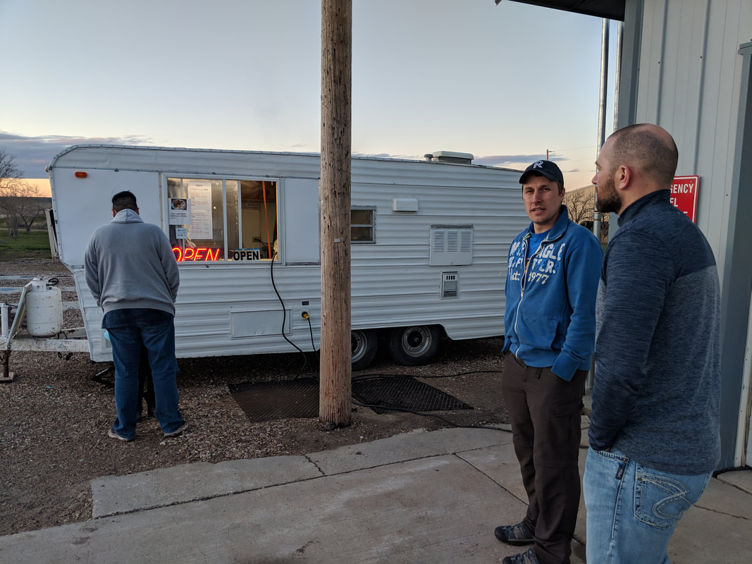
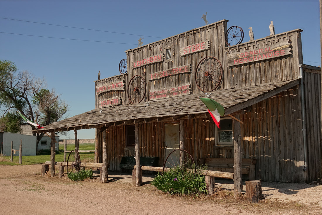
Pre hike meal at the chicken finger stand in the town of Scenic. We would visit this town again later about 50 miles into the walk
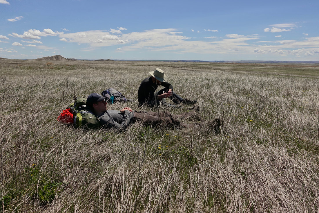
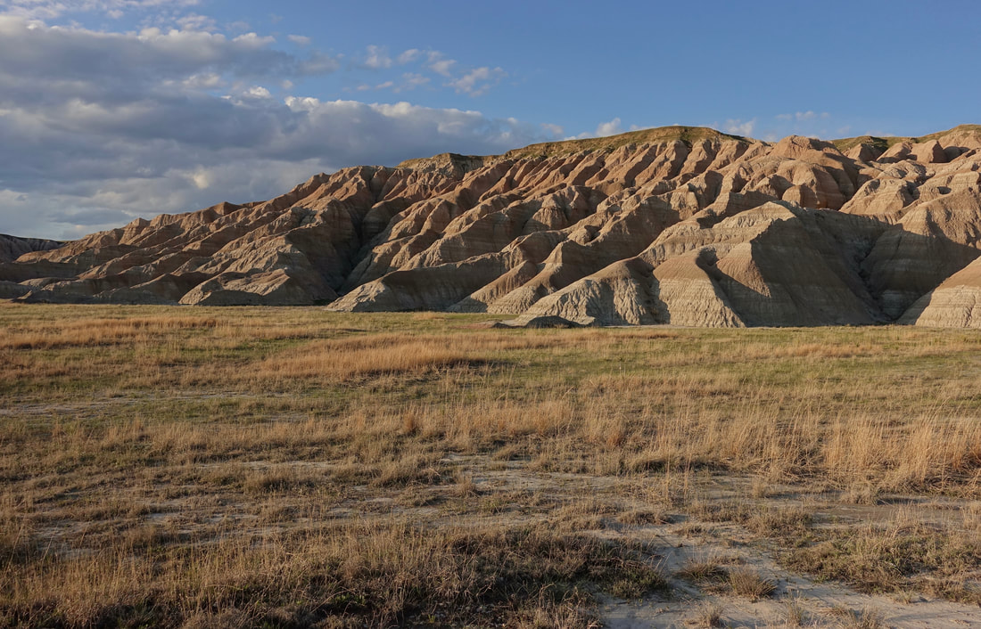
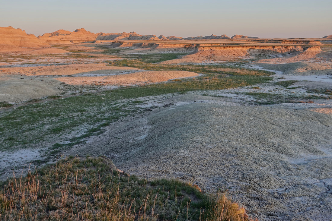
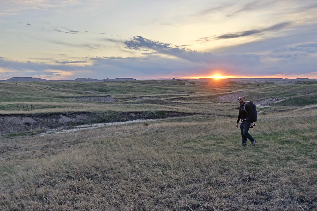
Halfway through day one
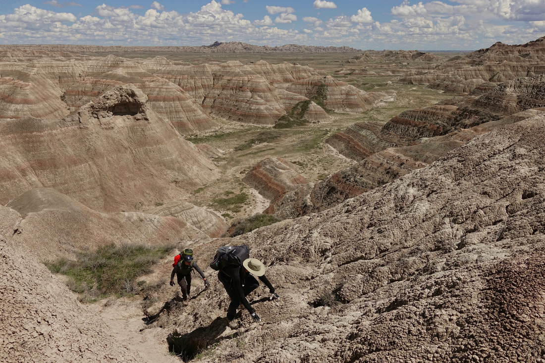
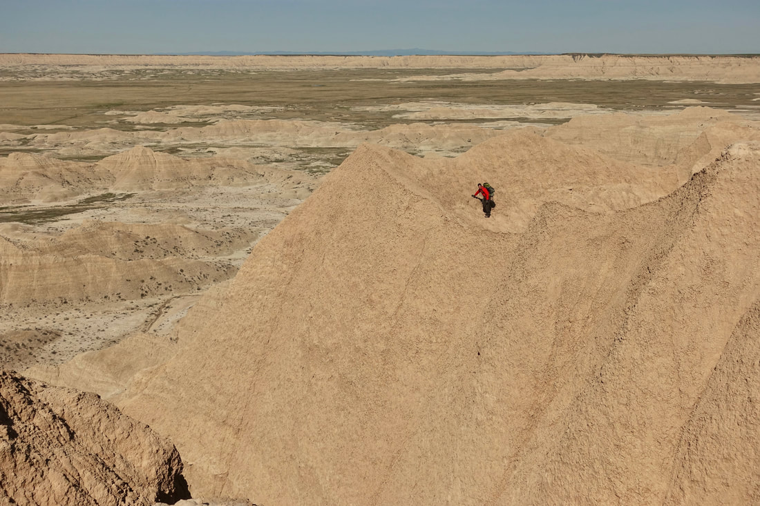
Climbing the first pass west of "The Castle"
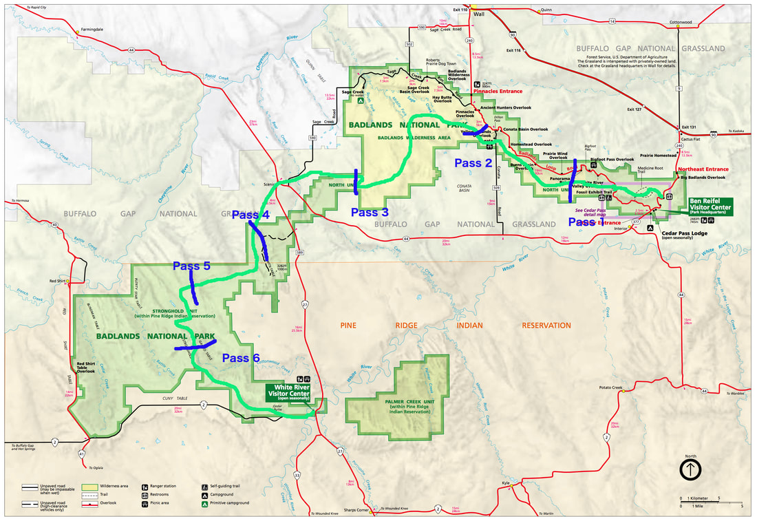
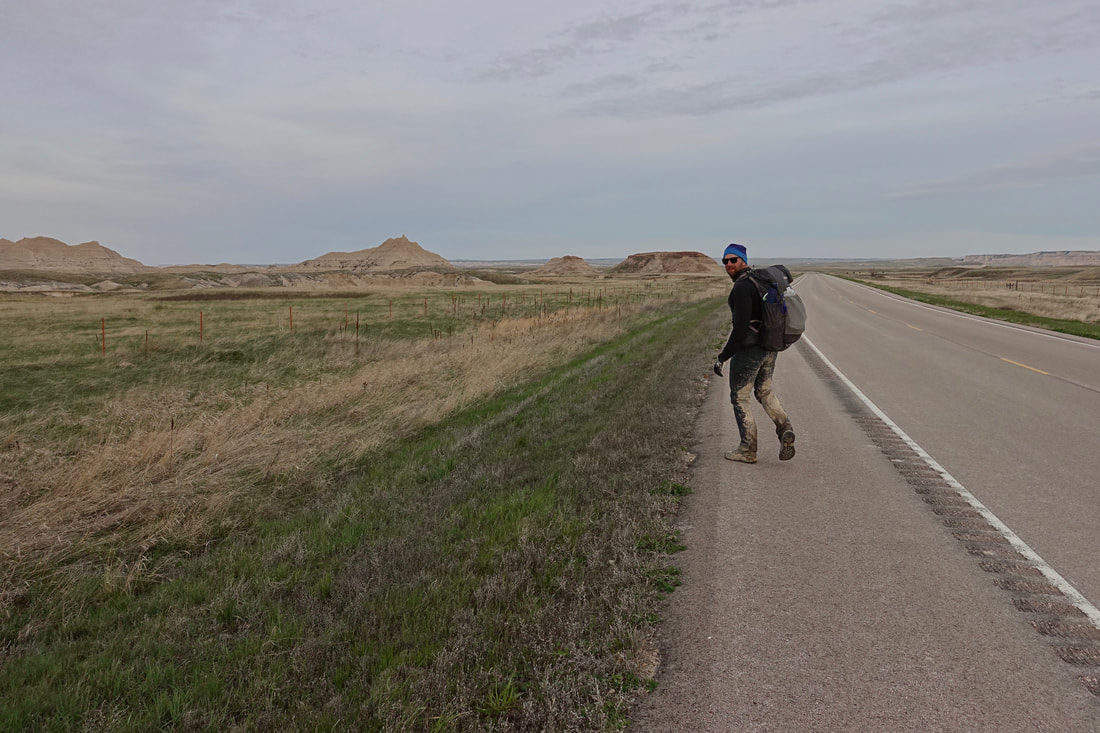
There are six major passes on the Badlands Traverse which goes from Ben Reifel VC to White River VC (80 miles one way)
With heavy packs and muddy conditions day one was the shortest and we camped on some dry ground east of Conata

Sunset from above camp
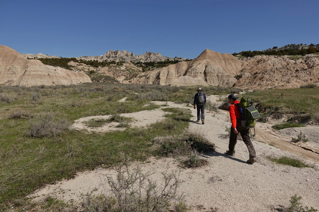
On day two there was a clear path leading to the Deer Haven area from the Conata picnic area
Climbing above Deer Haven
Thumbs up as we found a way down into the valley
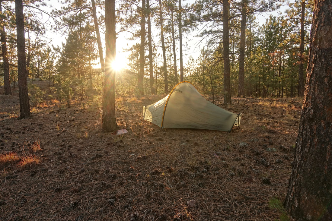
Warmest night on the trip at the Sage Creek Camp, the temperatures ranged from 30F to 70F in early May
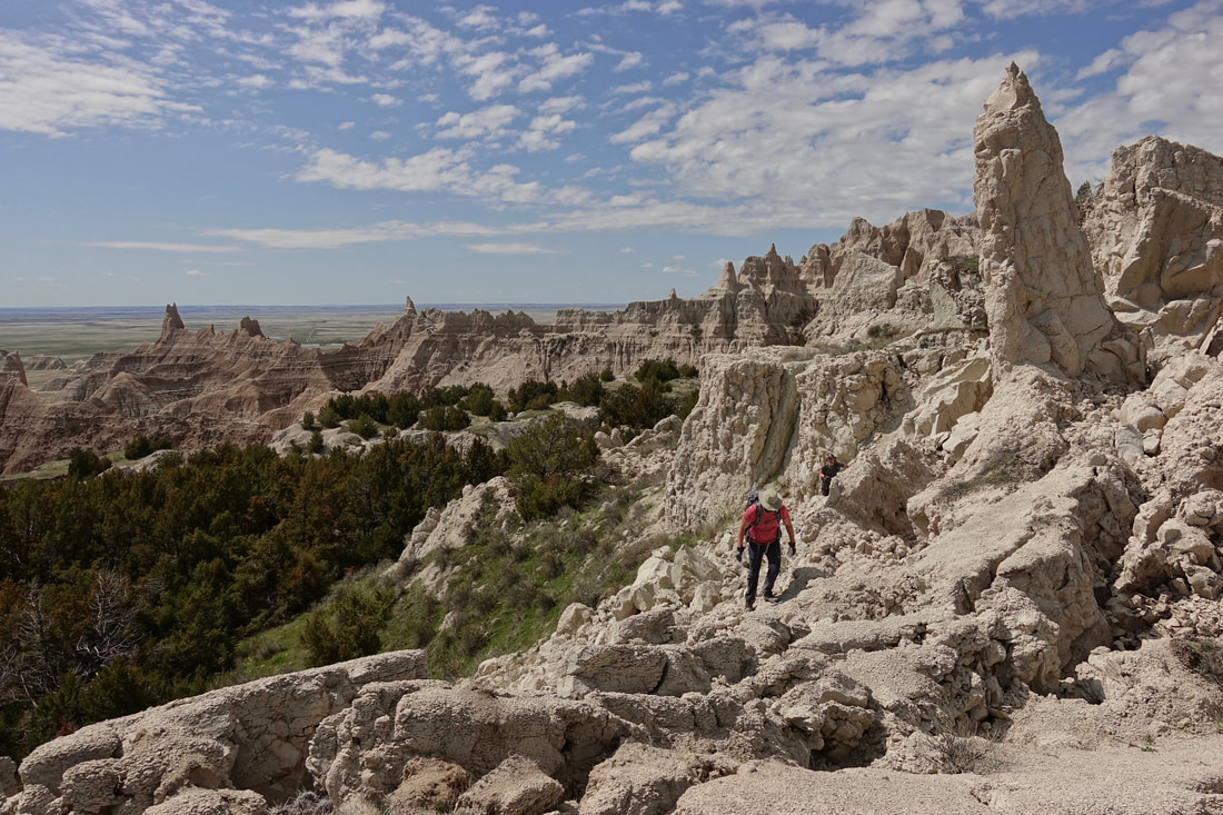
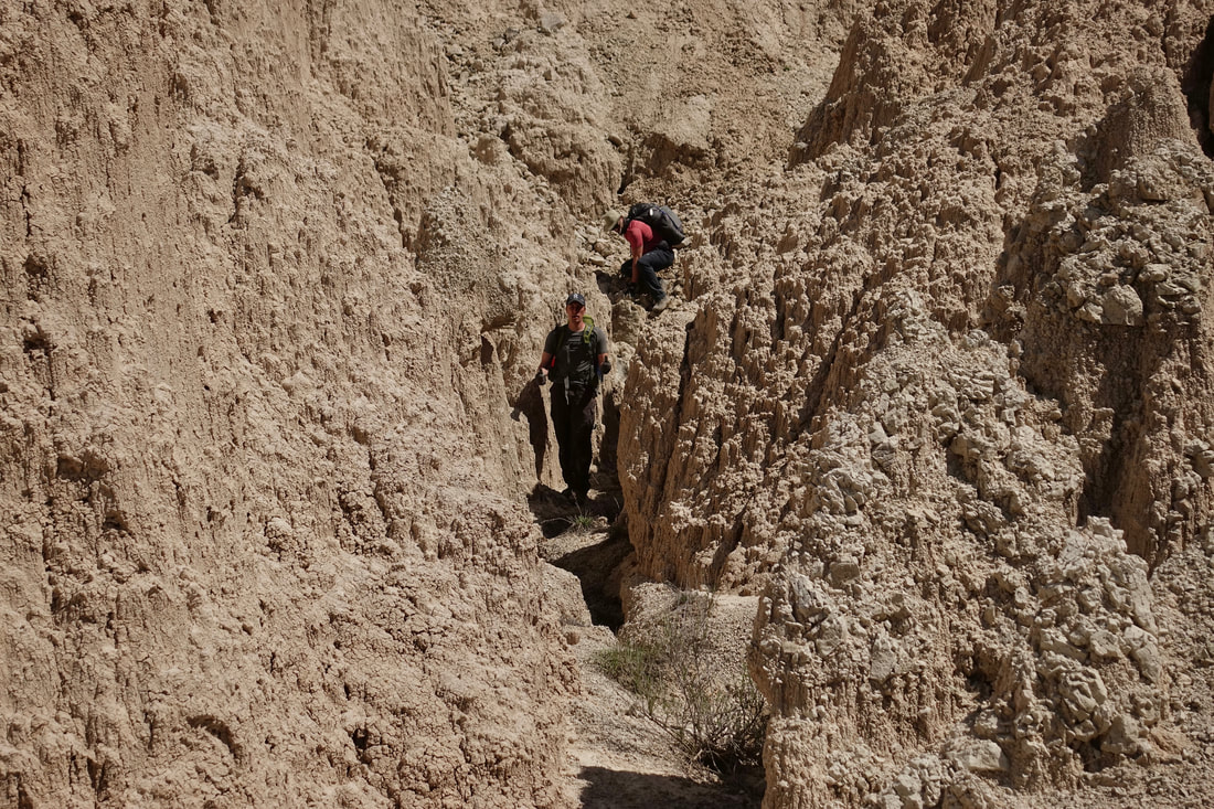
Matt on a ridgeline in southwest Sage Creek. This section hurt the most with repeated climbs up the pinnacles and no clear way down the other side
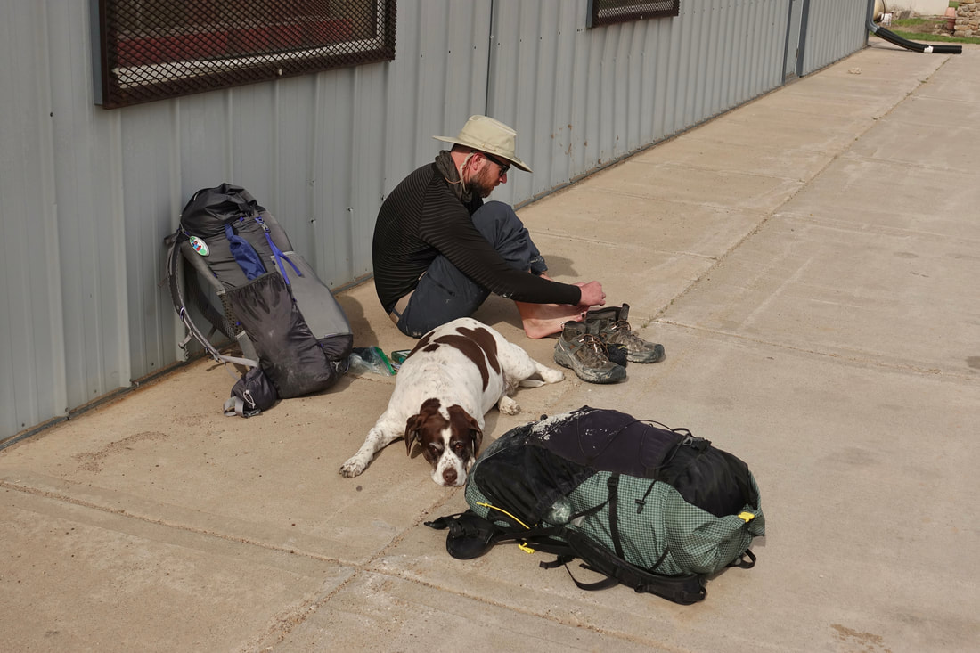
We reached the town of Scenic by late afternoon and said goodbye to Matt
Scott and I took a break, then continued to the Pine Ridge section of the park to complete the final thirty miles
We felt strong after filling up on burgers and eggrolls at the convenience store, making it over Sheep Mountain by sunset
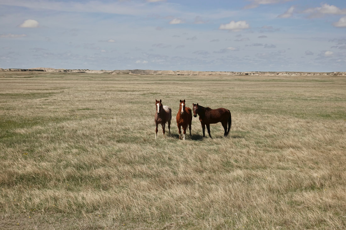
Curious wild horses near Cactus Flats, they kept inching closer as I was looking at the map
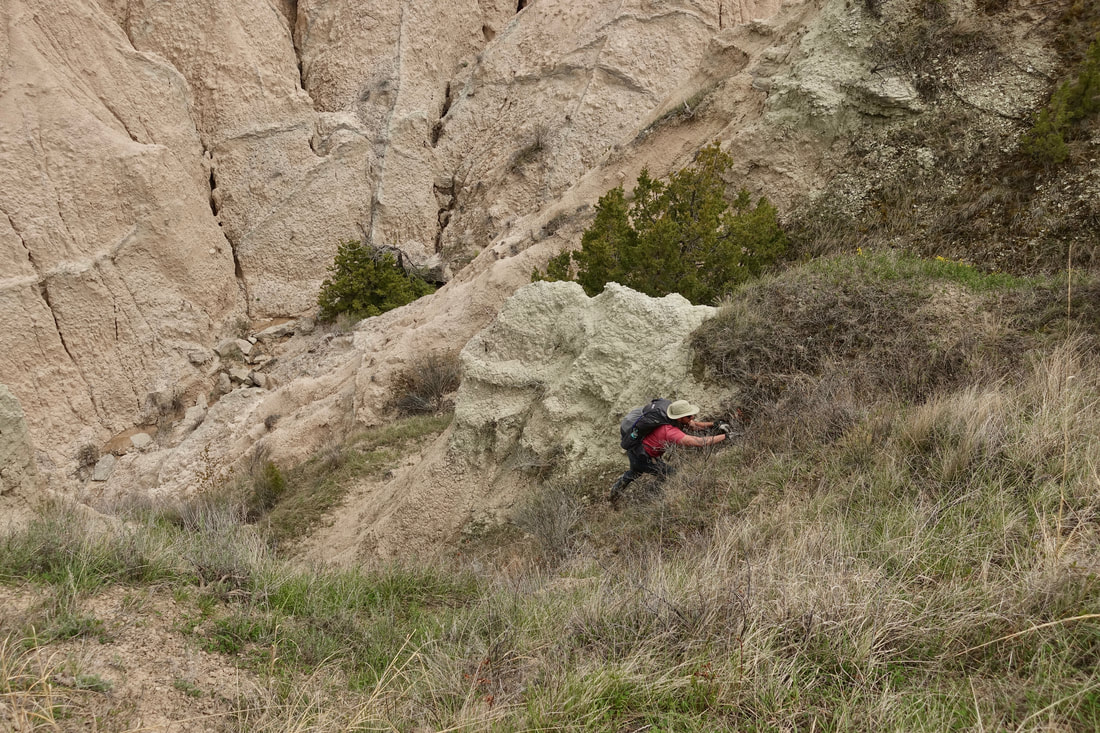
Scott climbing Stronghold Table
We got lucky finding ways over the final two passes on the first try
We thought getting through Stronghold by nightfall would be a good, yet we had already reached the area by midday
With the aforementioned good luck, we decided to finish the walk to White River VC. We went along the road as the light faded to avoid stepping on holes/cactus
Centennial Trail Black Hills
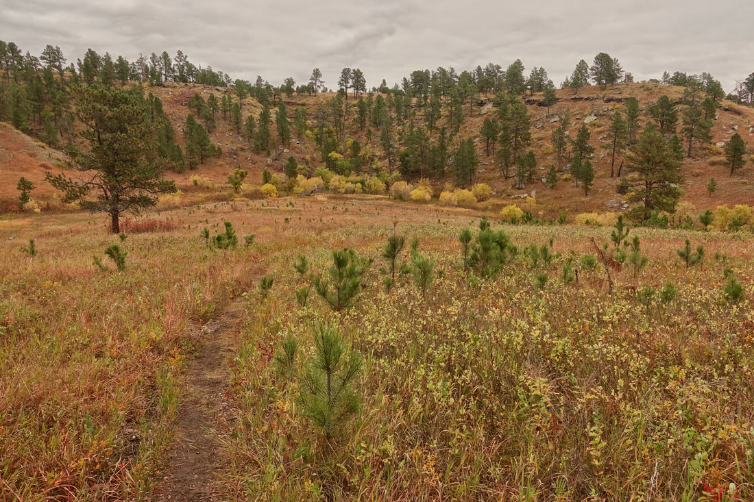
The Centennial is South Dakota's longest trail starting in Wind Cave National Park and ending near the town of Sturgis. A beautiful fall hike and one that I would probably reserve for when the temperature is cooler due to longer water carries
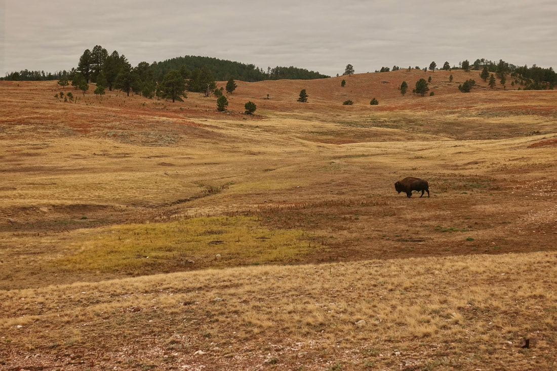
Several bison encounters on the first day in the rolling hills of Wind Cave

Depending on time constraints, a cave tour is a good way to start or end the walk. The well-formed boxwork ceilings are unique to this area
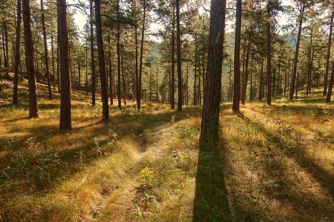
The sun came out as I reached Custer State Park and stayed with me for the remainder of the walk
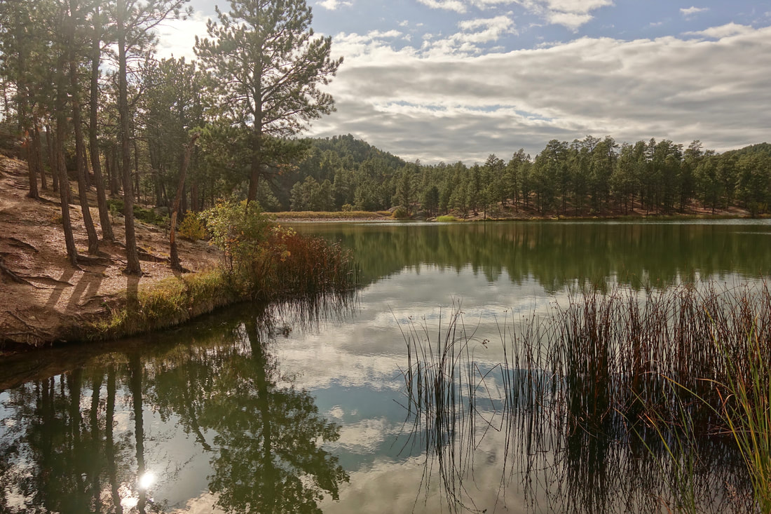
Legion Lake
Camp on the first night near Legion Lake Lodge, where I had dinner and breakfast and resupplied with snacks
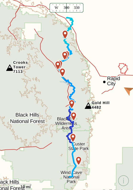
Overview Map
The official trail end is in Bear Butte State Park, an additional ten miles from where I ended the walk in the town of Sturgis
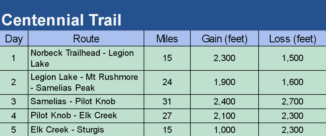
The walk took five days using somewhat expensive transport to and from the Rapid City Airport. I got a Lyft to Wind Cave and used the local airport transport service for the return drive from Sturgis. I resupplied food as I went picking up snacks at Legion Lake (limited) and Nemo Merchantile (larger grocery store). I also had meals at Legion Lake, Mount Rushmore, and Sugar Shack
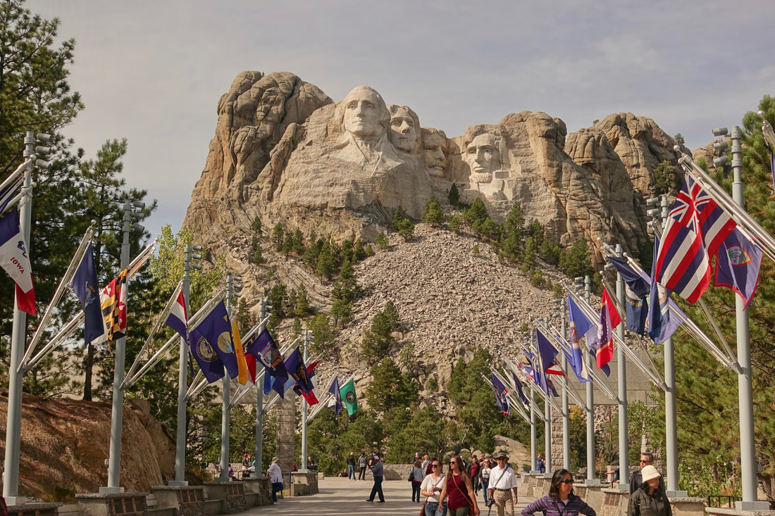
The trail goes alongside Mount Rushmore, a two mile side trip from the Black Elk Wildernerss Area
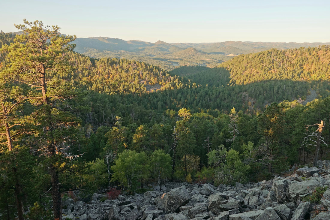
Morning sun from a ridge north of Samelias Peak
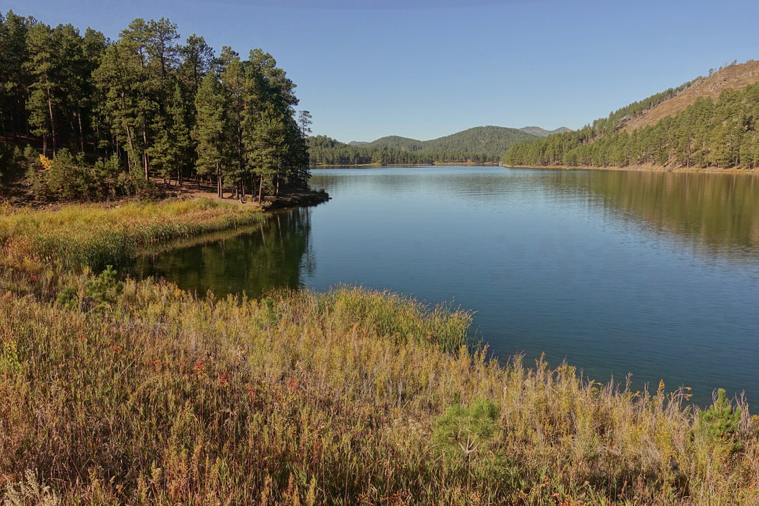
Heading down to Sheridan Lake
Would bring some flavoring for the water, the lakes are all popular fishing spots and the water is hard to drink. I found myself paying for water in the towns
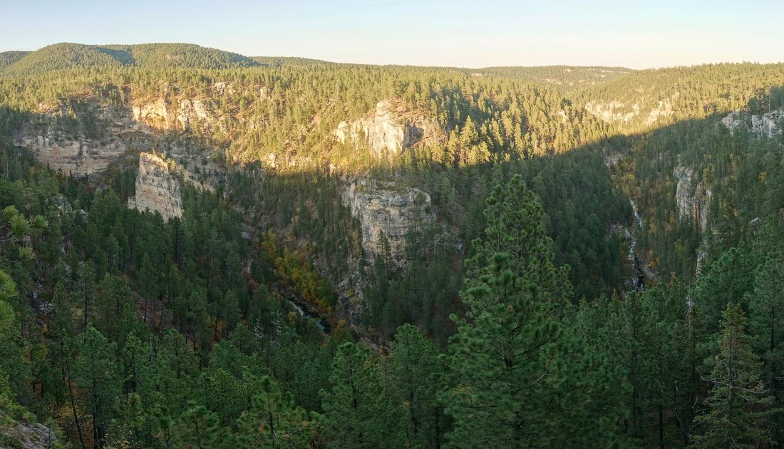
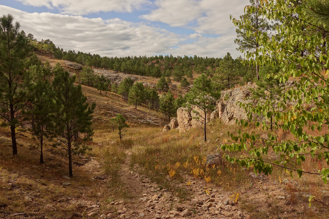
Elk Creek Canyon
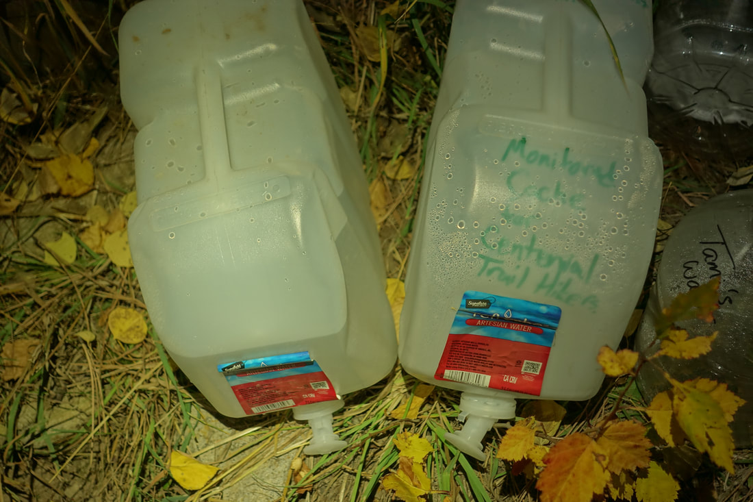
Lucky break at Elk Creek, an organization keeps water here for hikers. Elk Creek looks like a reliable water source on the map. After some post hike research, I found that there is a thirty mile section with no water from Dalton Lake to Sturgis/Alkali Creek Campground. For water sources, I used Legion Lake, Mount Rushmore, Sheridan Lake, Pactola Lake, Sugar Shack (restaurant in Merritt), Nemo Mercantile, Dalton Lake, and this monitored cache at Elk Creek
The final morning leaving the Black Hills for Sturgis
Maah Daah Hey Trail
I returned to the badlands again a few years later, this time of the North Dakota variety with a walk on the Maah Daah Hey Trail (95 miles, 4 days)
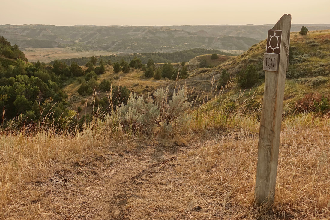
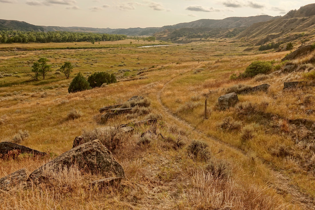
The trail is well marked throughout with posts and mile markers
The trail was often mowed, good for bikers so they are not peddling in high grass. And from a hiker perspective it helped me spot a few snakes
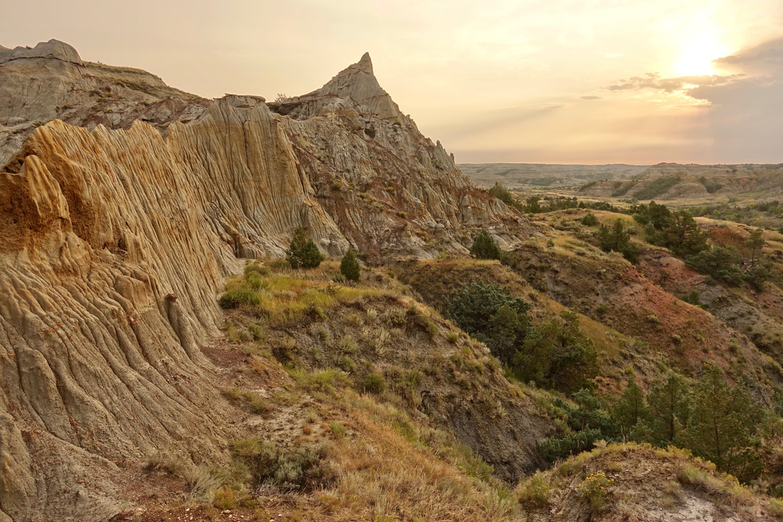
China Wall sunrise
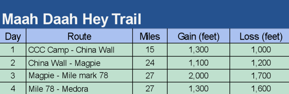
I walked the northern section from CCC Campground to Medora. I joined a biker shuttle from Dakota Cyclery to reach the trailhead. The designated campgrounds are the only water sources in the fall and are about 20 miles apart. There are waterboxes between the camps, about a half day drive to put water in them. Worth the effort as the water sources become 10 miles apart when using the boxes
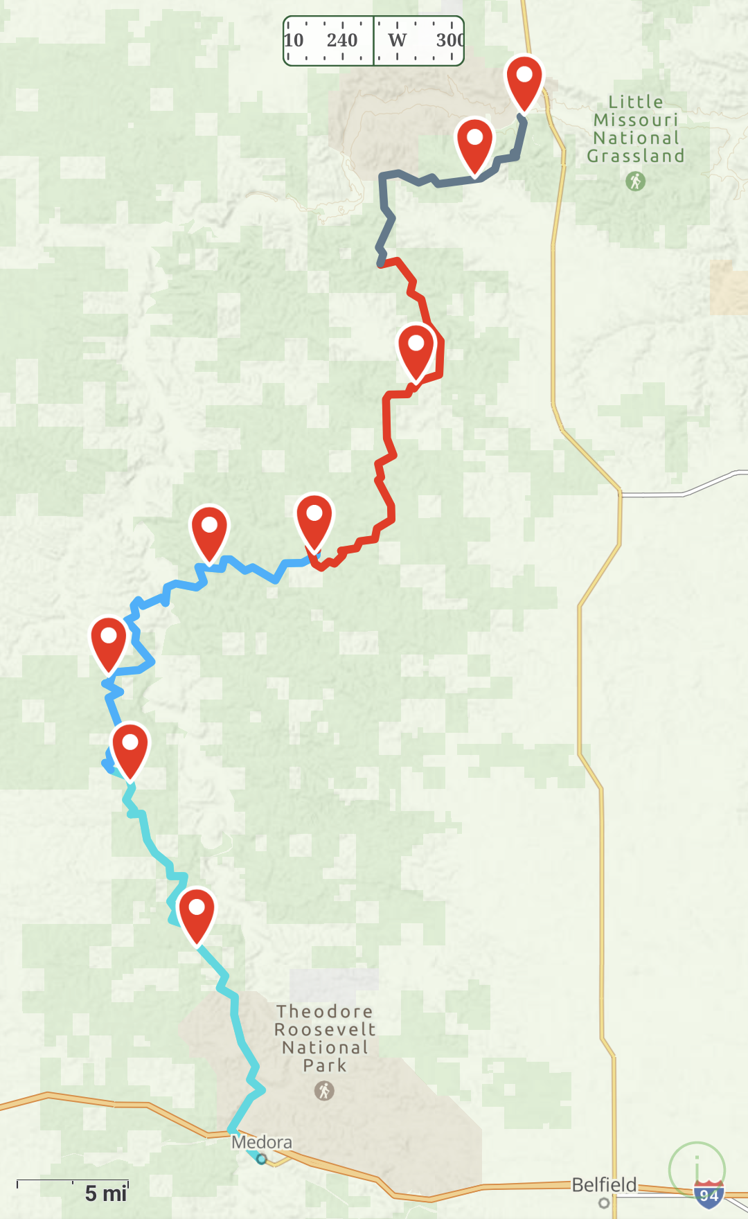
Overview map of the northern Maah Daah Hey Trail
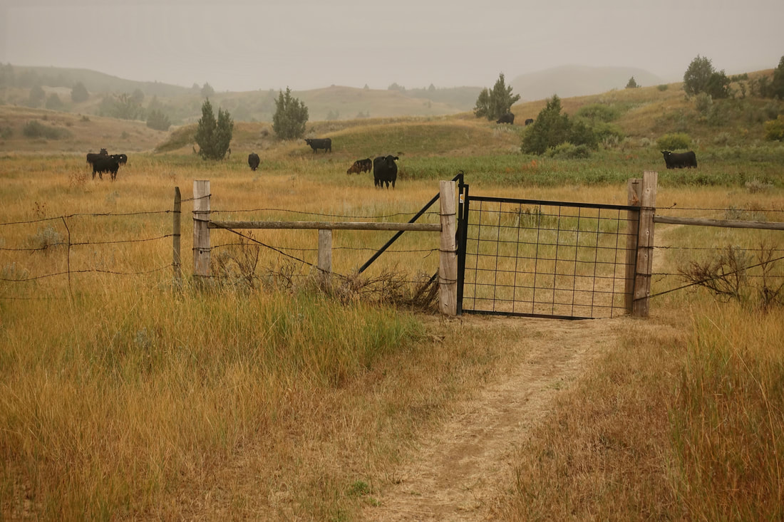
The downside to being outside a national park is the amount of cows on the trail. Enough of an annoyance that it lessened the overall experience for me
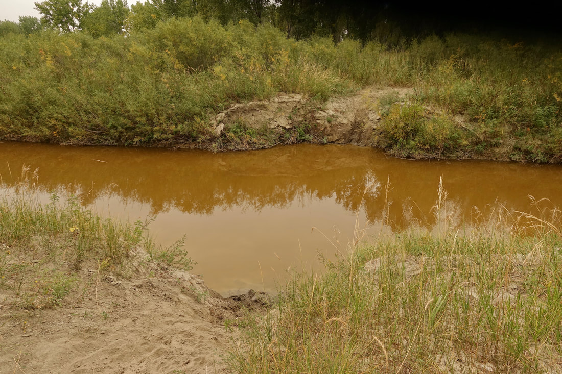
The only serious creek crossing in September was Whitetail -- waist deep mud. The Little Missouri comes shortly after if walking south to clean up
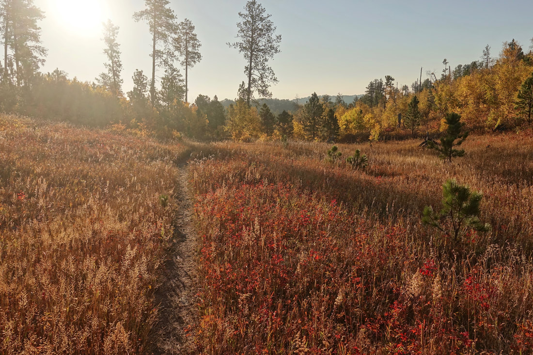
The weather was overcast for most of walk and around 70F in mid-September.
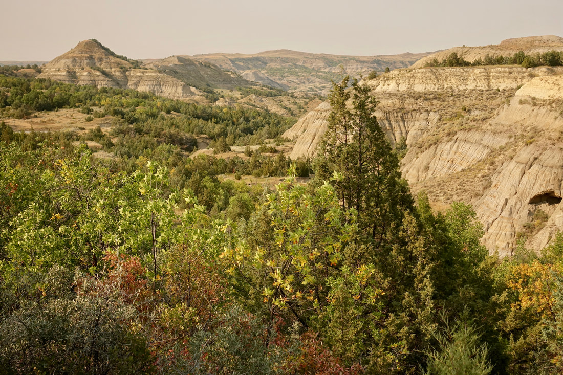
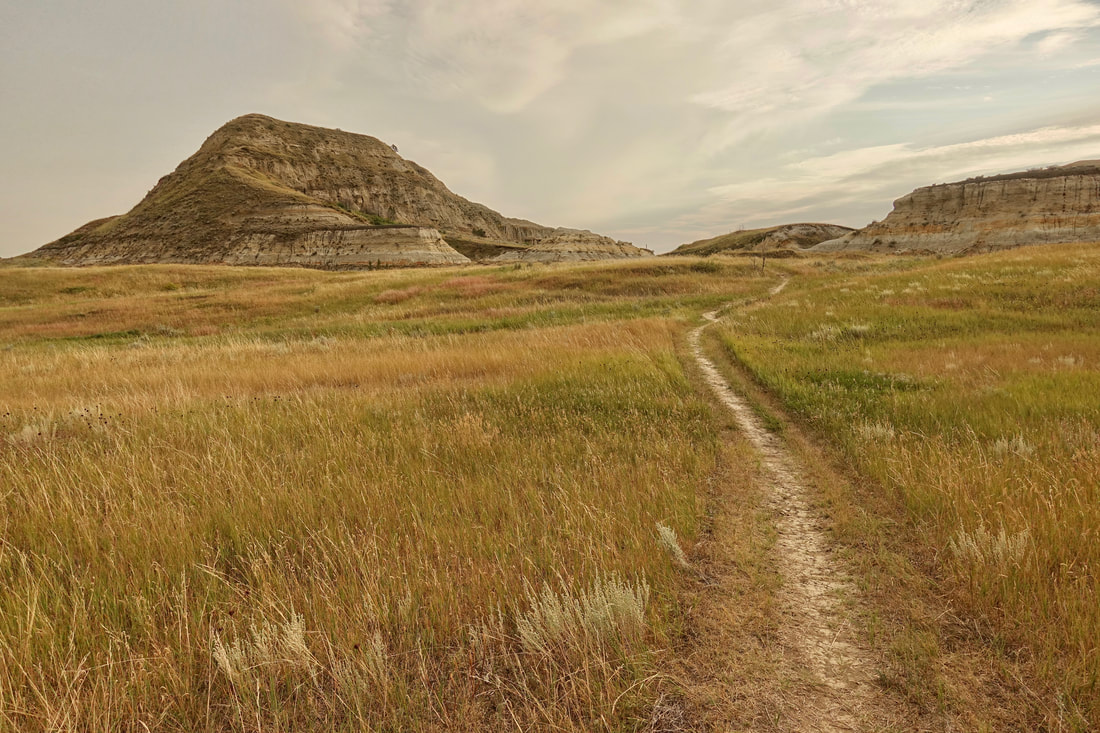
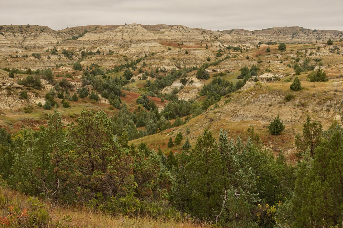
The final stretch in Theodore Roosevelt National Park